

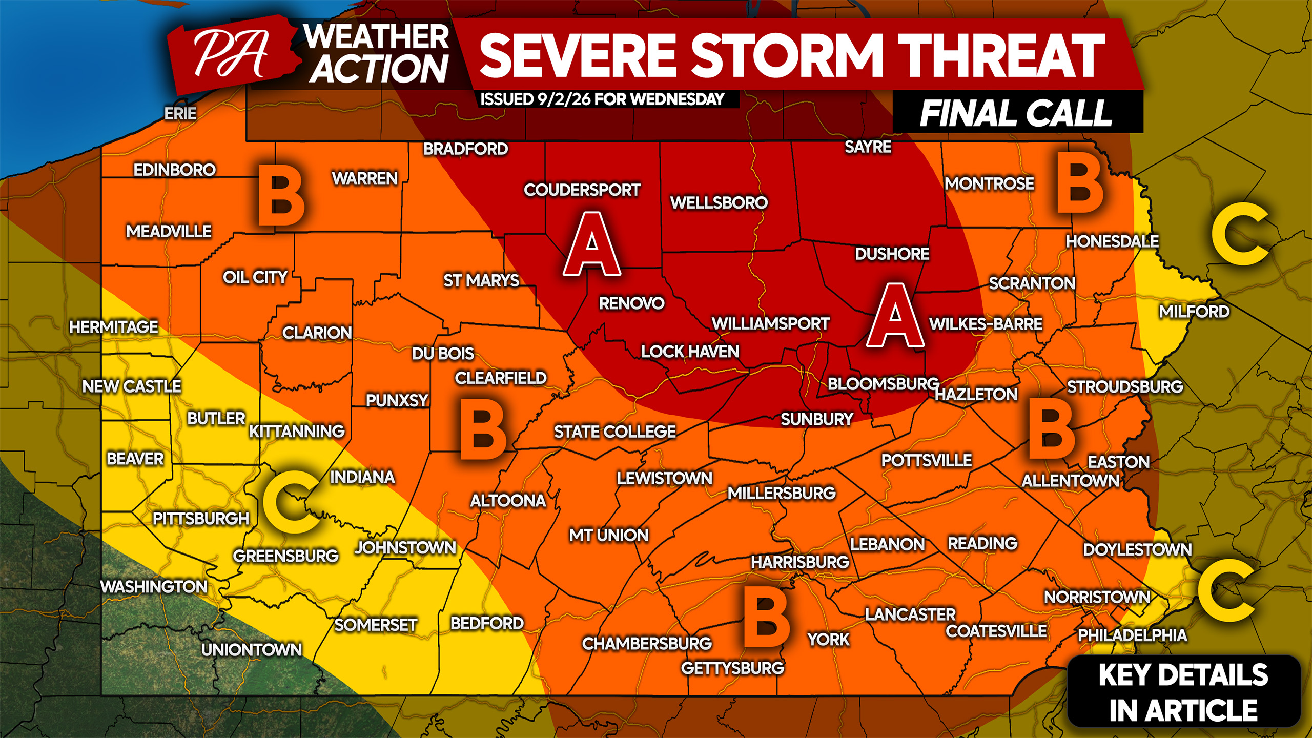
Today’s severe weather threat looks very impressive, with high wind shear and extremely impressive CAPE (energy) in the atmosphere. We have a recipe for damaging winds and isolated tornadoes late this afternoon through very early Thursday morning.
Storms will pop up in Western New York and Northern Pennsylvania around 3 – 5 PM this afternoon. These storms will immediately strengthen to severe criteria given the instability available today.
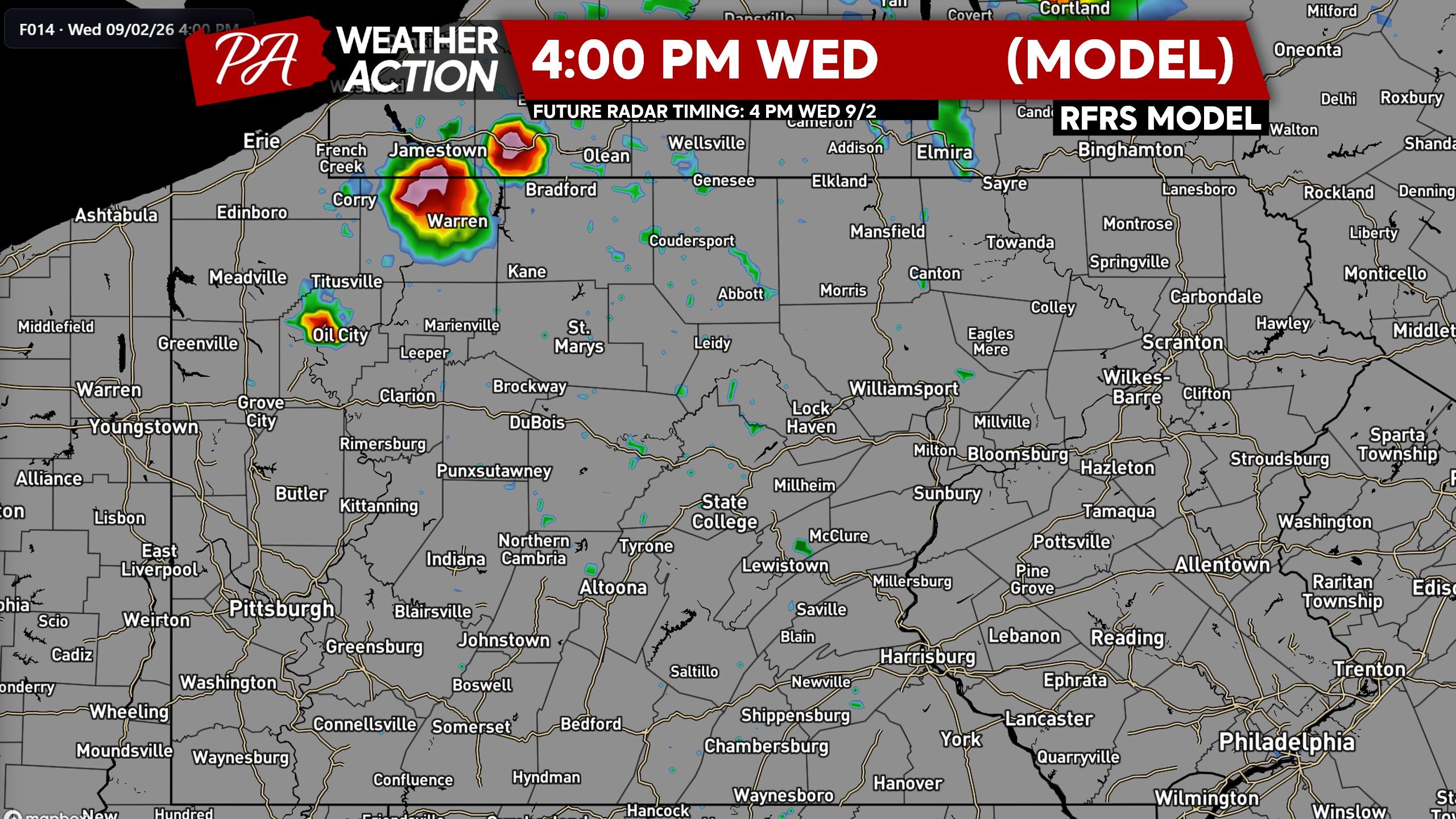
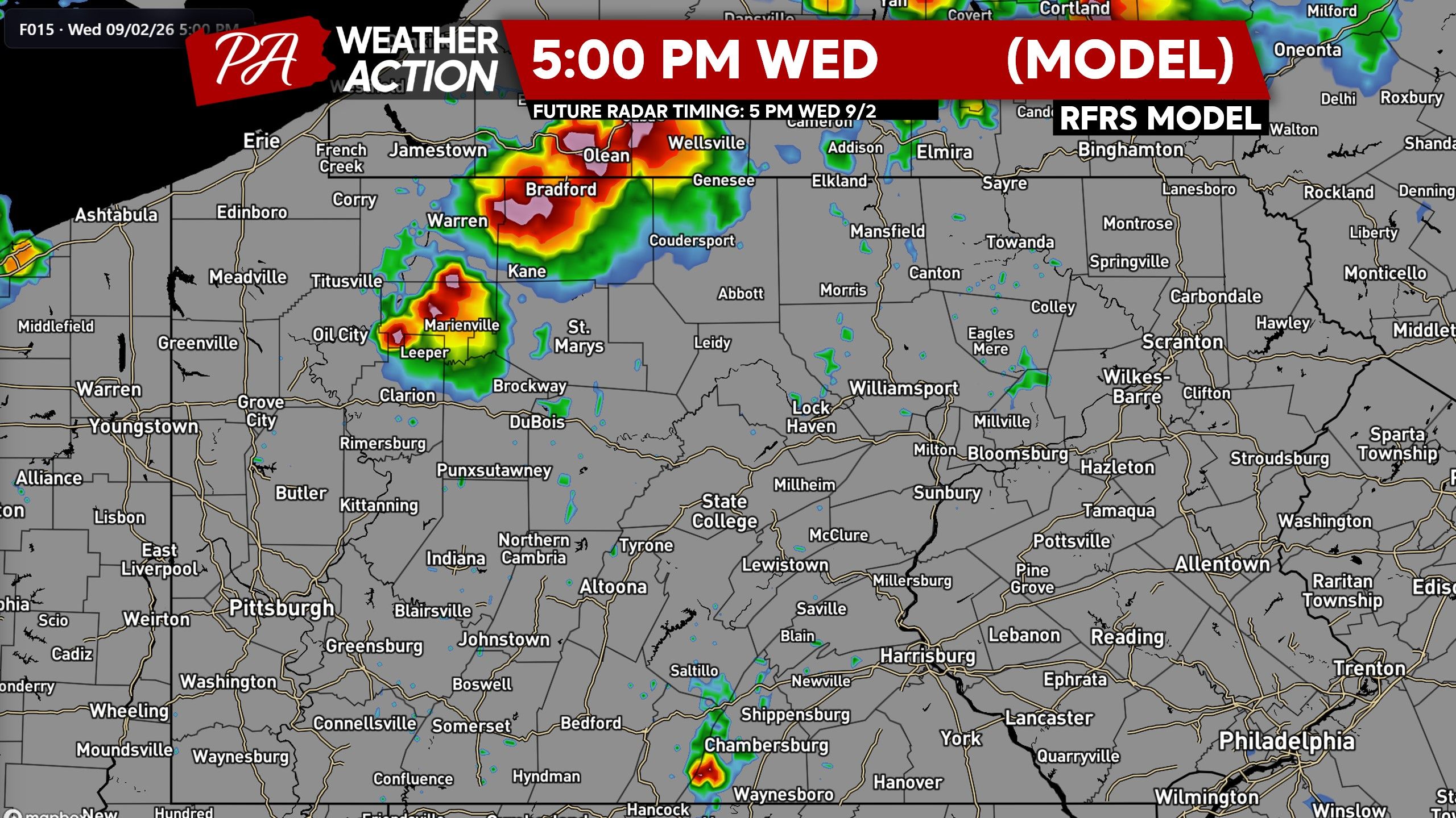
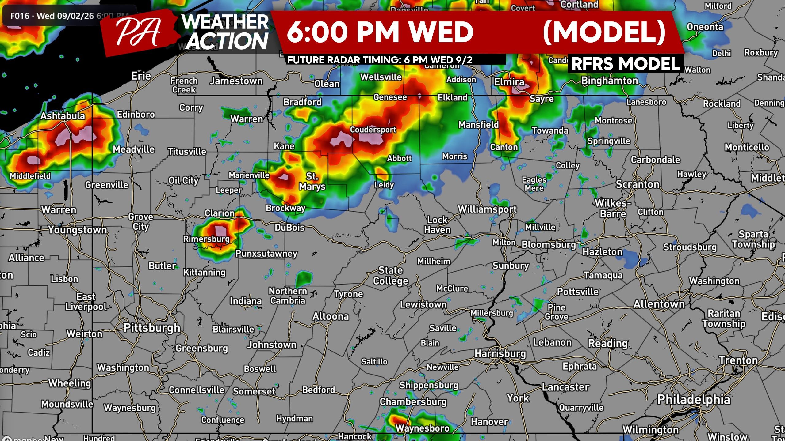
By dinnertime, several severe thunderstorms (perhaps clusters) will be moving south-southeast in Northern PA above I-80, with a considerable damaging wind risk as well as tornadoes. We saw several tornado warnings in North Central PA on Tuesday and expect to again today.
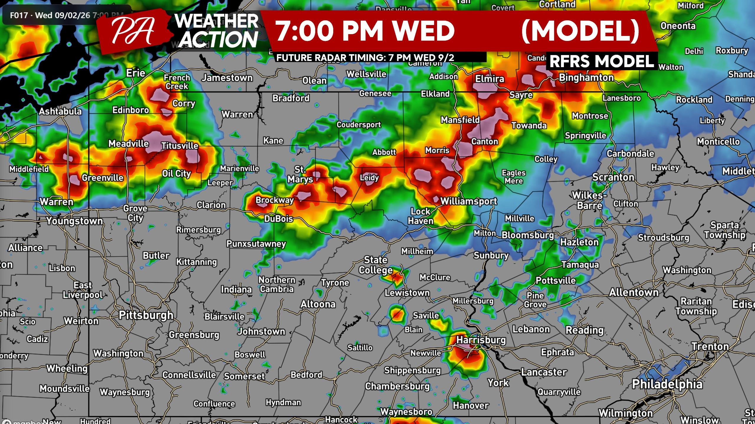
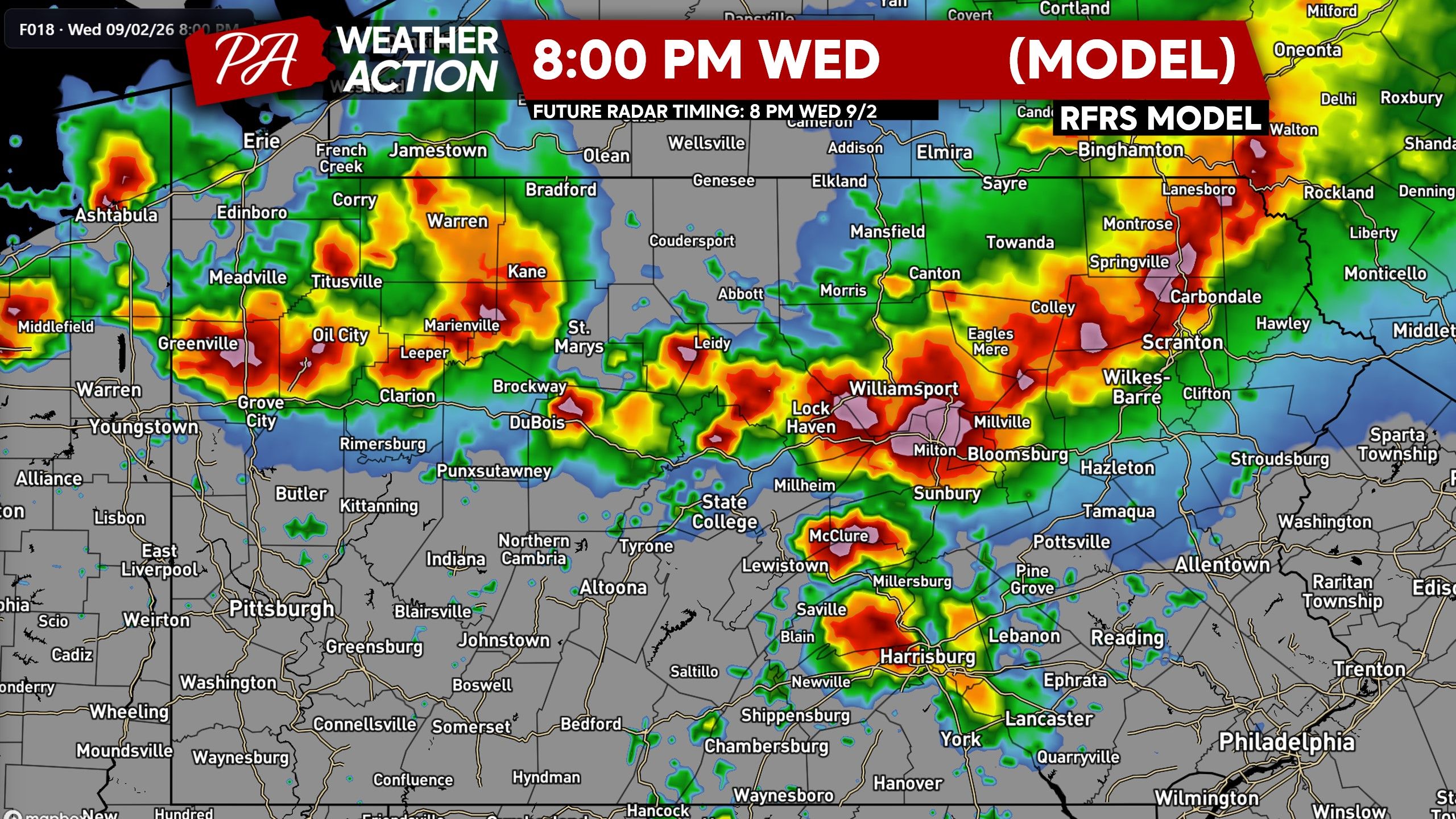
As the sun sets, widespread strong to severe thunderstorms are projected to be in the vicinity of I-80 across the entire state, with Central PA at highest risk of tornadoes. Storms may be less intense in the Poconos due to a more stable environment but these days are infamous for making it happen somehow.
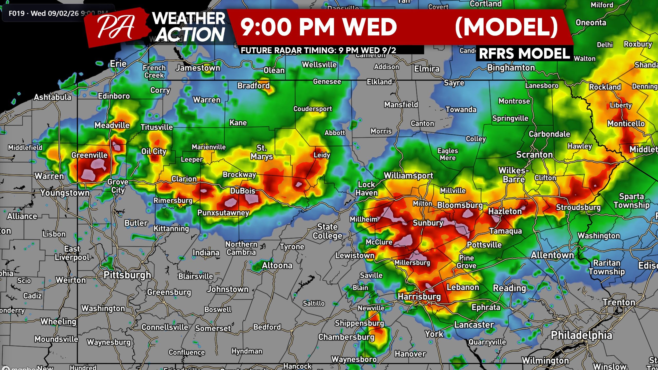
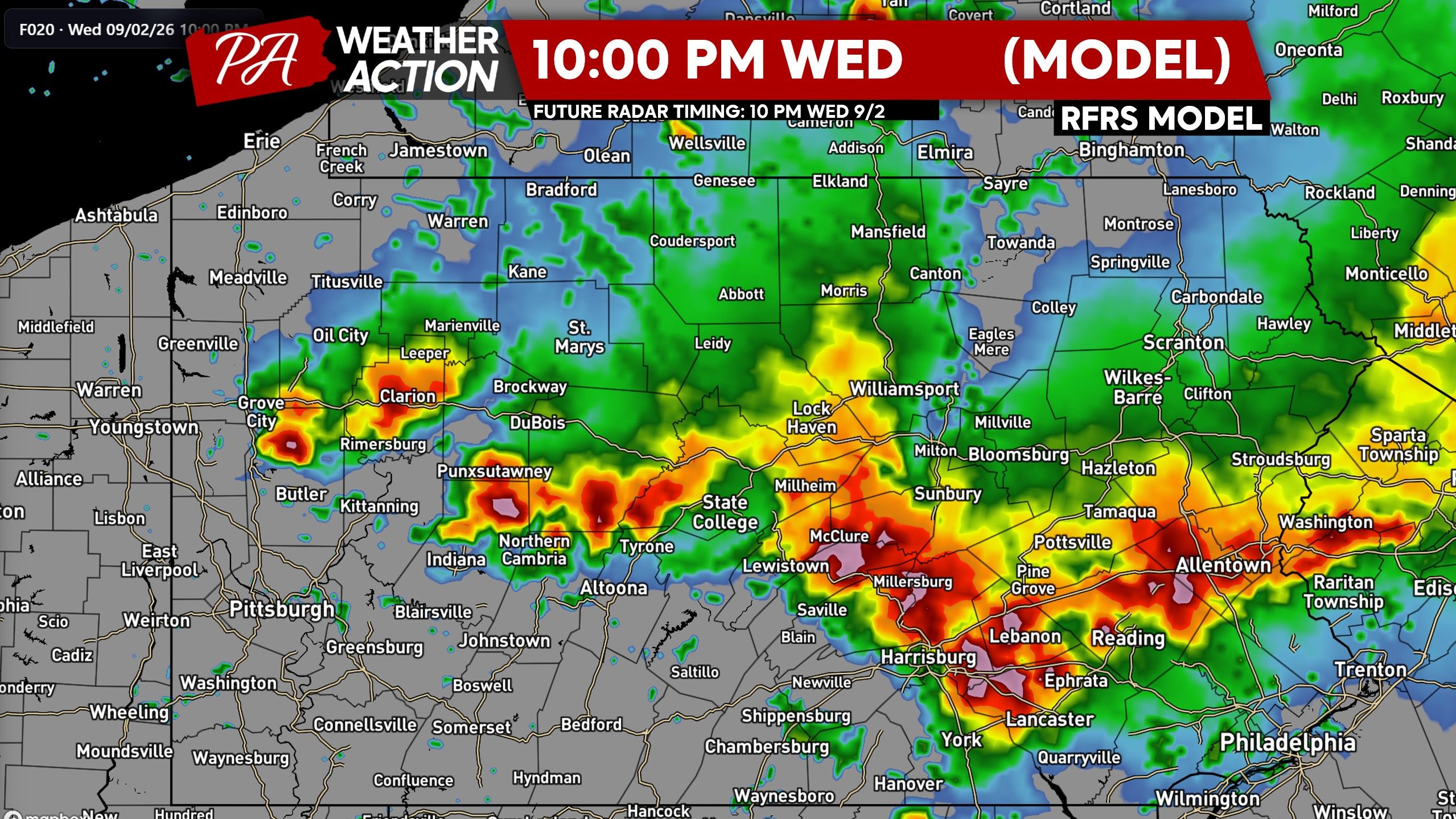
Around 9 – 10 PM tonight, severe thunderstorms should be near I-78 and I-81 from the Lower Susquehanna Valley to the Lehigh Valley. Soon after, strong storms are modeled to reach the Philadelphia Metro and the Mason-Dixon by before midnight.
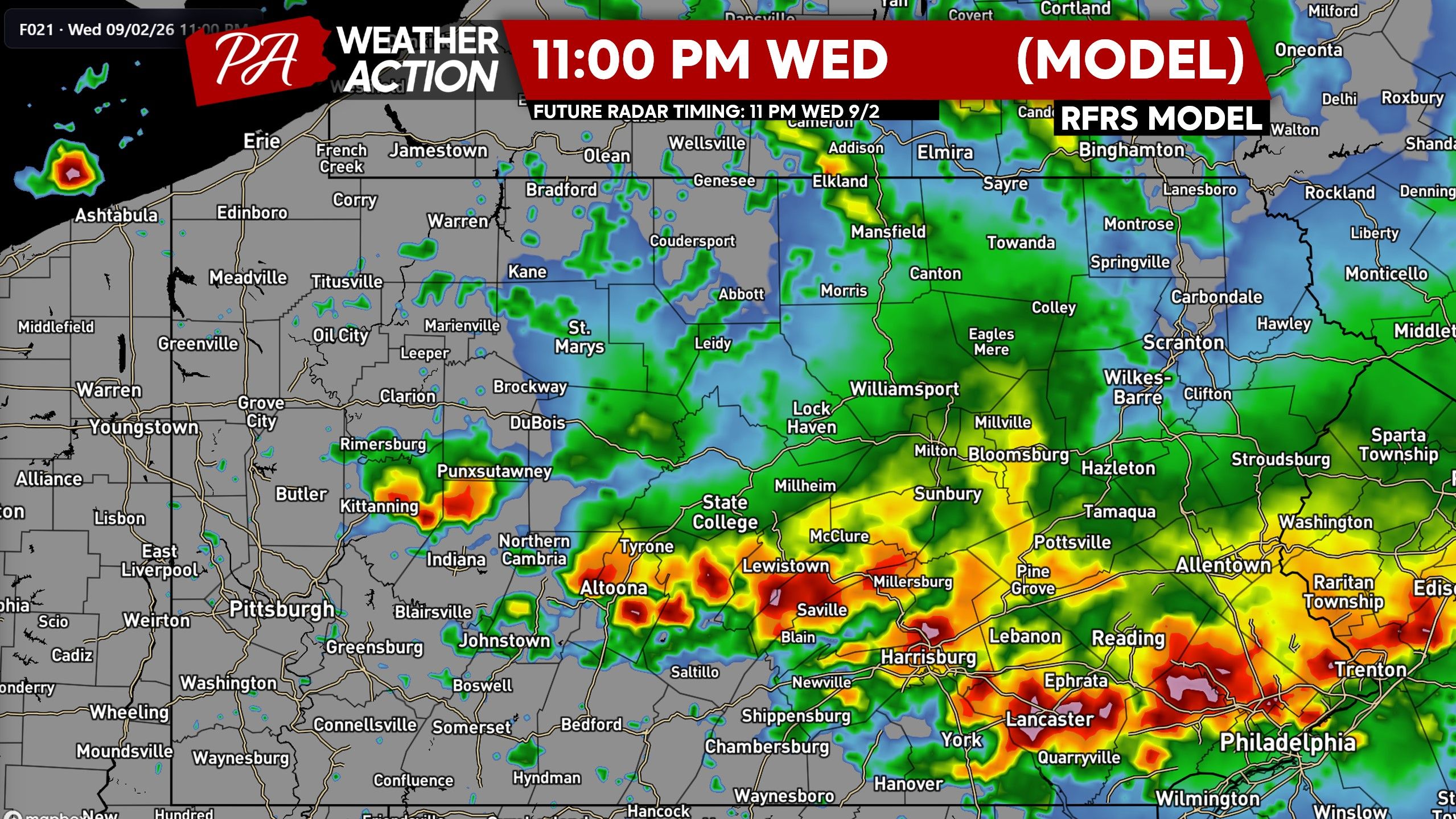
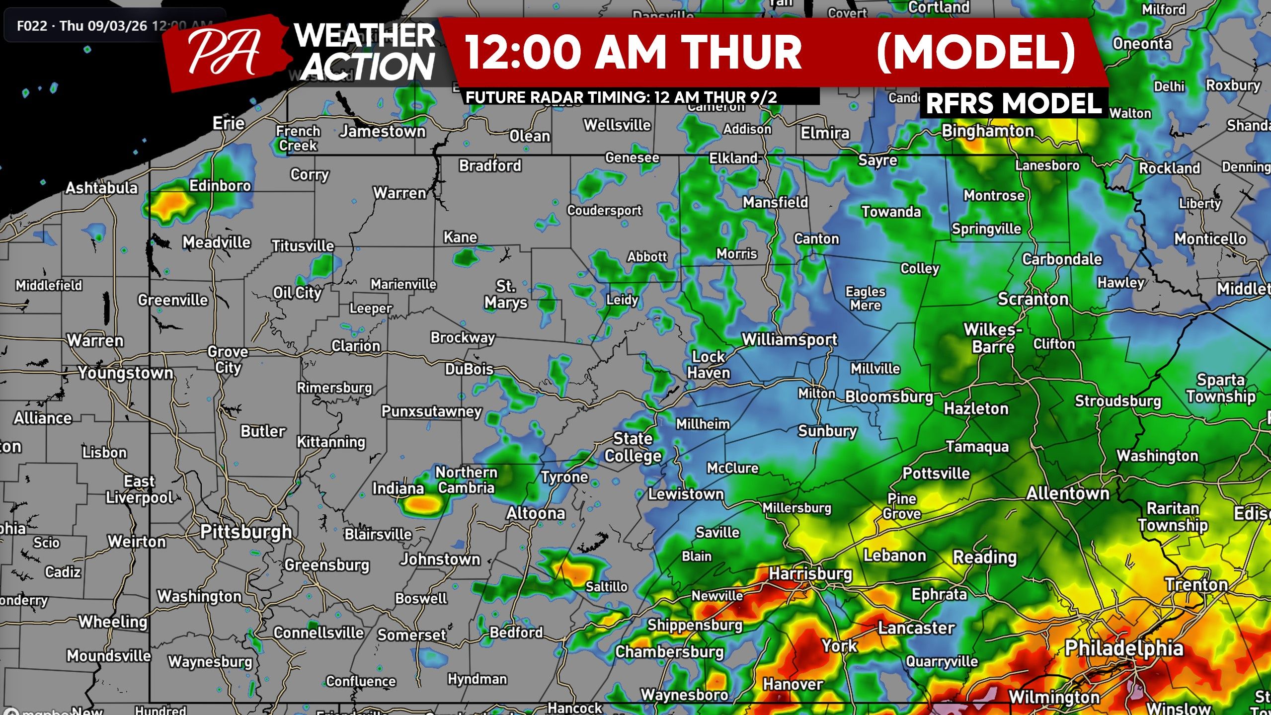
FINAL CALL SEVERE THUNDERSTORM FORECAST FOR WEDNESDAY 9/2
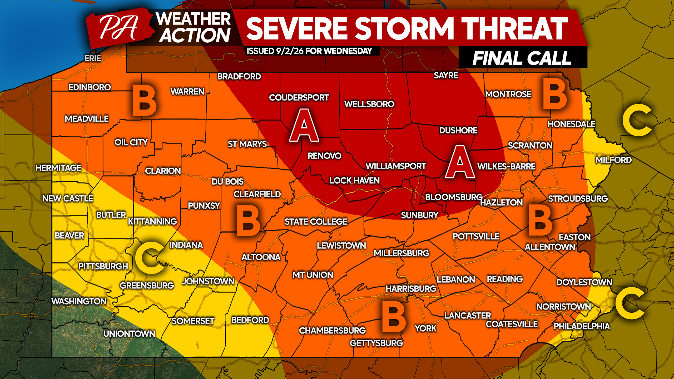
Area A: Widespread severe thunderstorms are expected late this afternoon through dinnertime. Damaging winds up to 80mph and a few tornadoes are possible, along with localized flash flooding.
Area B: Scattered severe thunderstorms are anticipated late this afternoon into the late evening. Damaging winds up to 70mph and an isolated tornado or two, and localized flash flooding possible.
Area C: Isolated strong to severe thunderstorms are possible late this afternoon through dinnertime, with the eastern side of this area more probable to see storms.
Don’t forget to pass along this imminent forecast with family and friends. Stay safe!

You must be logged in to post a comment.