
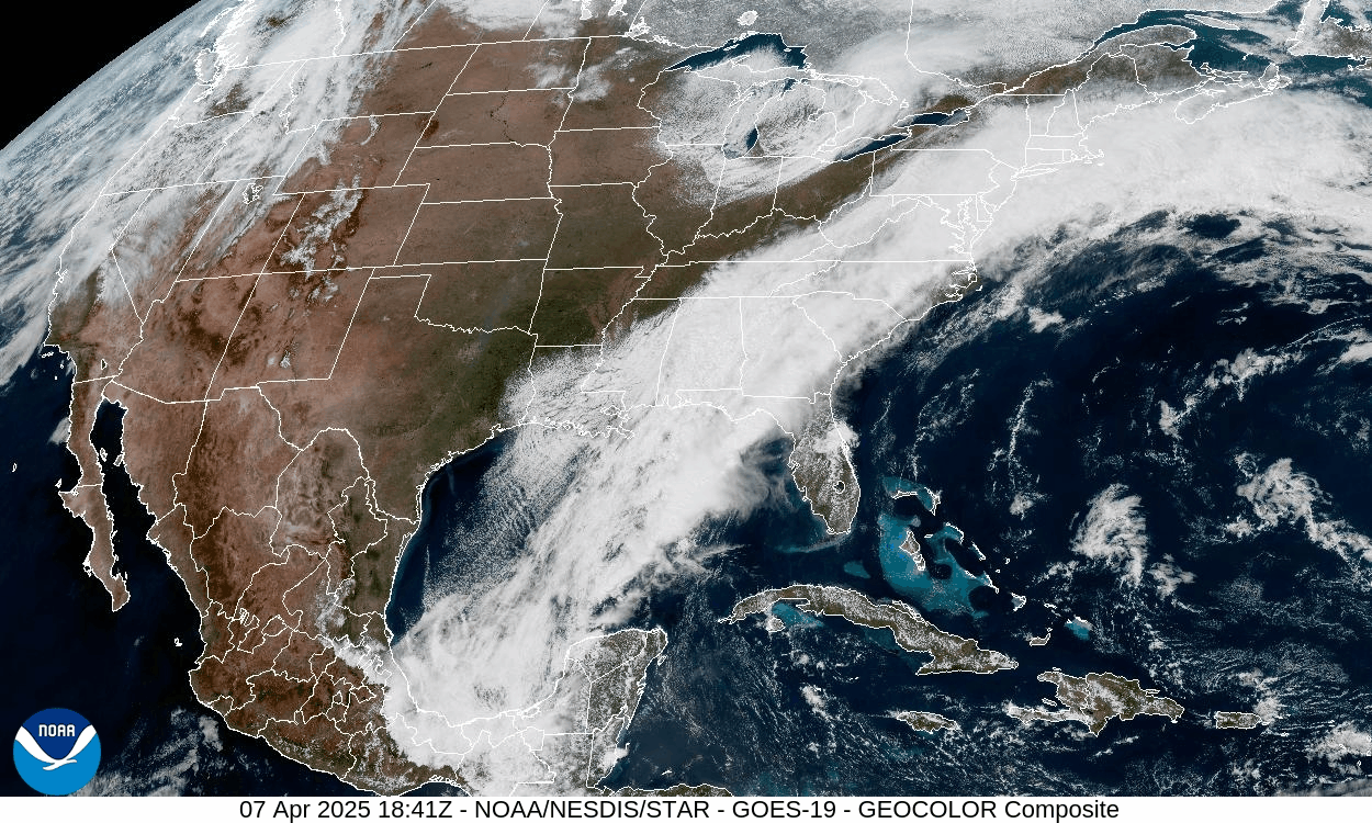
Moisture streaming northward along a frontal zone provided a cool damp day for our area with fog and drizzle. An arctic cold front will cross the area tonight, accompanied by some snow showers and followed by strong gusty wind after midnight.
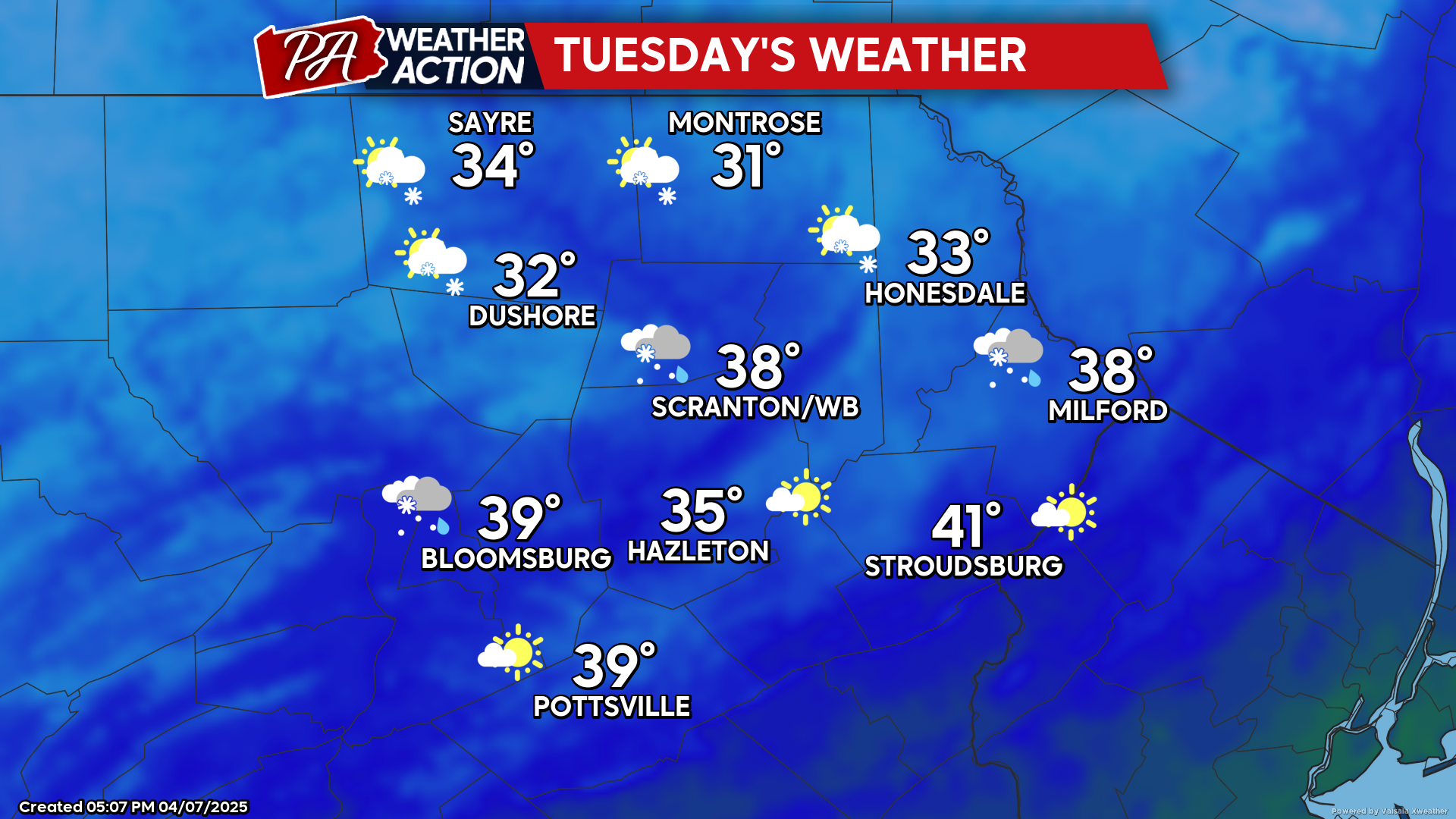
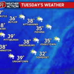
TUESDAY
Tuesday will feature blustery conditions and much-below-normal temperatures. Some of the higher elevations will fail to make it above freezing! The wind will gust from the northwest at 30-40 mph. Clouds and snow showers will blow across the northern and western counties, while the southeastern counties will experience partly cloudy conditions. Temperatures Tuesday night will plummet into the 20s region-wide, with some upper teens possible in the higher elevations!
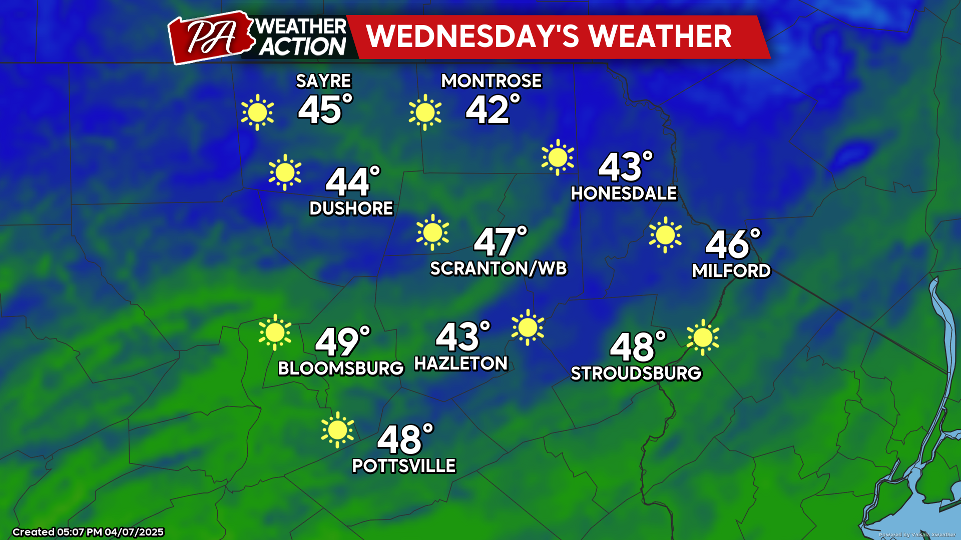
WEDNESDAY
High pressure will provide ample sunshine and more-calm conditions. While warmer than Tuesday, temperatures will remain colder than normal
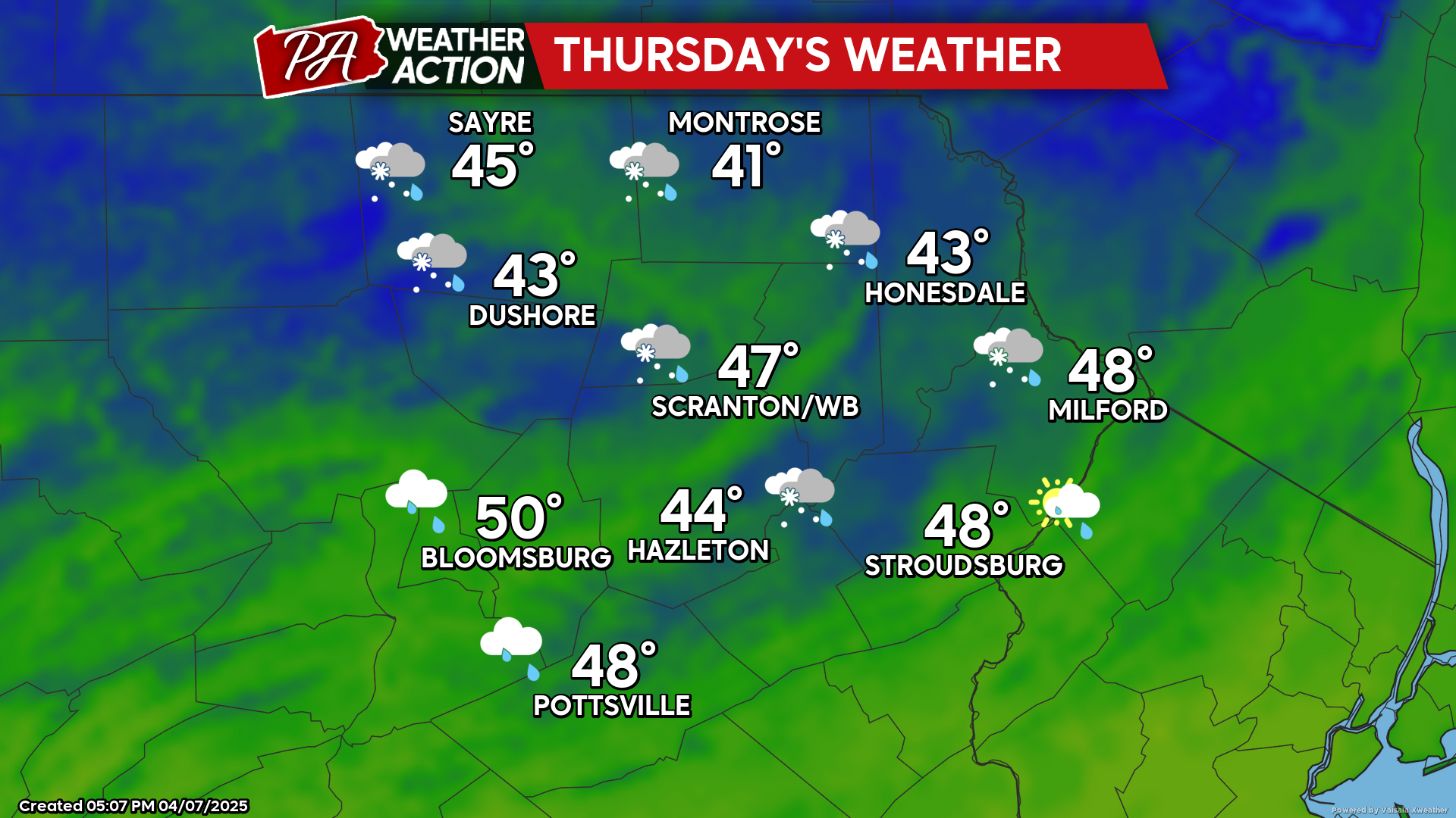
THURSDAY
A storm system will track northeastward into the eastern Great Lakes, spreading precipitation into our area during the daytime. It is very possible that the precipitation will start as a light wintry mix before transitioning into a cold rain. Enjoy!
You must be logged in to post a comment.