
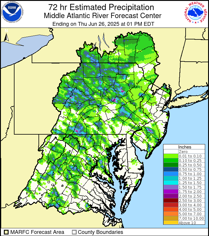
Scattered thunderstorms popped in yesterday’s heat and humidity, although they were localized. Here is a map of the estimated rainfall for the past 72 hours courtesy of the Mid Atlantic River Forecast Center:
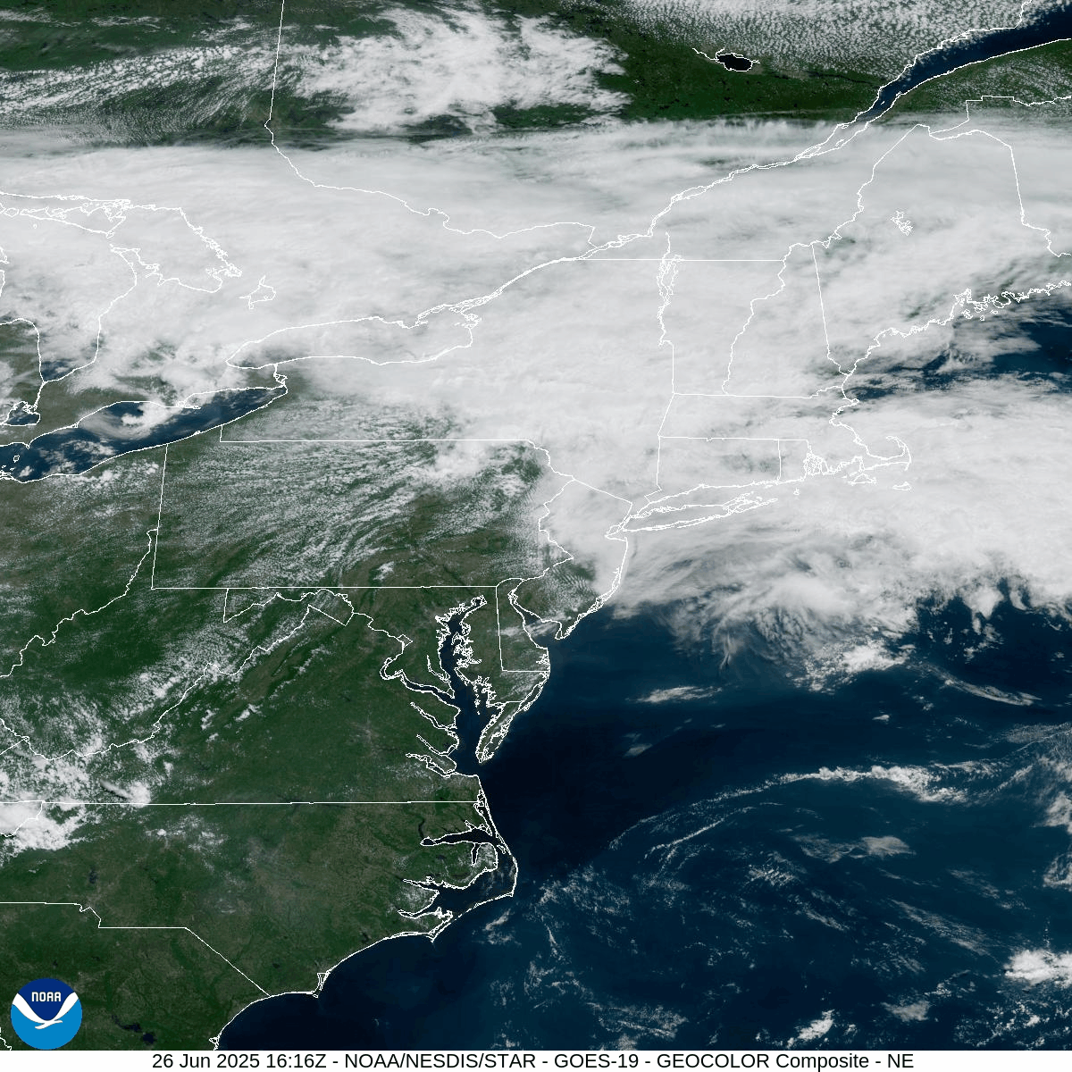
A backdoor cold front is currently pushing westward into eastern Pennsylvania and will provide relief from the recent oppressive heat and humidity. West of that front, showers and thunderstorms are igniting, some of which will bring heavy downpours. That front should clear our area tonight, and will return northward through our area this weekend.
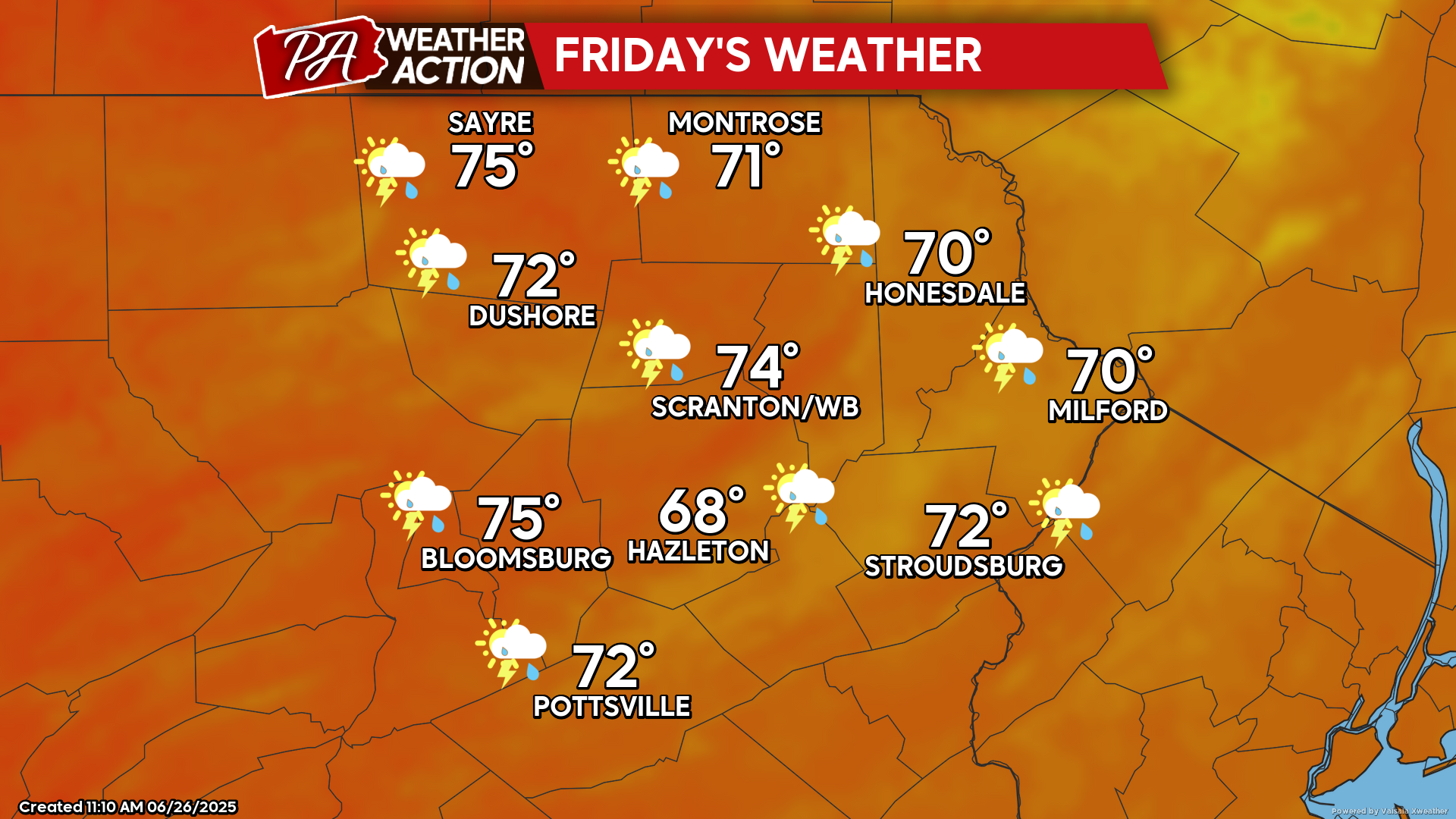
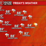
FRIDAY
Friday will feature much lower temperatures and humidity. The onshore flow off the Atlantic Ocean will maintain a lot of clouds and perhaps a few showers.
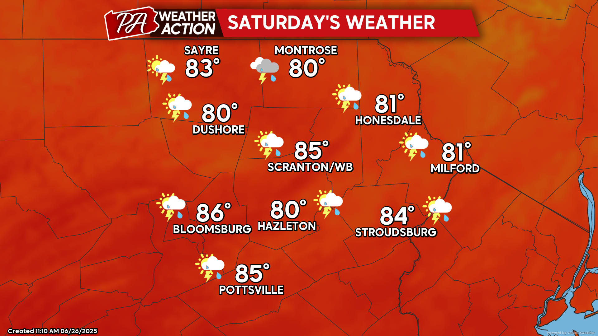
SATURDAY
The cold front will life back north of our area, with a south wind delivering higher temperatures and humidity. There could be some showers and thunderstorms, especially during the afternoon.
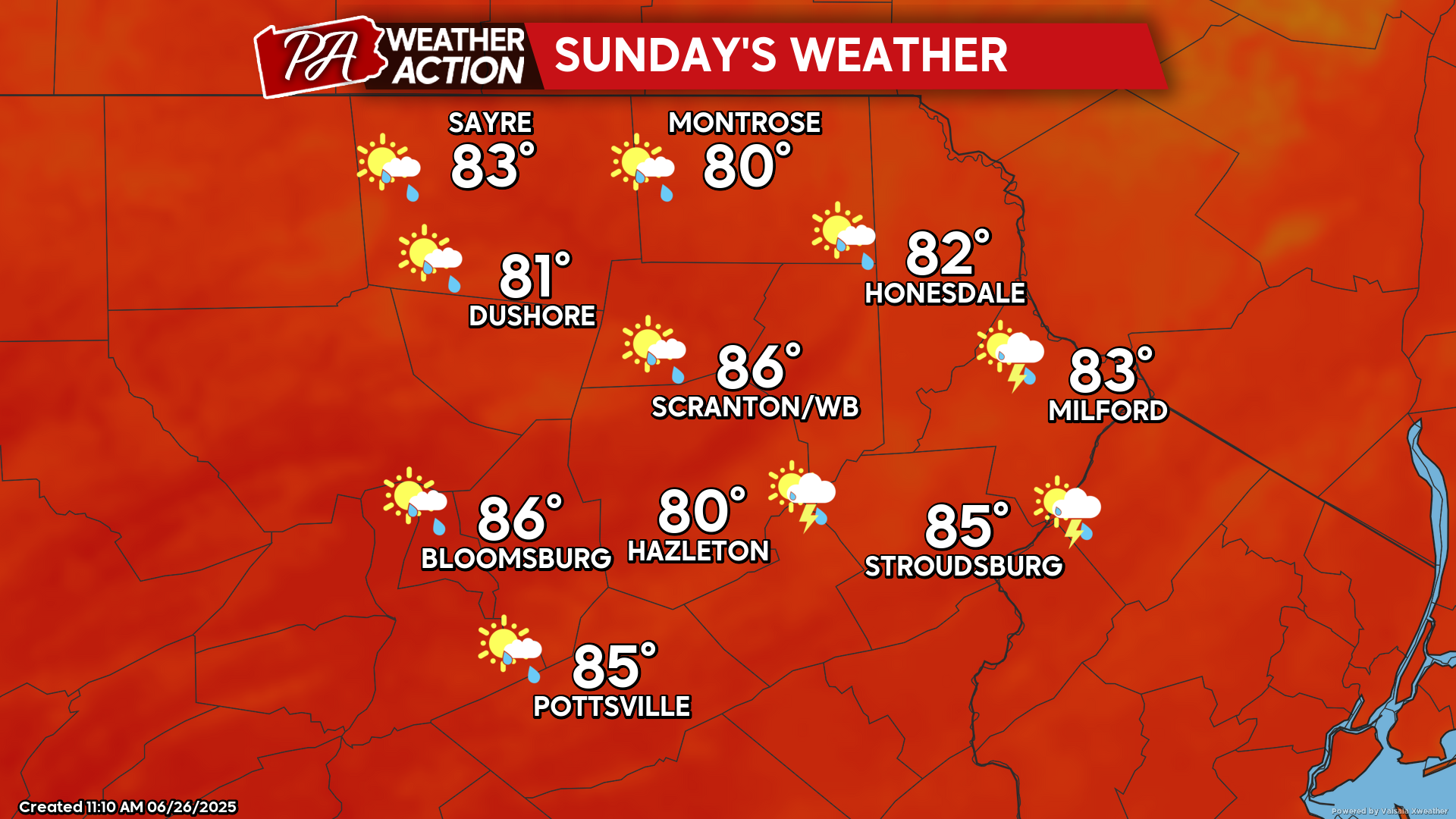
SUNDAY
Sunday will continue to be a warm and humid day. While there could be a few isolated thunderstorms, it will be a mostly-dry day.

You must be logged in to post a comment.