
The severe thunderstorm threat for today (Sunday) has increased rather significantly, as the front moved slower than expected. We have high dew points, plenty of wind shear (responsible for creating spin for tornadoes), and as a result a Level 3 out of 4 risk is up.
As always in severe weather season, impacts will be very localized. Even with straight line winds, which are a big concern today. They can be nearly as localized as tornadoes.
We won’t waste any time considering this threat is about to begin as we post this, so let’s get right into timing followed by the severe thunderstorm threat map.
Thunderstorm Timing in PA
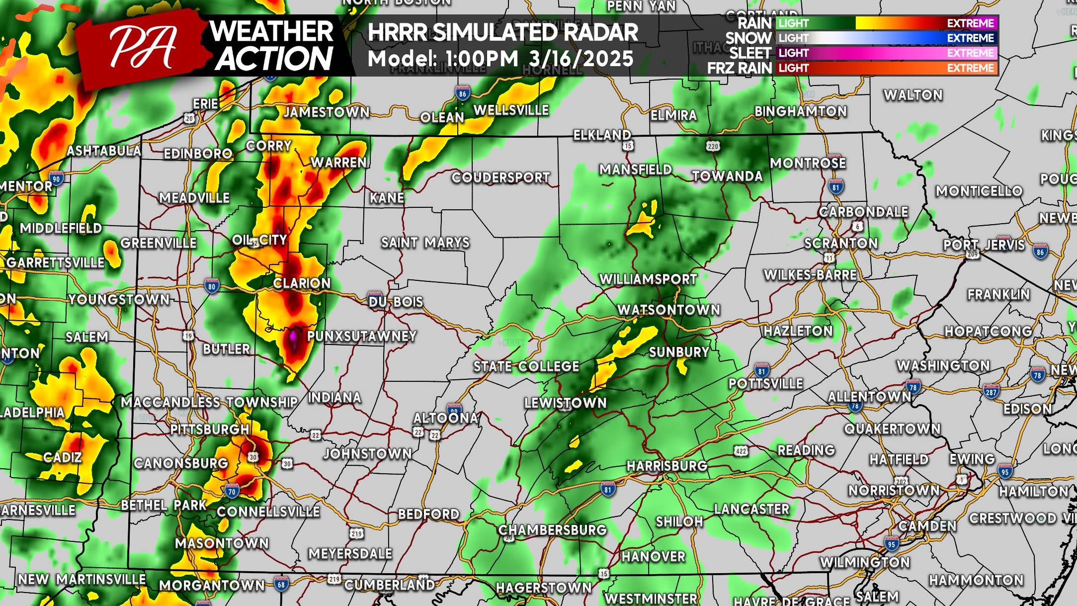
Storms are already approaching the Pittsburgh Area, and will likely hit the entirety I-79 corridor by 1 PM. These storms will be strong to severe.
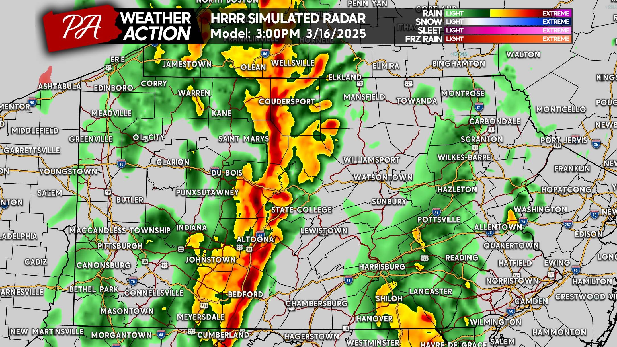
As we head later into the afternoon, a line of storms, with parts of it being severe, is expected to push east-northeast into Central PA. A few tornadoes are possible within this line, as a lot of wind shear is in play. Any tornadoes will likely be rain-wrapped, meaning you won’t be able to see them coming very well.
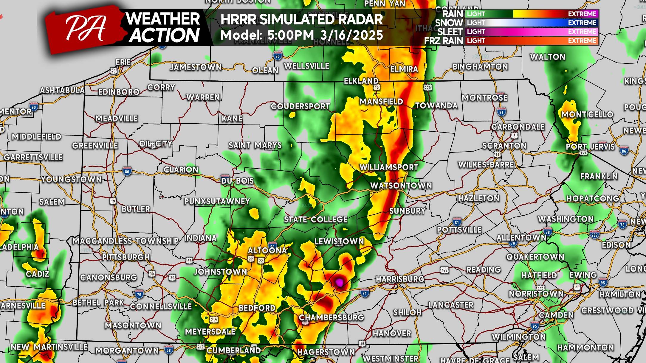
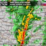
By 5:00 PM Sunday, this line of storms will begin to approach the easternmost extent of highest instability which will be west of Route 15. This does not mean there’s an invisible wall, and these storms will certainly continue to be strong east of Route 15. As you can see below, locations from Chambersburg to Williamsport look to see this line around 5 PM.
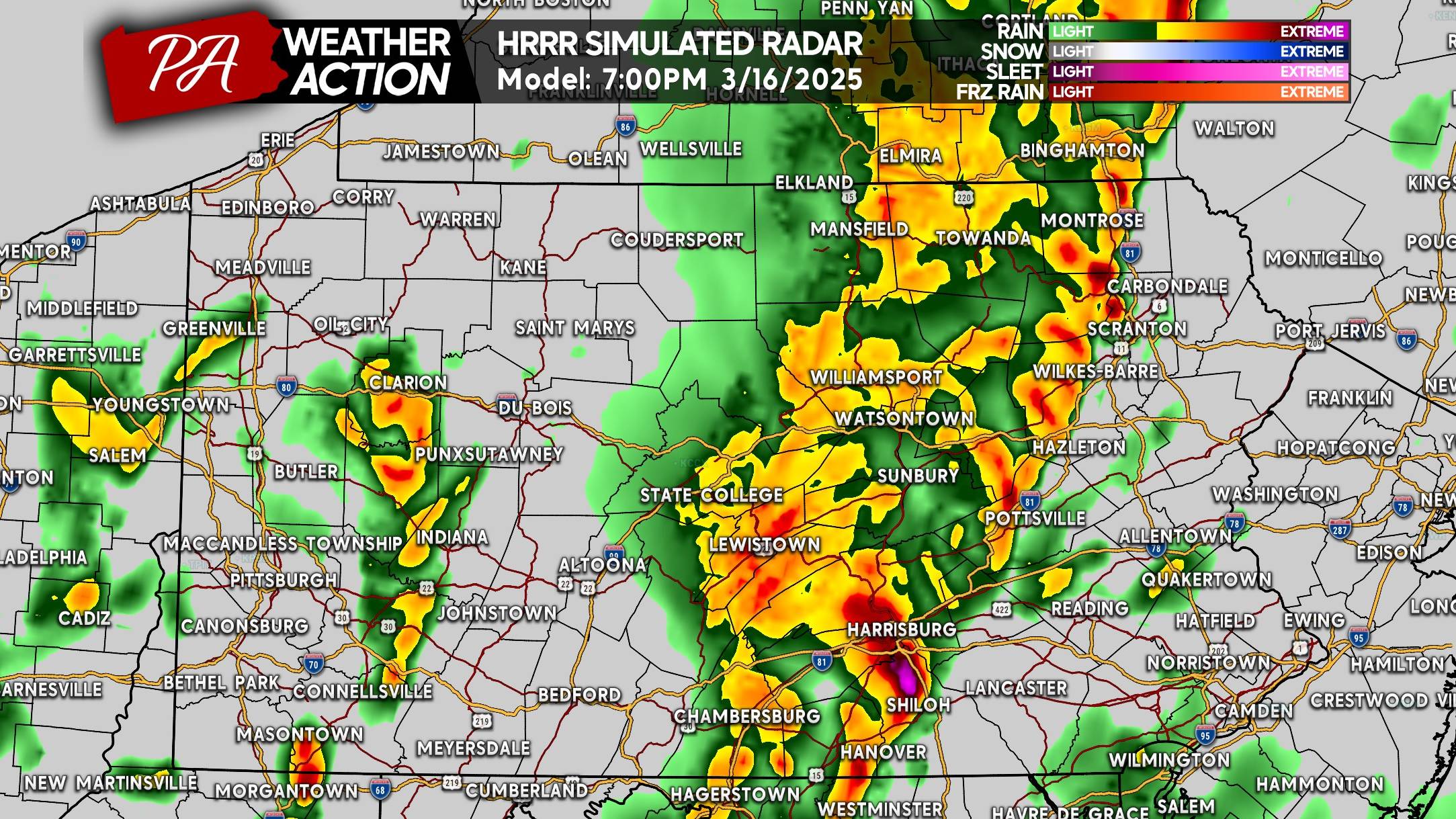
As we near sunset, these storms will really begin to exit the area of greatest instability. Cloud cover and a cooler, more stable environment will exist in Eastern PA. Scattered damaging wind gusts will still be possible near and west of I-81. Below is HRRR Future Radar for 7:00 PM Sunday.
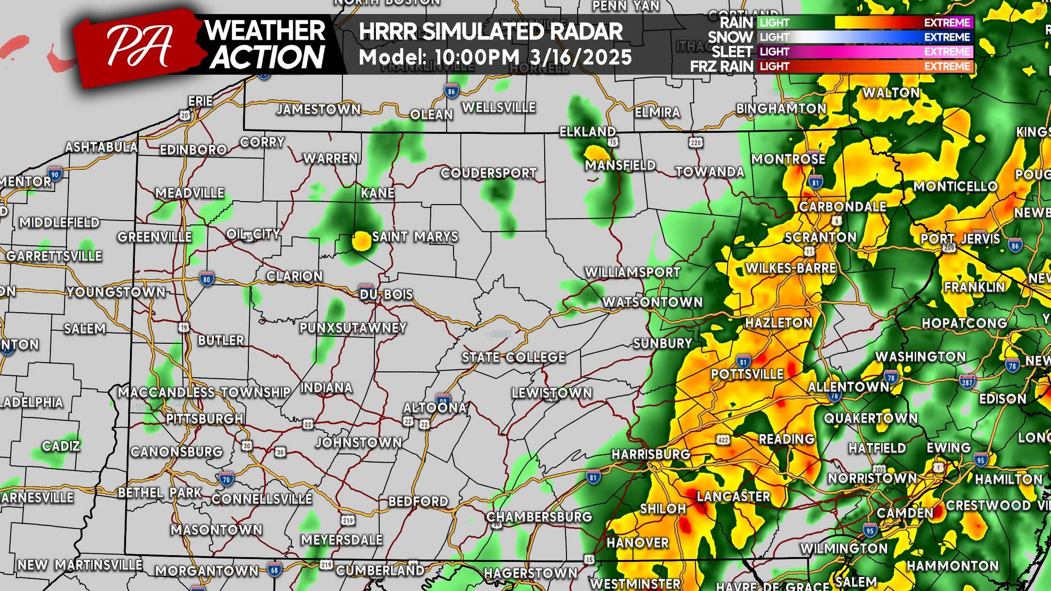
And finally by late Sunday evening, the line will evolve a large area of heavy rain with some embedded lightning and gusty winds. But the severe threat should be gone. Still some very beneficial heavy rain in Eastern PA by 10 PM.
SUNDAY’S SEVERE THUNDERSTORM THREAT FORECAST
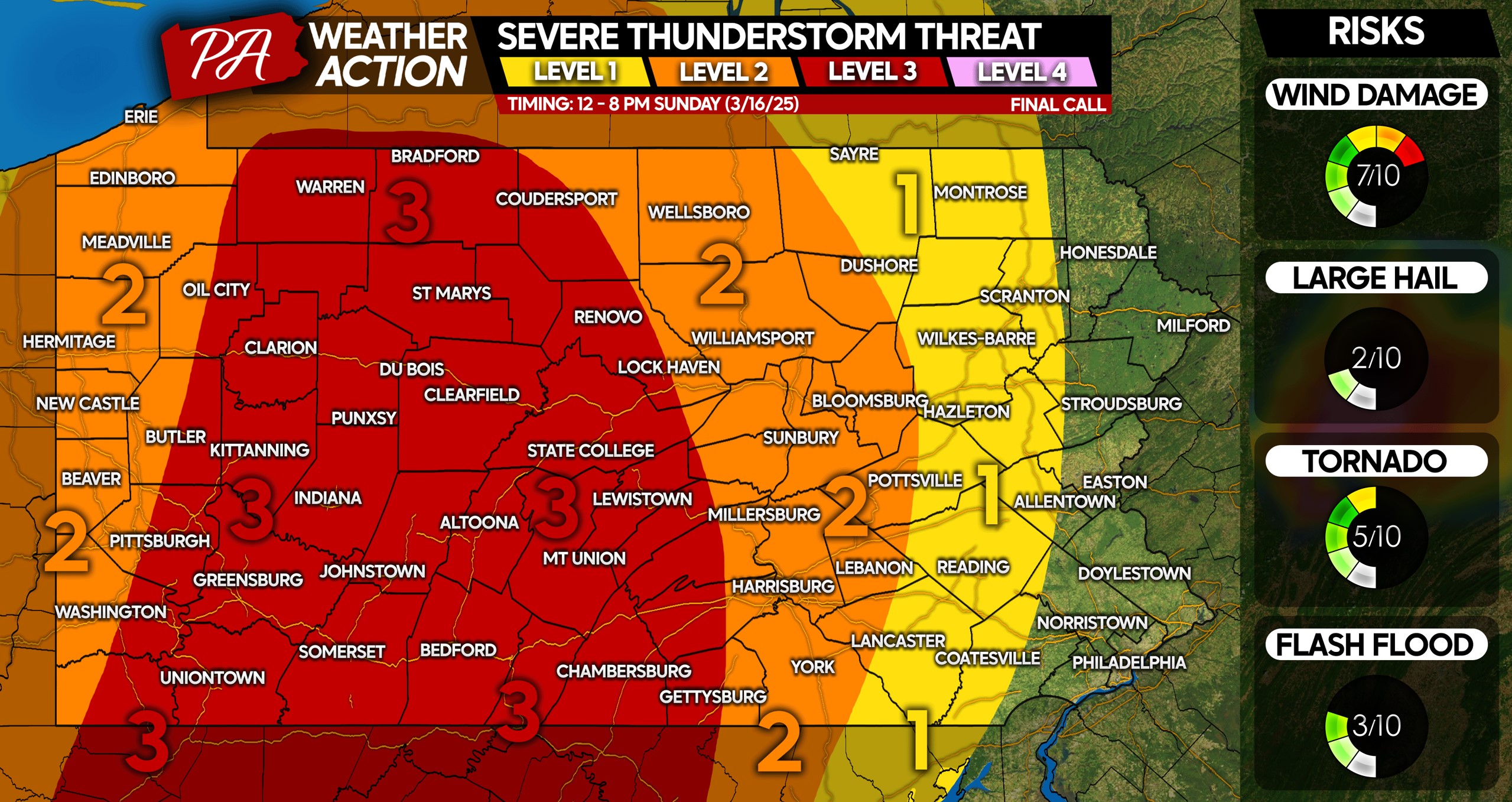
Level 3 Risk: Straight-line winds, which are powerful winds often 50 – 80 MPH, not associated with tornadoes, are possible within stronger parts of the line that will push through. A few tornadoes are possible within this risk area as well, and if they do occur they’ll be embedded within the line. Very low hail and flash flooding concerns.
Level 2 Risk: Widespread gusty winds of 35 – 55 MPH are expected, with scattered wind gusts up to 65 MPH possible within severe parts of the line. An isolated brief spin-up tornado is not out of the question, with a 2% chance of it hitting near you if you’re in this area.
Level 1 Risk: Gusty winds of 35 – 55 MPH are likely, with an isolated storm or two possibly producing severe wind gusts. There is not a tornado threat in this area.
Be sure to share this forecast with friends and family in affected areas. Have a way to be notified of latest alerts for your area!

You must be logged in to post a comment.