Posted inSevere Weather Uncategorized
First & Final Forecast: Damaging Severe Thunderstorms Possible Saturday and Sunday in PA
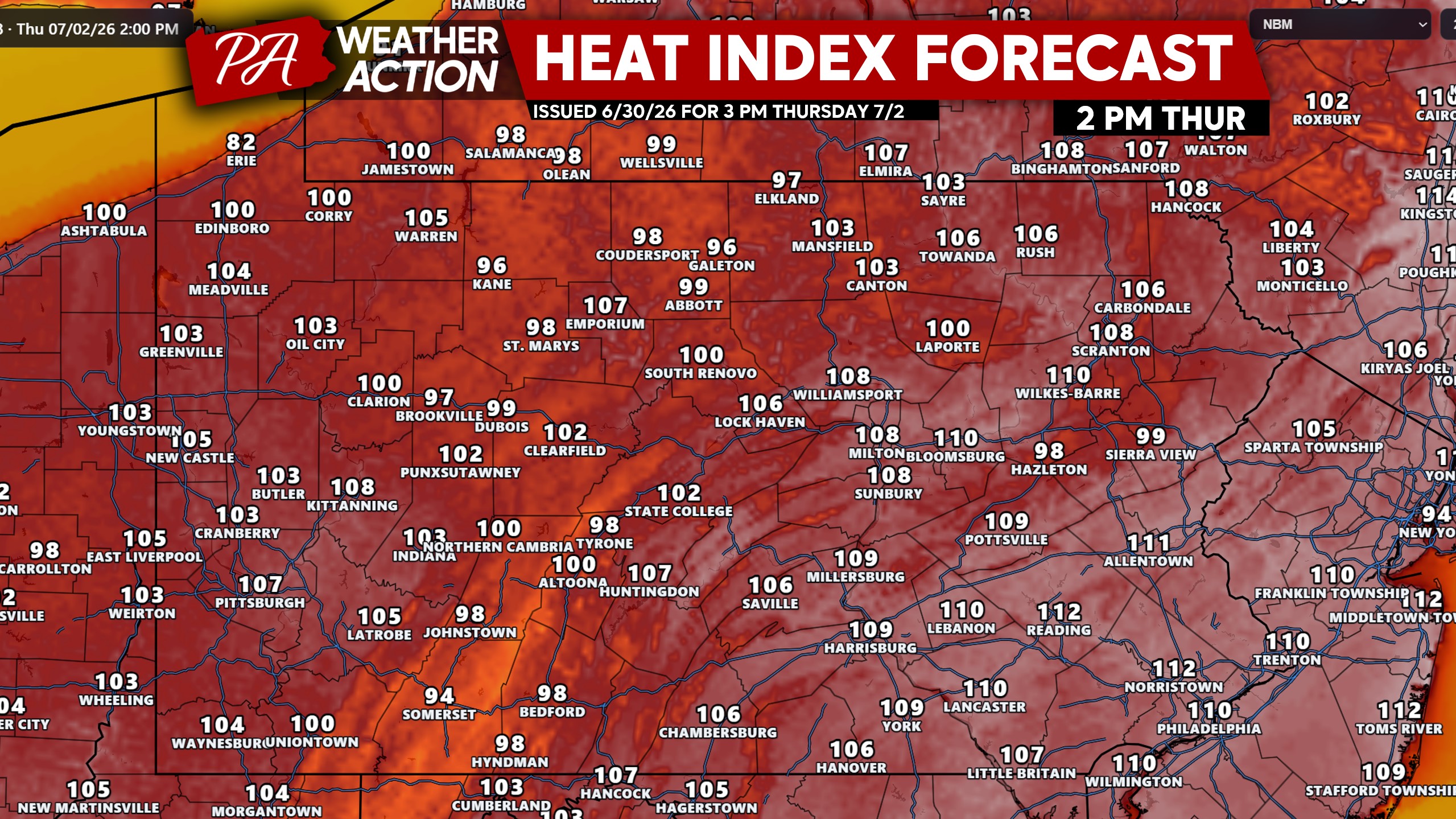
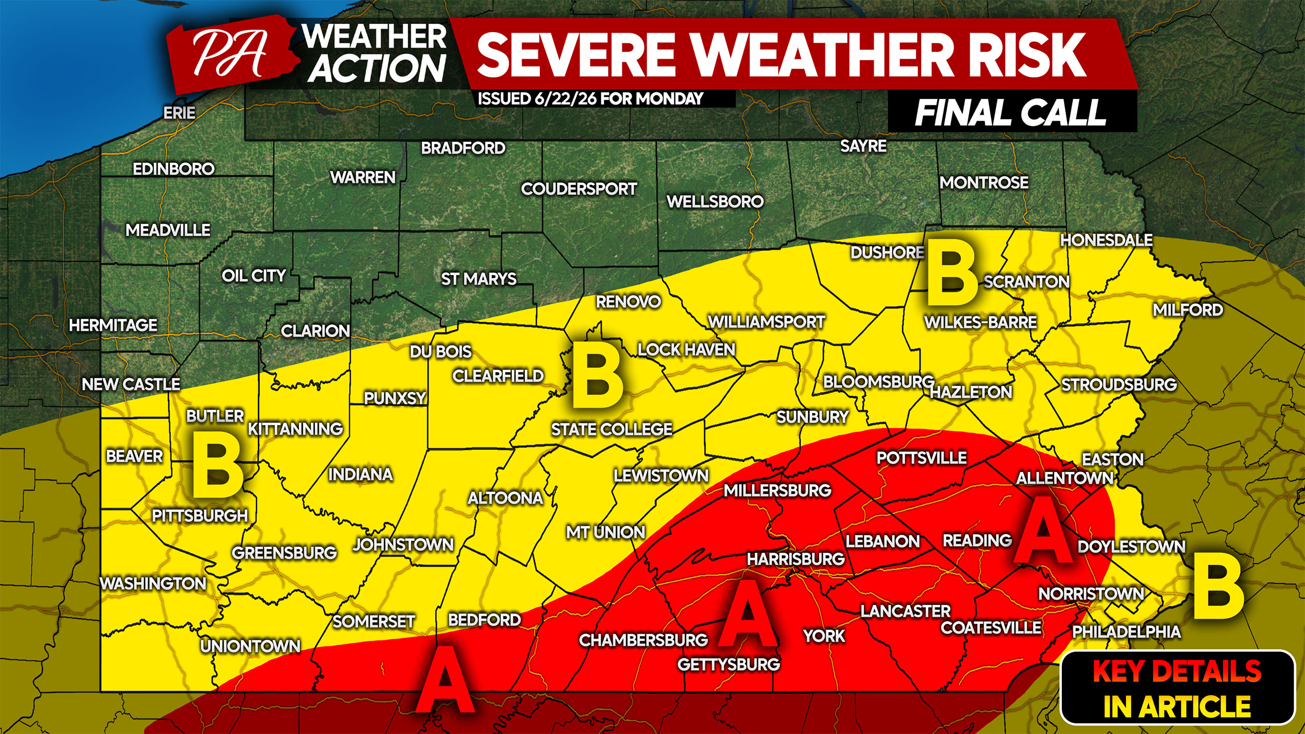
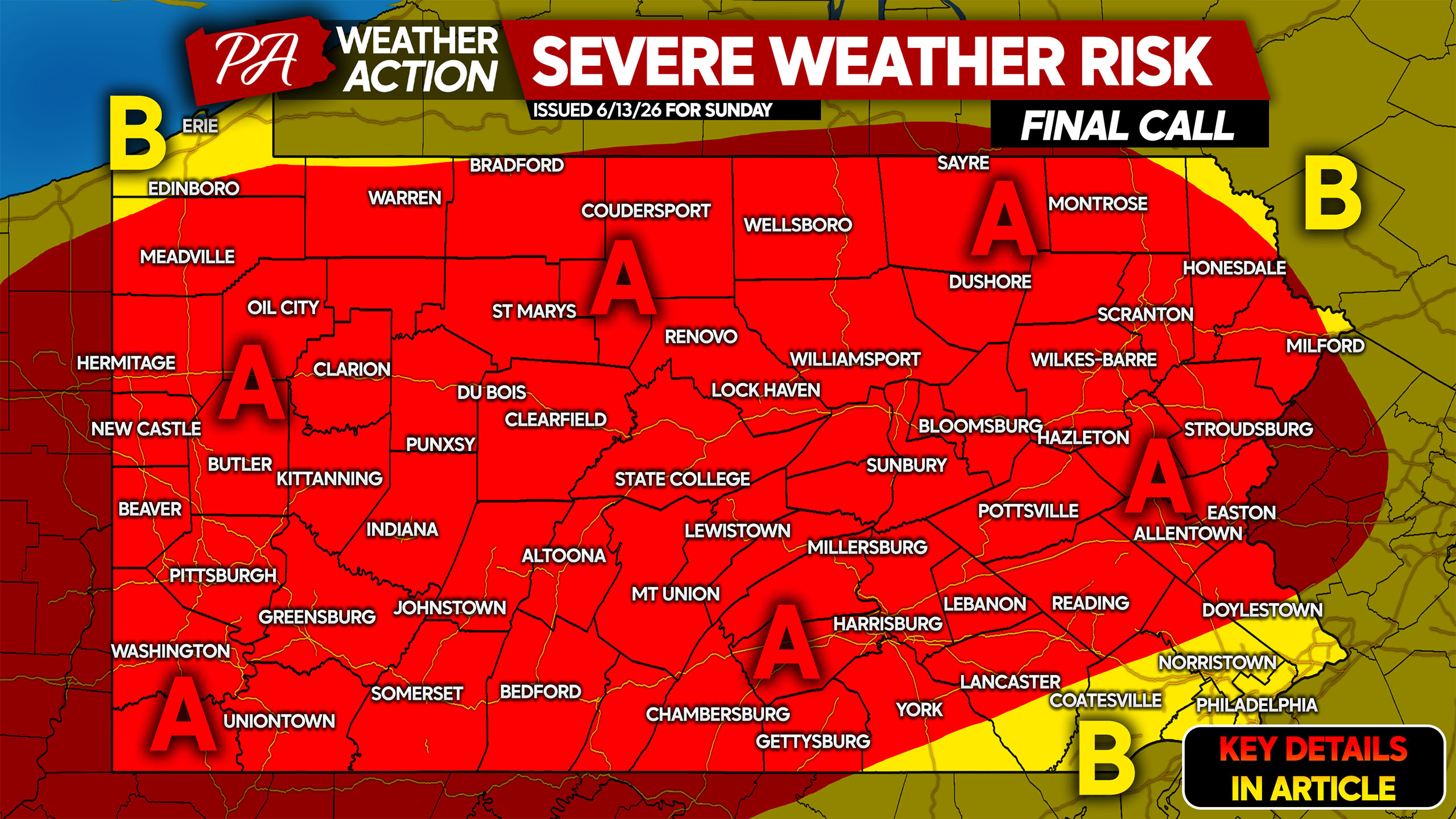
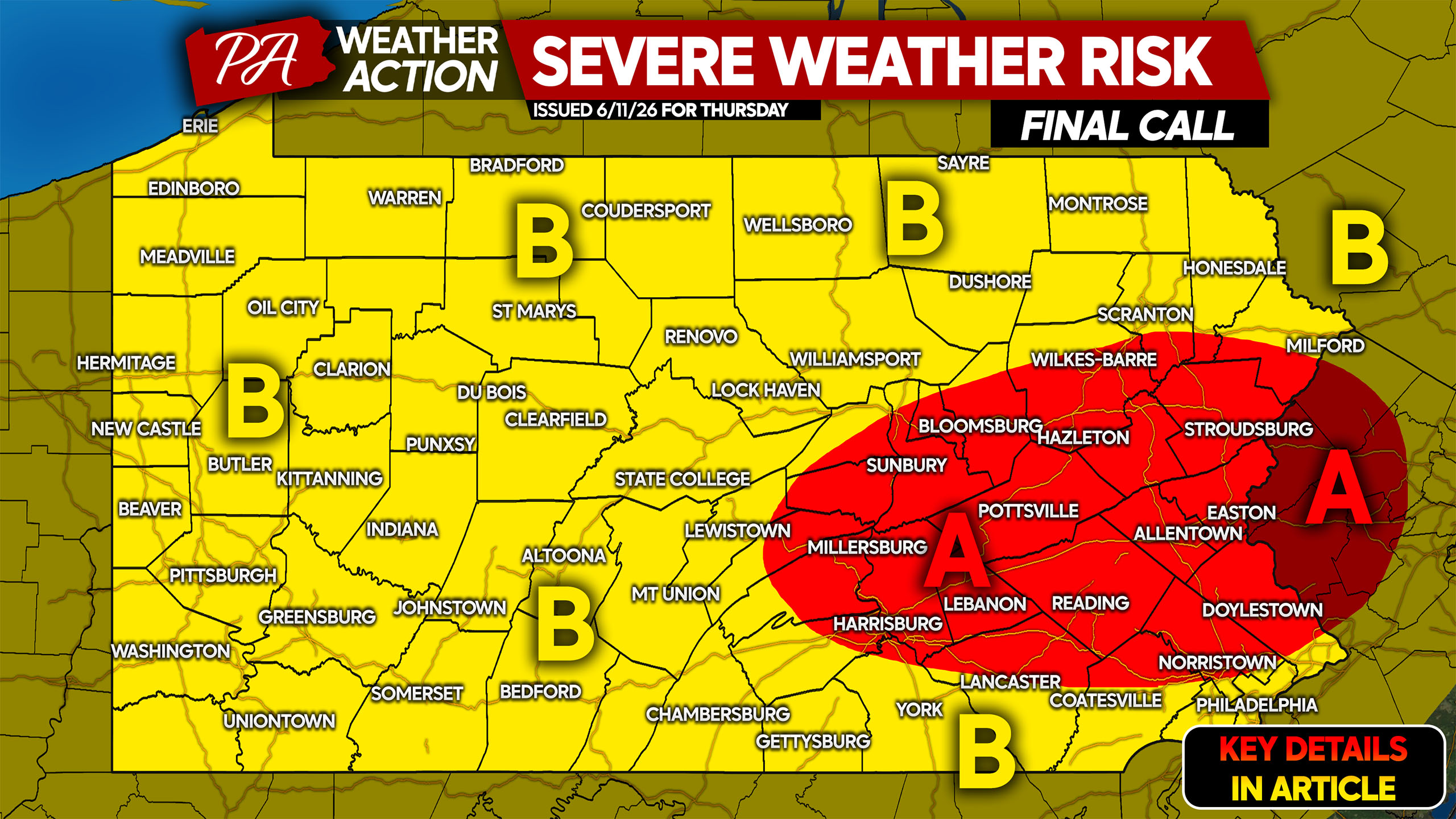
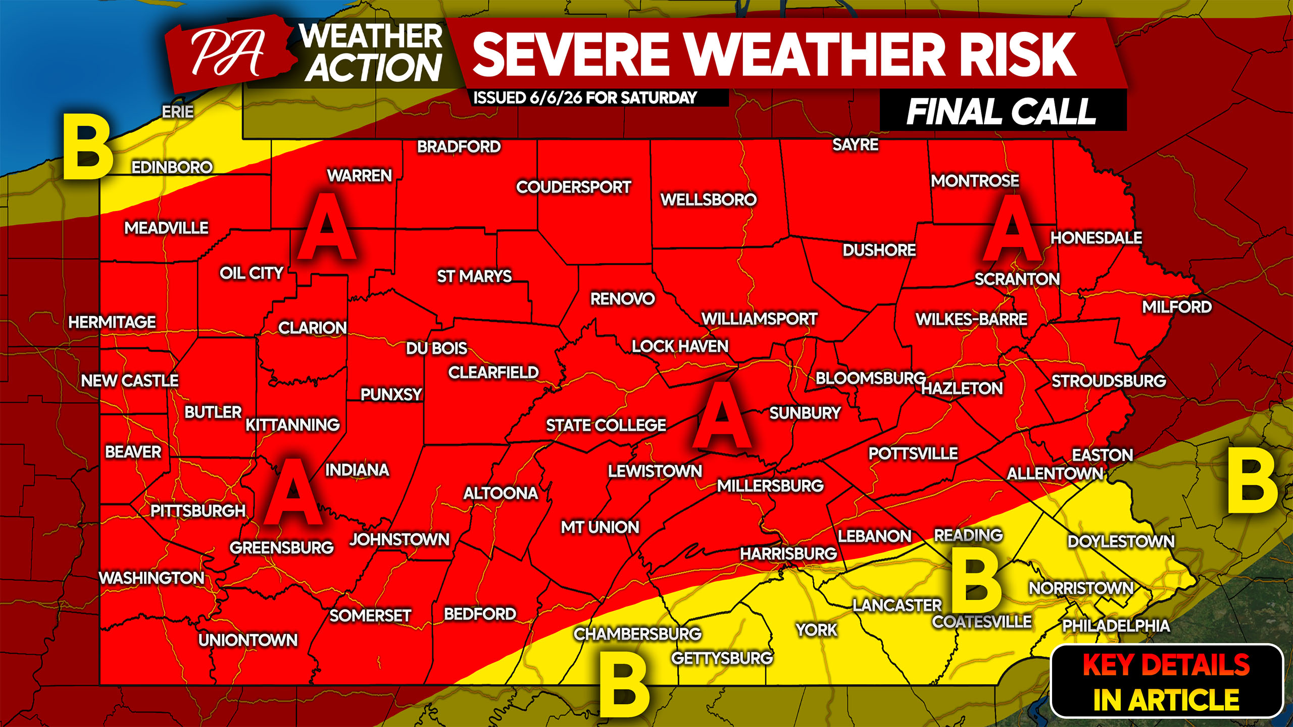
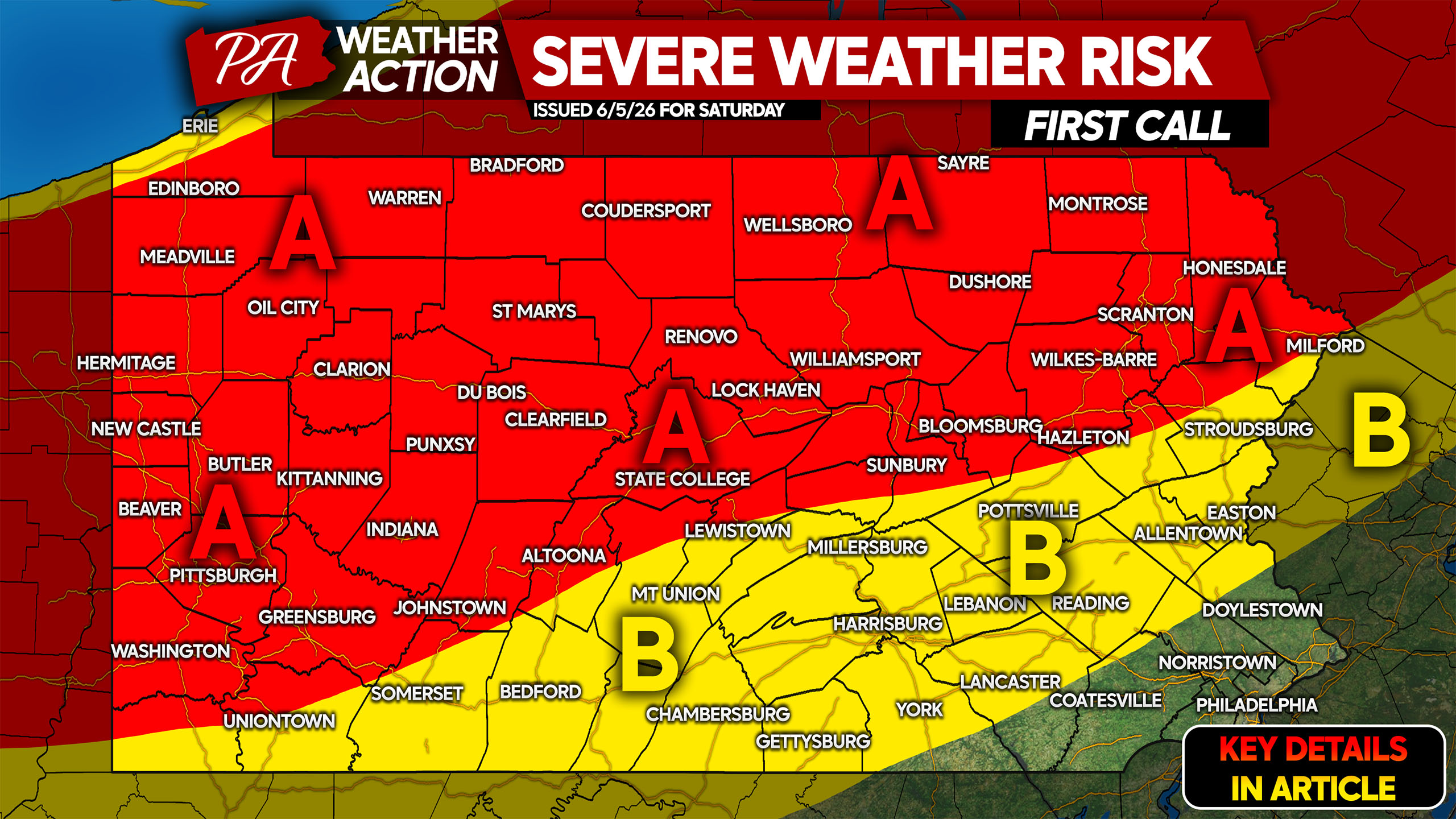
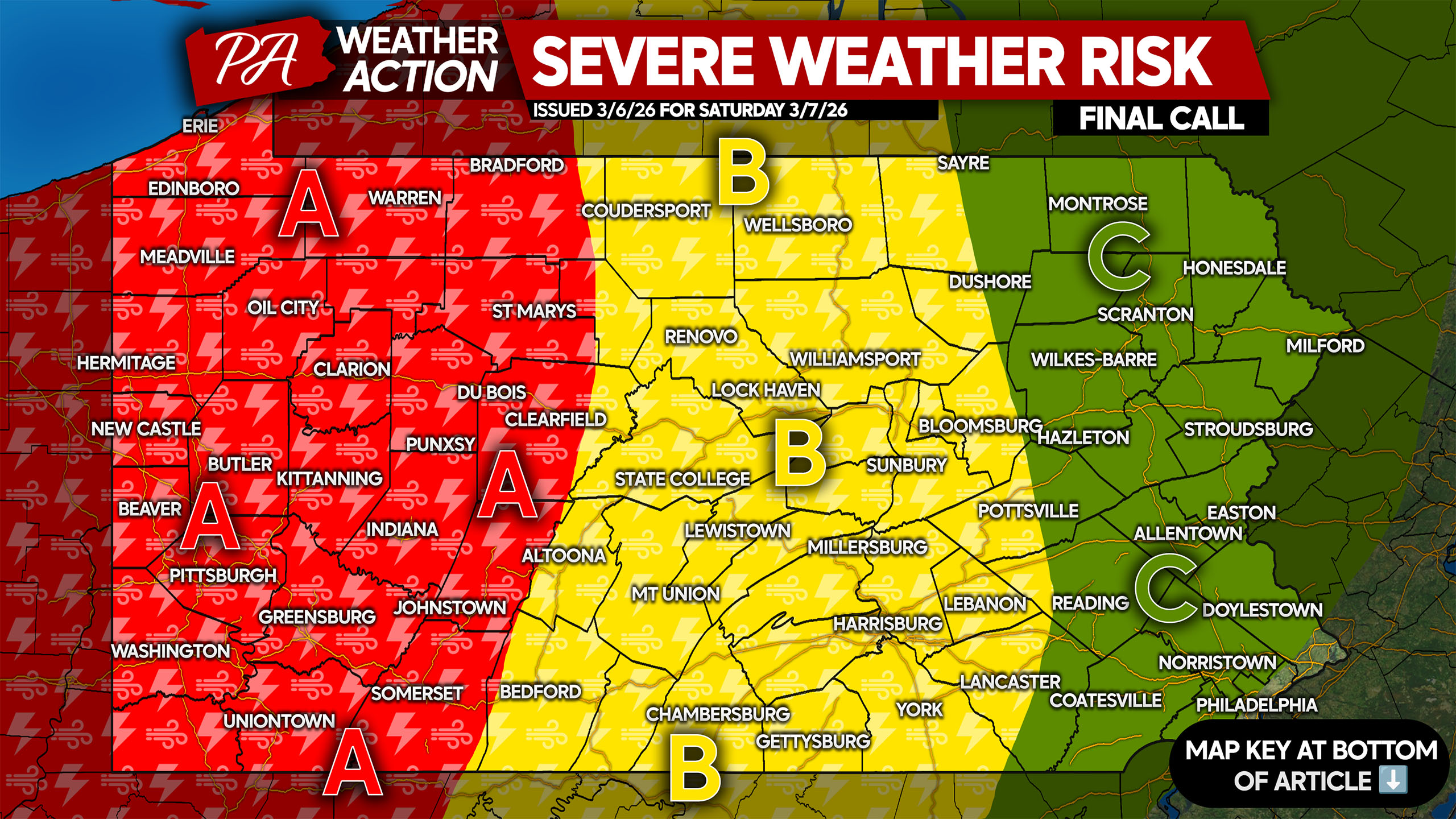
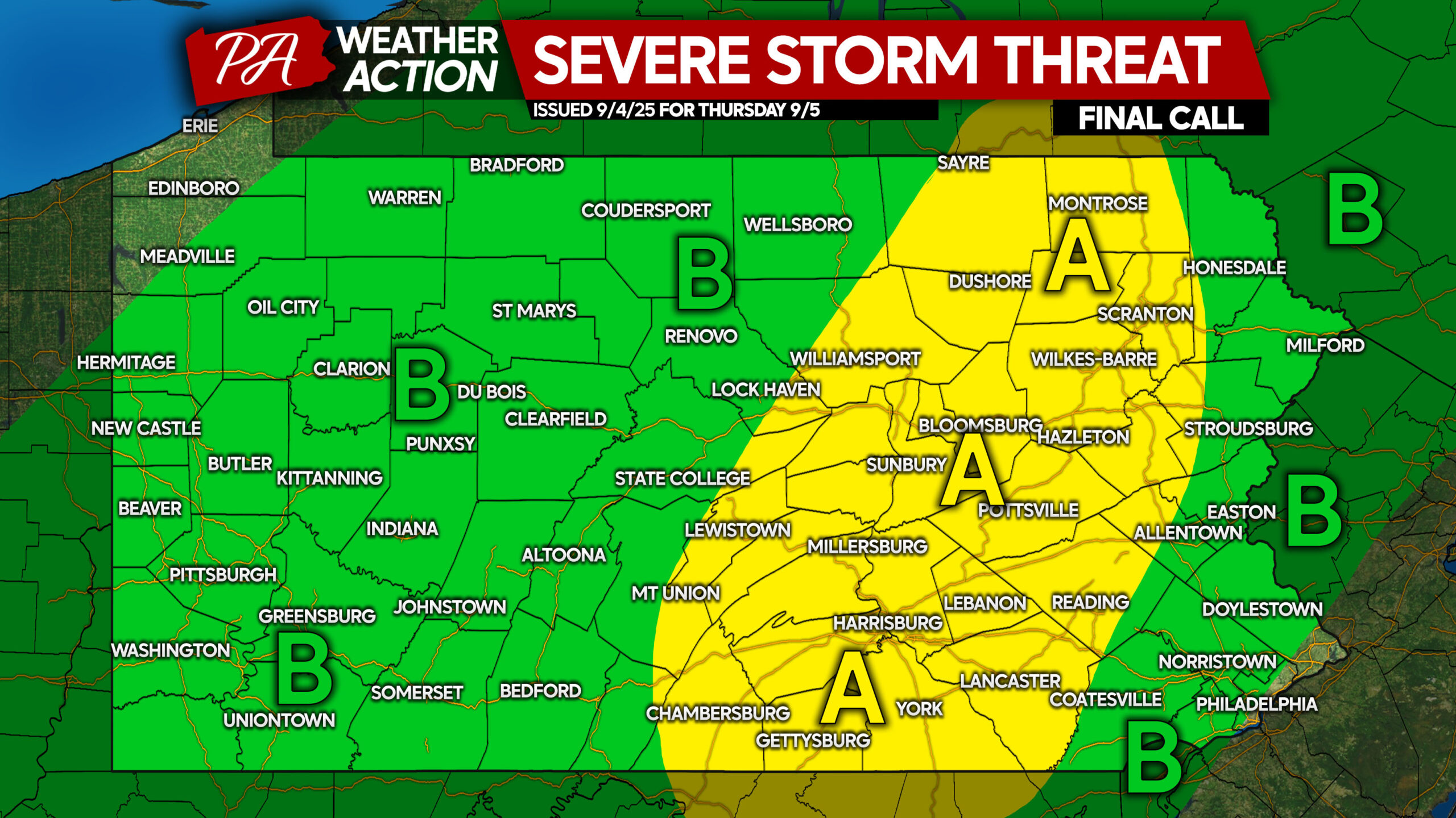
After damaging storms made their way through Northeast PA Friday evening, more storms pose a threat Saturday and Sunday. Firework shows will be heavily dependent…