
After a long period of bitter-cold temperatures, a surge of warmth infiltrated our region. Temperatures surged into the upper 40s and even 50s in parts of the region Sunday and Monday. The long-term cold ground remained frozen, however, making the ice resistant to the warmth. Mild weather will continue to dominate our region this week, but colder air will attack our area later this weekend into next week.
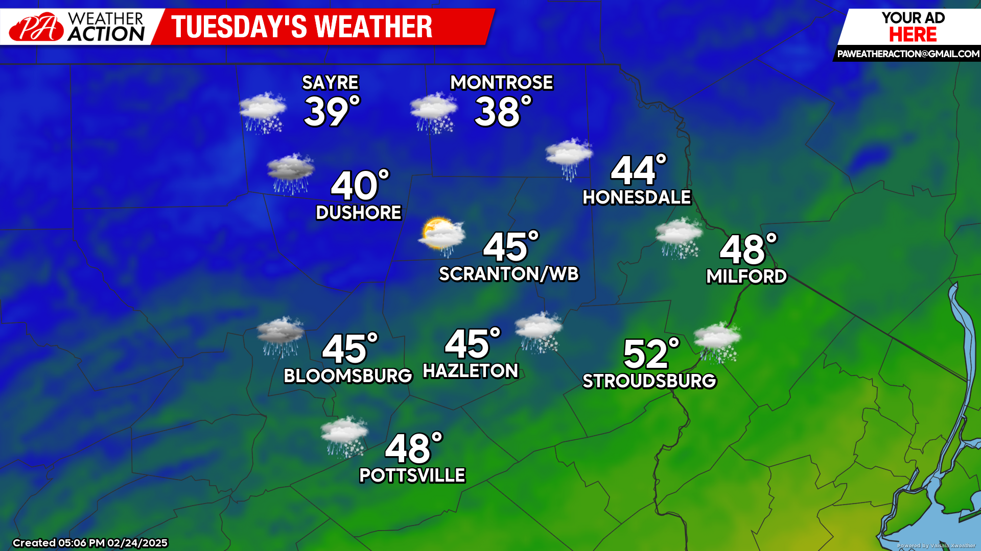
TUESDAY
A weak disturbance to our north will drag a cold front through our area shortly after sunset. Rain showers will precede and accompany the frontal passage through 8pm. A mix or changeover to snow will be possible over the higher elevations and northwestern counties, but little accumulation is anticipated.
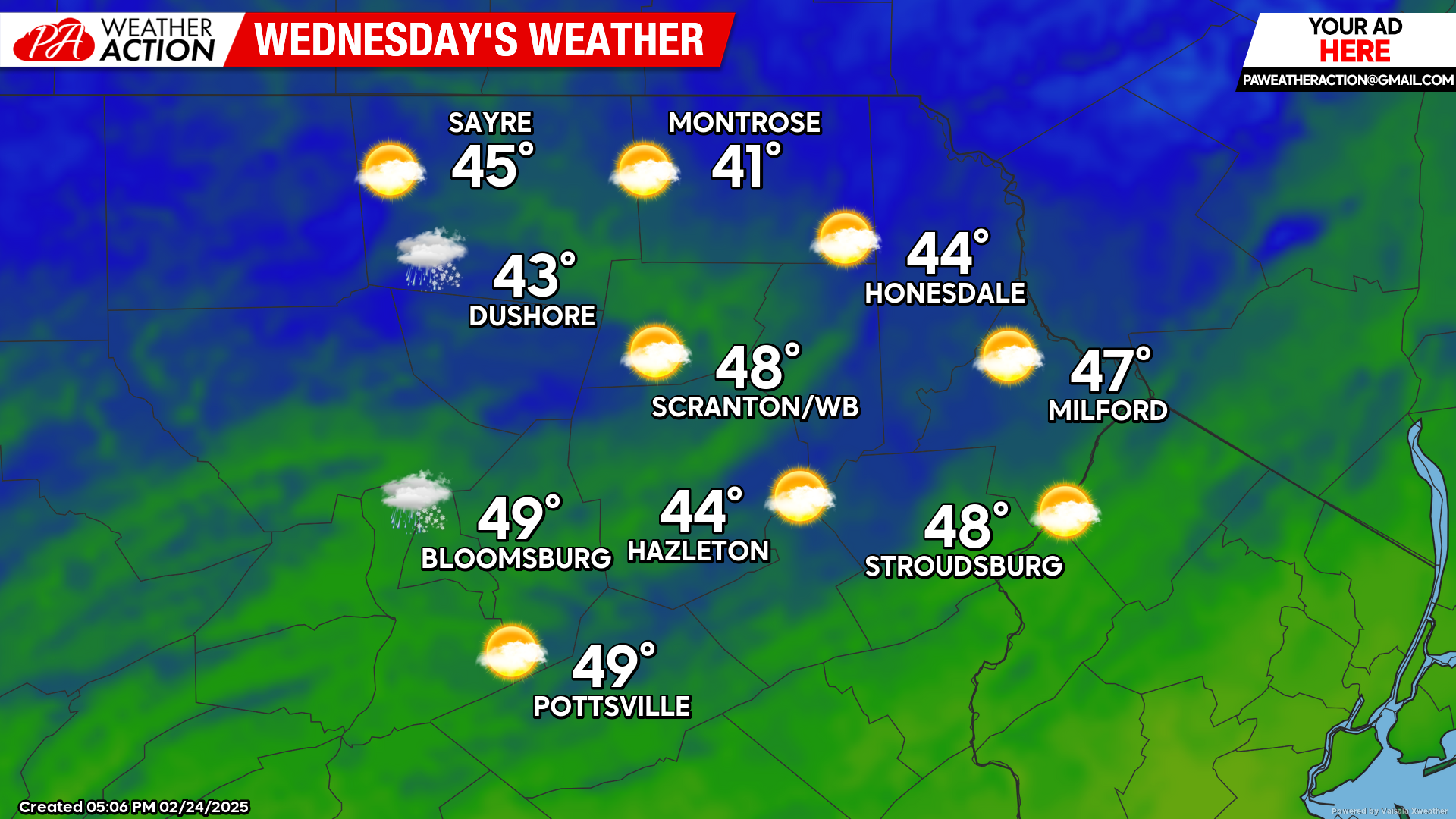
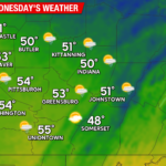
WEDNESDAY
Mild temperatures will follow Tuesday’s system, with widespread 40s across the region. A disturbance dropping into the Great Lakes will spread increasing clouds overnight, with some showers moving in late at night.
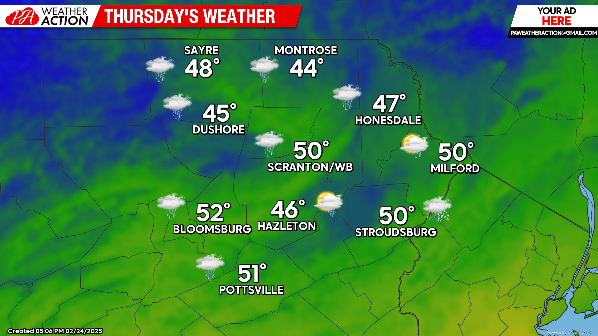
THURSDAY
The aforementioned disturbance will swing northeastward across northern New England, drawing showers and above-normal temperatures across our area. Precipitation amounts will generally be under a third of an inch.

You must be logged in to post a comment.