
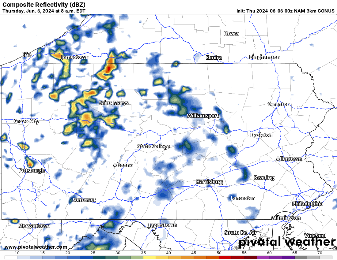
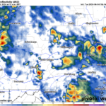
After yesterday’s rainfall, lingering showers and storms are happening throughout the state this morning. Below is the latest look at this morning’s radar:
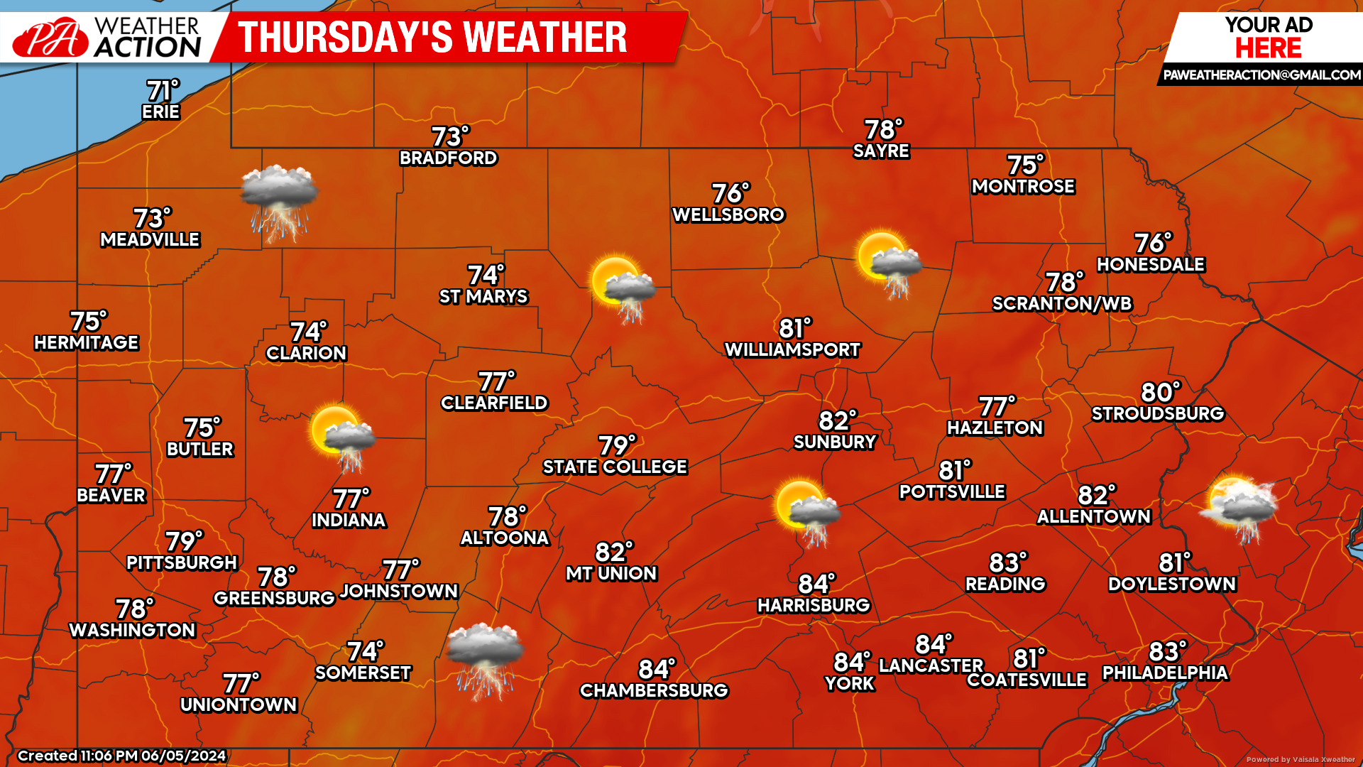
Today’s Weather Forecast: 7/10
Currently the overall pattern is very active across the state. Today will feature the chance for the showers and thunderstorms at times. These showers and storms will not be as widespread as yesterday.
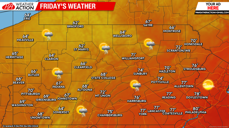
Friday’s Weather Forecast: 7/10
A passing shower or thunderstorm is possible Friday. The bigger story will be the cooler temperatures, especially for western areas where high temperatures will only reach the 60s.
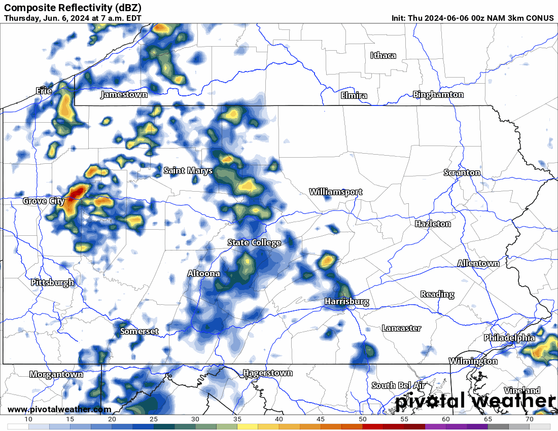
Hi-Res NAM Future Radar Through Saturday Morning:
Taking a look at the latest Hi-Res NAM future radar through early Saturday morning, it paints a pretty clear picture on what we can expect the next couple days. On and off showers and thunderstorms, but not nearly as widespread as yesterday’s rain. The top left of graphic below has the time stamp for reference.
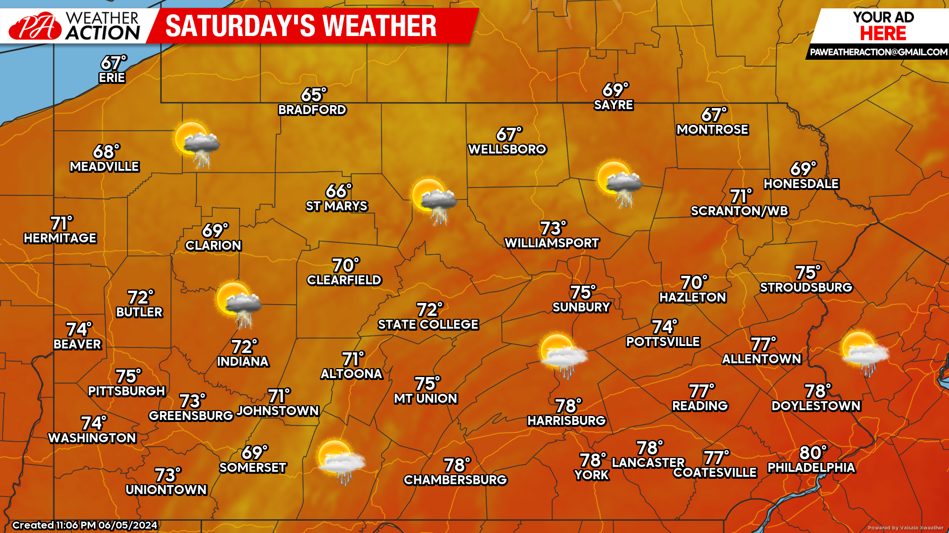
Saturday’s Weather Forecast: 8/10
Saturday will be mainly dry, with again, a chance for a passing shower or thunderstorm. A round of showers is likely as we head into Saturday night thanks to another disturbance passing through the state.
What about Sunday?
Looking at the latest data, the showers Saturday night will likely linger into the morning hours Sunday. Sunday will likely dry out as we advance into the afternoon hours.
You must be logged in to post a comment.