
Widespread chances for showers and thunderstorms are possible throughout the region beginning on Saturday and continuing into early next week. Given the current ground saturation, the chances of flooding are possible, especially in thunderstorms with heavy rains. Temperatures will be closer to the seasonal average throughout the weekend.
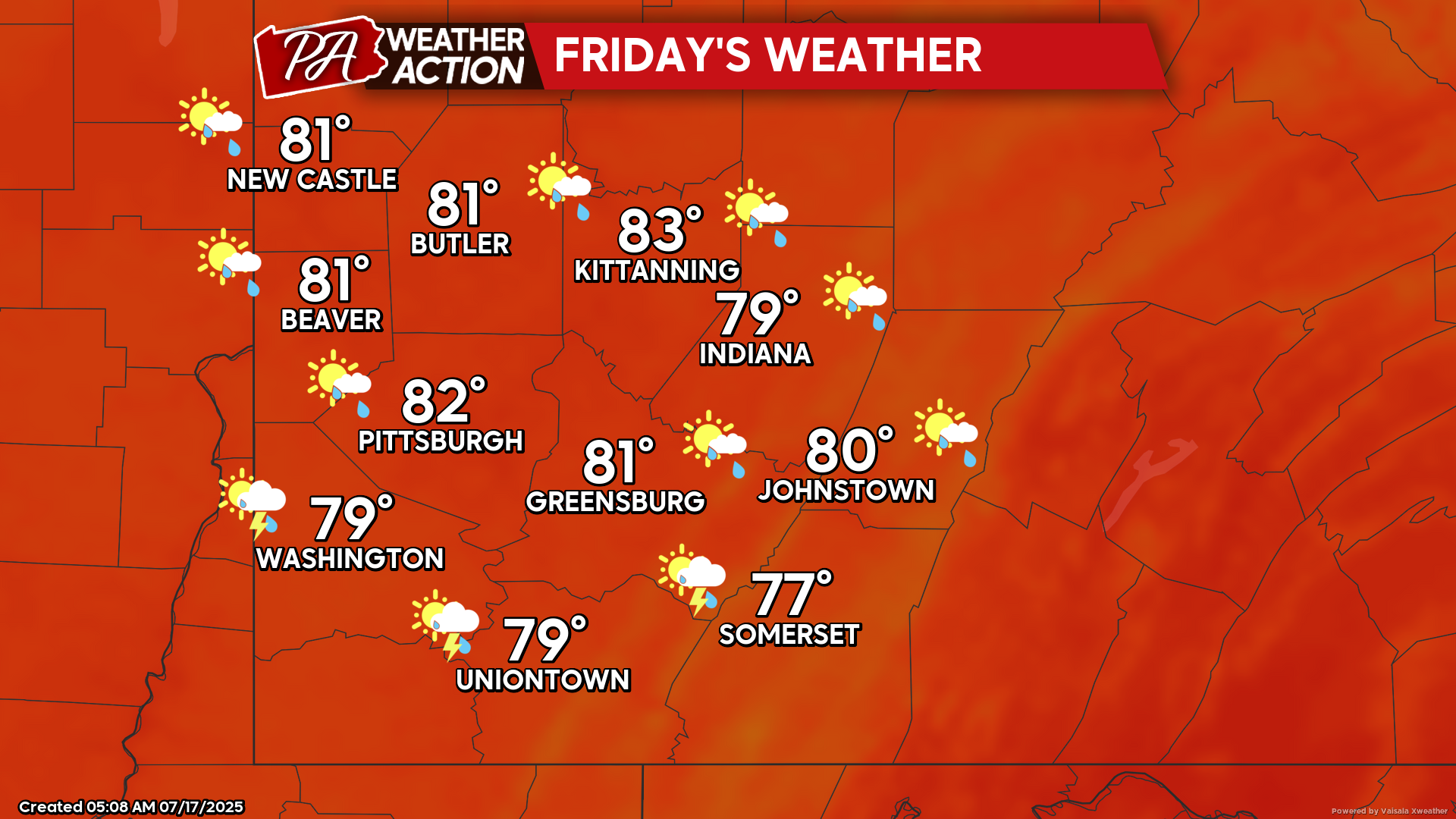
Friday
Low chances for showers for the majority of the region, southern portions of the region could potentially experience rain with the passage of a frontal boundary to the south. Mostly cloudy to partly sunny conditions will be experienced. Highs will be in the low 80s to upper 70s, lows will be in the mid to low 60s. Winds will be light and variable.
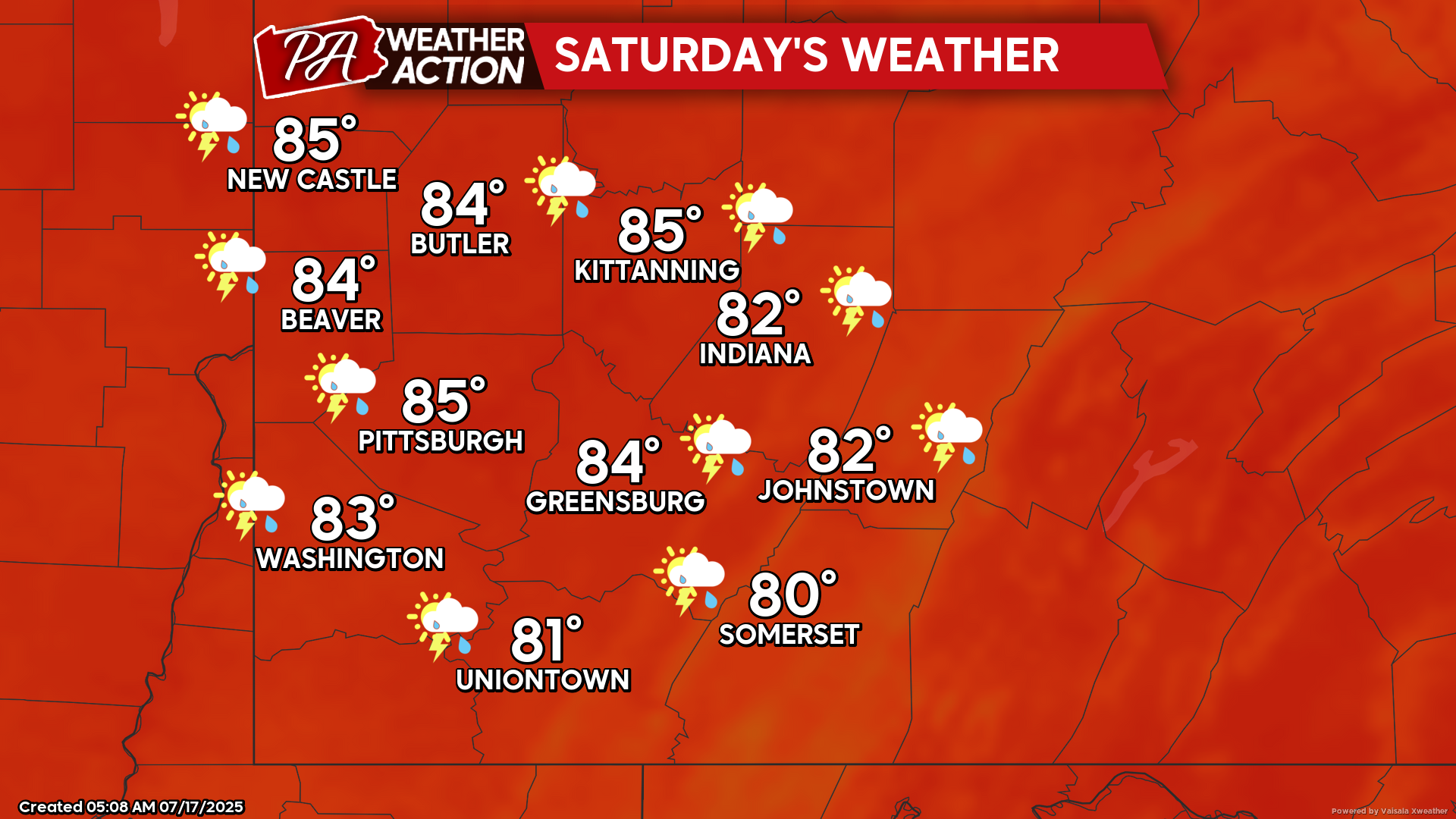
Saturday
Patchy fog in the morning hours will transition to mostly cloudy skies with an increased chance for showers and thunderstorms starting in the afternoon hours and continuing throughout the day. Highs will be in the mid to low 80s, lows will be in the low 70s to mid 60s. Winds will be out of the south-southwest at 5-8 mph.
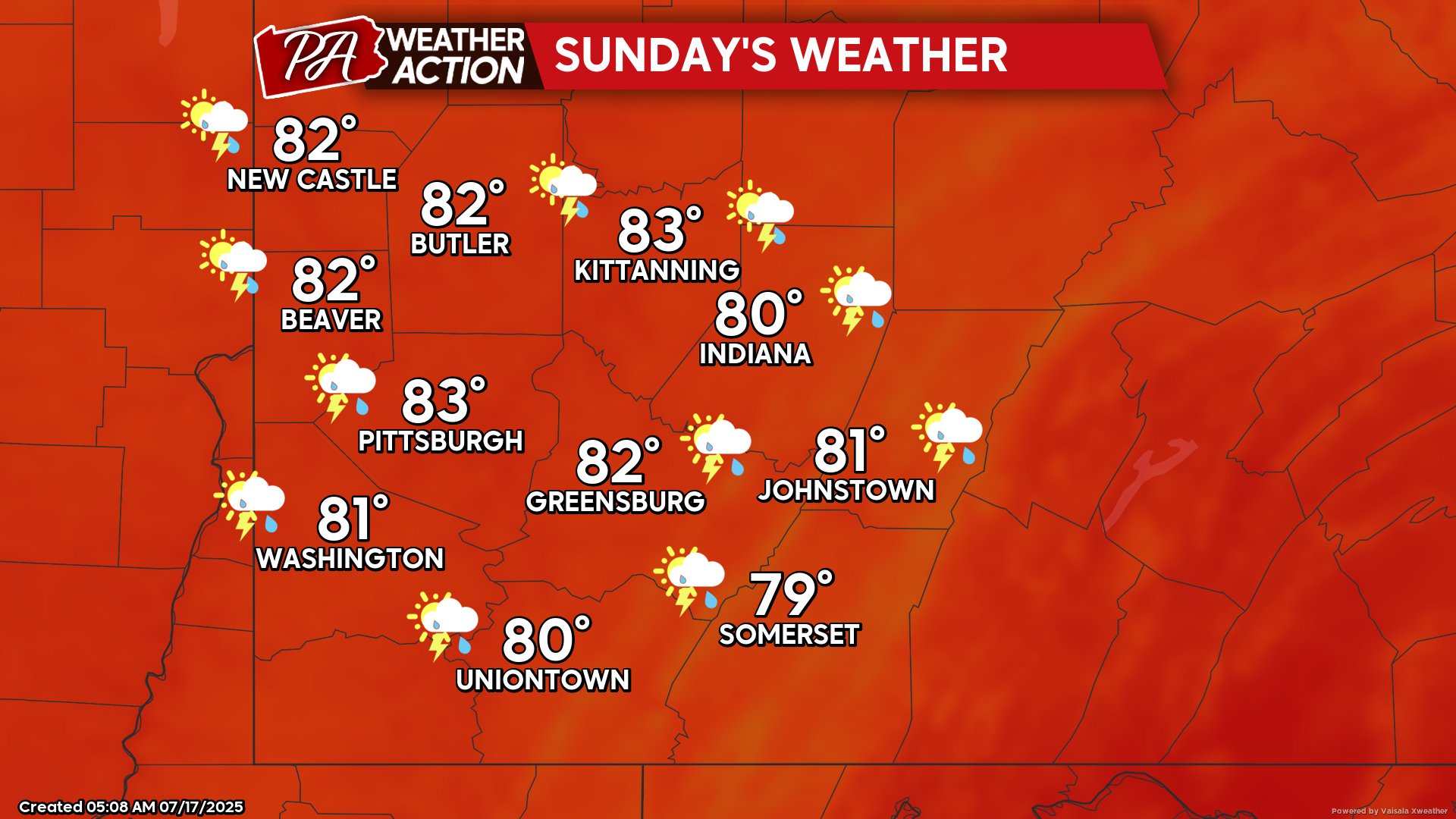
Sunday
Mostly cloudy with showers likely throughout the day. Highs will be in the low 80s to upper 70s, lows will be in the mid to low 60s. Winds will be variable at 5-10 mph.
Above average temperatures will return early next week, with chances for showers and thunderstorms starting Tuesday. Be sure to follow PA Weather Action for more details and forecasts.
You must be logged in to post a comment.