A pattern shift to much-needed wet conditions will commence tonight. A storm system will move northeastward through the Great Lakes and into Eastern Canada overnight, dragging a warm front through our area. Scattered showers will accompany that frontal passage overnight.
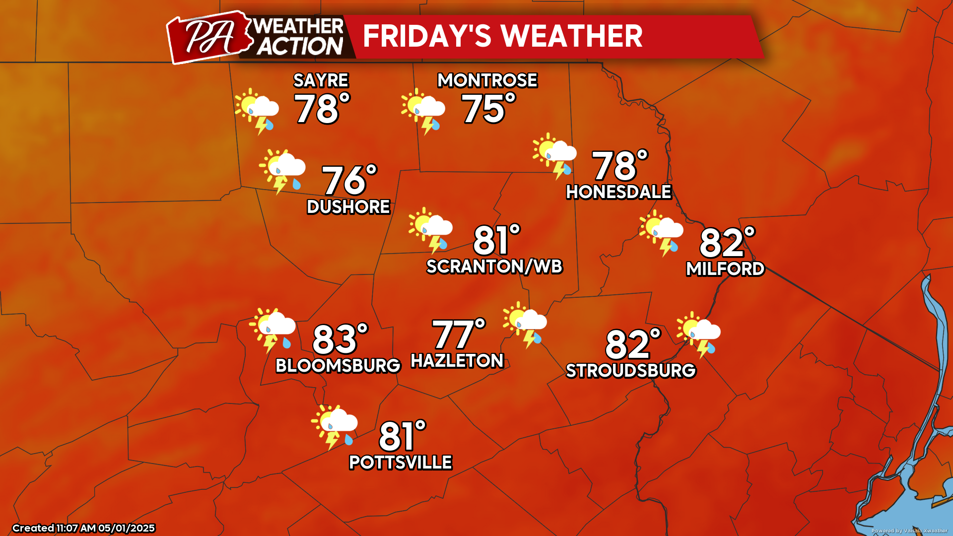
FRIDAY
That warm front will move north of our area, delivering very warm and humid conditions. There could be a few isolated afternoon thunderstorms as that system’s cold front creeps into western Pennsylvania, but widespread storms are not anticipated. Temperatures Friday night will only fall into the upper 50s to low 60s.
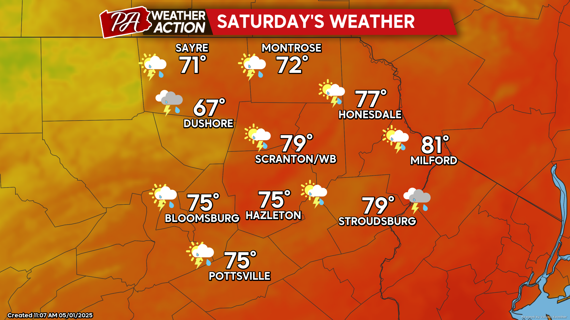
SATURDAY
That cold front will slowly move eastward across the region, accompanied by showers and thunderstorms with locally heavy rain. Most areas will experience several hours of rainfall. However, the day won’t be a complete washout, as much of the precipitation will be along the front. Our southeastern counties might not experience thunderstorms until mid-late afternoon.
There will also be a tight temperature gradient across the front. The day will dawn warm and humid for everyone. As the front crawls eastward, cooler air will move in behind the front. By mid-afternoon temperatures will range from the low 50s near the New York border, to possibly near 80 in the southeastern valleys of Monroe and Carbon counties. The cold front should clear the region by sunset.
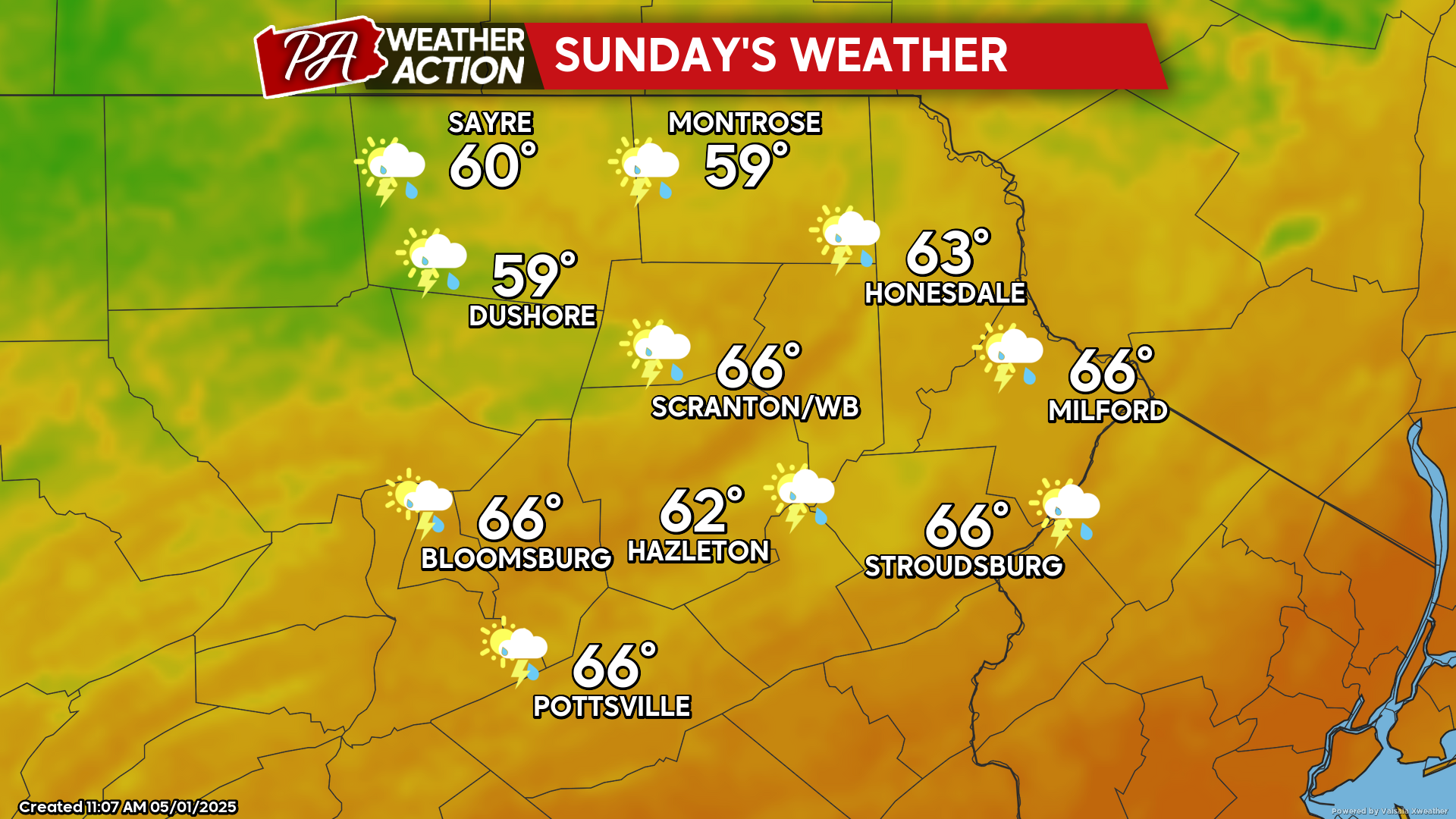
SUNDAY
Meanwhile, a disturbance exiting the Rockies will deepen into a large cut-off low over the Mississippi River by Sunday. This will maintain unsettled conditions with showers and thunderstorms Sunday into the first half of next week. This setup will bring drought-ending much-needed rainfall to the area. Rainfall totals through early next week could be a widespread 2-4″ across the area!