

This morning’s penumbral lunar eclipse dimmed the moon somewhat, but despite 96% of the moon within Earth’s ‘penumbra’, without the full shadow of Earth’s umbra, you might have noticed that the moon did not appear too different than ‘normal’. All locations on the moon within Earth’s penumbra experienced a ‘partial eclipse’ of the sun. Penumbra is the zone where the eclipsed object is only partially blocked by the eclipsing object. The ‘umbra’ is the zone where the eclipsed object is completely blocked by the eclipsing object. Had the moon moved into Earth’s umbra, the sun would have been completely blocked and every place on the moon would experience a total solar eclipse. From our perspective on Earth, the moon would have appeared to be a very dim maroon. That extreme difference between what we witnessed this morning and the dim maroon we see when the moon experiences a total solar eclipse, is also the difference between partial and total solar eclipses we experience on Earth when the moon eclipses the sun. The areas that experience a partial eclipse are still somewhat bright. Totality is vastly different, with the sun blocked, and even some planets and stars visible! It is also the ONLY time you can see the sun’s corona on Earth. Something to think about as this solar month concludes with a solar eclipse path of totality nearby.
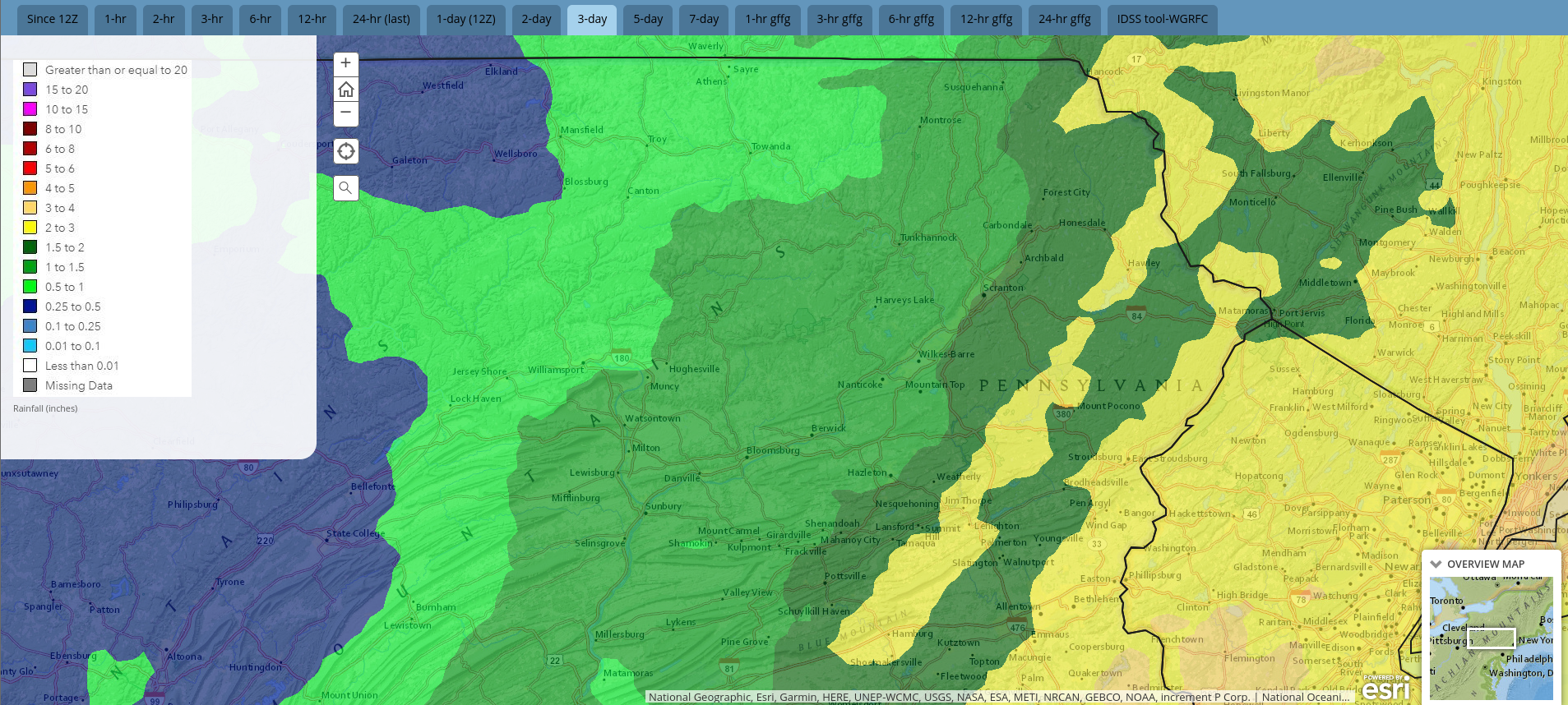
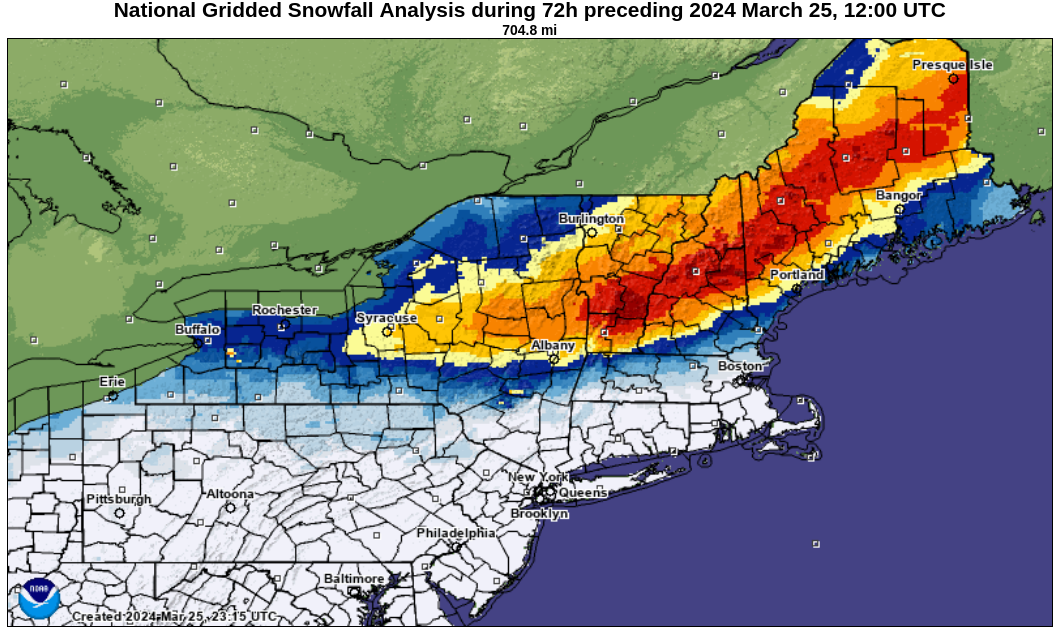
Saturday’s storm inundated the area with as much as 2″ rain in the southern and eastern Poconos, to around a half inch in our northwestern counties. Meanwhile, those of you hoping to salvage some dignity of their snowfall stats narrowly missed out on a copious covering of early-Spring snow that blanketed much of New York State and northern New England with 1-2 FEET of snow. Even parts of our area had some accumulation. Sayre in Bradford County reported 0.7″ snow.
Radar-estimated precipitation for last weekend:
Snowfall from last weekend’s storm:
As that system departed, it blasted the area with gusts over 40mph Saturday afternoon and night. The higher elevations were hit harder, with Mt Pocono peaking at 61mph. Widespread power outages resulted.
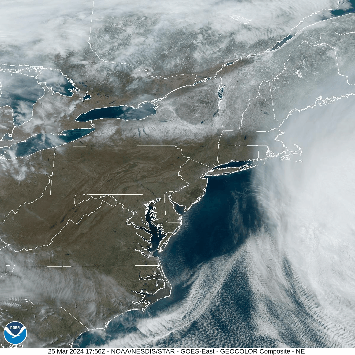
The areas that enjoyed significant snowfall can easily be spotted in the visible satellite loop from Monday afternoon March 25th. On the eastern side of that satellite loop is a cut-off low in the Atlantic that is crawling westward and will spread low clouds westward across New Jersey and into the eastern parts of our area later tonight. On the western side of the image, you can see clouds moving northeastward ahead of a cold front associated with an area of low pressure that will move through the Great Lakes Tuesday and into Canada on Wednesday.
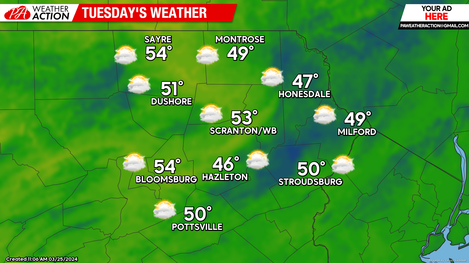
TUESDAY:
Clouds will increase, both from the east from the offshore system, and from the west from the approaching frontal zone. There could be an insolated shower as well.
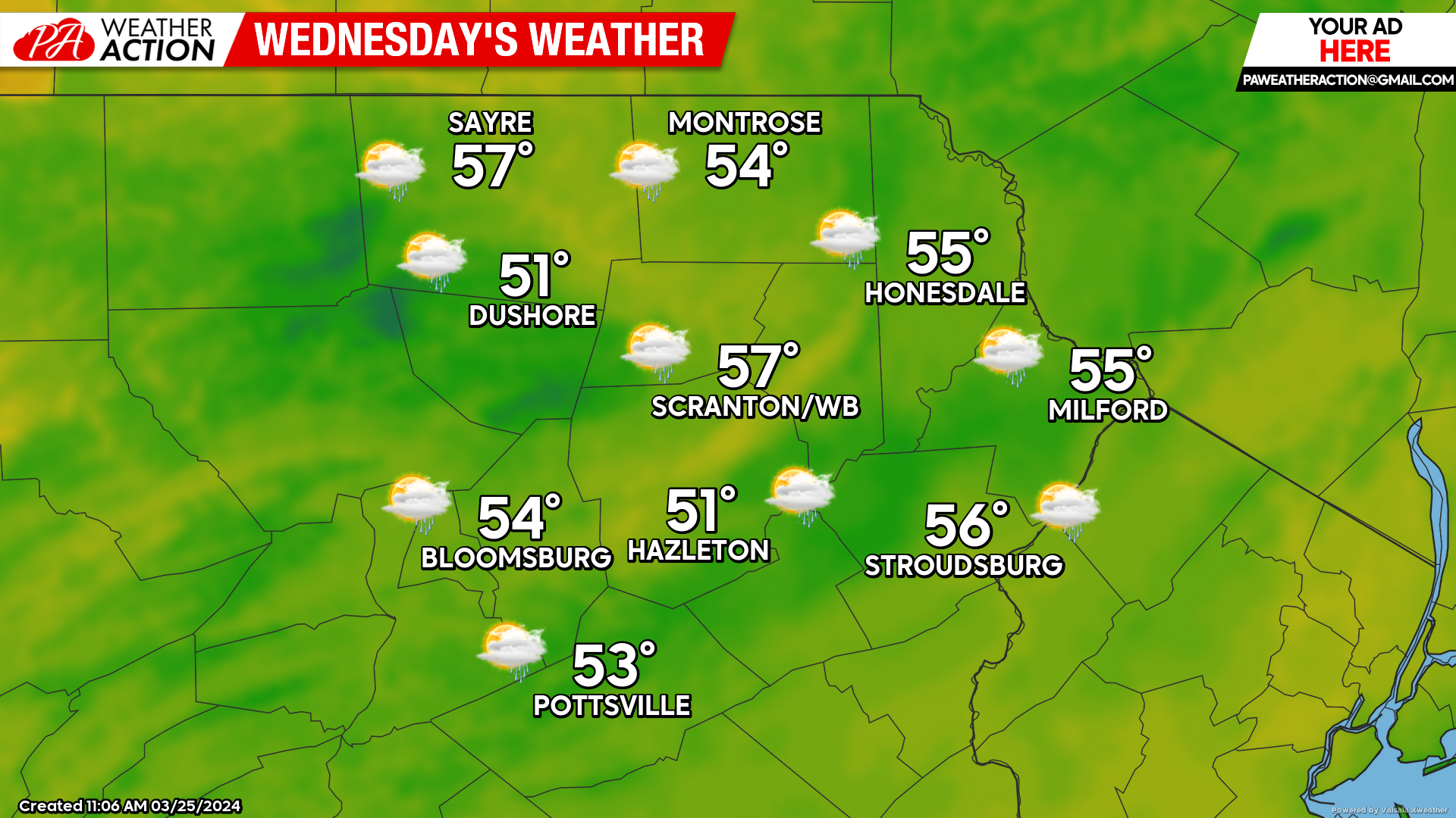
WEDNESDAY:
The front will encroach on our area, spreading scattered showers from west to east across our region.
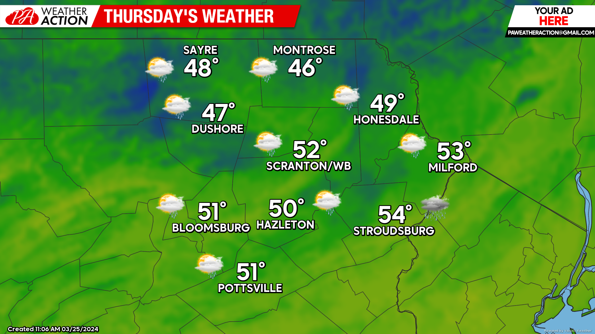
THURSDAY:
As that frontal zone slows near the Atlantic Coast Wednesday night into Thursday, another area of low pressure will intensify and move northeastward along the front to deliver soaking rain to parts of our area Thursday.
You must be logged in to post a comment.