
Showers will return to parts of the state for the middle and later parts of this workweek. Specifically the eastern half of Pennsylvania looks more probable to receive wet weather in the form of relatively consistent rain showers. The Philadelphia Phillies’ opening day game, scheduled to begin just after 3:00 PM Thursday, should not be delayed. Light rain showers will be in the Philadelphia Area though, making for not the most pleasant of outings with temperatures in the low 50s.
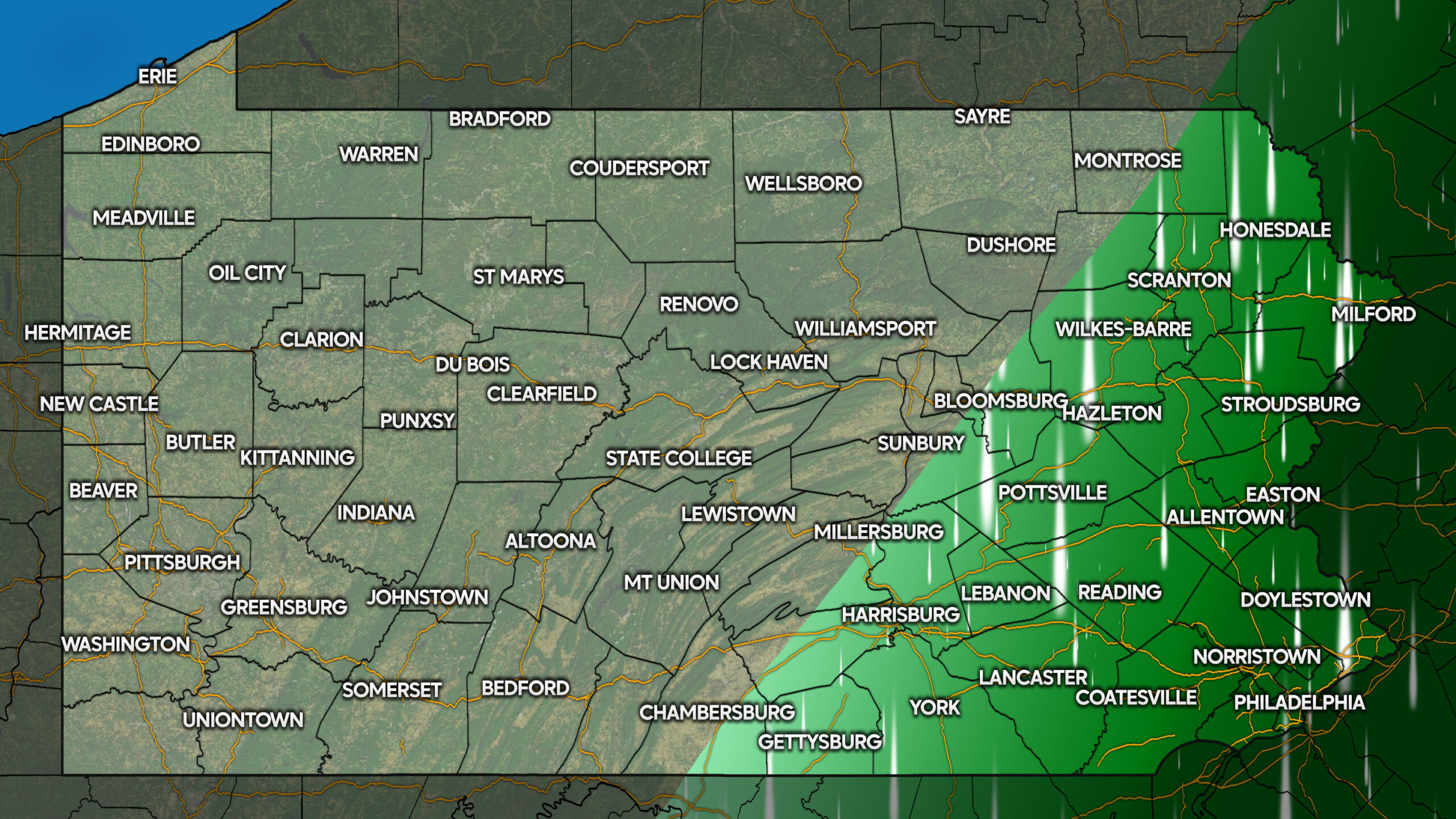
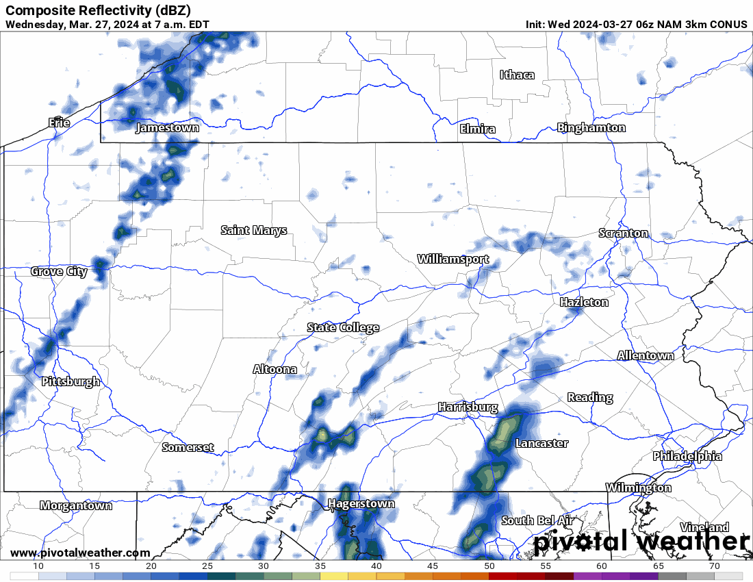
Scattered rain showers will be draped across Pennsylvania Wednesday as a cold front very slowly approaches the area. Coverage will be more widespread in Eastern PA, but it will still be spotty. See future radar from the Hi-Res NAM model below.
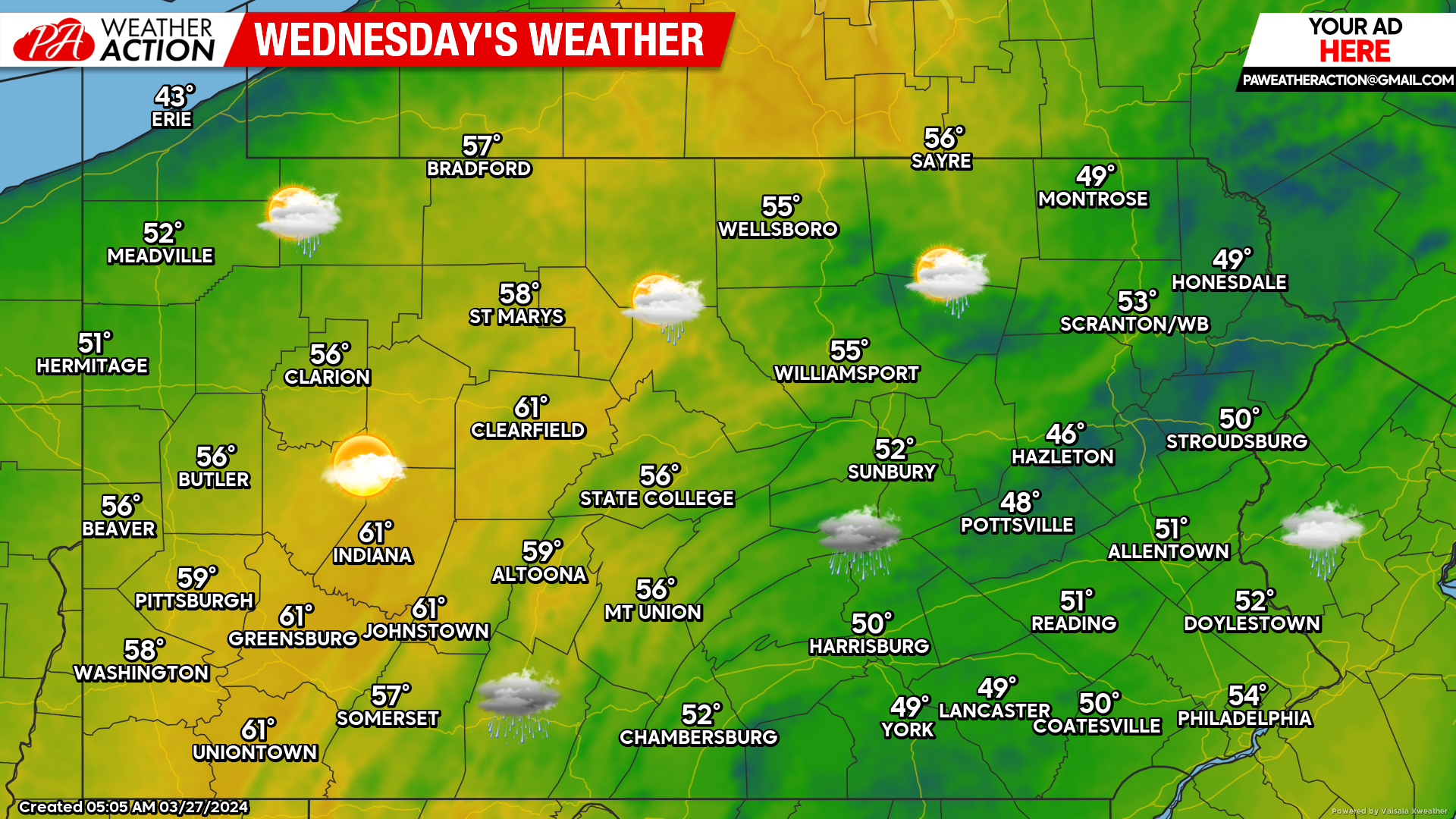
High temperatures will again be configured abnormally, with warmest highs over and just west of the Alleghenies, due to breaks of sunshine in those areas. Below is Wednesday’s Forecast Map.
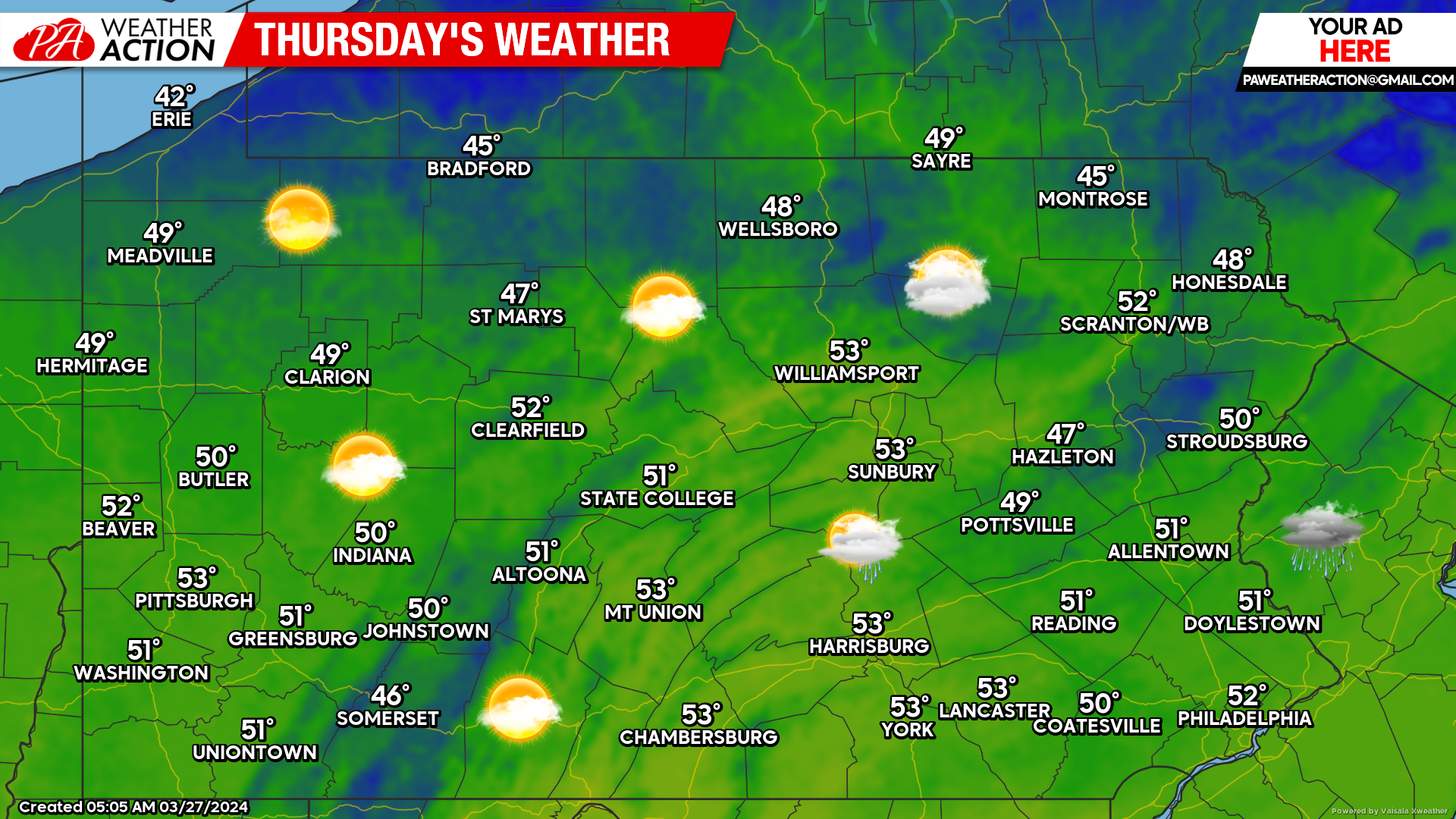
Showers Thursday will be almost entirely exclusive to Southeast PA, as the cold front begins to usher dry air in from west to east across the state during the day. Below is Thursday’s forecast map.
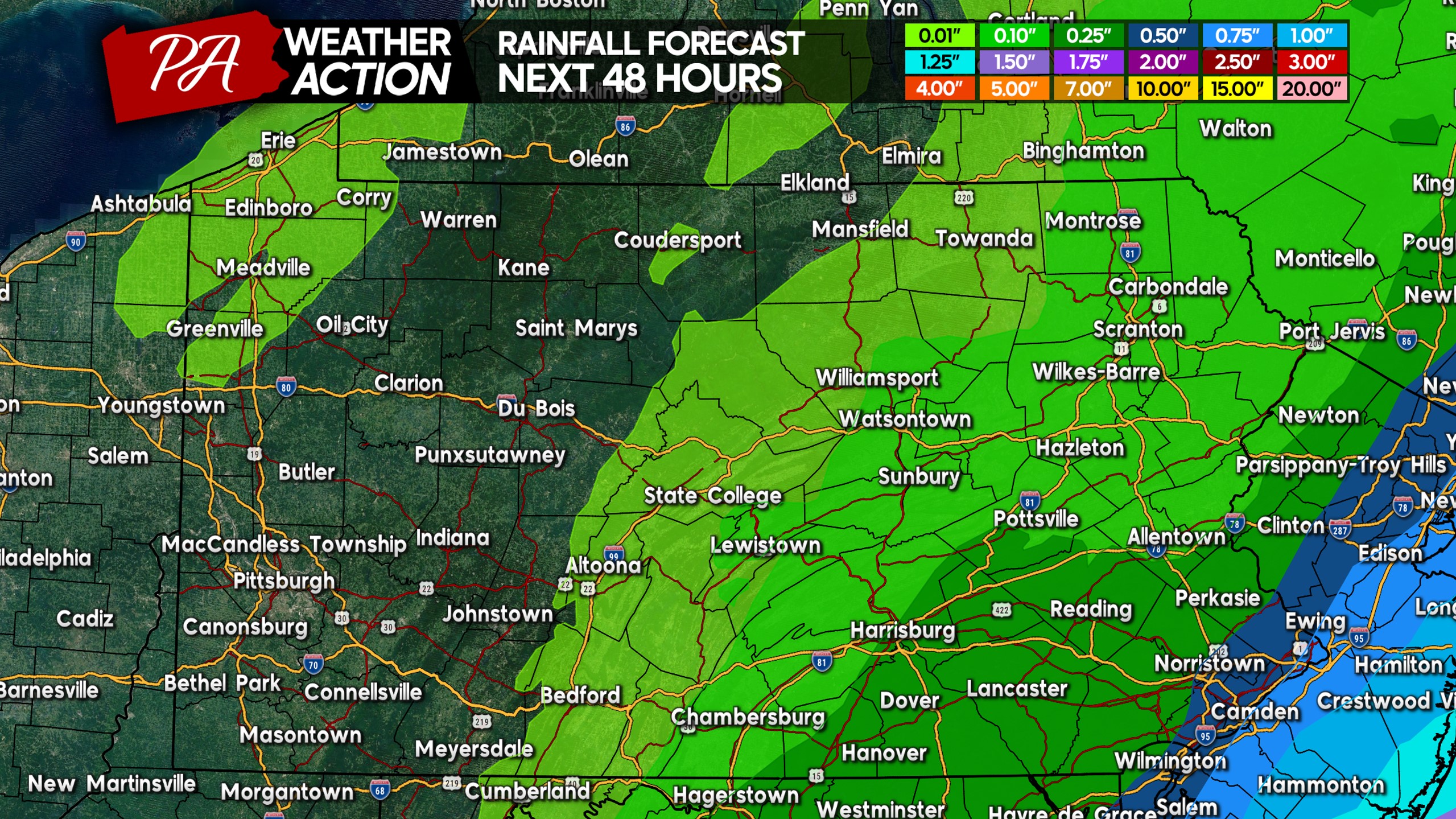
Rainfall amounts will be highest in Southeast PA, where around a half inch is expected. Amounts will decrease as you head west, becoming very minor in Central PA. Here is the rainfall forecast map through Thursday night.
Friday looks to bring mostly sunny and breezy conditions with seasonable temperatures. View the Friday and Saturday Forecast graphics here.

You must be logged in to post a comment.