
A low pressure system will move through the region Friday and into Saturday bringing the chance for showers and thunderstorms. Temperatures will remain below normal before rebounding Sunday and continuing into next week.
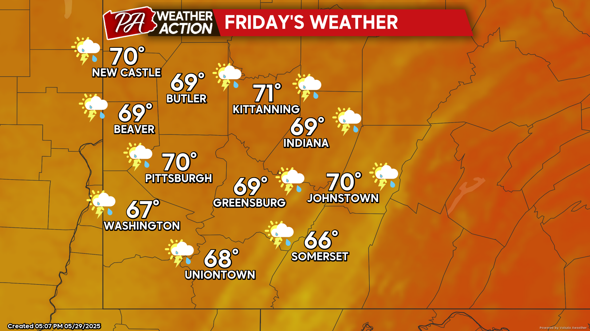
Friday
Cloudy conditions with afternoon and evening showers and thunderstorms are possible. Highs will be in the low 70s to upper 60s, lows will be in the mid to low 50s. Winds will be light out of the west-northwest around 5 mph, gusty conditions could be possible in thunderstorms reaching 25 mph.
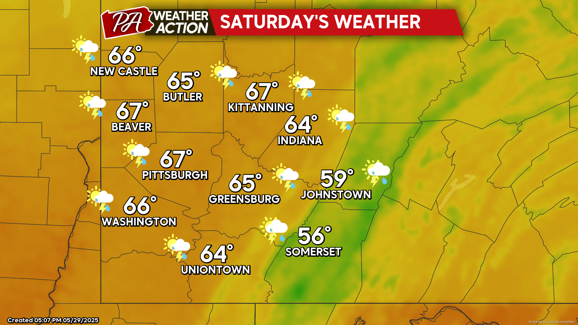
Saturday
Lingering morning showers are possible, followed by partly sunny skies and cooler temperatures. Highs will be in the mid to low 60s, lows will be in the low 40s to upper 30s. Gusty conditions are expected with winds out of the northwest at 5-15 mph, wind gusts 25+ mph are possible in some areas.
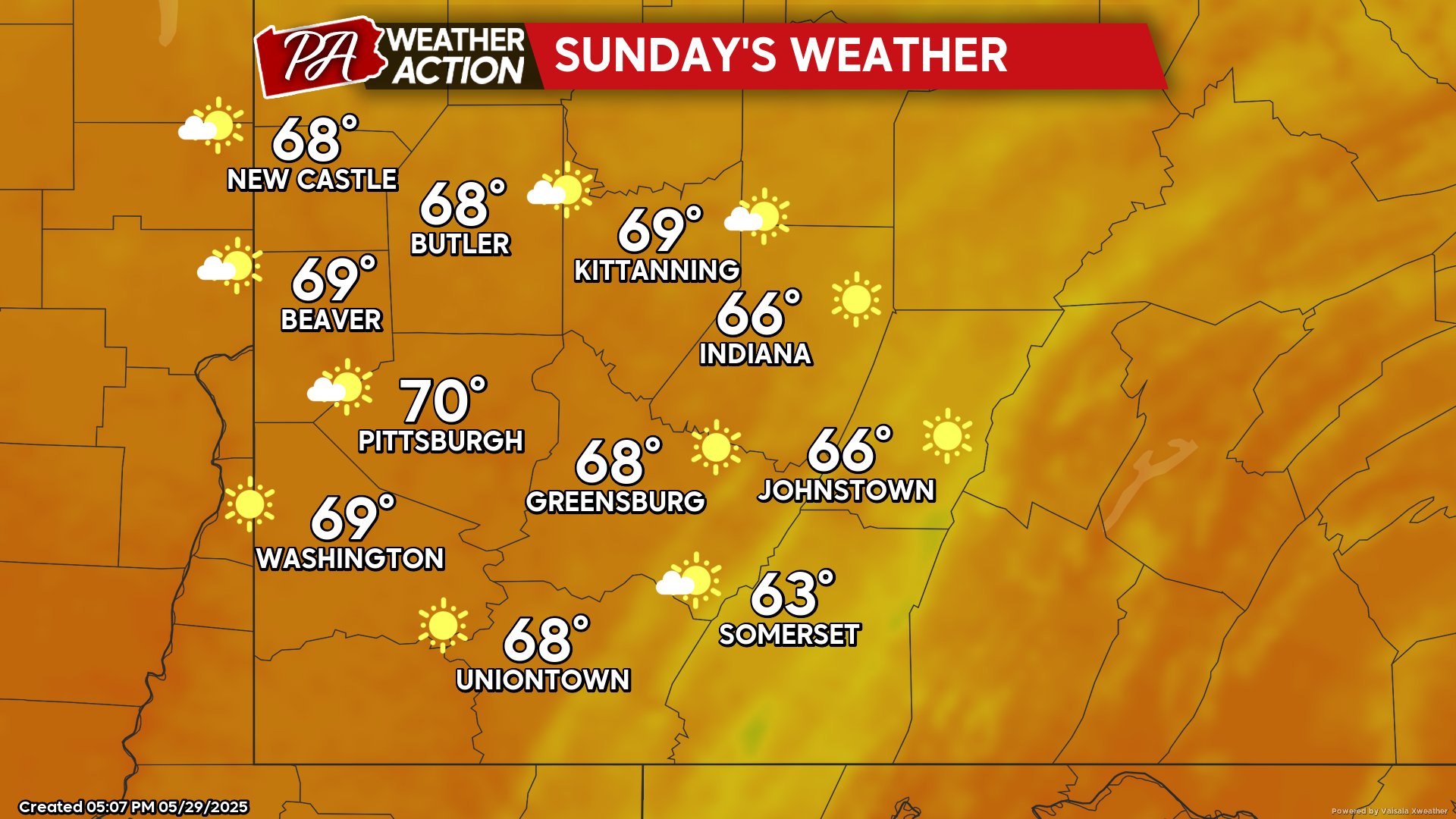
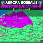
Sunday
Mostly sunny conditions return with a warming trend beginning to set in. Highs will be in the low 70s to mid 60s, lows will be in the mid to low 40s.
Clear conditions and warmer temperatures are expected for next week. Be sure to follow PA Weather Action for more details and daily statewide forecasts.
You must be logged in to post a comment.