
Good Evening Everyone! I don’t know about you, but it has been quite a hectic week! Luckily, the weather decided to cooperate for the most part with seasonable temperatures and dry conditions prevailing throughout the week. Unfortunately, as luck would have it, we are tracking a coastal system that is set to bring some more substantial rain and gusty winds to the region as we head into this weekend.
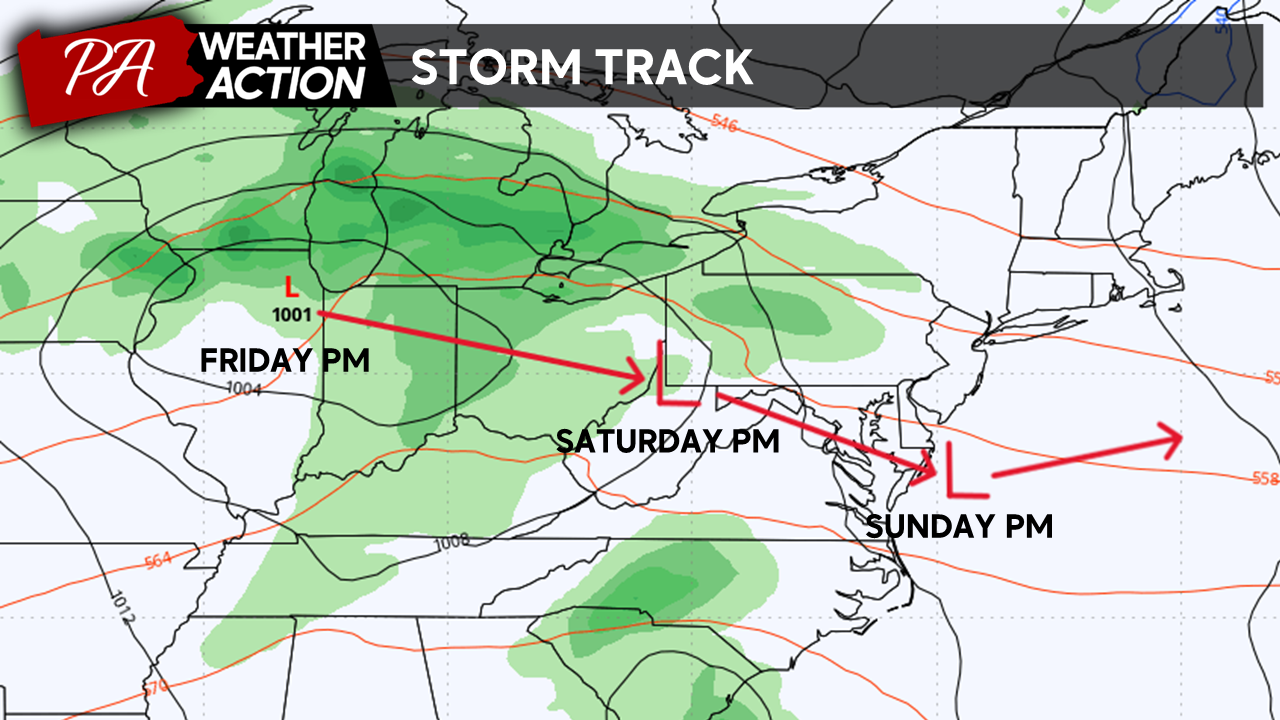
Our storm system will move out of the Plains and into the Ohio Valley Friday Evening. By Saturday expect rain to overspread the region as our low moves into the mid-Atlantic. By Sunday, our storm system will transfer its energy to the coast, redeveloping a coastal low; increasing winds before it moves out to sea.
Friday
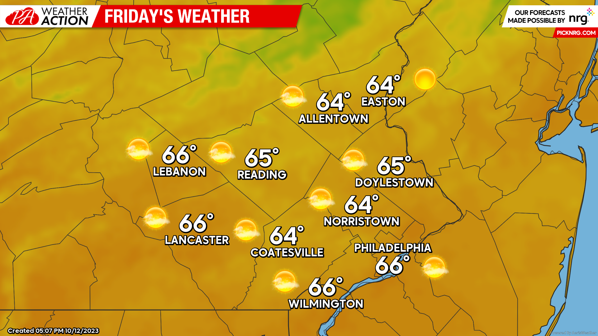
Friday the 13th will be the last dry day to enjoy for a while as our storm approaches from the west. Expect pleasant conditions to start Friday morning with mostly clear skies and lows in the mid-40s to low-50s. Expect an expansion of high level, cirrus cloud cover as we head throughout the day on Friday, however, the afternoon should remain bright and pleasant with highs topping out into the mid-60s. Winds should remain light out of the N at 5-10mph.
Saturday
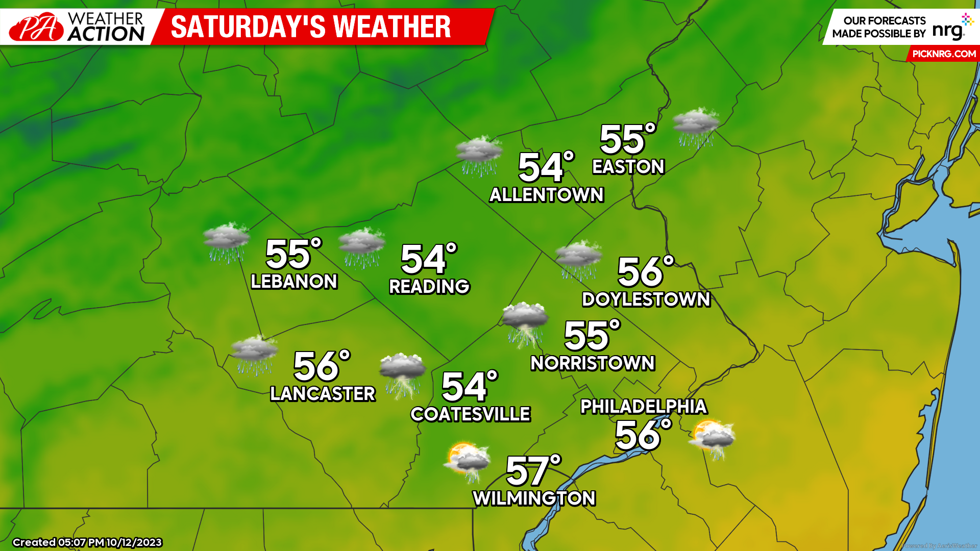
Cloud cover will increase overnight as our storm system moves in for the day on Saturday. Expect extensive cloud cover to start off your day with a few showers already possible across our western counties by daybreak. Lows will start in the mid-upper 40s Saturday morning. Light rain should overspread the entire region throughout Saturday morning. Heavier rounds of precipitation are likely by the afternoon with a few rumbles of thunder possible across Southeastern zones. Rain should keep temperatures cool on Saturday compared to average with highs only topping out in the mid-50s. Winds will begin to increase by the afternoon as well blowing out of the N at 10-20mph. Rain will continue into the overnight hours.
Sunday
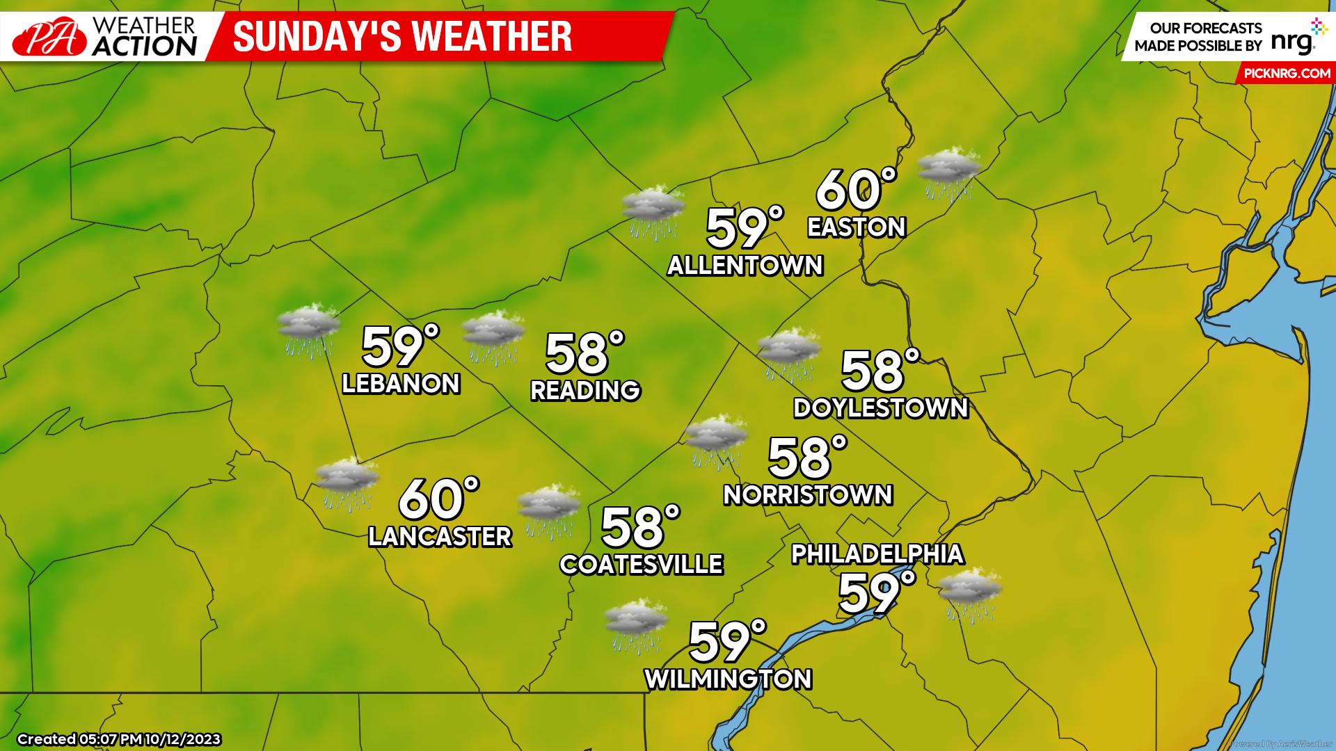
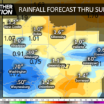
Rain will linger into Sunday morning with lows starting in the upper 40s. Our storm system will transfer its energy to the coast bringing an increase in winds before it slides out to see. Rain will end from west to east by Sunday afternoon as our low pulls away, however, winds may still gust up to 30mph Sunday afternoon. Cloud cover will continue to keep our temperatures in check with highs topping to the upper-50s to near 60. Although steady precipitation will end for most on Sunday, scattered showers will linger throughout the afternoon and into the overnight hours. Overall a general 1-2 inches of rain is expected across the region this weekend.
Beyond the weekend, a surface trough will settle in behind the front. This will keep our weather cool, cloudy, and showery as we head into next week. We are also tracking the potential development of another coastal low by the middle of next week that may bring a return of ore substantial precipitation to the region. If you have any questions are comments about the forecast feel free to let me know! I hope everyone has a fantastic weekend despite the weather!
-Michael Woytowiez

You must be logged in to post a comment.