
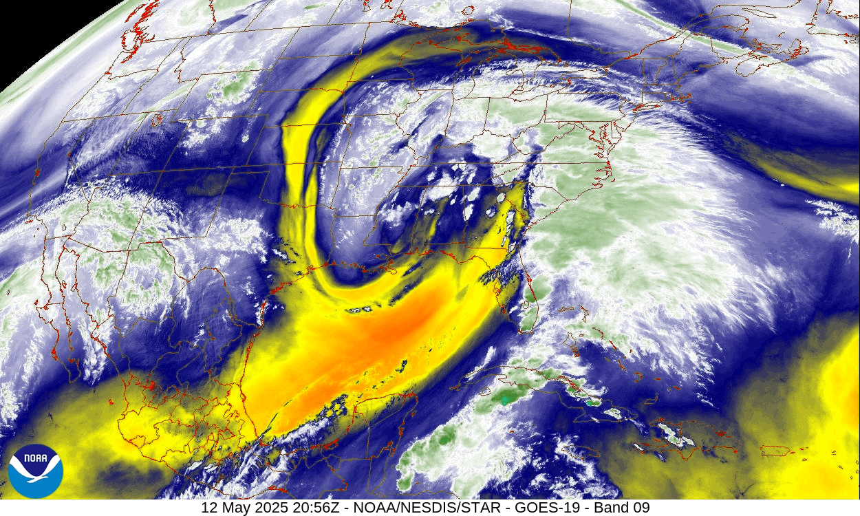
A cut-off low currently just south of Tennessee is circulating moisture northward into our area. That low will crawl into Ohio by Wednesday and into eastern Canada on Thursday. Rain from this system will move into our area Tuesday morning, with the opportunity for showers continuing into the weekend.
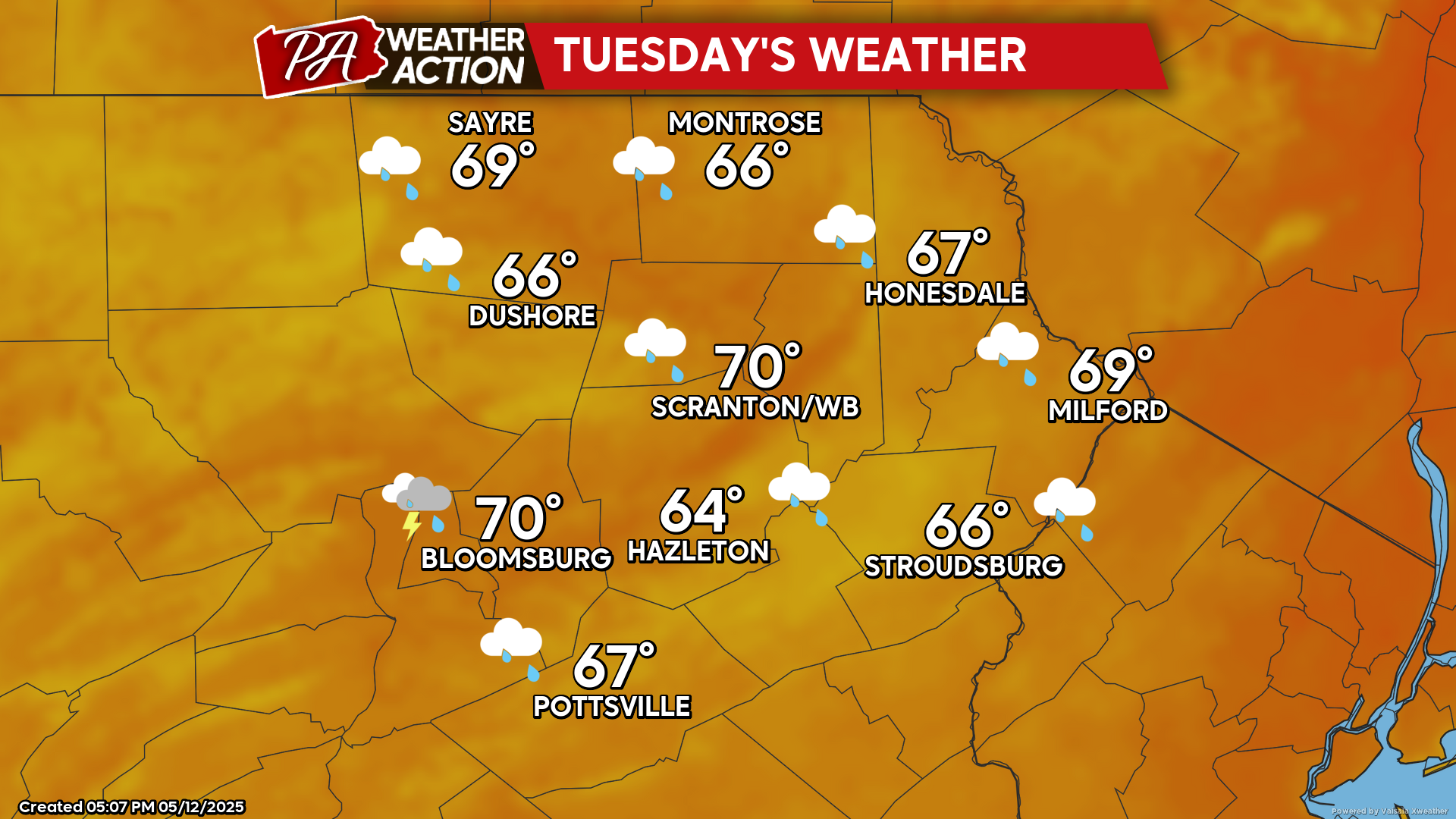
TUESDAY
As that cut-off low crawls into Ohio, it will induce a wind from the southeast in our area along with showers. Overnight temperatures will be warmer than recent nights, with most areas remaining in the 50s for lows tonight and Tuesday night.
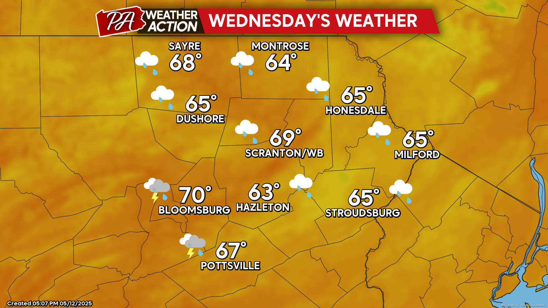
WEDNESDAY
Wednesday will be another wet day with clouds and showers. The breezy conditions will continue with southeast wind gusting 20-30 mph.
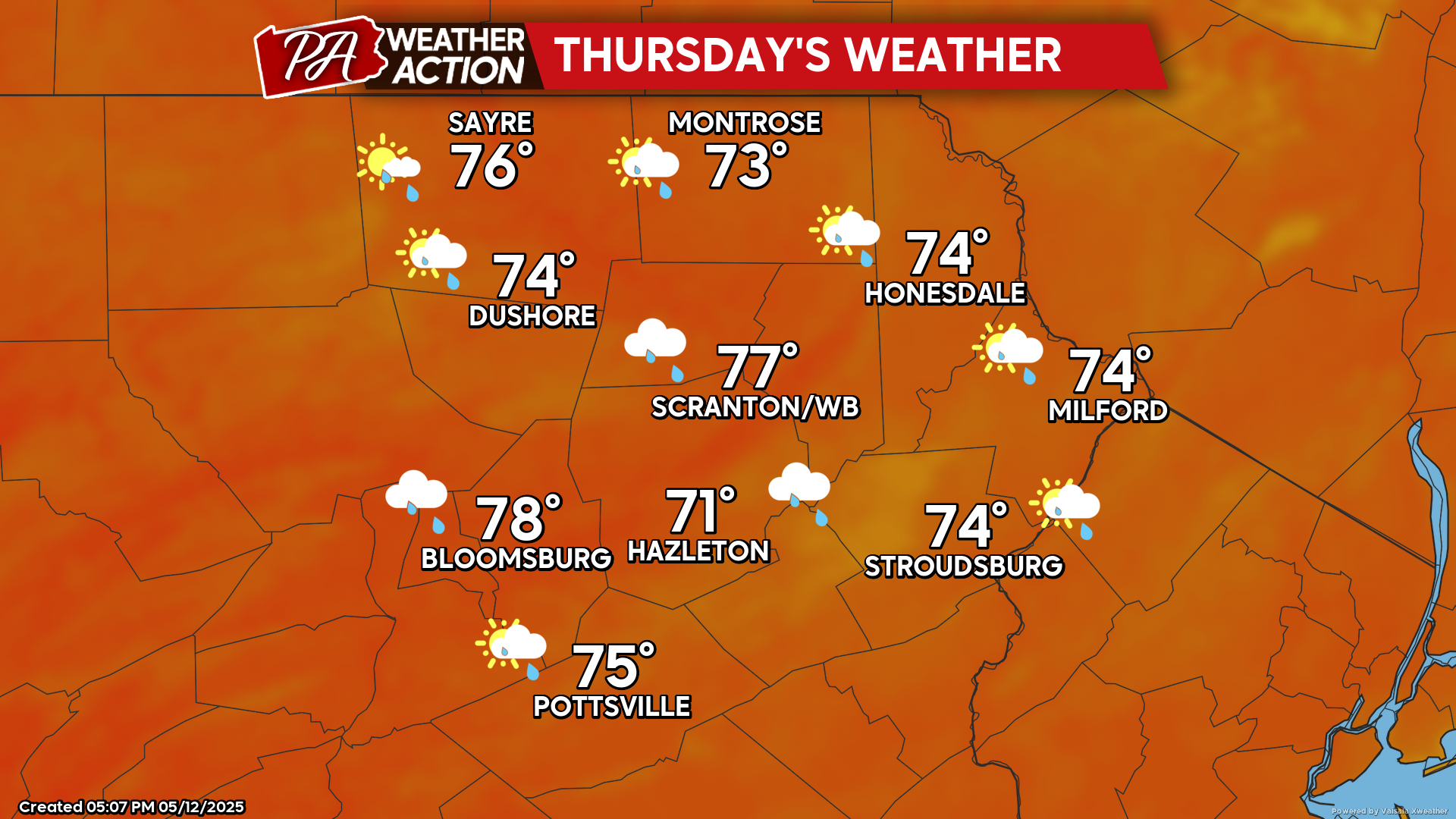
THURSDAY
That cut-off low will finally start to open up and move into eastern Canada. As it does so, it will drag a warm front through our area Wednesday night. Temperatures on Thursday will get into the 70s. It will also feature some sunshine and fewer showers. However, there will be the opportunity for some thunderstorms. Looking ahead through the weekend, several cold fronts will bring additional opportunity for showers and thunderstorms Friday-Sunday.


You must be logged in to post a comment.