
This is not an April fools’ joke, we are tracking more accumulating snow for the Sunday night into Monday morning time period. The good news is, all Easter outdoor activities will not be impacted.
While it is not often our area receives snow this time of year, when we do, timing and intensity of the snow is key for accumulations to occur.
This time of year, it is very hard to get snow to accumulate even on the grass because of the sun angle. However, if the snow occurs during the night, the snow will accumulate much easier on grassy surfaces. With this upcoming snow event, timing looks to be perfect for our South-Central areas to see snow accumulate on grassy surfaces.
Rain and snow showers will overspread Southwest Pennsylvania after 8:00 PM Sunday evening and will eventually turn to all snow. The snow will continue to spread eastward as the night progresses. Take a look at the latest GFS valid for 2:00 AM Monday Morning: 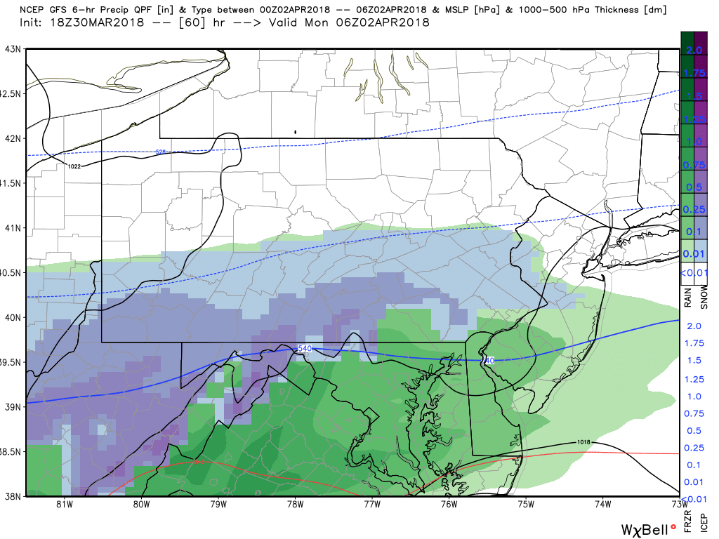
Not surprisingly, this is a marginal setup. Plain rain is not too far off from our area, but it is expected to stay south of the PA/MD line.
This is fast moving system, likely a 6 to 8 hour event. That will help keep snow totals down for areas that do receive the heavier snows. We expect lesser snow totals for far Eastern Pennsylvania and especially as you head closer to the coast because the bulk of their precipitation will fall after sunrise Monday morning. Again, the strong sun angle this time of year, will make it extremely tough for snow to accumulate. Below is a look at 8:00 AM Monday Morning: 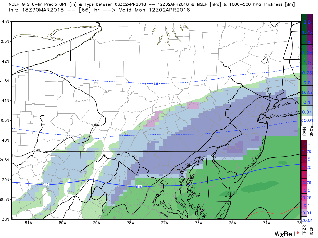
FIRST CALL SNOW FORECAST SUNDAY NIGHT INTO MONDAY MORNING:
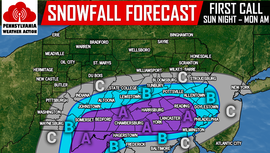
Area A: This area will receive the heaviest snows before sunrise Monday morning allowing for snow to accumulate on grassy surfaces. We cannot rule out some slush on the roads before sunrise. 2 to 3 inches of snowfall is expected, with localized locations receiving as much as 4 inches of snow.
Area B: 1 to 2 inches of snowfall is expected in grassy surfaces.
Area C: A coating to 1 inch of snowfall is expected.
For people that are sick of the snow, do not be too upset. Whatever snow does accumulate, will be melted by Monday evening. Temperatures will warm up well into the 40s Monday afternoon.
Stay tuned to our final call forecast that will be posted tomorrow evening as there will still be some adjustments over the next 24 hours.
Make sure you have our Facebook liked to stay updated with the latest, click here>>>Pennsylvania Weather Action’s Facebook Page
Share the snowy forecast to your family and friends using our icon below!


You must be logged in to post a comment.