
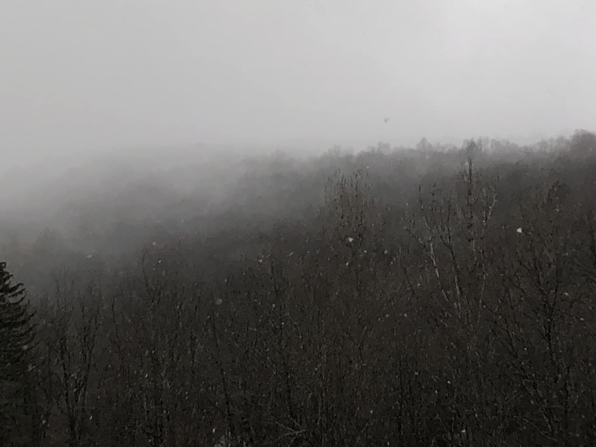
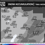
A shot of arctic air provided the first widespread snow showers and whitening of the ground in our area for the 2023-2024 winter season. However, the lake-effect belts fared much better with as much as 40″ burying the Tug Hill plateau of New York!
That arctic surface high has since moved off the coast and circulated milder air into our region today. A system will pass to our west Friday, spreading showers into our area by afternoon, which will persist into Friday evening.
While not a washout, cloudy skies and unsettled conditions will continue through the weekend, including the threat of showers.
On a brighter note, there is the opportunity for a geomagnetic storm and potential auroras Friday morning, although it is not currently known whether it will happen early-enough for auroras to be visible from our area before sunrise.
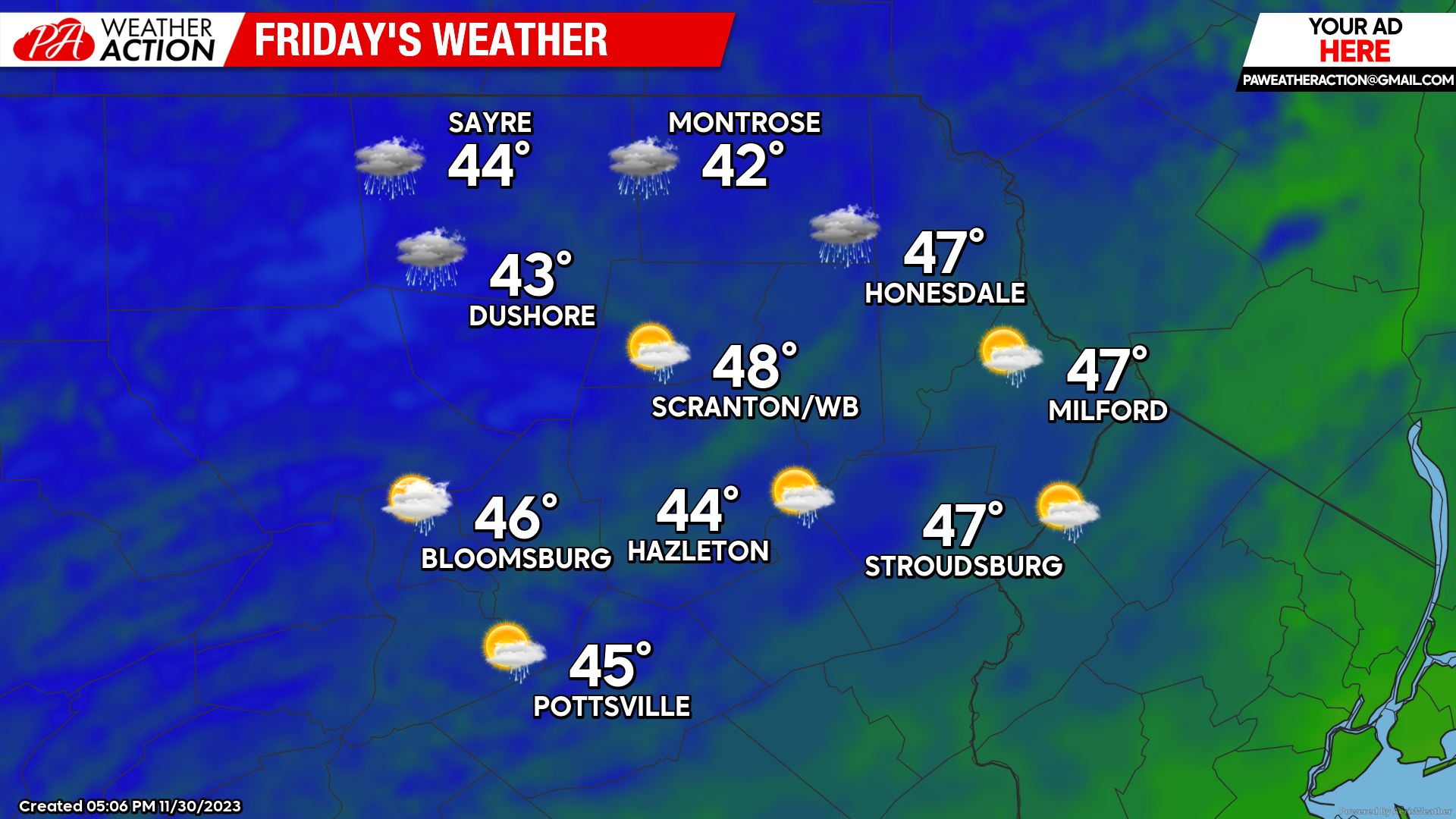
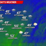
FRIDAY
Cloud will arrive early, with showers overspreading the area midday and afternoon.
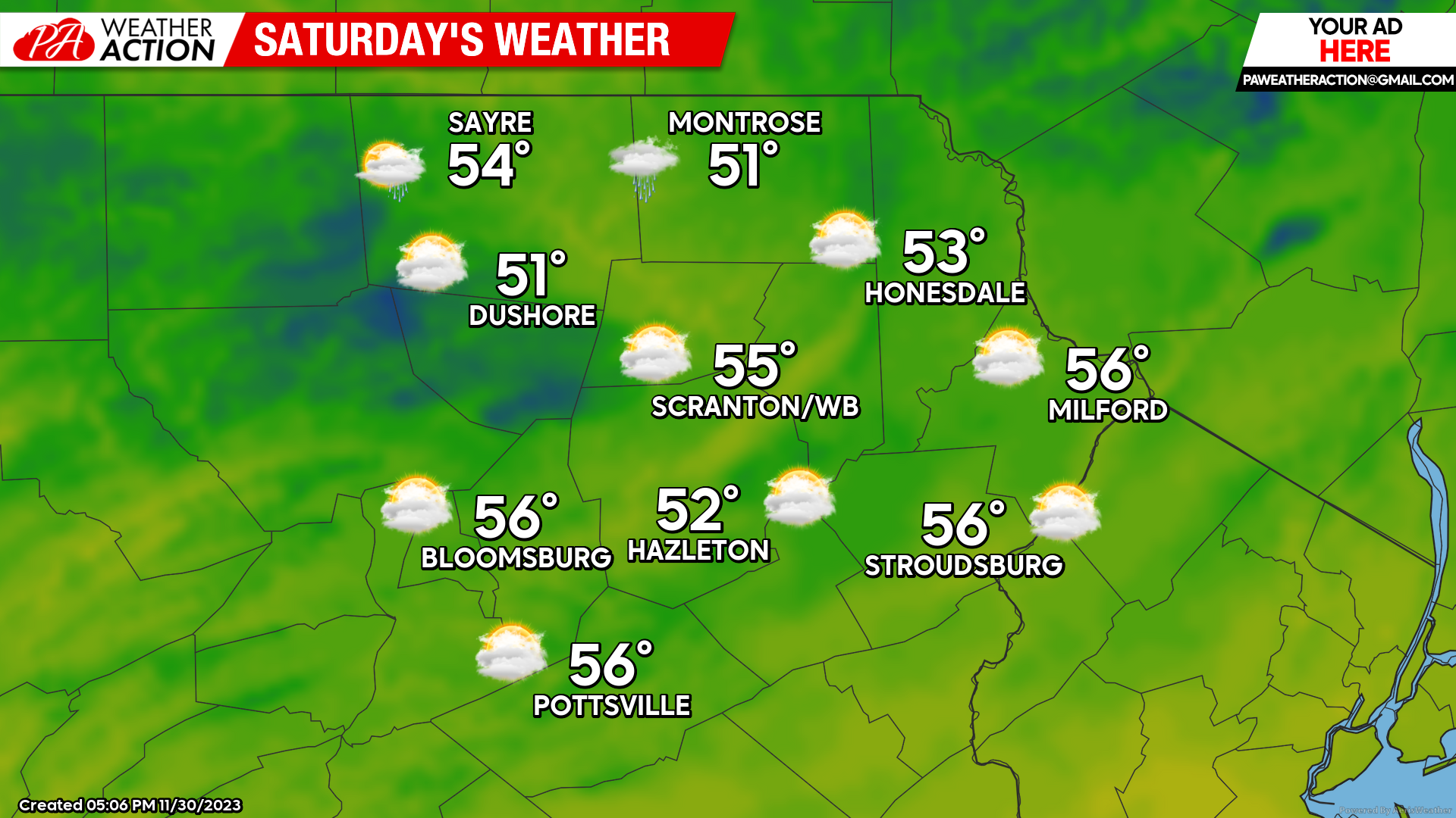
SATURDAY
Mostly cloudy conditions and warmer-than-normal conditions will continue, with the threat of a light shower – although most of the day will be dry.
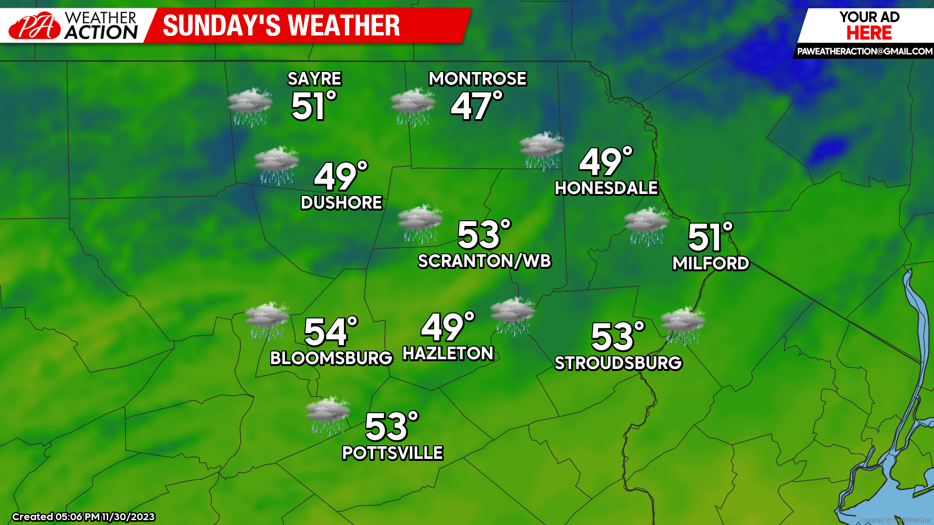
SUNDAY
Warmer than normal conditions and unsettled weather will continue, with clouds and more-widespread showers possible.
You must be logged in to post a comment.