
Cooler, more seasonable temperatures with chances for rain and accumulating snow this week.
Tuesday
A mostly cloudy start to the day will bring a chance for rain to enter the region in the afternoon hours transitioning to snow after sunset. A chance for snow showers will continue overnight. Highs will be in the Low 40s to mid 30s. Lows will be in the low 30s to mid 20s.
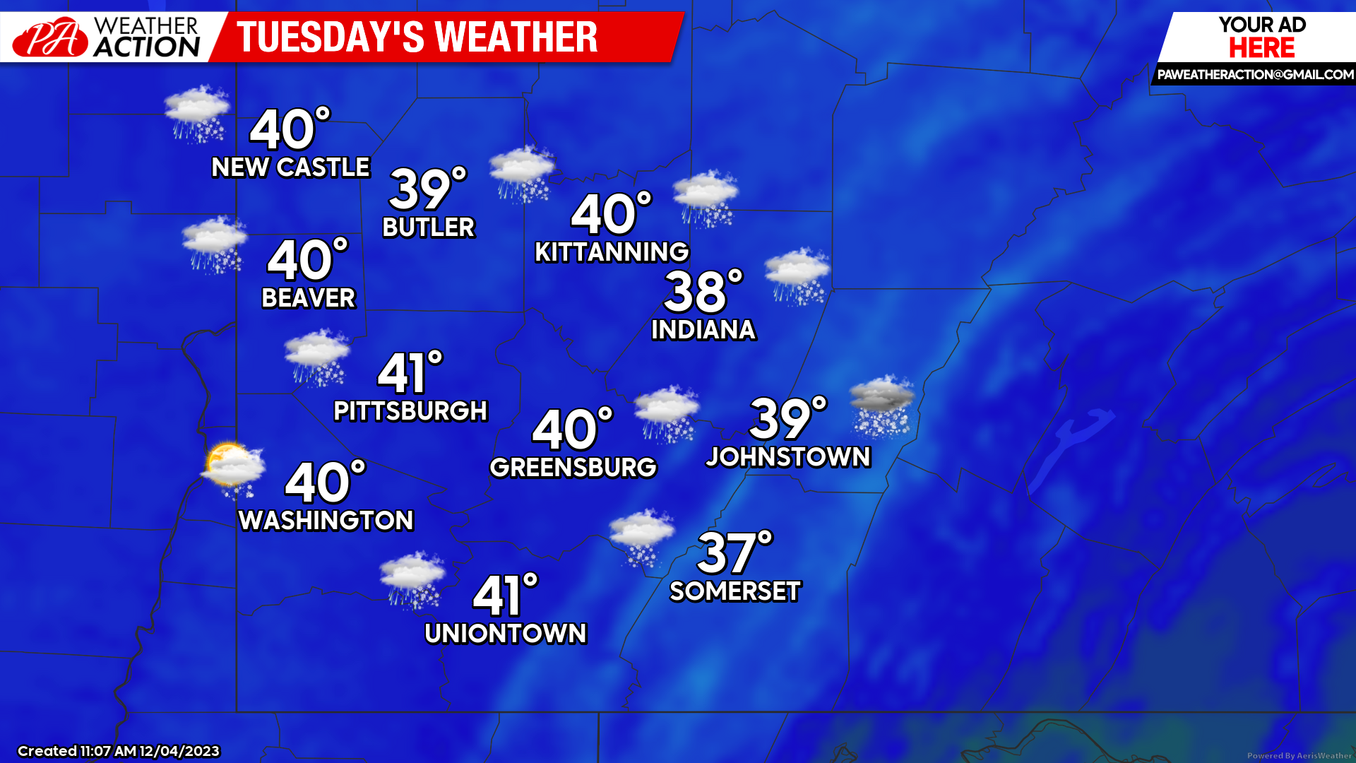
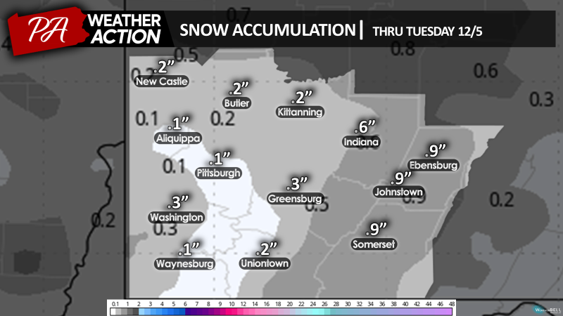
Snow accumulation will range between a tenth of an inch to up to 1 inch in higher elevations.
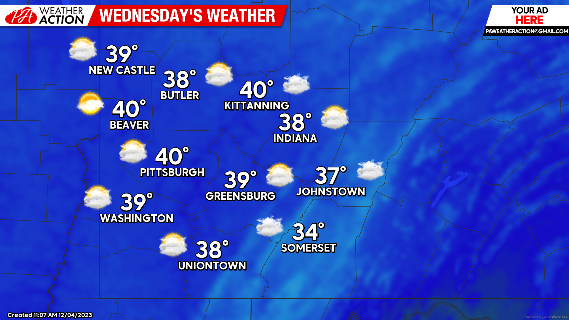
Wednesday
A slight chance for snow will continue throughout the region on Wednesday. Snow chances will drop from east to west starting in the early morning hours transitioning to a mostly cloudy conditions, these conditional chances will persist throughout the day. Highs will range in the low 40s to low 30s. Winds will be out of the Northwest at 6 to 11 mph. Lows will be in the high to mid 20s.
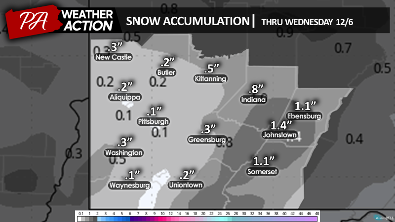
Overall snow accumulation for this week will range between a tenth of an inch to up to 1-2 inches in higher elevations.
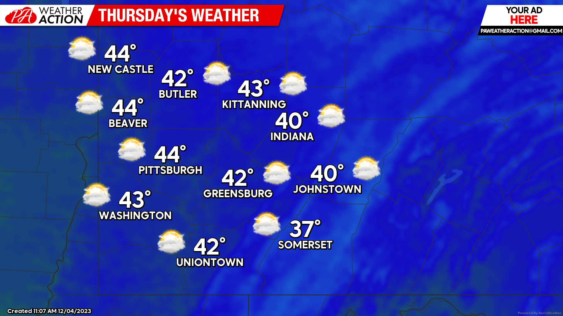
Thursday
Mostly cloudy with a slight increase in temperature. Highs will range in mid 40s to mid 30s. Lows will be in the mid to low 30s.
Temperatures will continue to rise with rain likely this weekend. Be sure to follow PA Weather Action for all the details.


You must be logged in to post a comment.