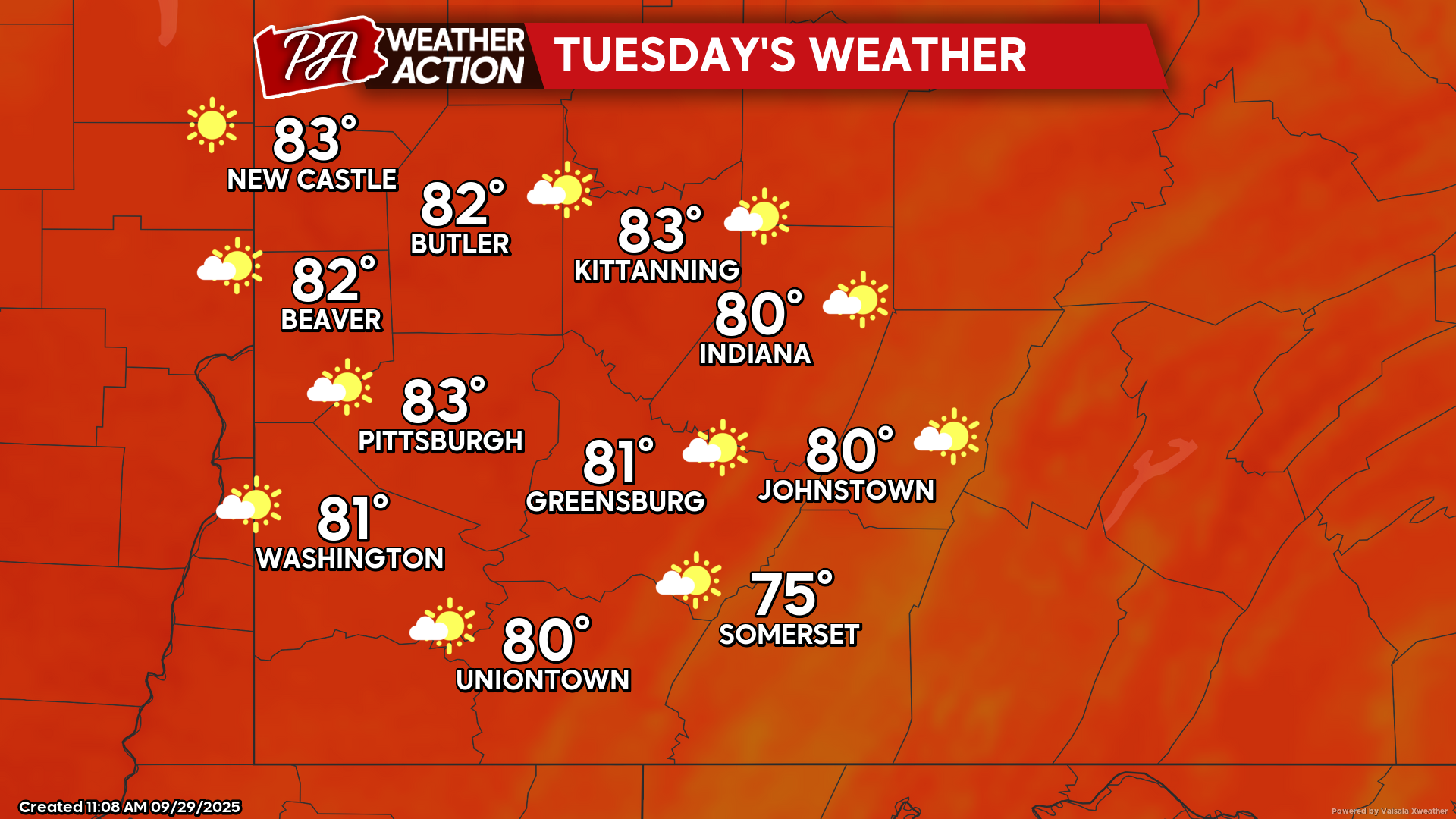
High pressure will bring the continuation of mostly dry conditions and above seasonal average temperatures throughout the week. Tuesday Mostly sunny conditions with a slight…
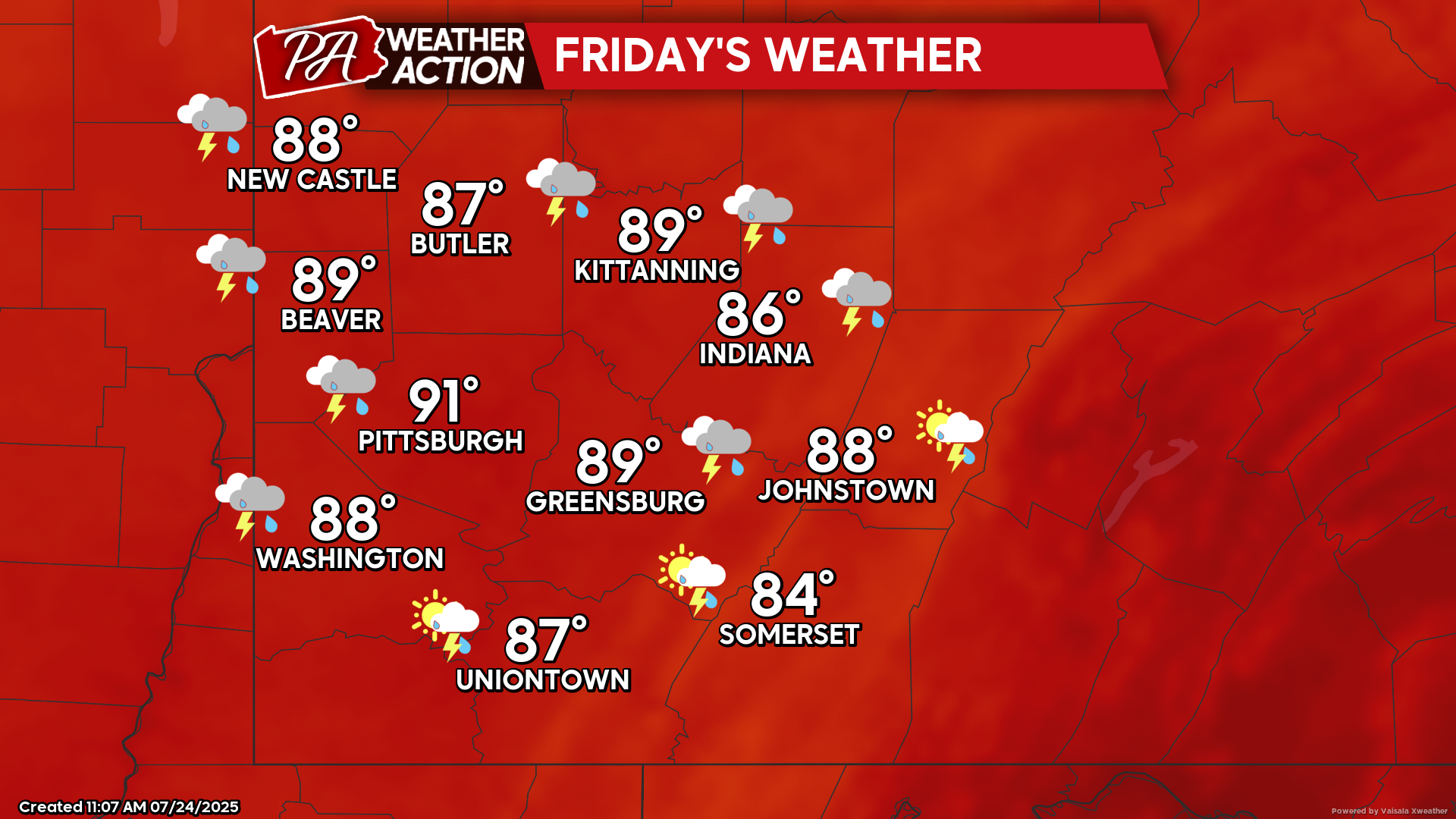
The passage of a cold front this evening will bring chances for showers and thunderstorms however, drier conditions are expected on Friday and continuing throughout…
A pattern of cooler, below seasonal average, weather is expected throughout the region this week, with mostly clear conditions expected through mid-week. A slight chance…
The passage of a cold front this weekend will bring chances for showers and thunderstorms late Saturday and into Sunday. Temperatures will briefly warm up…
High pressure will continue to bring clear conditions to start the week. Chances for showers and thunderstorms are possible as we approach mid-week, with temperatures…
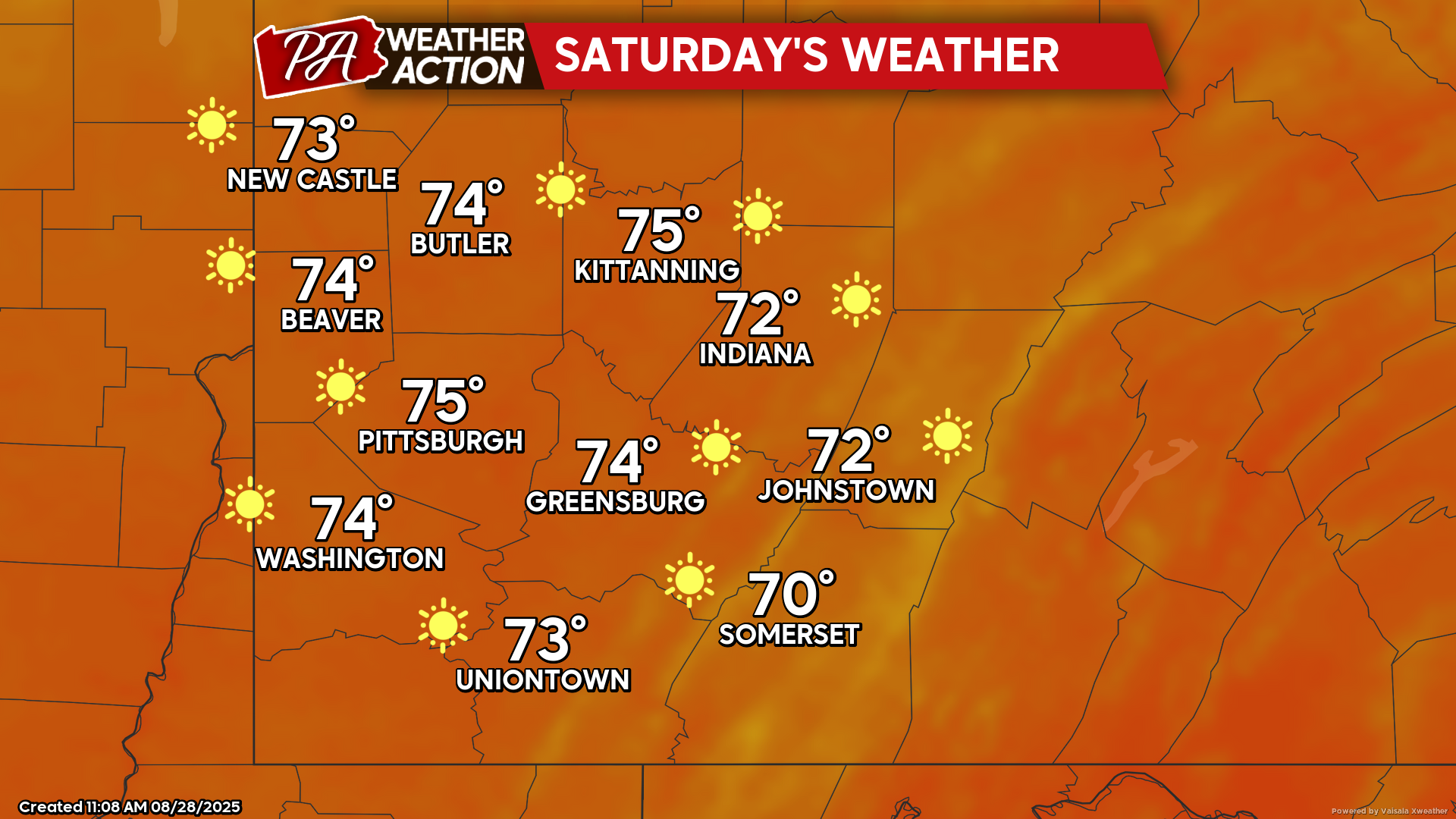
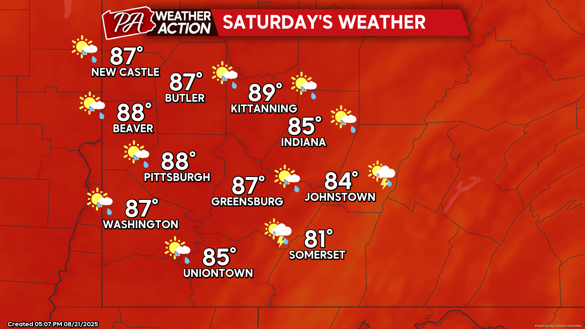
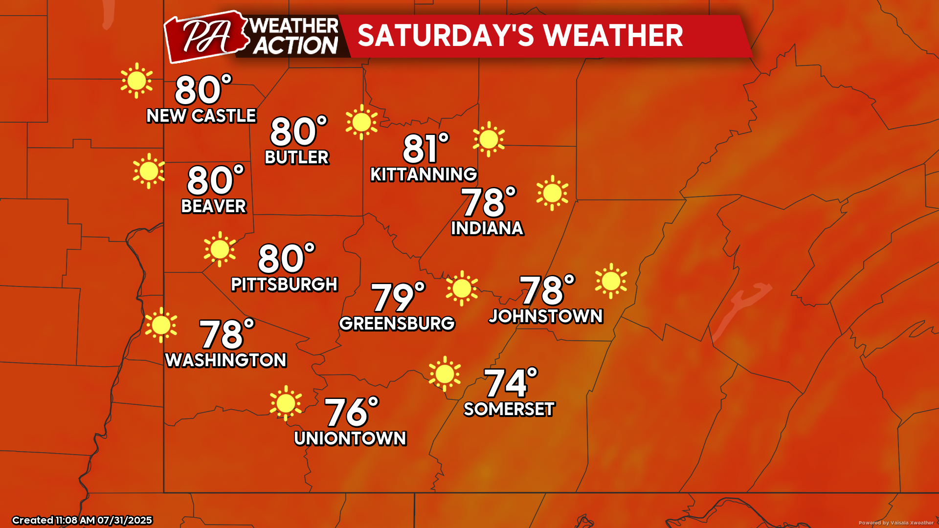
Dry conditions are forecasted for this weekend, with temperatures trending upward to above the seasonal average. Friday Mostly sunny conditions. Highs will range in the…
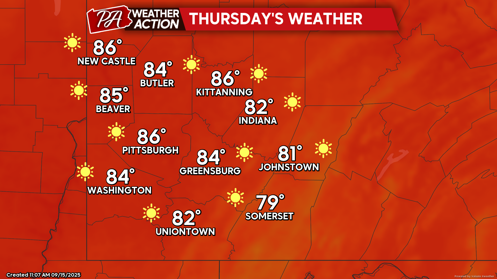
High pressure will continue to bring sunny skies. Temperatures will remain seasonable with a slight increase as the week progresses. Slight chances for showers move…
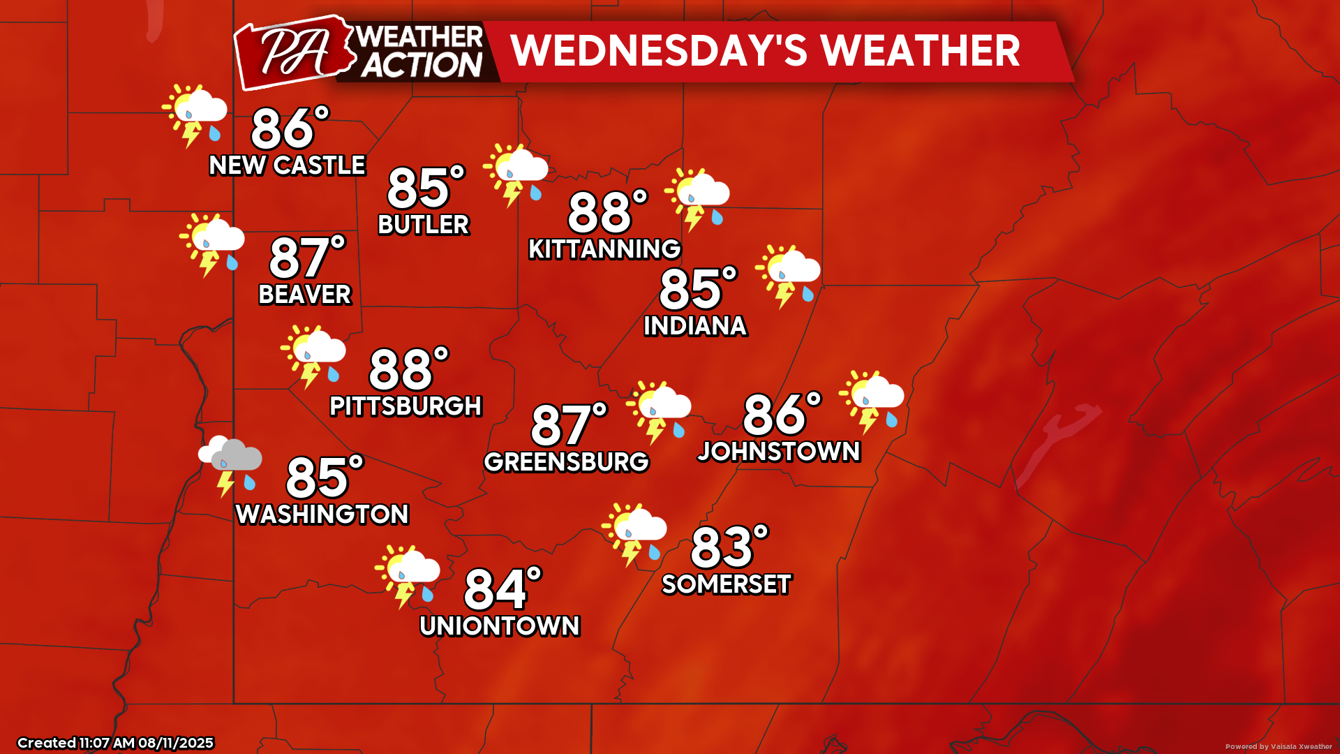
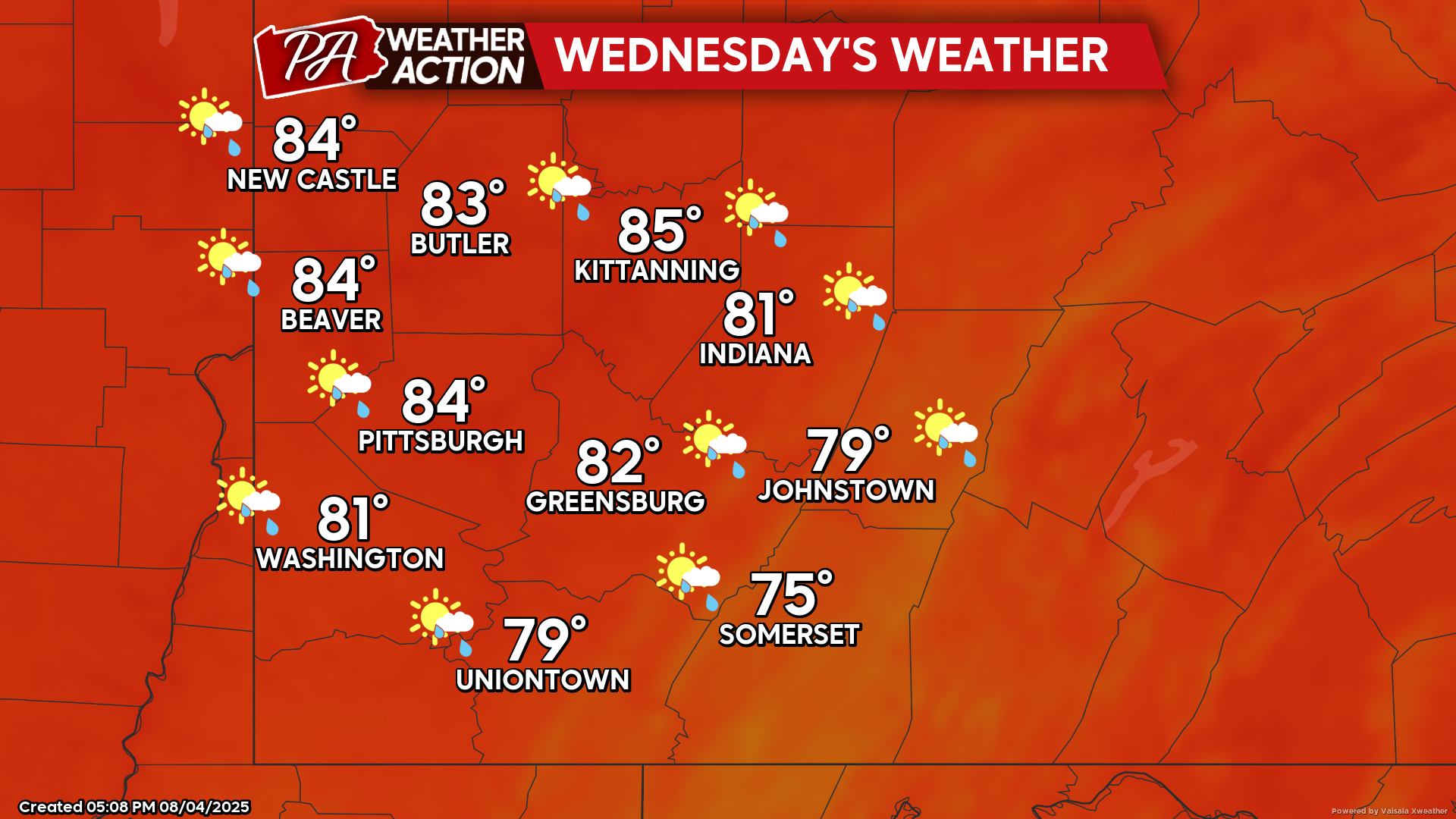
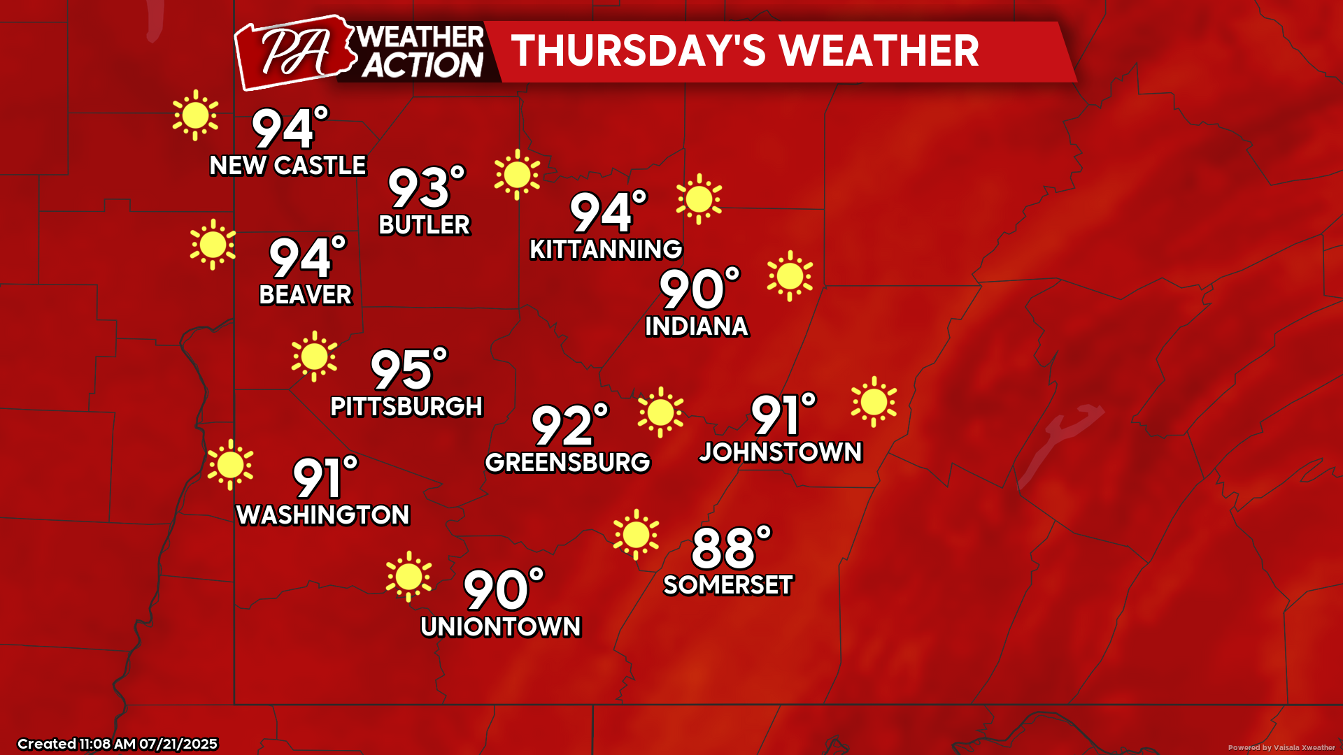
Hot temperatures will continue. The passage and forecasted stalling of a cold front will bring chances for showers and thunderstorms across the region over the…
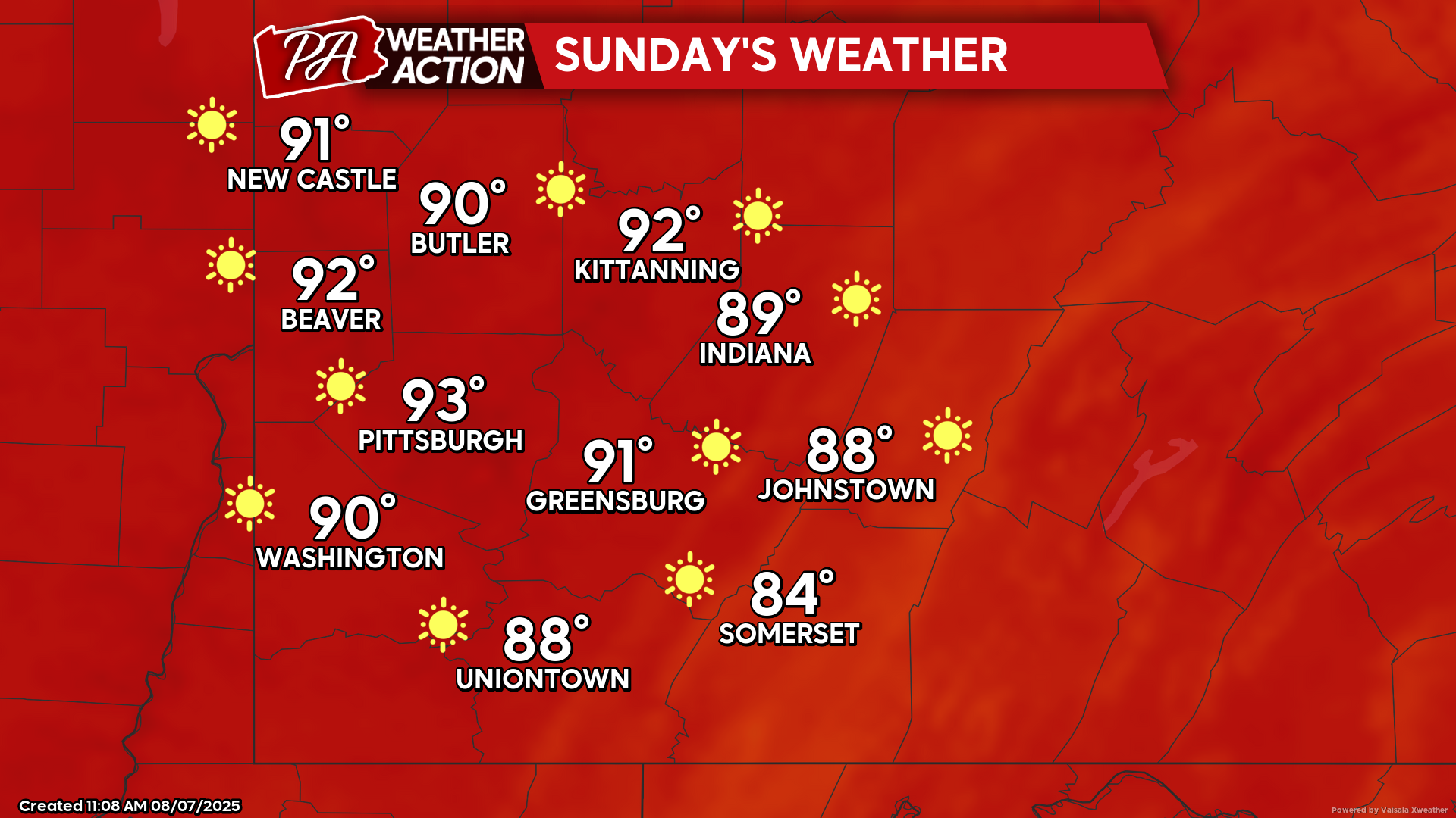
Dry and seasonable conditions to start the week. A warming trend will set in, bringing higher temperatures, but still dry conditions, by mid-week. Urban areas…
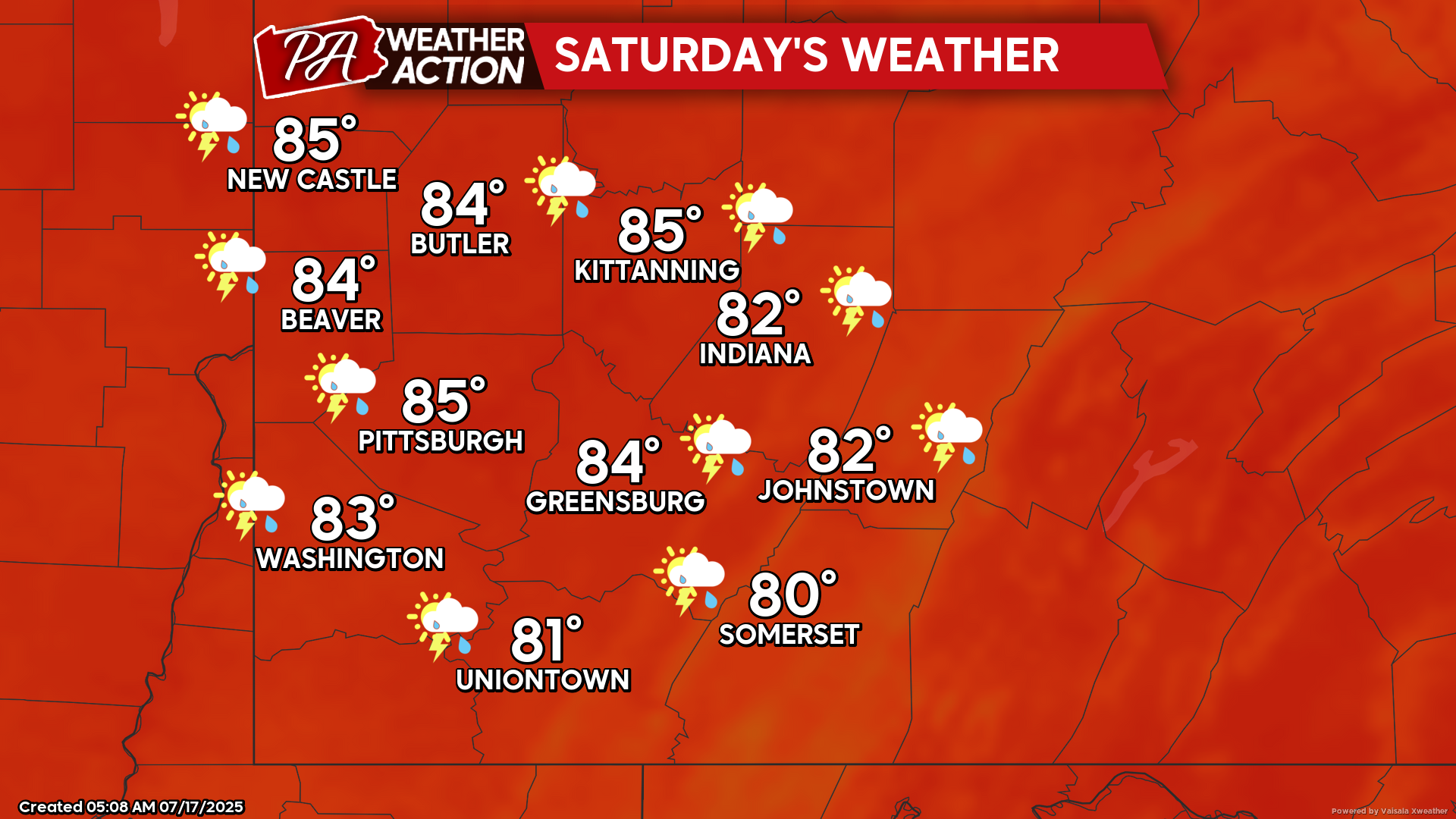
Widespread chances for showers and thunderstorms are possible throughout the region beginning on Saturday and continuing into early next week. Given the current ground saturation,…
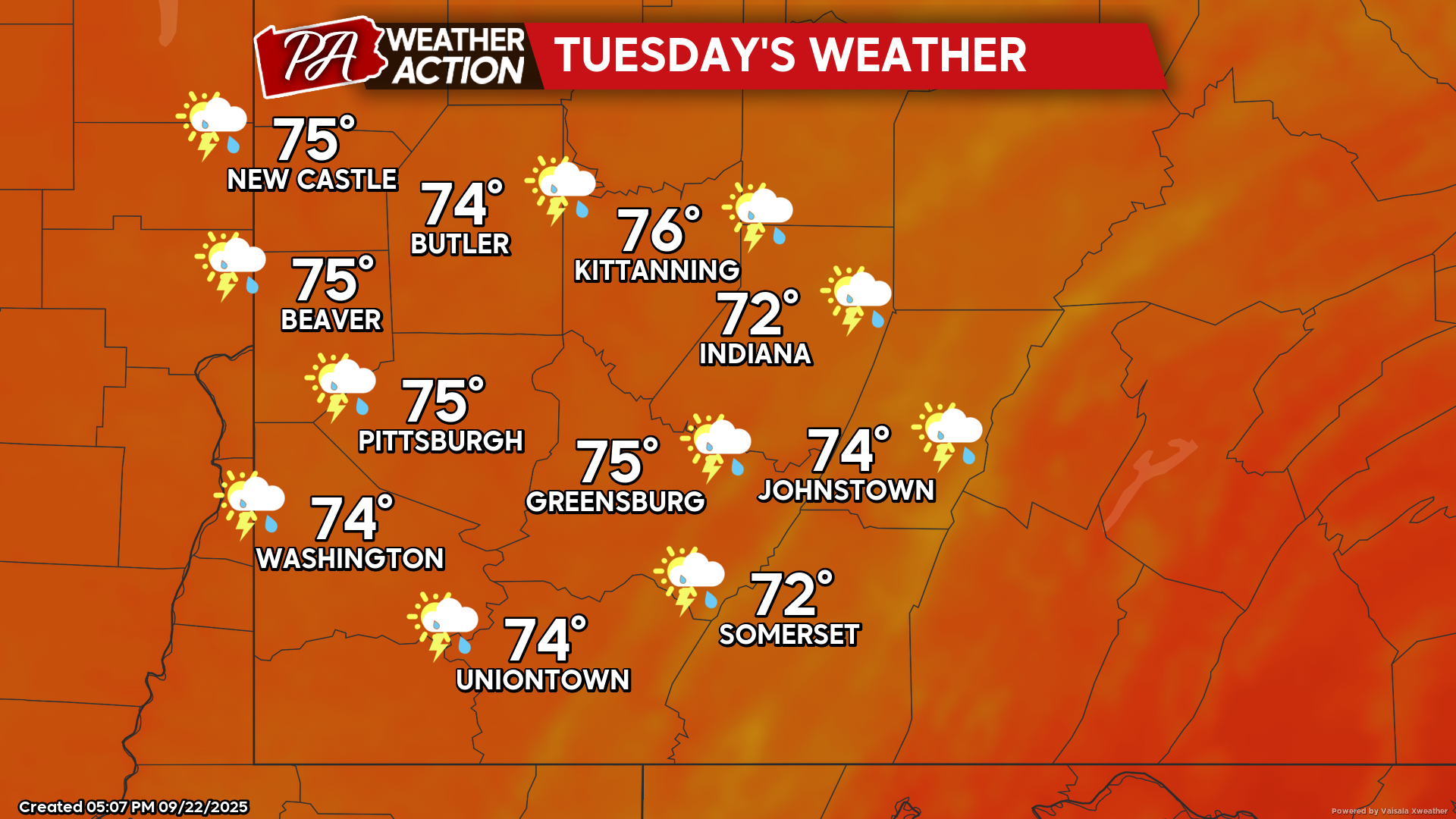
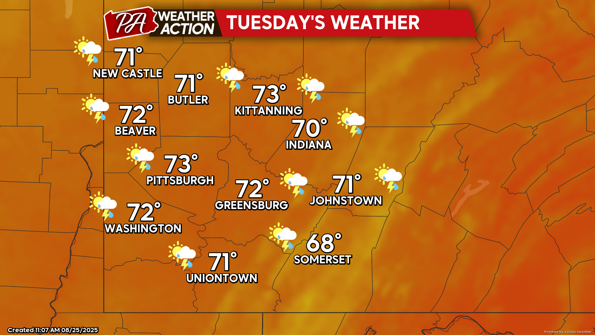
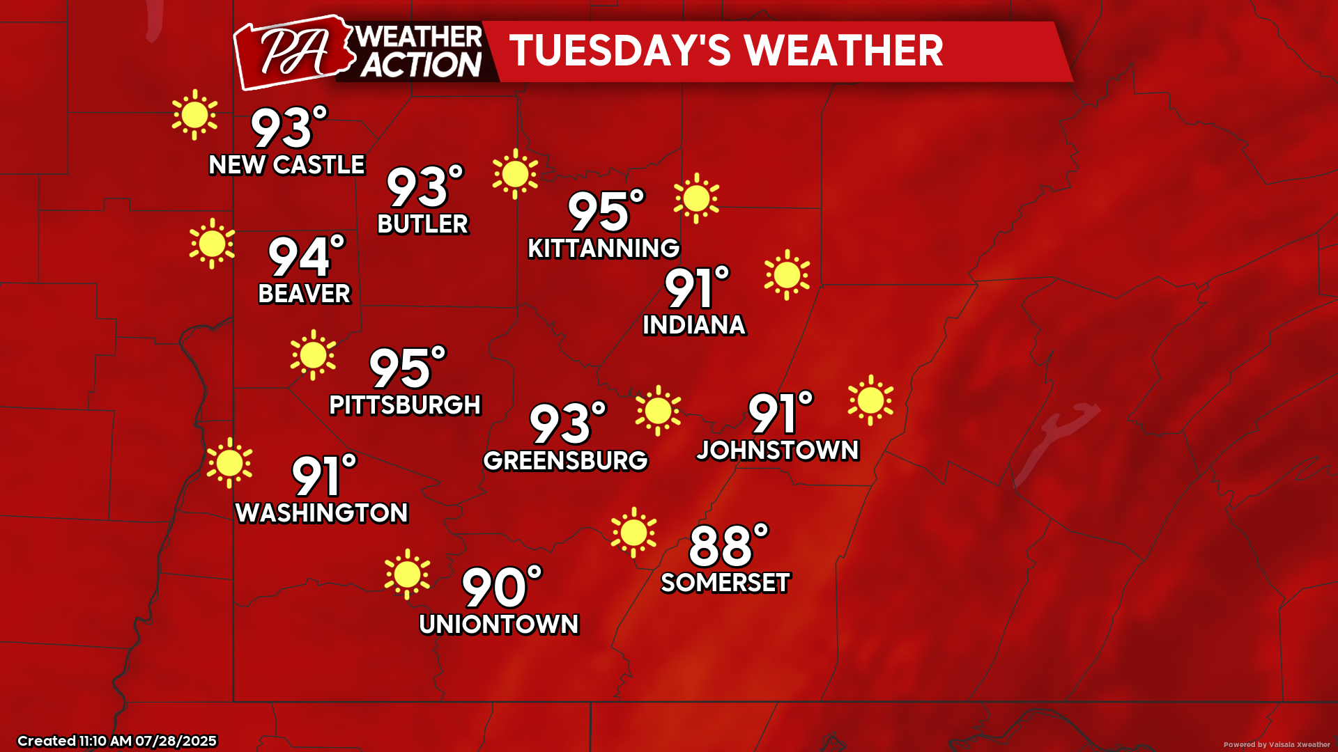
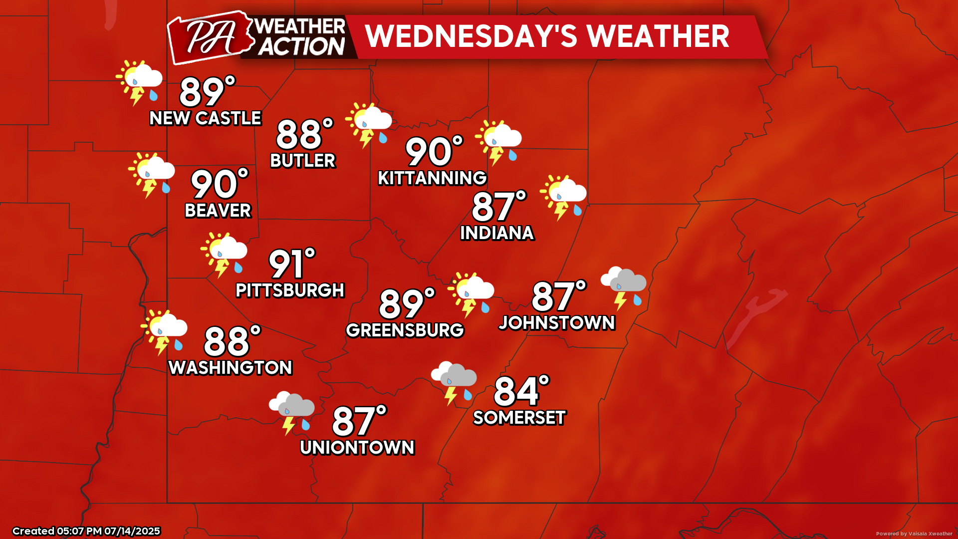
Above average temperatures with chances for severe weather and flooding potential through mid-week. Tuesday Mostly sunny and hot, with a slight chance for rain, especially…