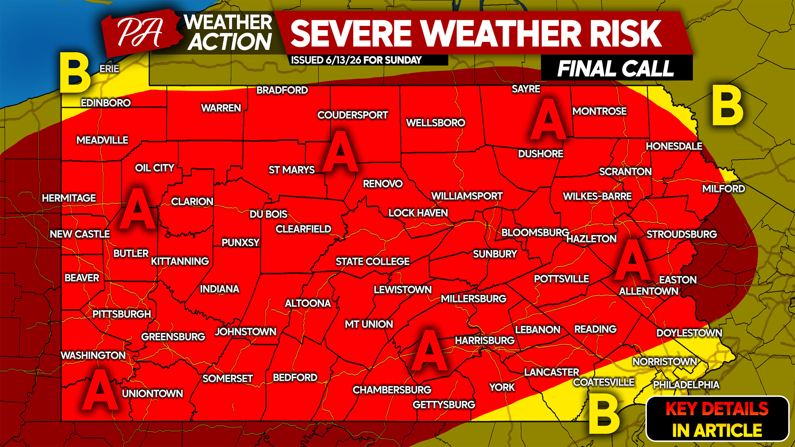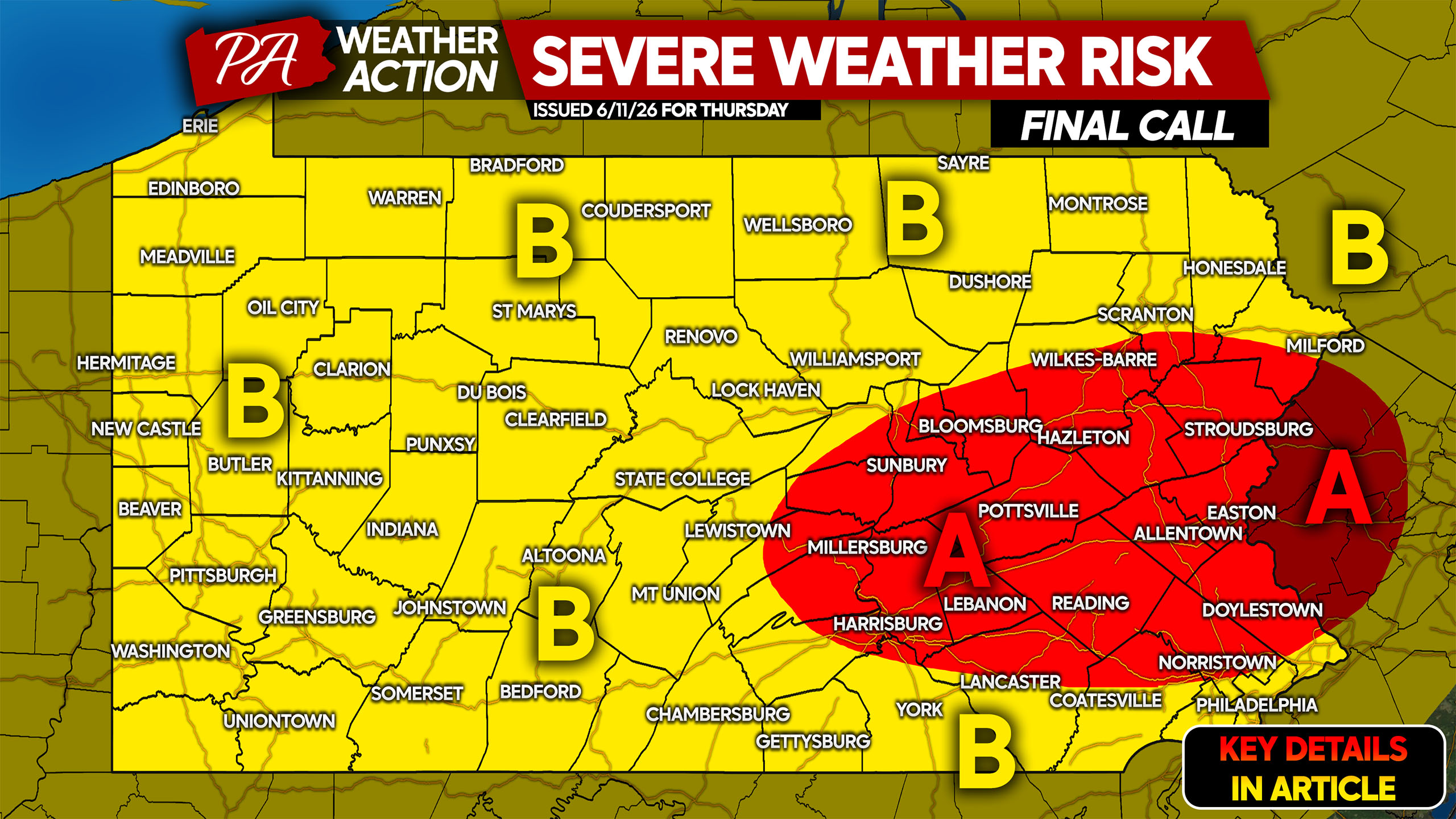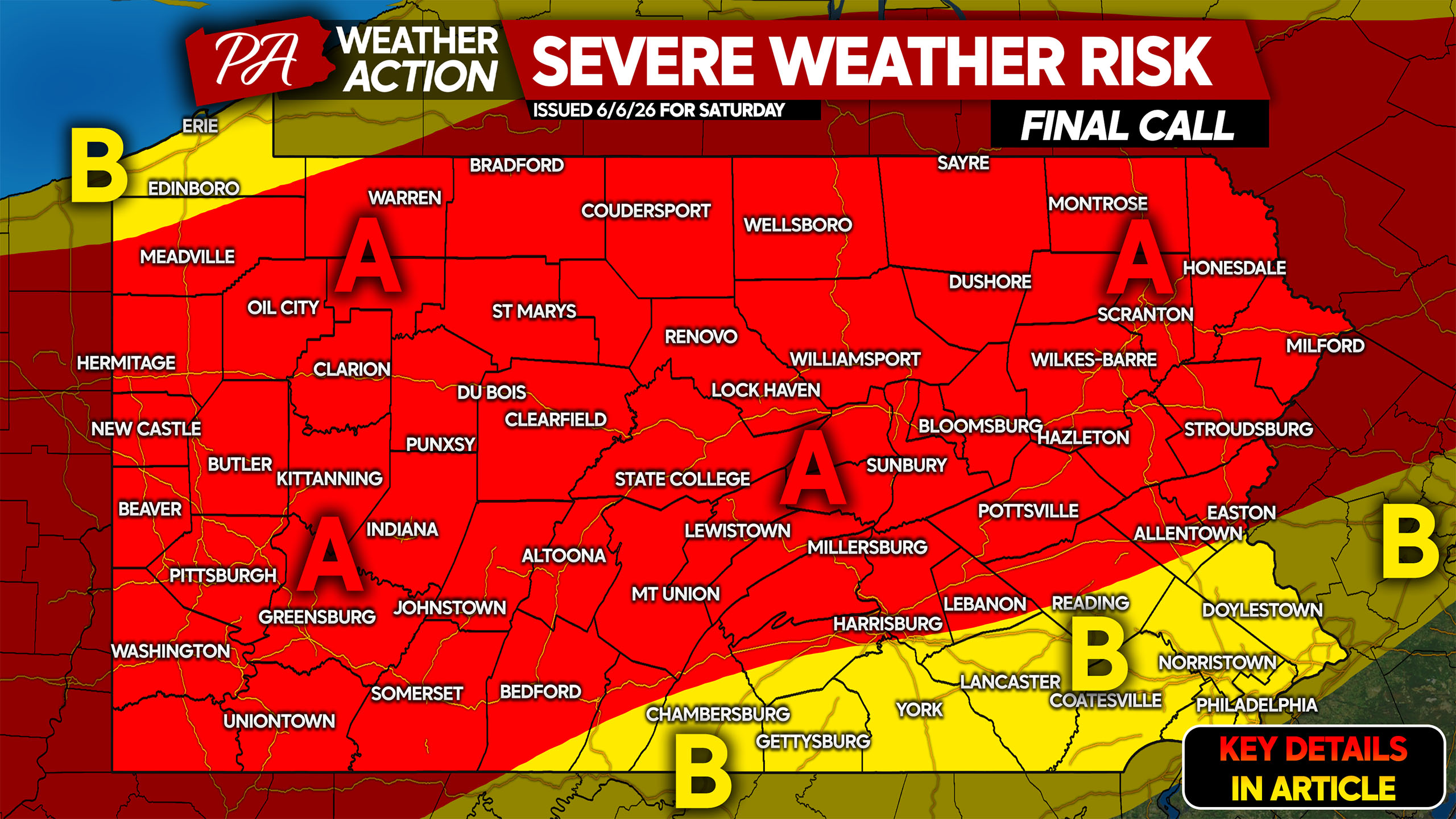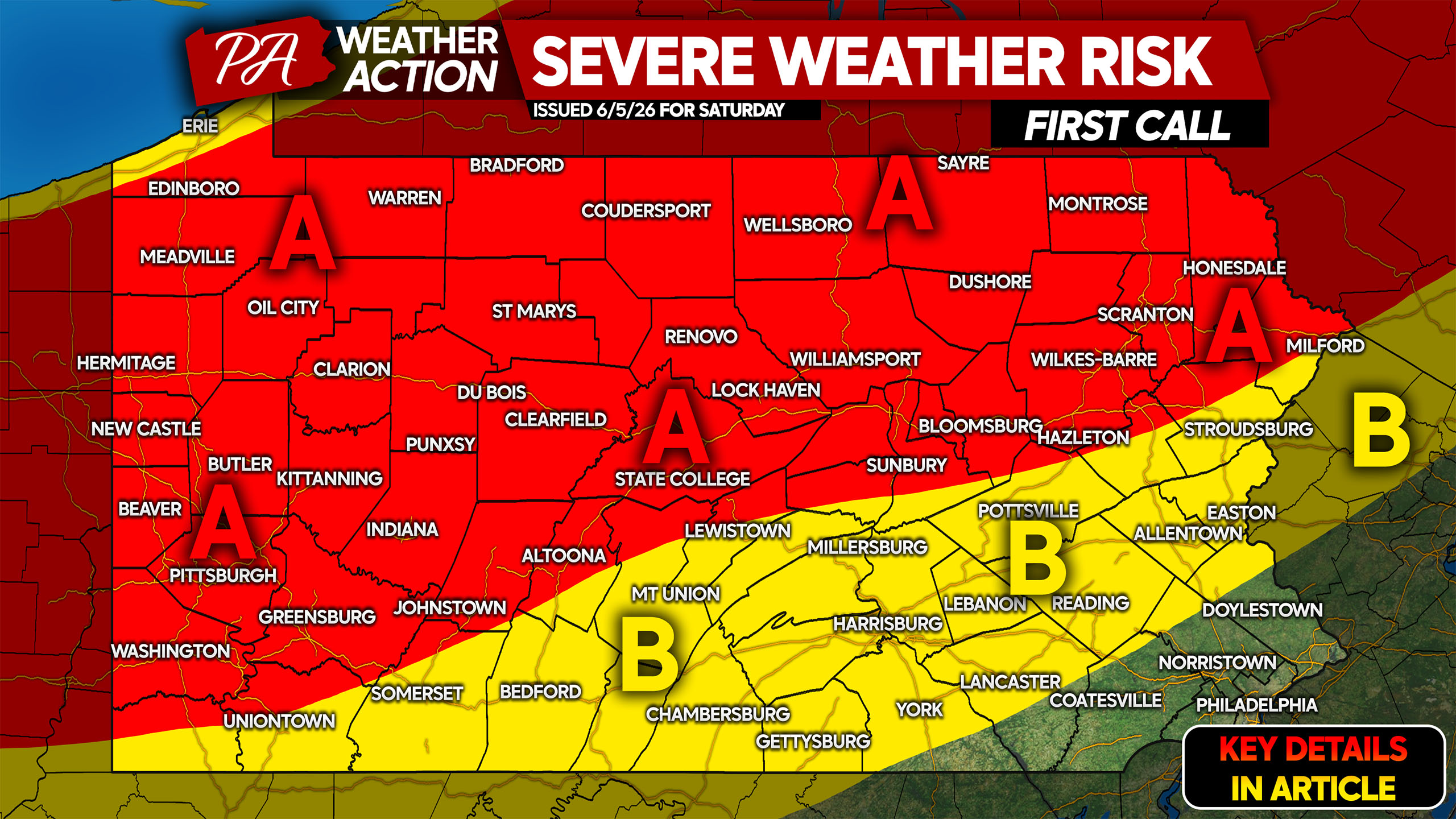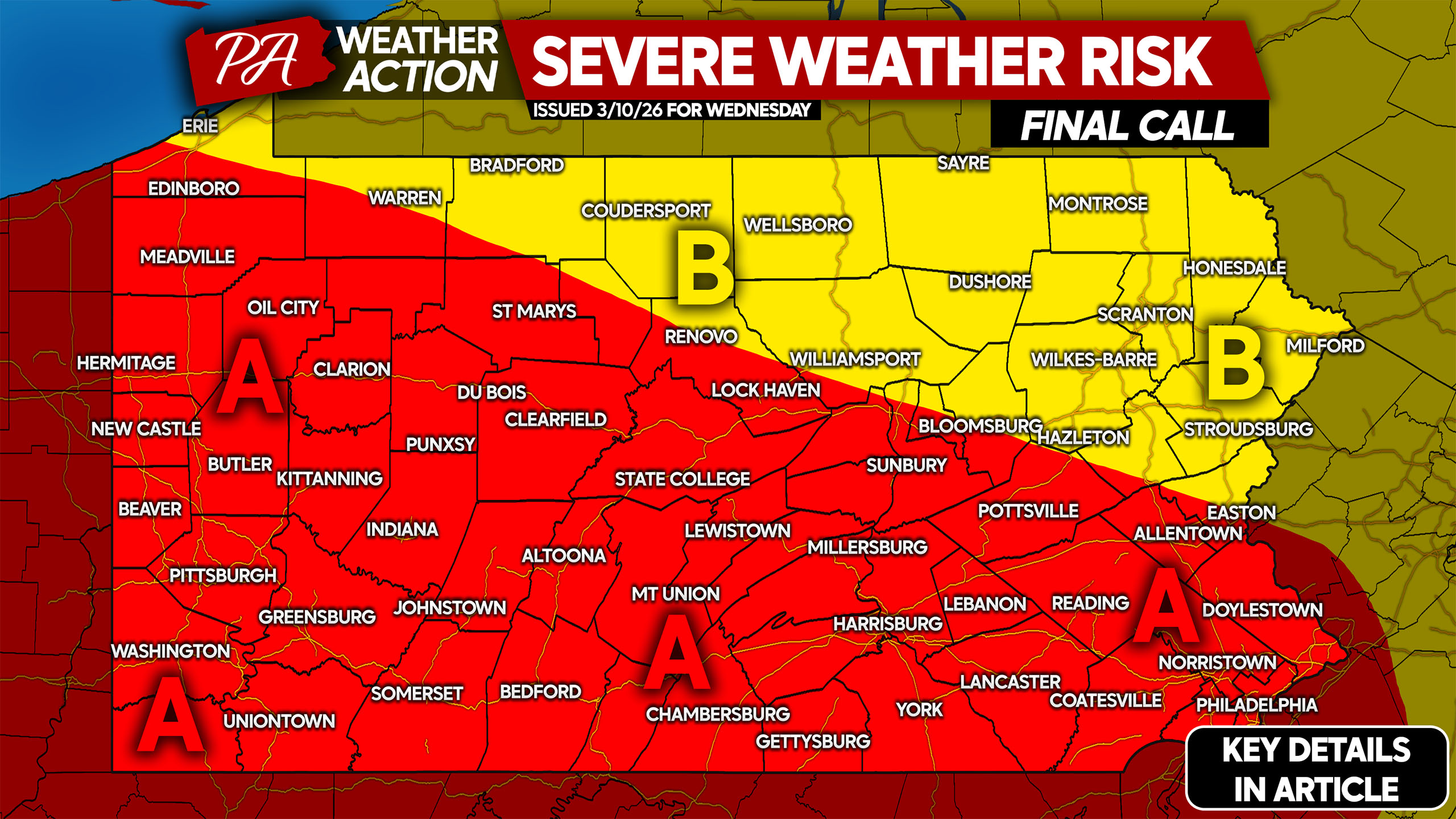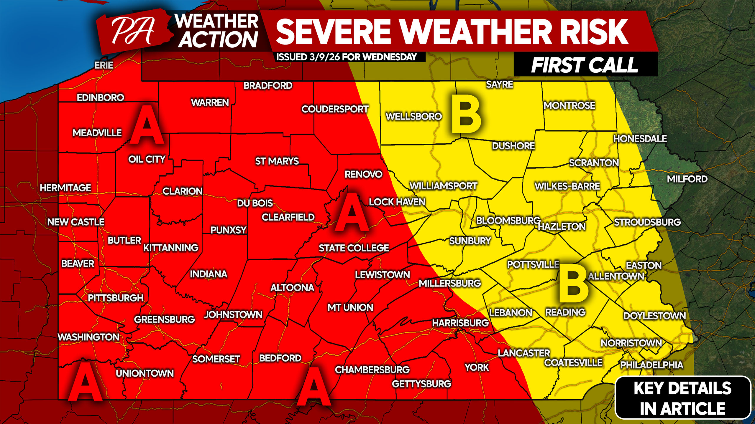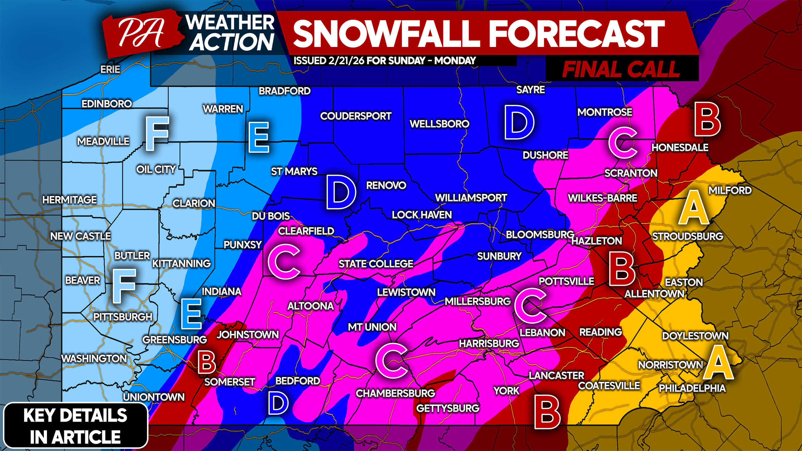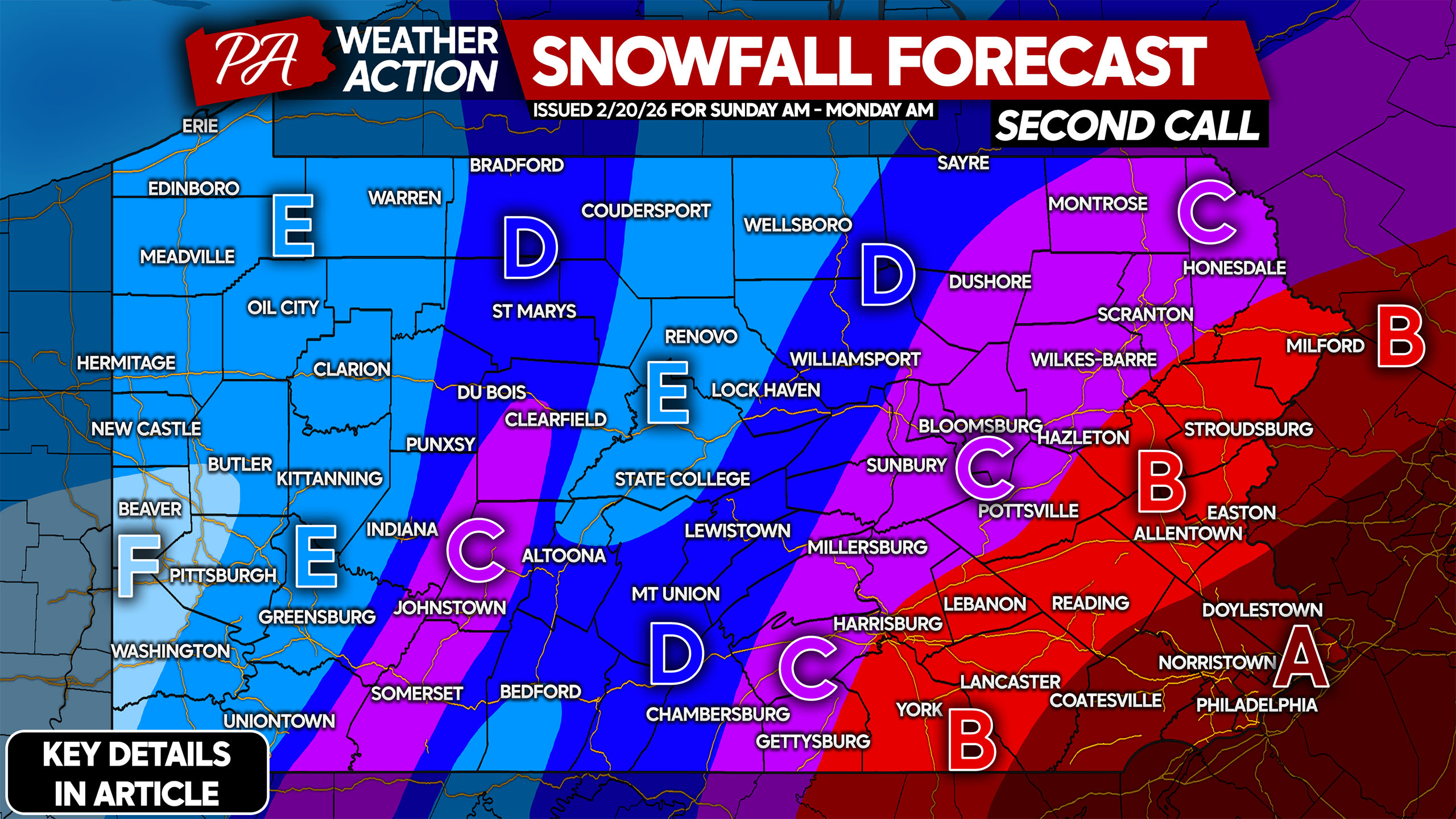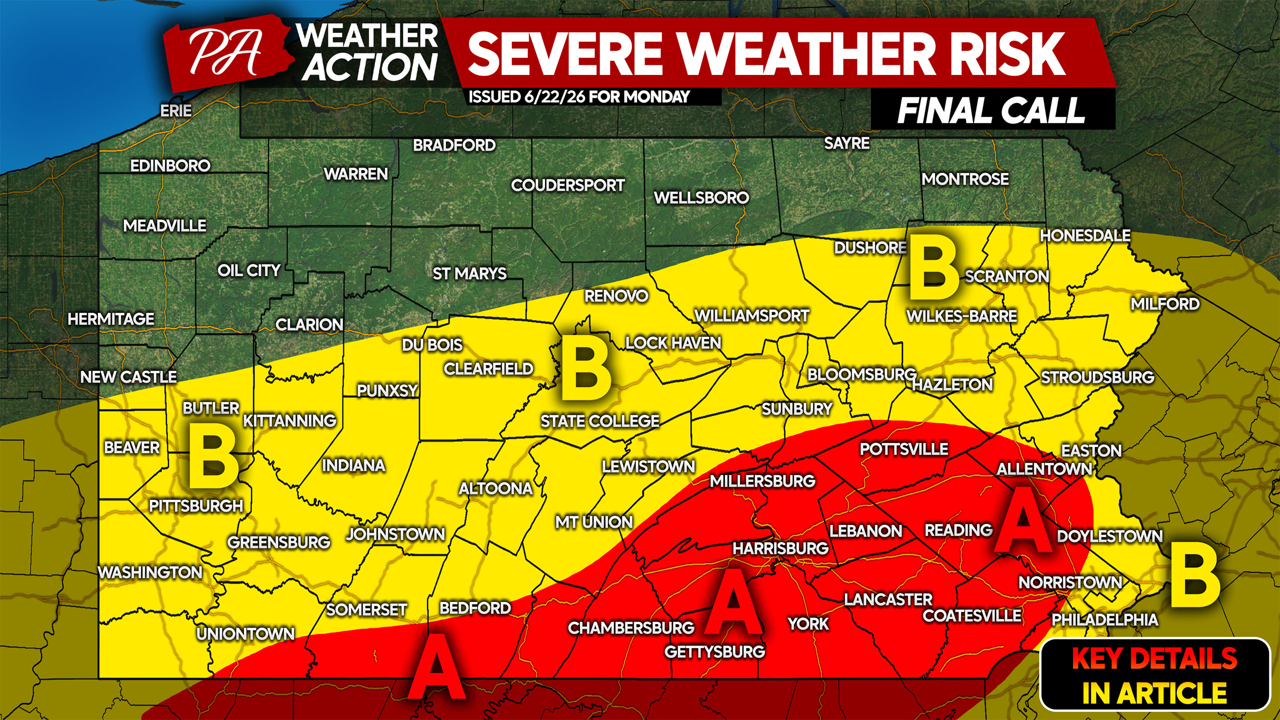
Posted inSevere Weather
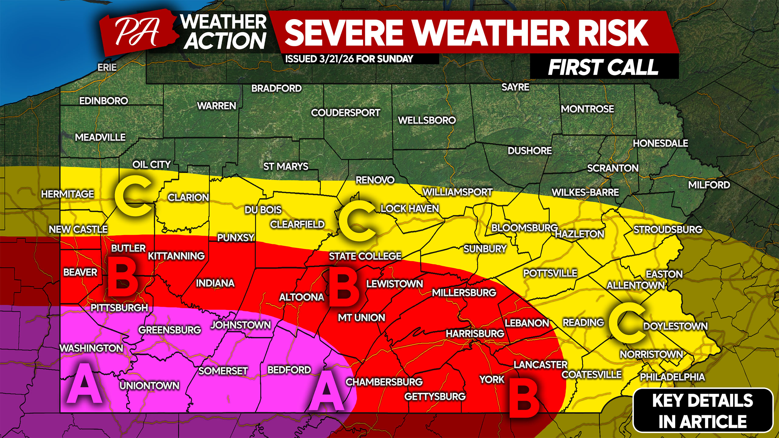
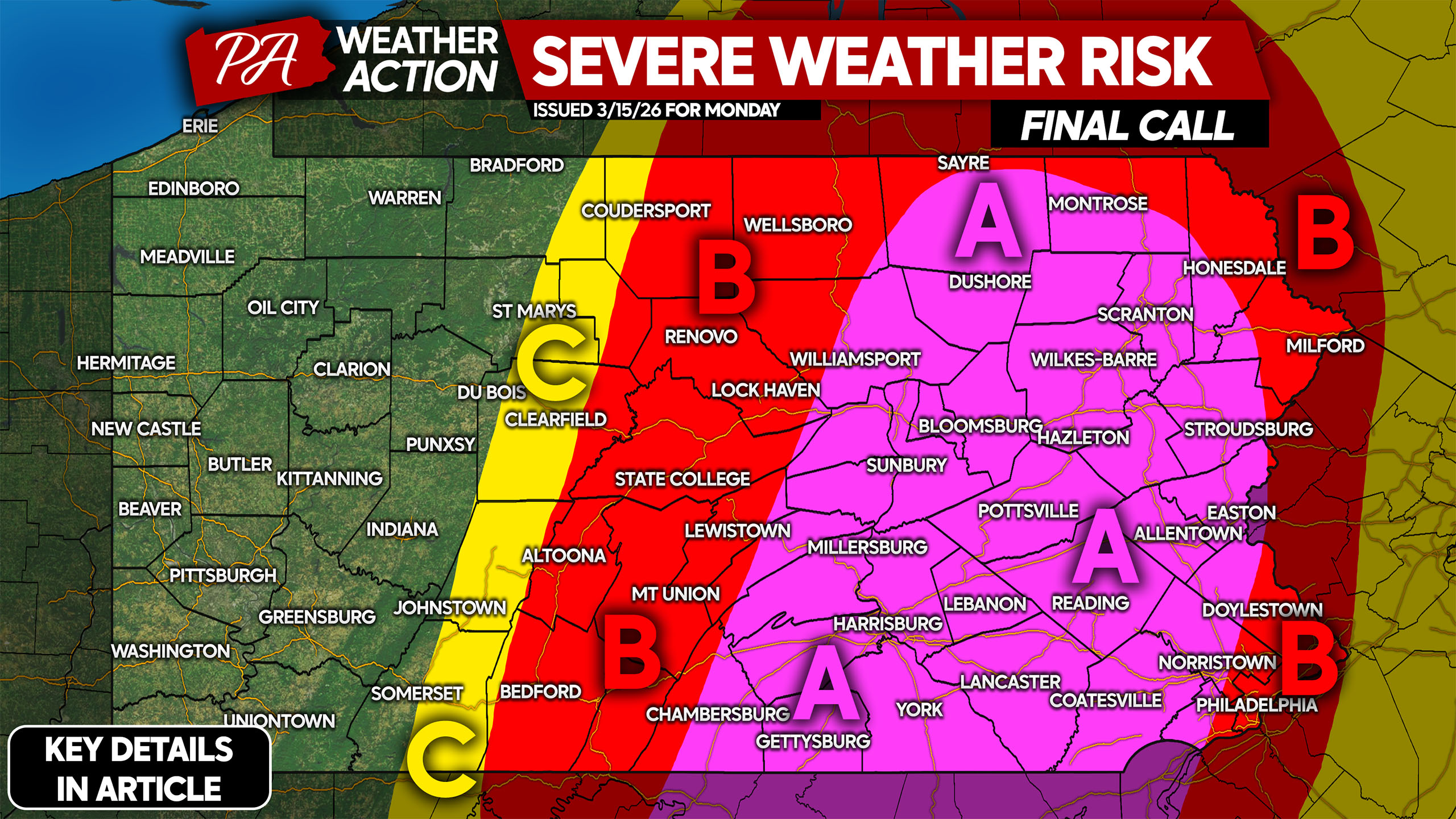
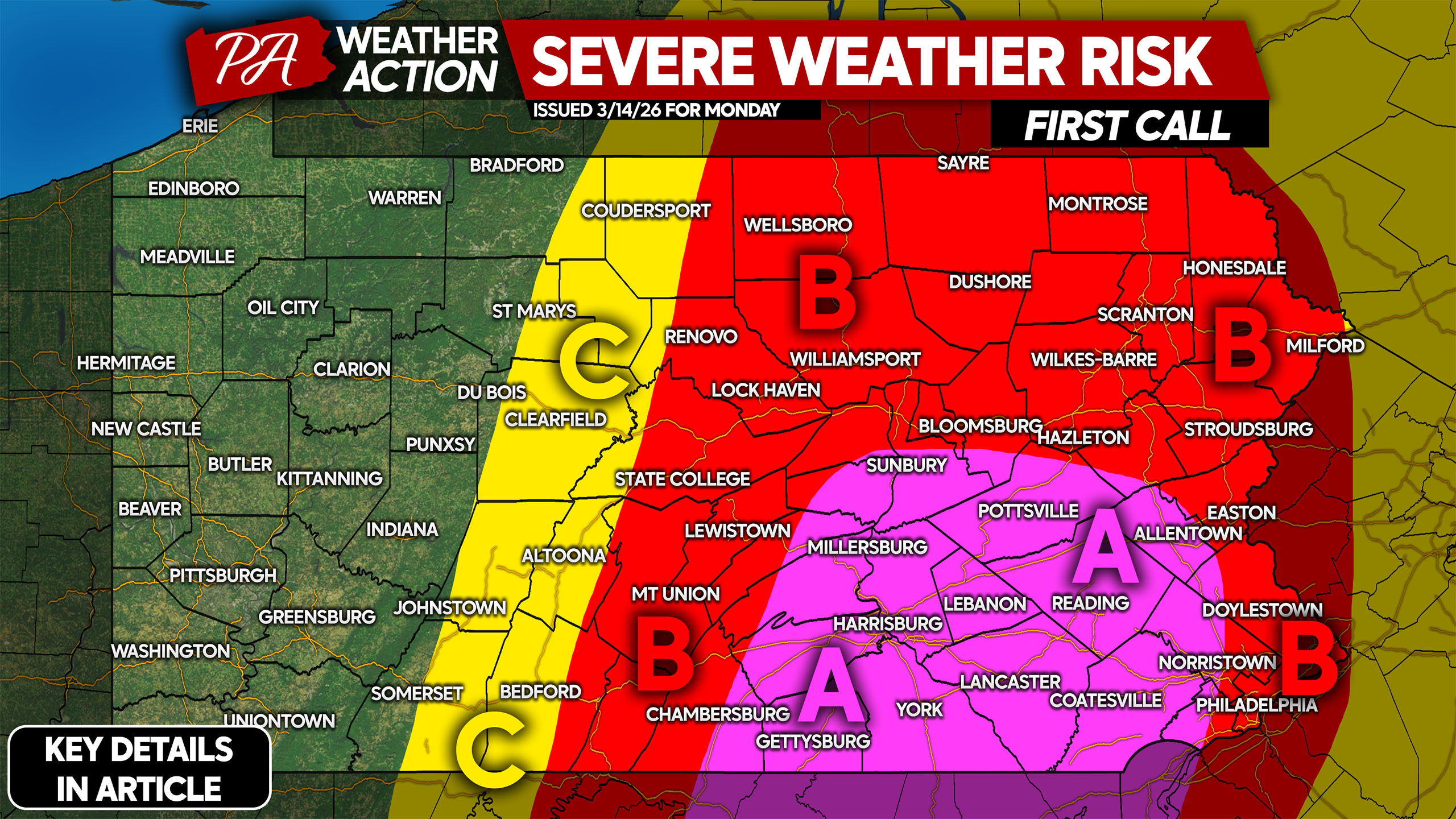
Damaging Winds & An Isolated Tornado Possible in Severe Storms Across PA Monday
Strong to severe thunderstorms will return to parts of the state Monday as a low pressure passes overhead. While Northern PA sees moderate rain and…