
Good Saturday morning to you all. This morning we are dealing with a mix of clouds and sunshine taking a looking at our latest satellite imagery:

Today’s Weather Forecast: 9/10
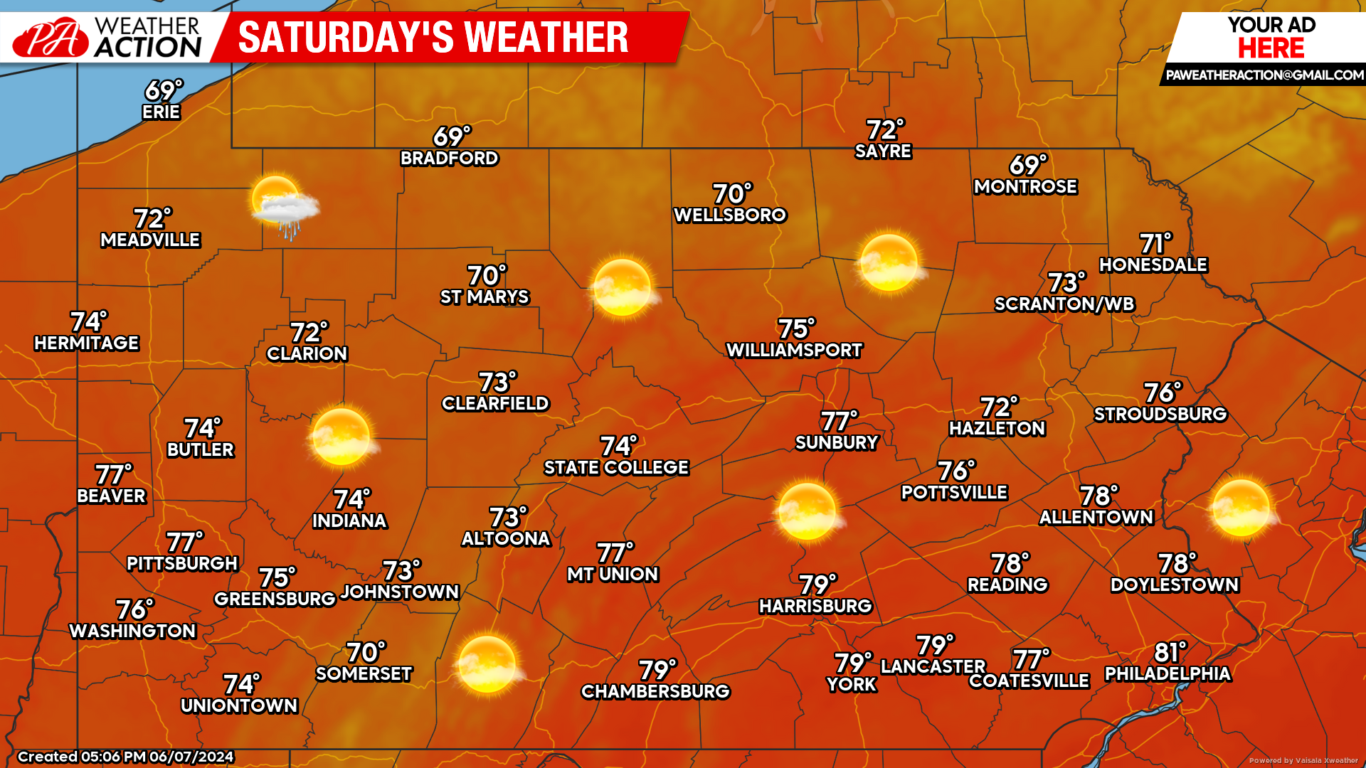
The only thing that will prevent today from being a perfect 10/10 is the increase in clouds later this evening that will eventually lead to showers overnight. However, during the daytime hours, today will be spectacular with high temperatures generally in the 70s.
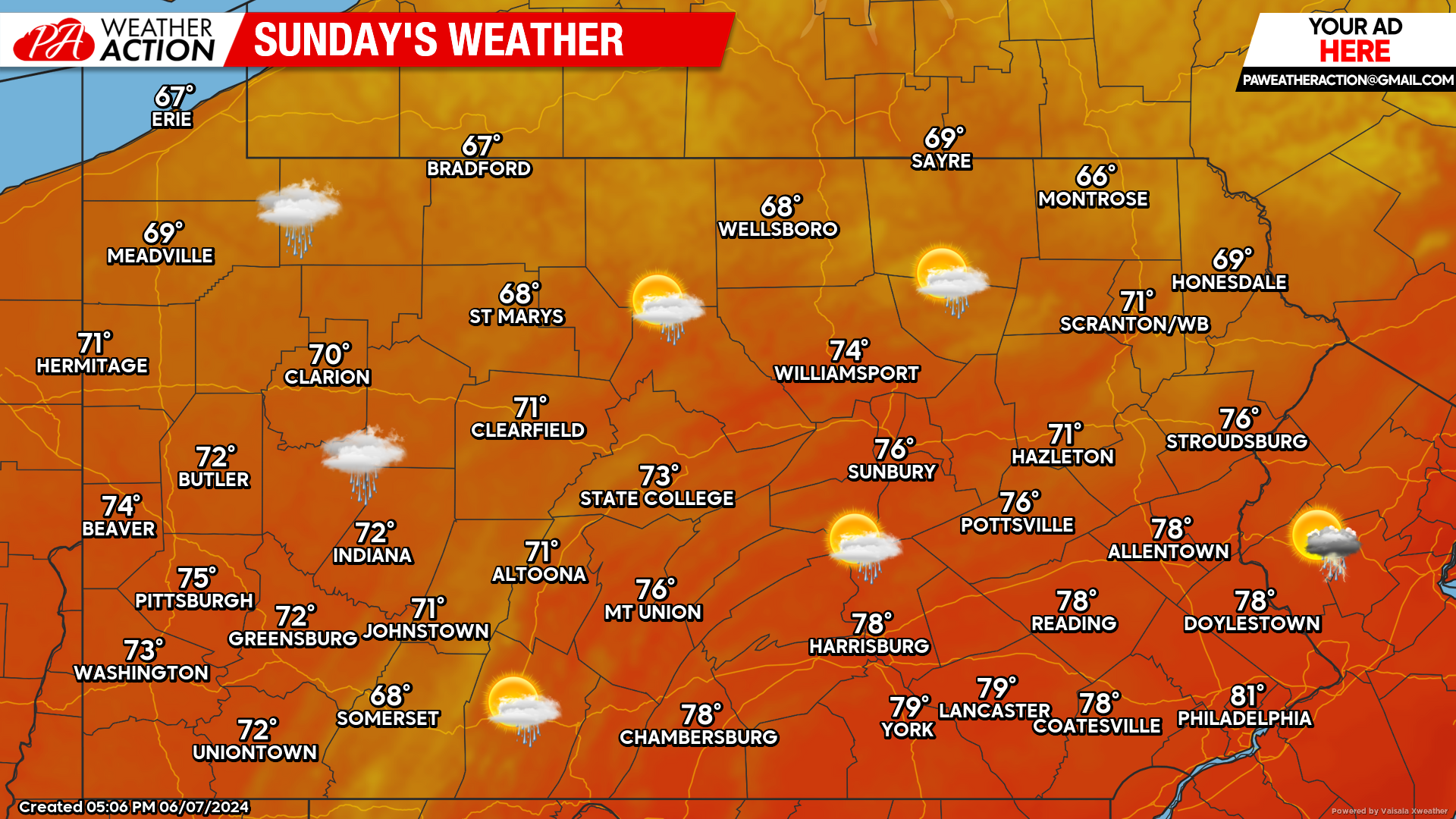
Sunday’s Weather Forecast: 7/10
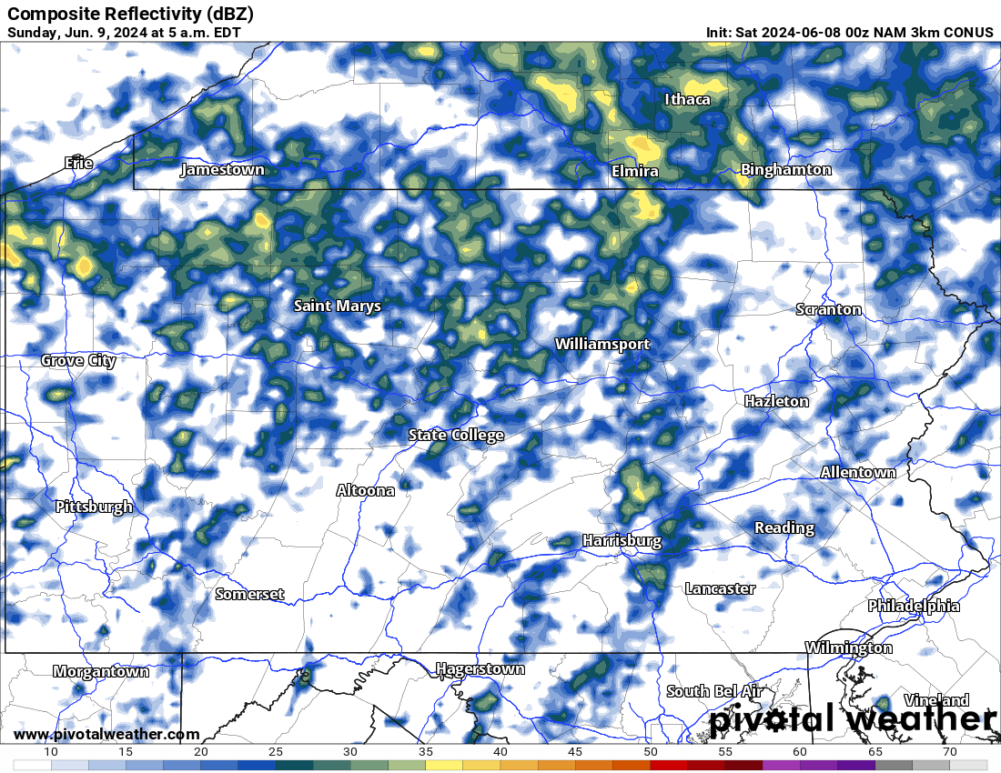
Sunday will feature rain showers during the early morning hours. Most of the rain will be gone by the late morning hours. The rest of Sunday should remain dry with high temperatures once again in the 70s.
Hi-Res NAM Future Radar Through Early Monday:
The majority of this weekend will be dry with the exception of the late night hours into early Sunday Morning. Most of the shower activity will be after 10:00 PM tonight and will last through the mid-morning hours tomorrow. For reference, the time stamp is in the top left of the graphic below.
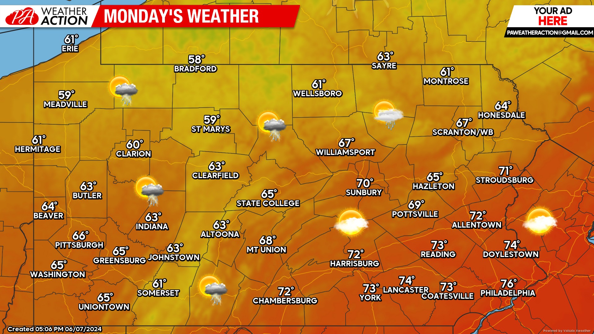
Monday’s Weather Forecast: 7/10
Isolated showers and thunderstorms are possible Monday, but not likely. Much cooler temperatures will be felt across the state’s higher elevations as well as all of the northern tier counties.
Looking Ahead:
Looking into next week, no major systems are expected to impact the region. A shower or thunderstorm from time to time is possible, but no widespread significant rainfall is expected anytime soon.

You must be logged in to post a comment.