
Severe weather season is finally waking up here in Pennsylvania as we near the second week of June. A cold front draped across the Northeast US will push through later today, with warm and moist air out ahead. This will create an ideal environment for severe thunderstorms to develop across the state.
FUTURE RADAR TIMING
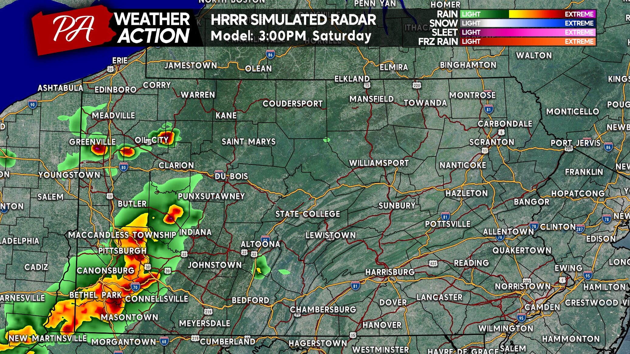
Start by mid-afternoon, storms will likely fire up near the Ohio border and move east. That means the Pittsburgh metro is now looking at earlier timing, and models are suggesting two rounds of storms in Southwest PA. Below is the HRRR model for 3:00 PM Saturday.
As that line pushes east into the Allegheny Mountains late this afternoon, more storms are projected to develop near I-80 in Northwest PA. These cells will move more southeasterly. Here is the 5 PM future radar.
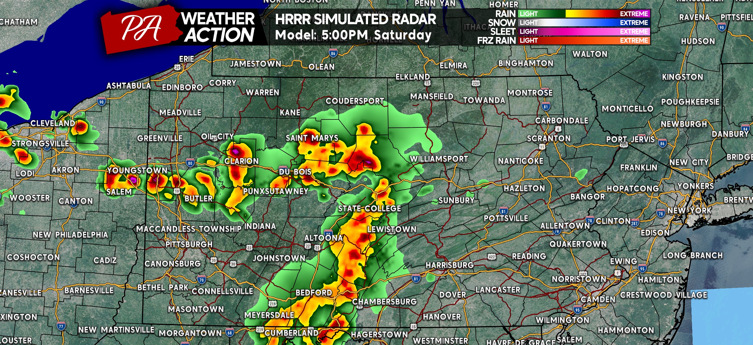
If there is to be an isolated tornado today, it would occur with one of those cells in Western PA, but even that threat is very low. Nonetheless, some of these cells tis evening particularly in Western PA could be potent with damaging winds and localized hail.
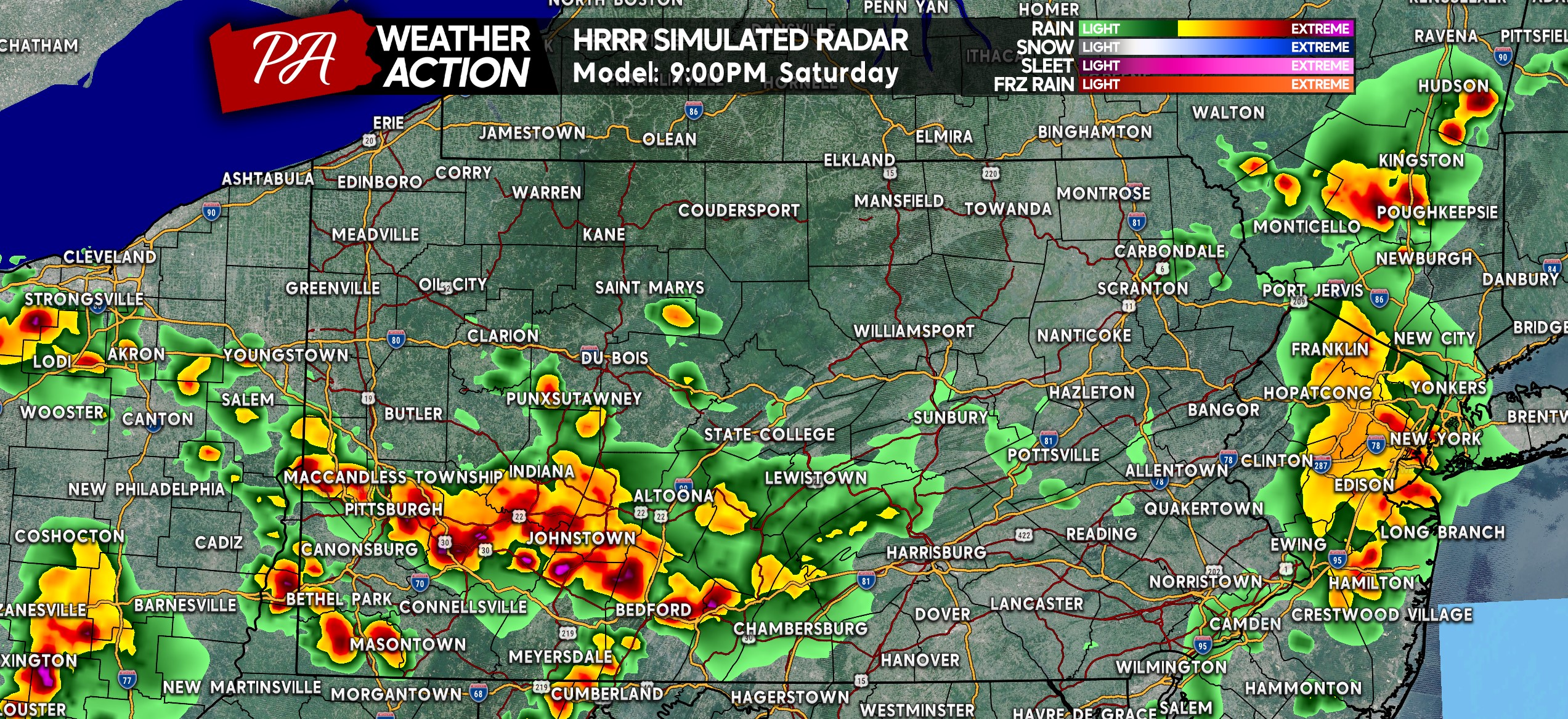
Also, a line of strong to severe thunderstorms will be pushing through Central PA around dinnertime and into Eastern PA by sunset. Below is the HRRR model future radar for 7 PM.
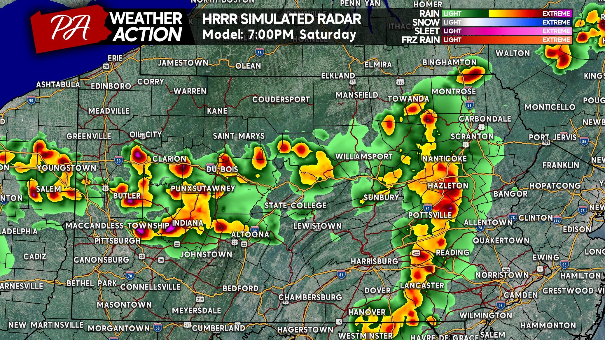
Even after sunset, instability will remain as storms crash through the southwest quarter of the state. In addition, storms should clear Eastern PA by 9-10 PM tonight. Areas along the MD and WV border west of I-81 may see impacts around 10-11 PM tonight.
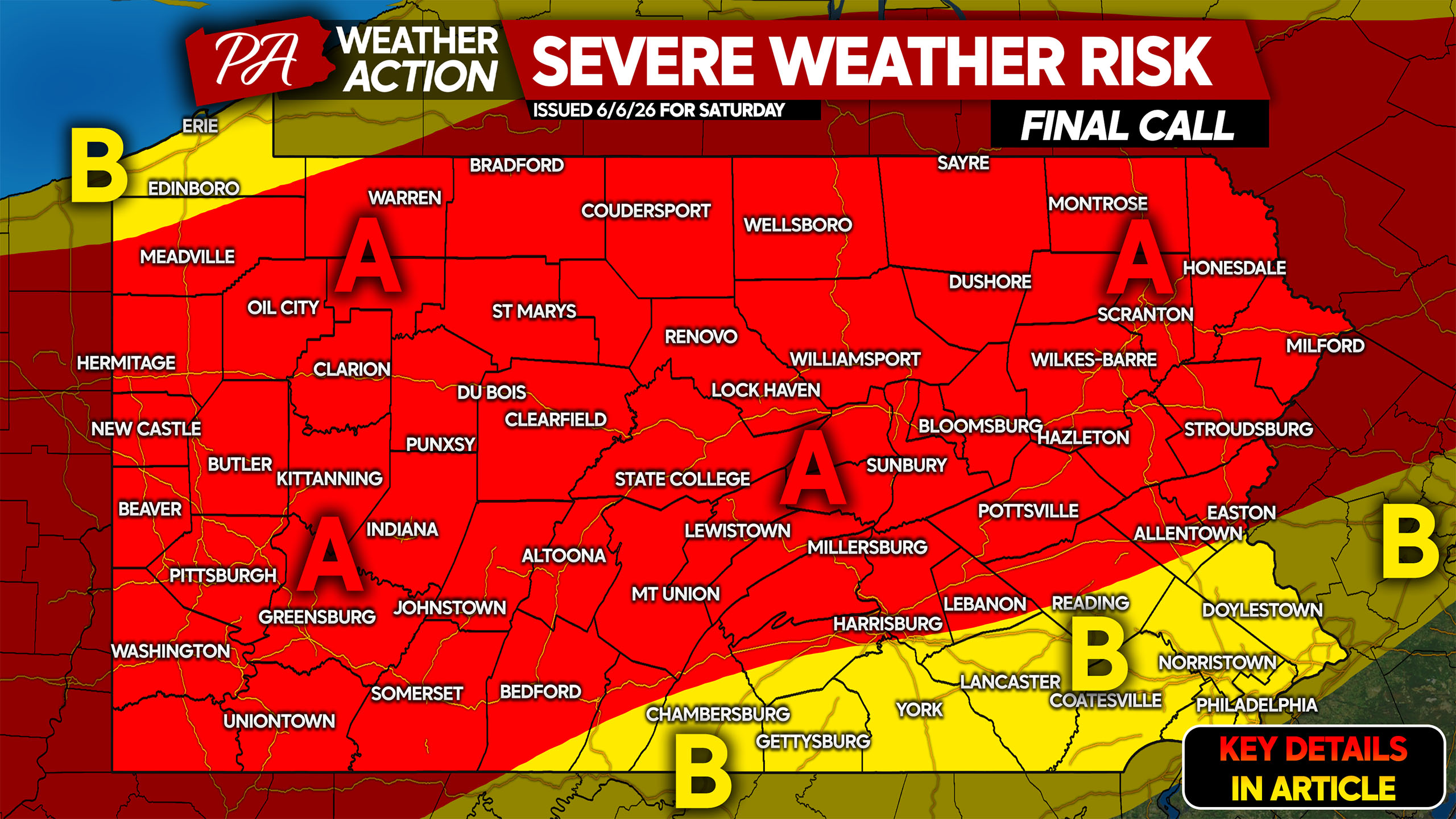
FINAL CALL SEVERE THUNDERSTORM THREAT FORECAST FOR SATURDAY
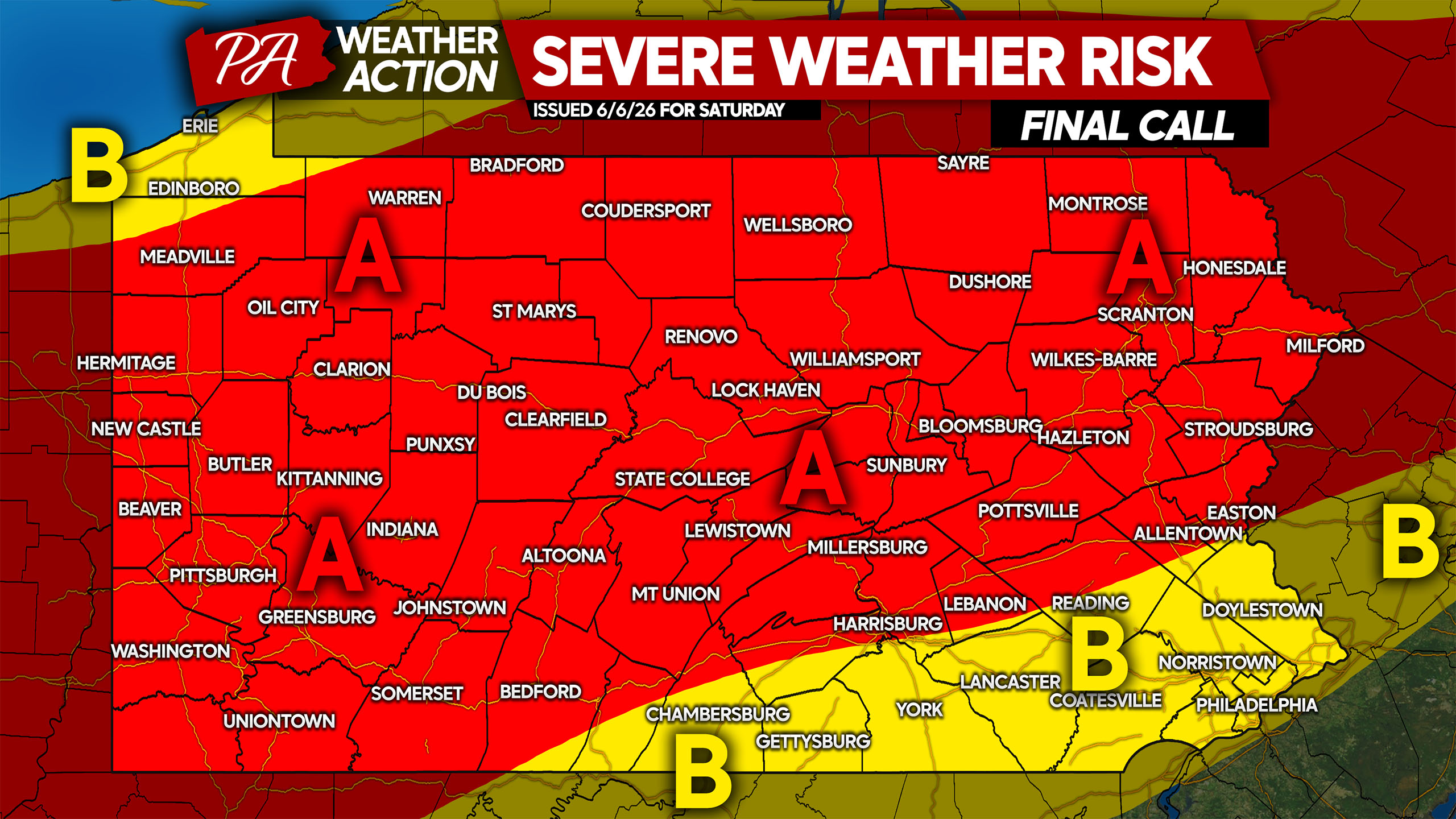
Area A: Scattered strong to severe thunderstorms expected late Saturday afternoon into the late evening. Damaging winds up to 70 MPH are the main threat, followed by isolated hail and a very isolated tornado possible.
Area B: Isolated strong to severe thunderstorms possible late Saturday evening as storms enter this area (except Erie). Damaging winds up to 60 MPH are the main concern.
Graduation ceremonies should be unaffected if complete by around 2 PM in Western PA, 4 PM elsewhere.
Don’t forget to share this forecast with friends and family who may have outdoor plans today!

You must be logged in to post a comment.