
After experiencing a seasonably warm and pleasant week, low pressure and dreary conditions will dominate the region for the weekend. Unfortunate news for those of you attending the Penn State Whiteout football game!
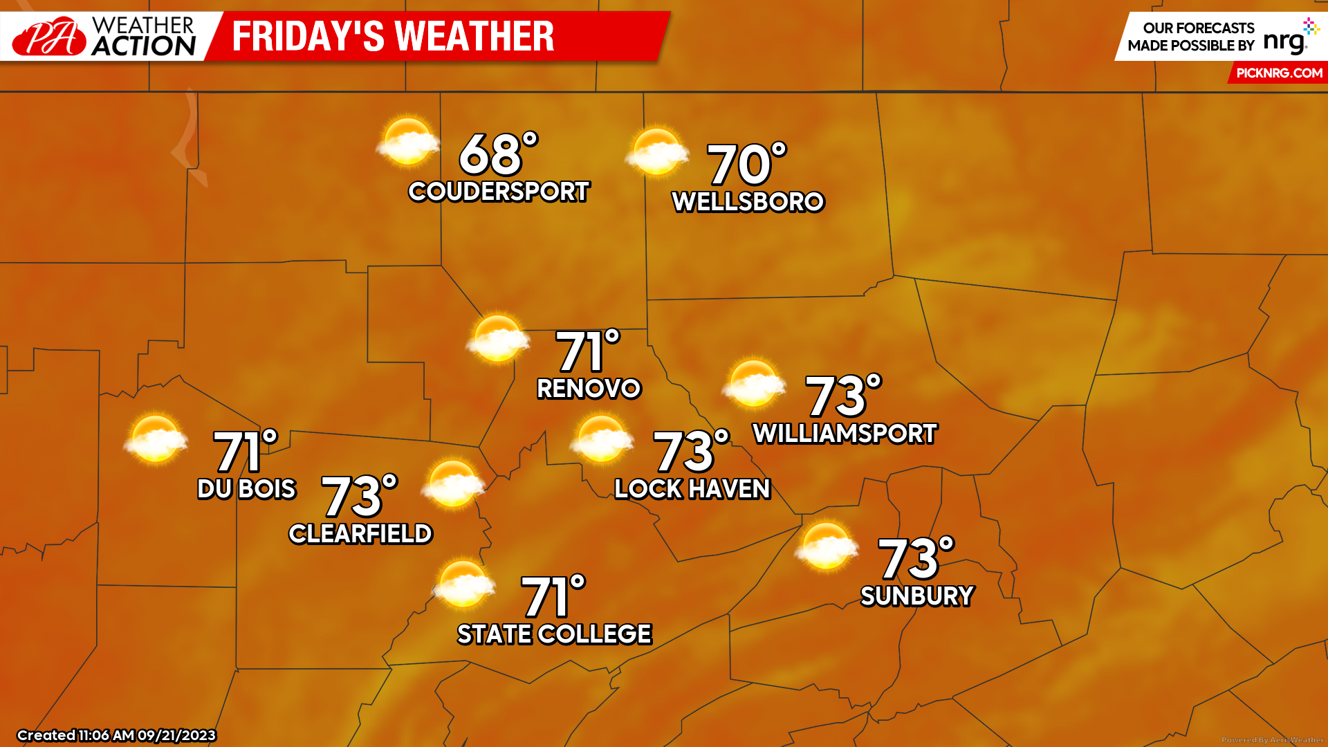
Friday
The last bit of the high pressure system that lingered around the region this week and brought sunny and clear skies will be seen. Starting off with a foggy and chilly morning with temperatures in the upper 40s to low 50s, fog will give way to partly cloudy skies for the remainder of the day, not as clear of skies as we’ve been seeing. Highs are expected to peak in the upper 60s to low 70s. Calm winds throughout the day.
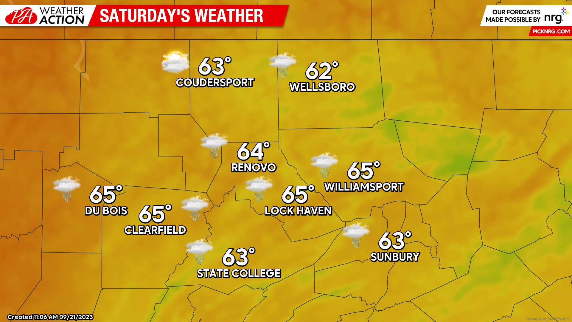
Saturday
Weather starts to become increasingly more unsettled as the day goes by. Beginning with mostly cloudy skies in the morning, the chance of rain will increase significantly in the afternoon hours as a tropical disturbance off the East coast starts to move into the area. Temperatures will be below average as well, only getting into the low 60s for much of the region. Rainfall totals continuously increase going into the evening. Gusty winds are also associated with this low pressure system, with some areas experiencing gusts of up to 15 mph.
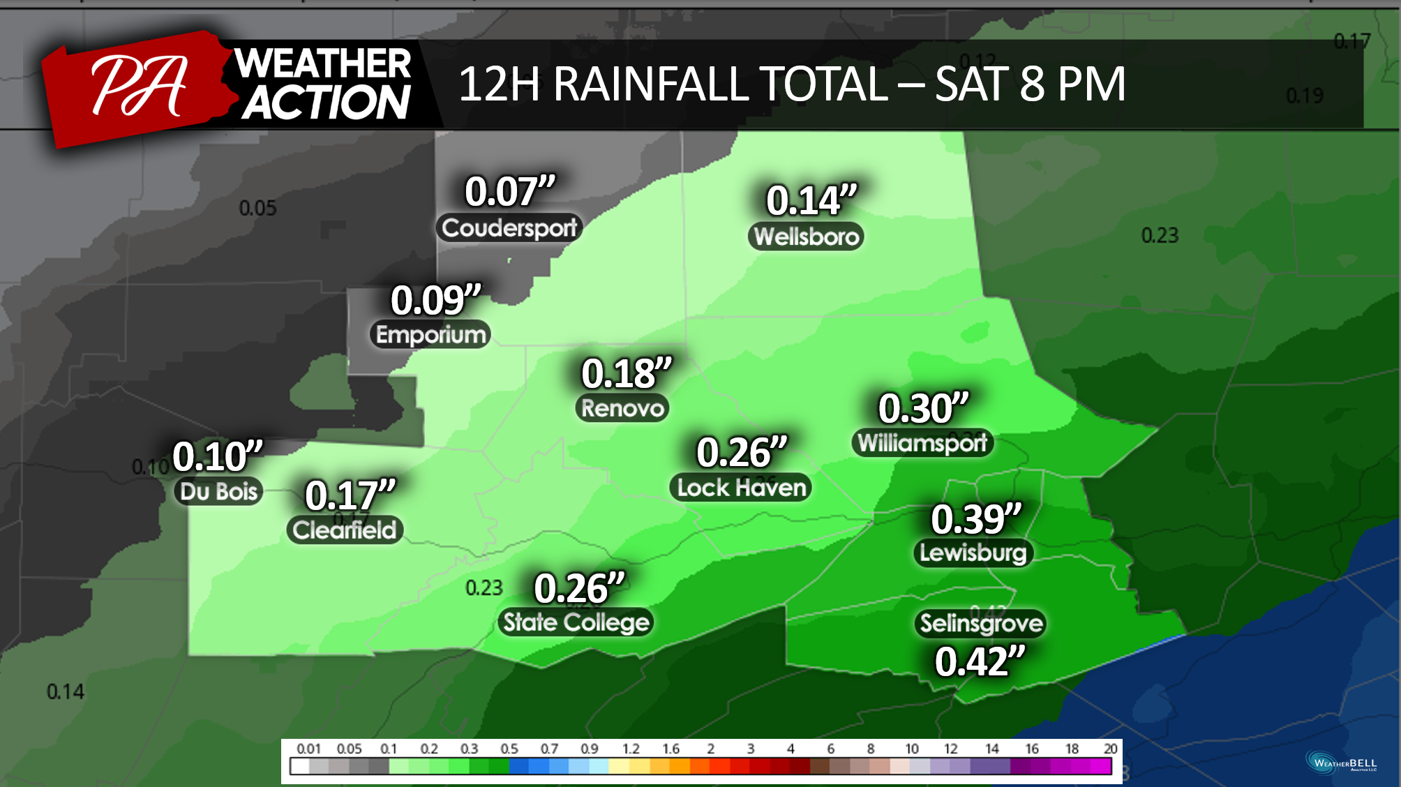
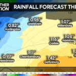
Rainfall totals vary across the region, ranging from 0.07″ in Coudersport to almost half an inch of rain in Selinsgrove at 8 PM on Saturday.
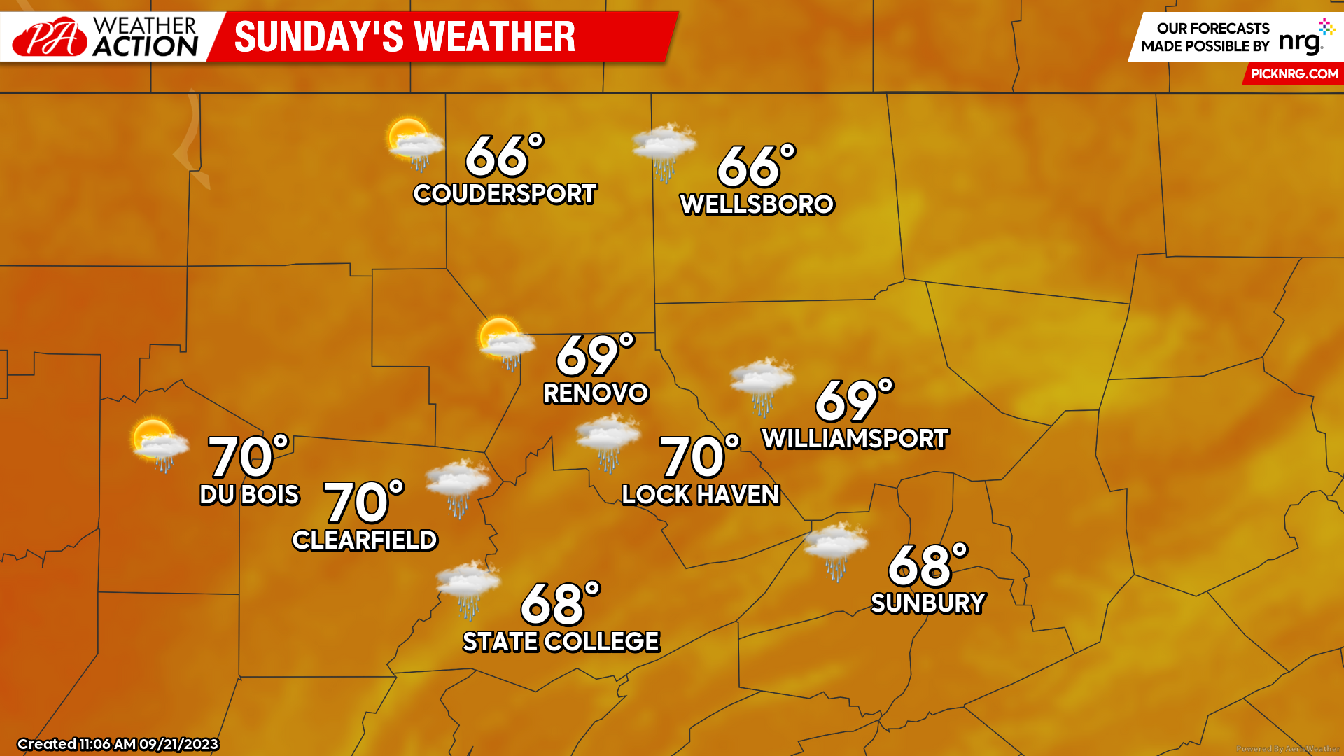
Sunday
Rain lingers for the majority of the day, but more scattered instead of constant. Some areas can expect more rainfall if they are closer to Central PA. Highs return to about average temperatures, topping off in the high 60s to low 70s. Clouds will be abundant for the majority of the day, with a chance of some sunshine peeking through at times.
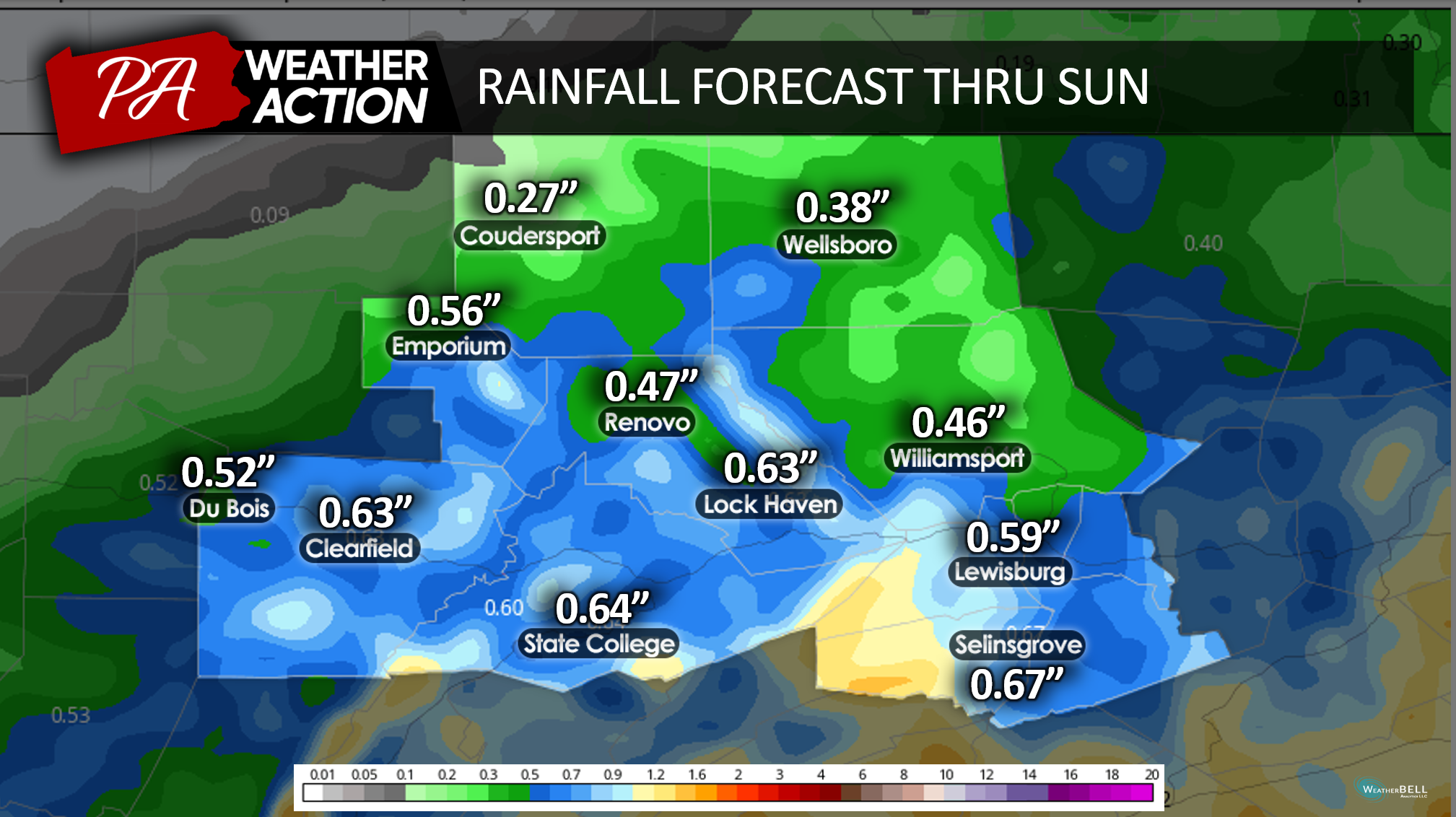
Accumulated rainfall totals over the weekend through Sunday. Most areas could see over half an inch of total rain over the weekend.
Try to stay dry this weekend! Penn State Football doesn’t stop for the weather!
Sara Stierly
You must be logged in to post a comment.