
Good afternoon everyone! I hope you all had a great week and soaked in the warmth and sunshine because changes are coming as we head into the weekend as a coastal low pressure system moves up the East Coast.
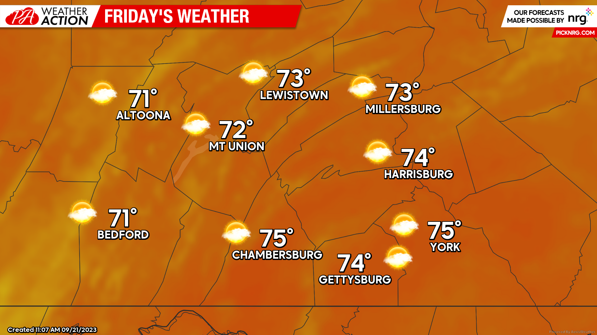
Friday
As we close up the workweek on Friday, expect generally mostly sunny skies across the region although you will see an increase in high-level cirrus clouds associated with the low pressure system that is expected to develop off of the Southeast Coast. Soak in the sunshine as much as you can because changes will be coming as we dig deeper into the weekend.
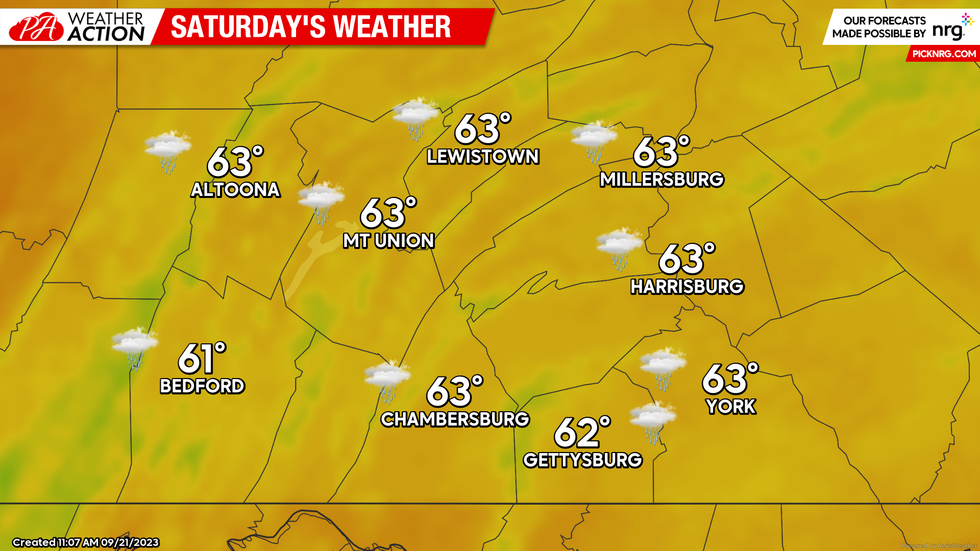
Saturday
Changes are expected on Saturdays as precipitation begins to move in from the south, impacting much of our local region. Expect high temperatures into the lower 60s across the region, although temperatures will fall into the low-to-mid 50s during the afternoon hours as heavier rainfall rates move into the region.
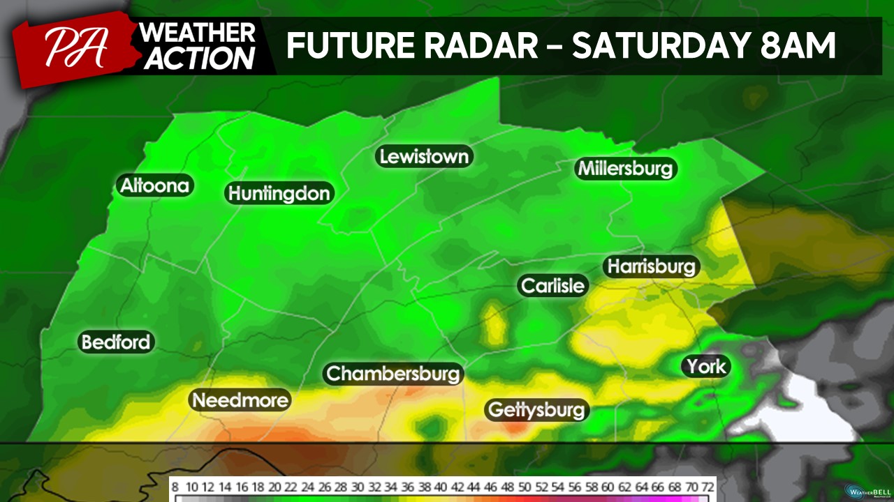
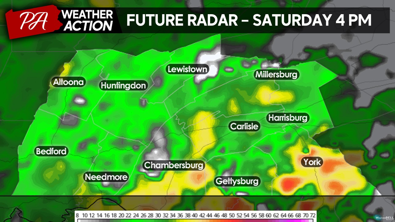
Taking a look at the future radar from one of the models, expect scattered to widespread rain showers throughout the entire day on Saturday area-wide. Keep in mind for potential shifts in the track of the low pressure system. A further eastward and southern track will bring less rain into the region while a further westward and northern track will bring further widespread impacts.
By the early morning hours, rain will be falling across the entire region, with the heaviest rates in the yellow, orange, and red colors.
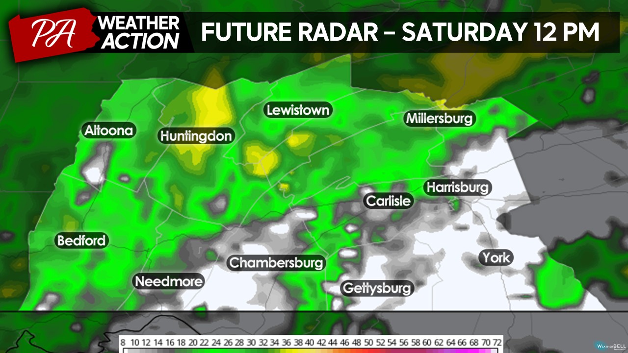
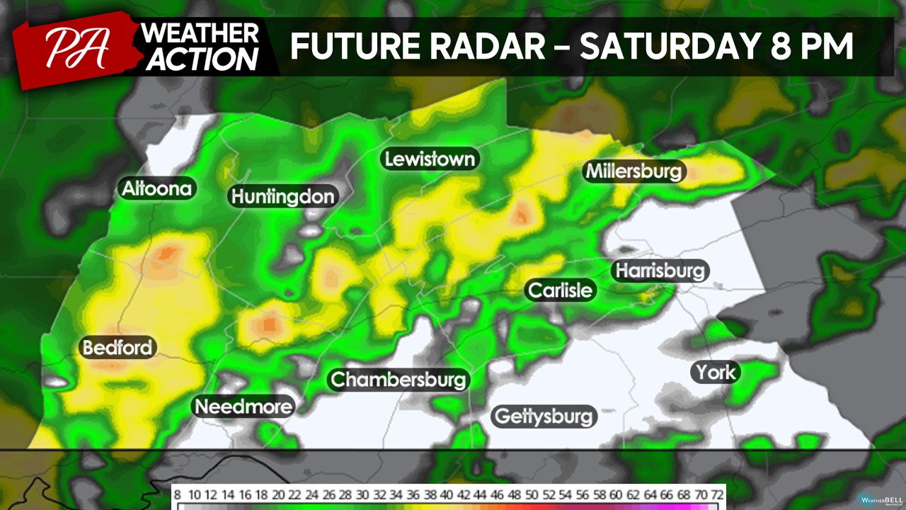
Showers will continue into the lunch hour, however, there may be breaks in the precipitation shield allowing lull in the shower activity.
By the mid-afternoon hours, precipitation will slowly fill back into the region, with localized areas of heavier rainfall.
Toward the evening, showers will likely continue for the majority of the region. A few breaks in shower activity will be possible- but they will be short and quick overall.
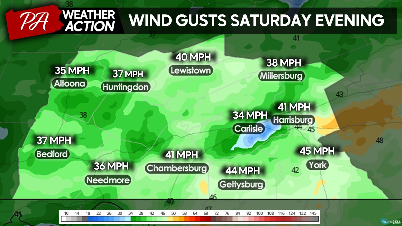
If you have outdoor plans on Saturday, stay tuned for any changes in the forecast but it may be crucial to have a backup plan for any outdoor activities. On top of the potential rain, it will be rather breezy across the area Saturday evening, with wind gusts between 35 – 45 MPH out of the north. Feeling more like early November than mid-September for sure!
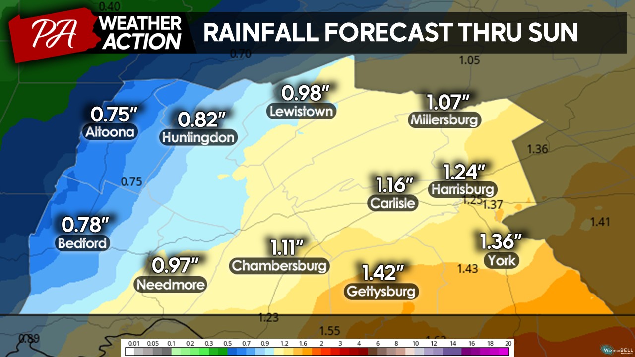
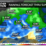
Overall, the further south and east you are located, the higher your impacts will be. Expect a general 0.5 to 1.5″ inches of rain across the area, with the heaviest amounts across the Harrisburg, York, and Gettysburg regions. Keep in mind, locally heavier bands of rain may lead to higher amounts of rainfall and isolated areas may receive slightly lower amounts. Considering the recent dry conditions across portions of south-central Pennsylvania, this rainfall will surely be beneficial!
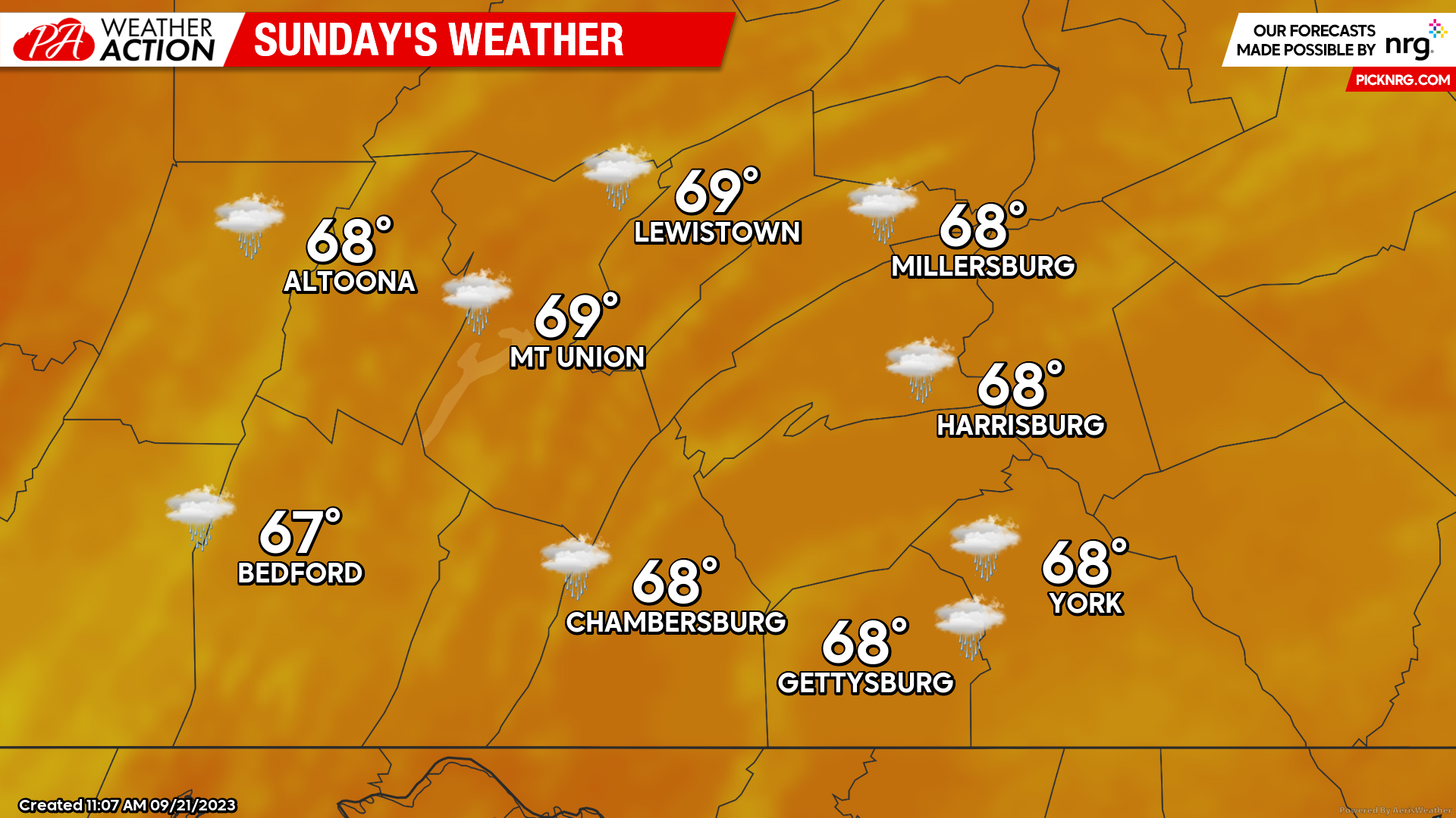
Sunday
Sunday will be quieter compared to Saturday, however, there may be lingering clouds and showers across the region leftover from the low pressure system. The majority of the showers should occur during the early afternoon hours, with the afternoon and evening hours drying out. Temperatures should rise into the upper-60s to low-70s, dependent on the amount of sunshine in the afternoon.
I hope you have a great weekend! If you have any questions regarding the forecast, please reach out!
Denys Khrulov

You must be logged in to post a comment.