
A pattern of cooler, below seasonal average, weather is expected throughout the region this week, with mostly clear conditions expected through mid-week. A slight chance for lake effect showers are possible, especially for the northern portions of the region, early Tuesday.
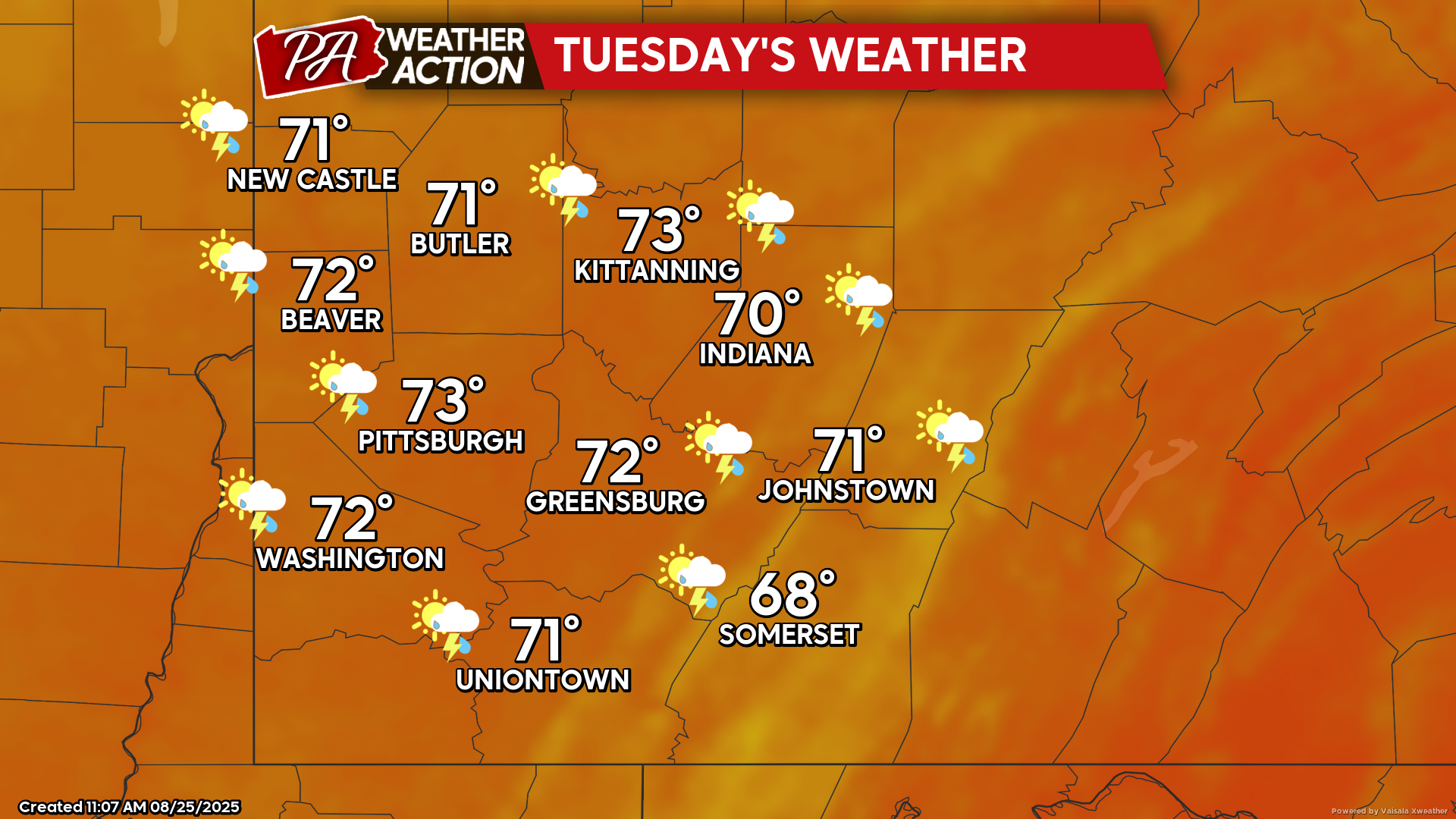
Tuesday
Lake effect showers are possible in the morning and early afternoon hours for portions of the region, with patchy fog possible throughout the region, followed by partly to mostly sunny skies. Highs will be in the low 70s to upper 60s, lows will be in the low 50s to mid 40s. Winds will be out of the west-southwest at 6-11 mph.
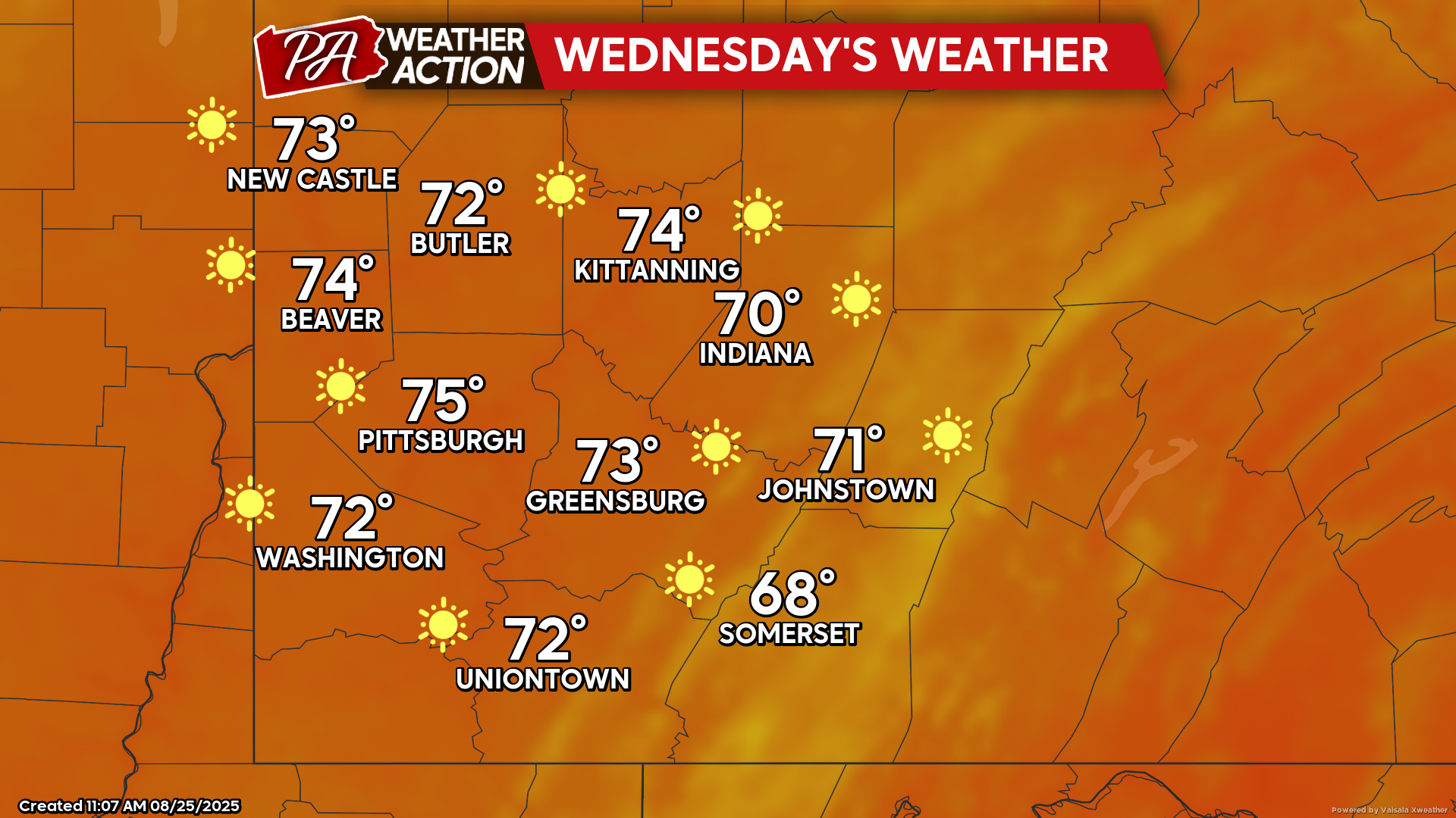
Wednesday
Clear conditions and sunny skies are expected. Highs will be in the mid 70s to upper 60s, lows will be in the low 50s to upper 40s. Winds will be out of the west at 5-9 mph.
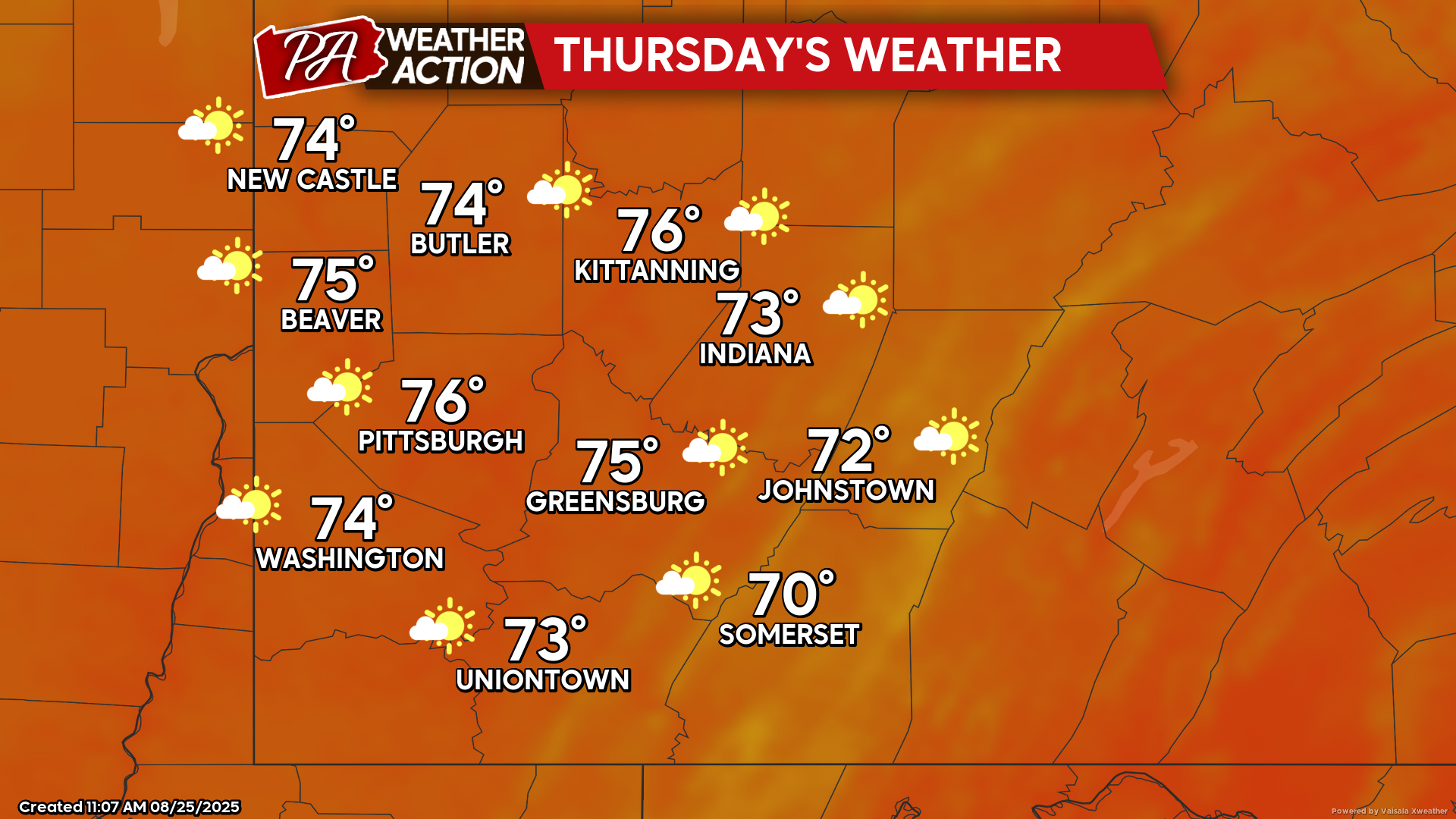
Thursday
Mostly sunny and breezy with a slight chance for evening and overnight showers. Highs will be in the mid to low 70s, lows will be in the mid to low 50s. Light winds out of the south will transition to winds out of the west at 8-15 mph, wind gusts approaching 25+ mph are possible later in the day.
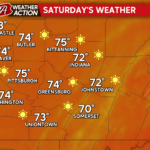
Clear conditions are expected to continue into the weekend with a slight increase in temperatures. Be sure to follow PA Weather Action for more details and forecasts.
You must be logged in to post a comment.