
Unseasonably cold temperatures will continue this week with overnight low temperatures in the single digits and wind chill values ranging between -5 and -15 degrees Tuesday night. The low-pressure system originally forecasted to impact the entire region continues to shift south, lowering the chances for impactful snowfall through mid-week.
Tuesday
Coldest temperatures of the week are expected on Tuesday with dry, mostly sunny, conditions. Highs will be in the low 20s to mid-teens, lows will be single digits. Winds will be out of the West at 10-15 mph, wind gusts approaching 30 mph are possible with wind chill values as low as -15 degrees.

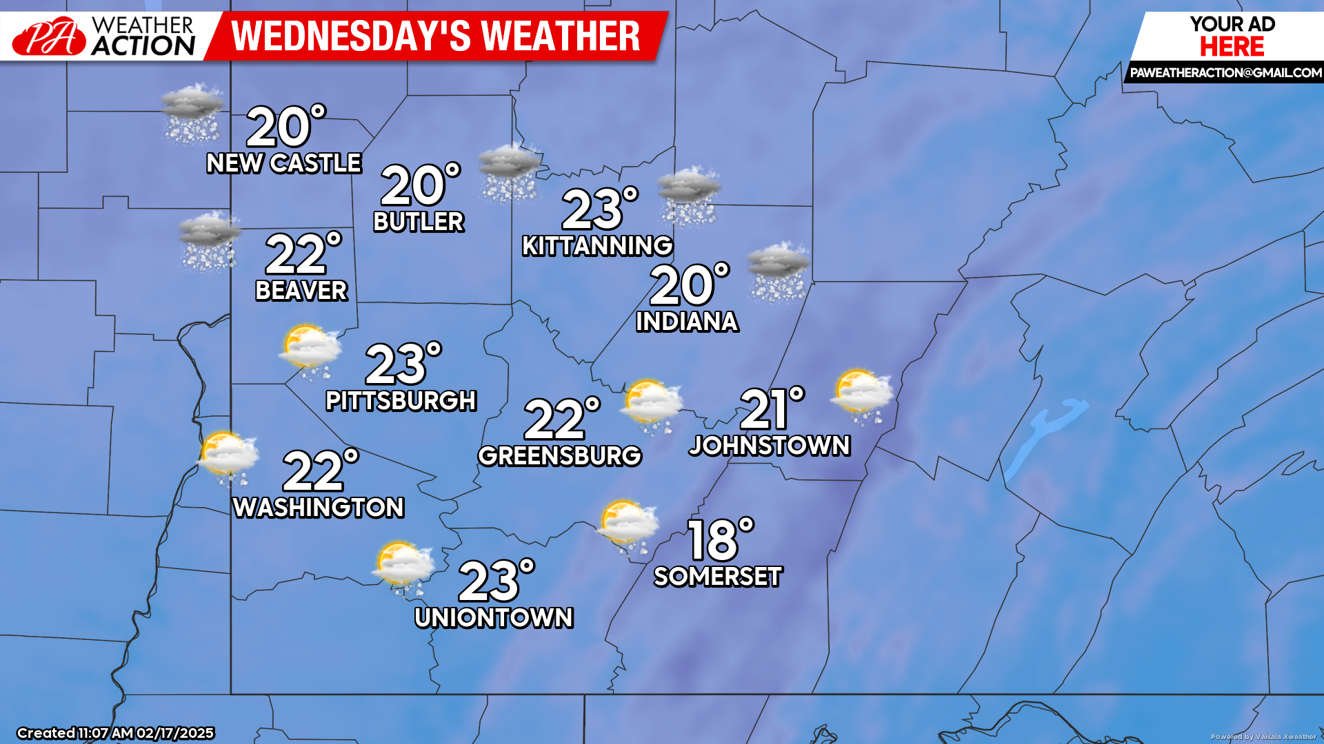
Wednesday
Mostly cloudy, with chances for snow in the overnight hours. Highs will be in the low 20s, lows will be in the low teens to upper single digits. A light northwest wind is expected.
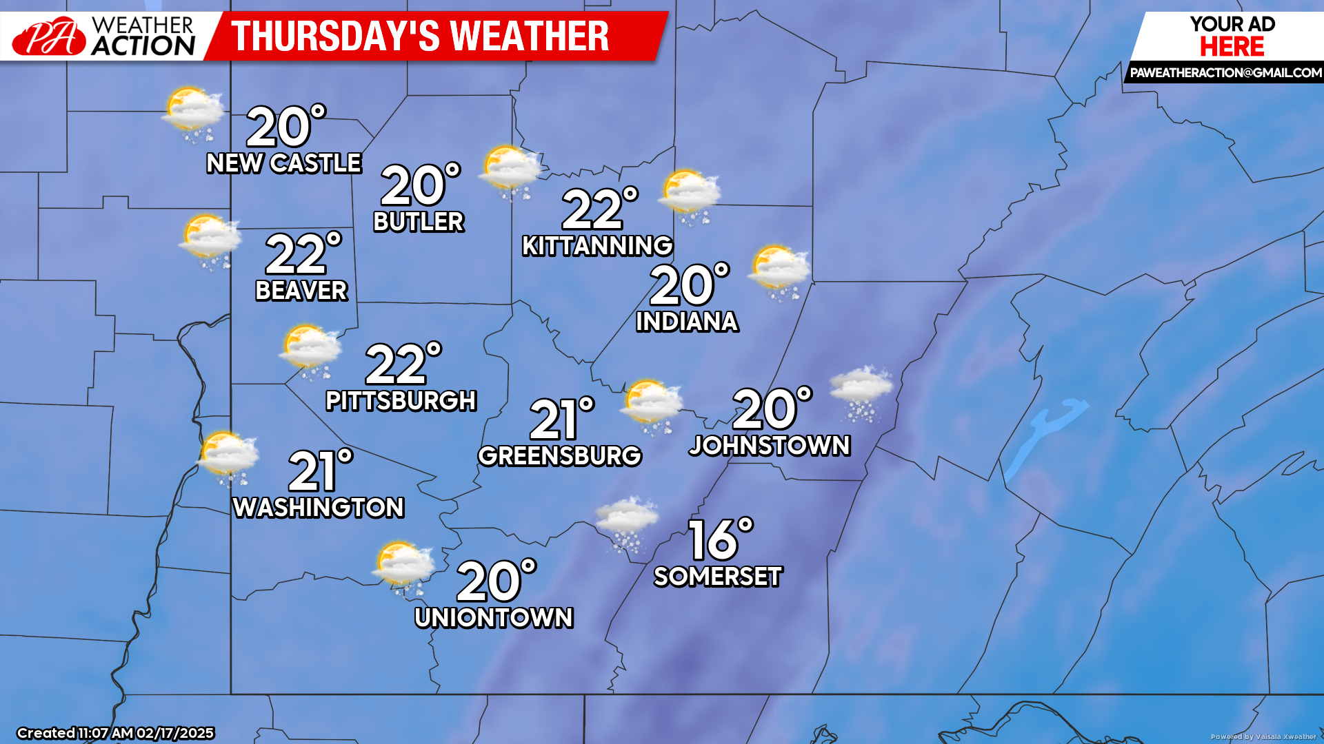
Thursday
Snow showers are likely, especially in the southern counties and the higher elevations. Highs will be in the low 20s to mid-teens. Winds will be out of the Northwest at 5-15 mph, wind gusts ranging between 25-30 mph are possible, especially in the higher elevations.
Dry conditions and warmer temperatures are expected this weekend. PA Weather Action will continue to monitor and provide statewide forecast on snowfall potential throughout the week.
You must be logged in to post a comment.