
After three weeks of no rainfall, the remnants of Nate will bring Pennsylvania much needed precipitation. Showers from the storm have already begun to stream into the area.
Heavier rainfall will come into the picture by Sunday Evening. Here is the Future Radar for 9 PM Sunday.
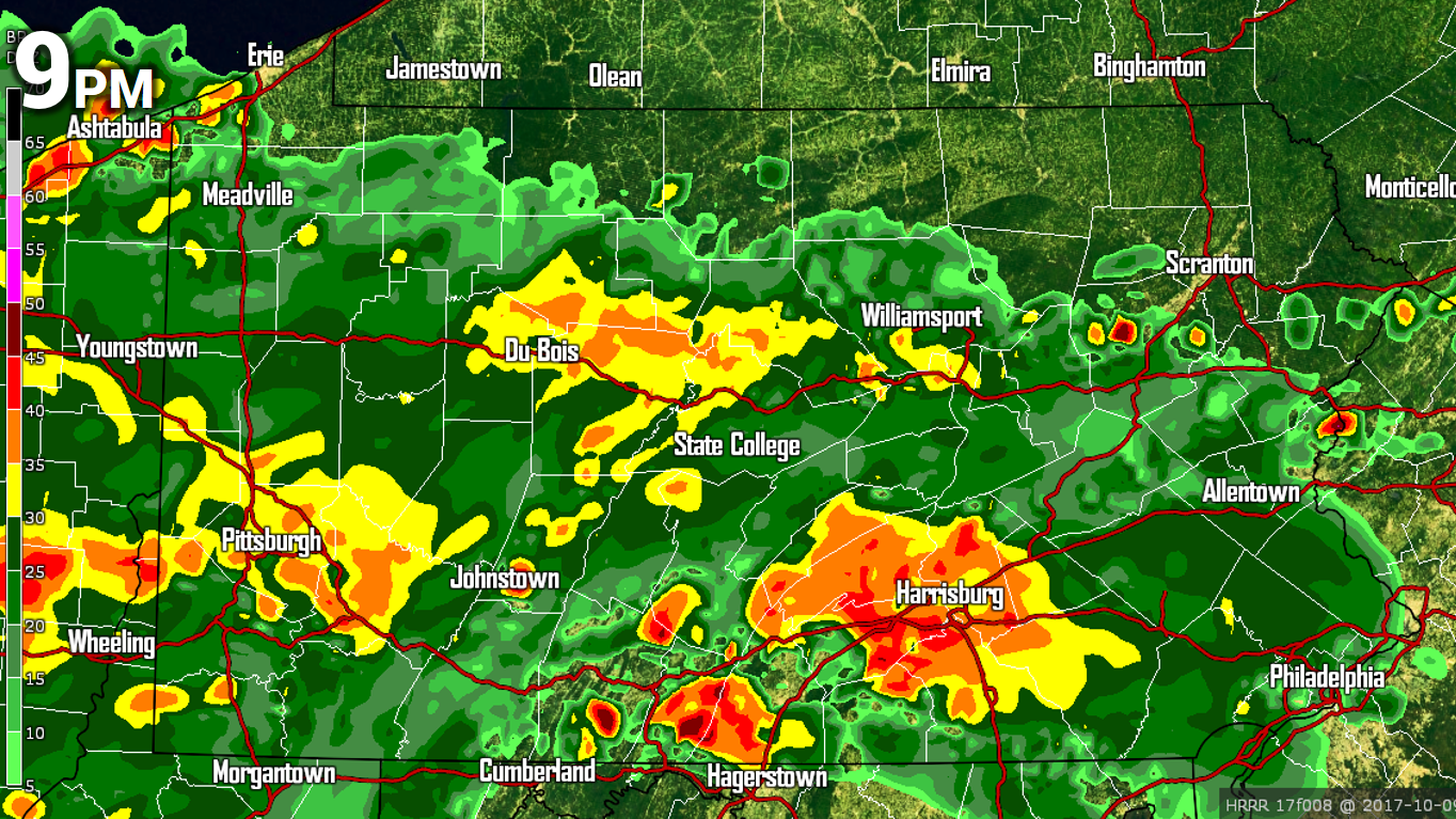
By this time there will be some heavier pockets of rain around Harrisburg and Pittsburgh. Rain will continue into the night. Here is the Future Radar for 7 AM Monday.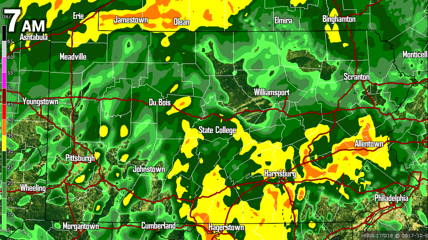
Rain will exit the area by Monday Afternoon, with only a few lingering showers left over in Eastern PA.
RAINFALL FORECAST
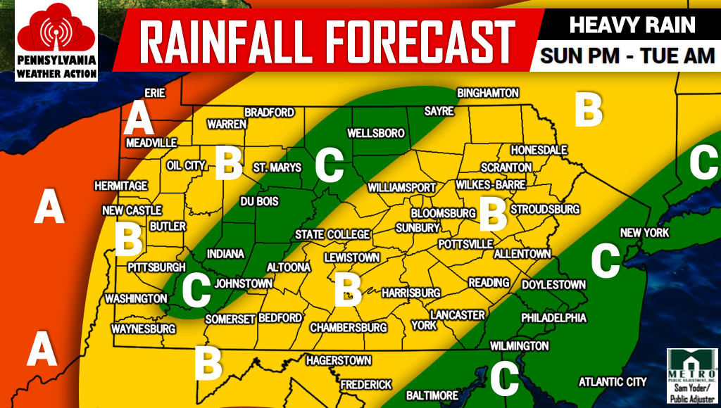
Area A – This area can expect 2-3″ of rainfall.
Area B – This area can expect 1-2″ of rainfall.
Area C – This area can anticipate .5-1″ of rainfall.
Be sure to share the forecast below.


You must be logged in to post a comment.