
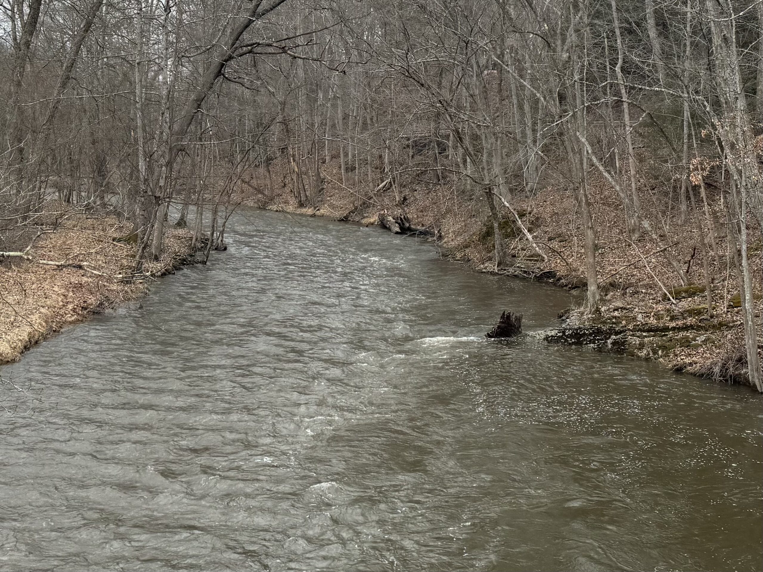
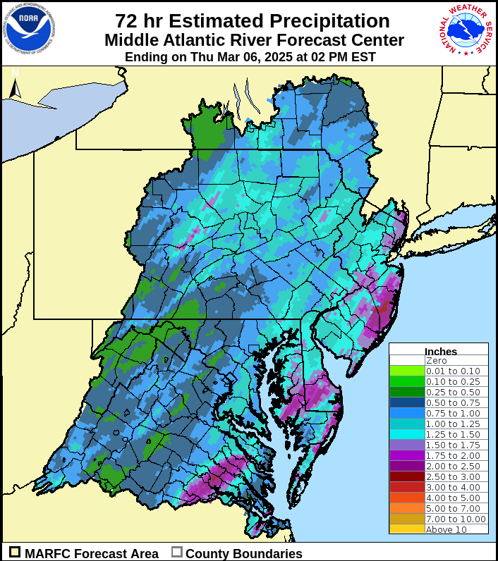
Heavy rain inundated the area on Wednesday along with wind gusts over 30 mph. Up to 2″ rain fell, causing swollen creeks and some ice jams on the rivers, but no significant flooding occurred.
The storm system responsible for yesterday’s rain is creating a tight pressure gradient over our area, resulting in increasingly strong wind this afternoon. Another cold front will cross our area this evening, resulting in wind gusts exceeding 40 mph from the northwest this evening through overnight.
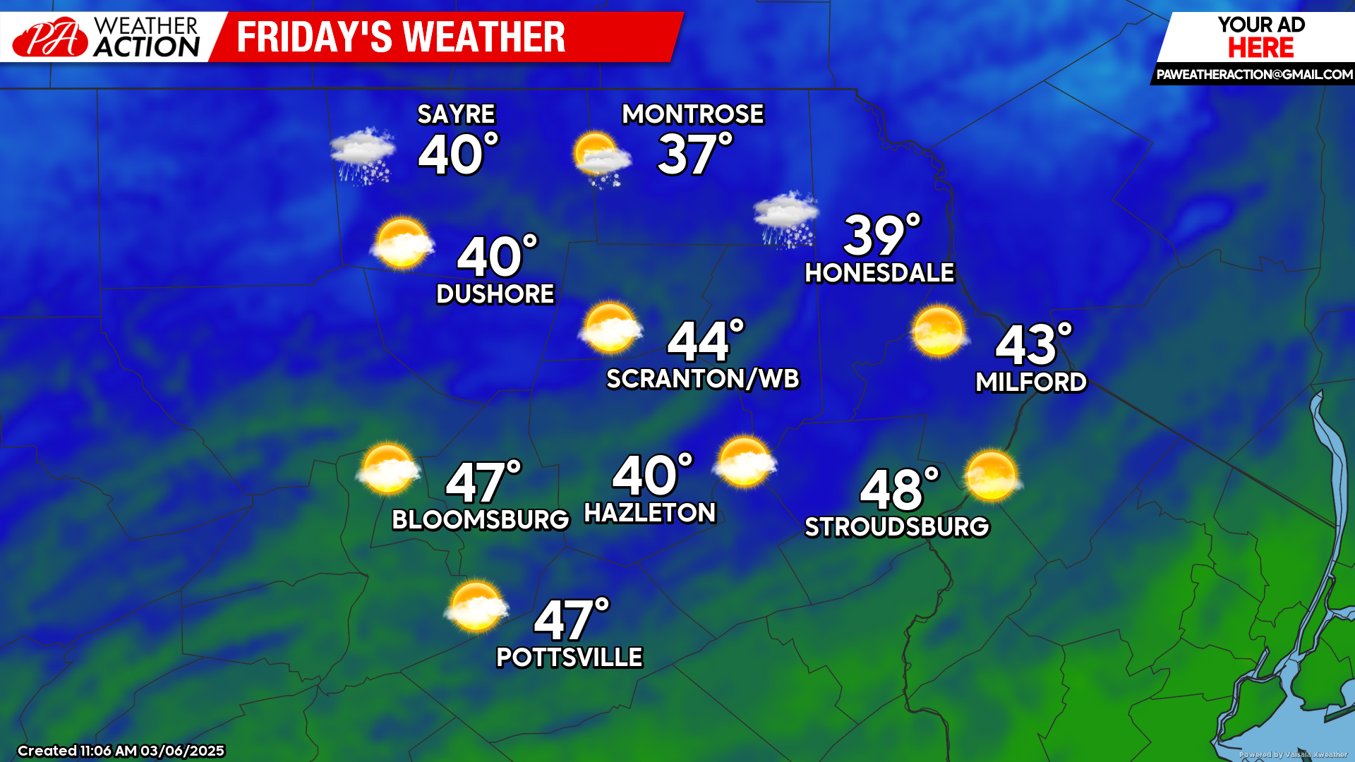
FRIDAY
Strong wind gusts will continue from the west, exceeding 40 mph at times. There could be a few snow showers during the morning near the New York border. A decaying upper-level disturbance will also move through the area Friday night which could bring some clouds with the slight chance of a snow shower Friday night in the rest of the area.
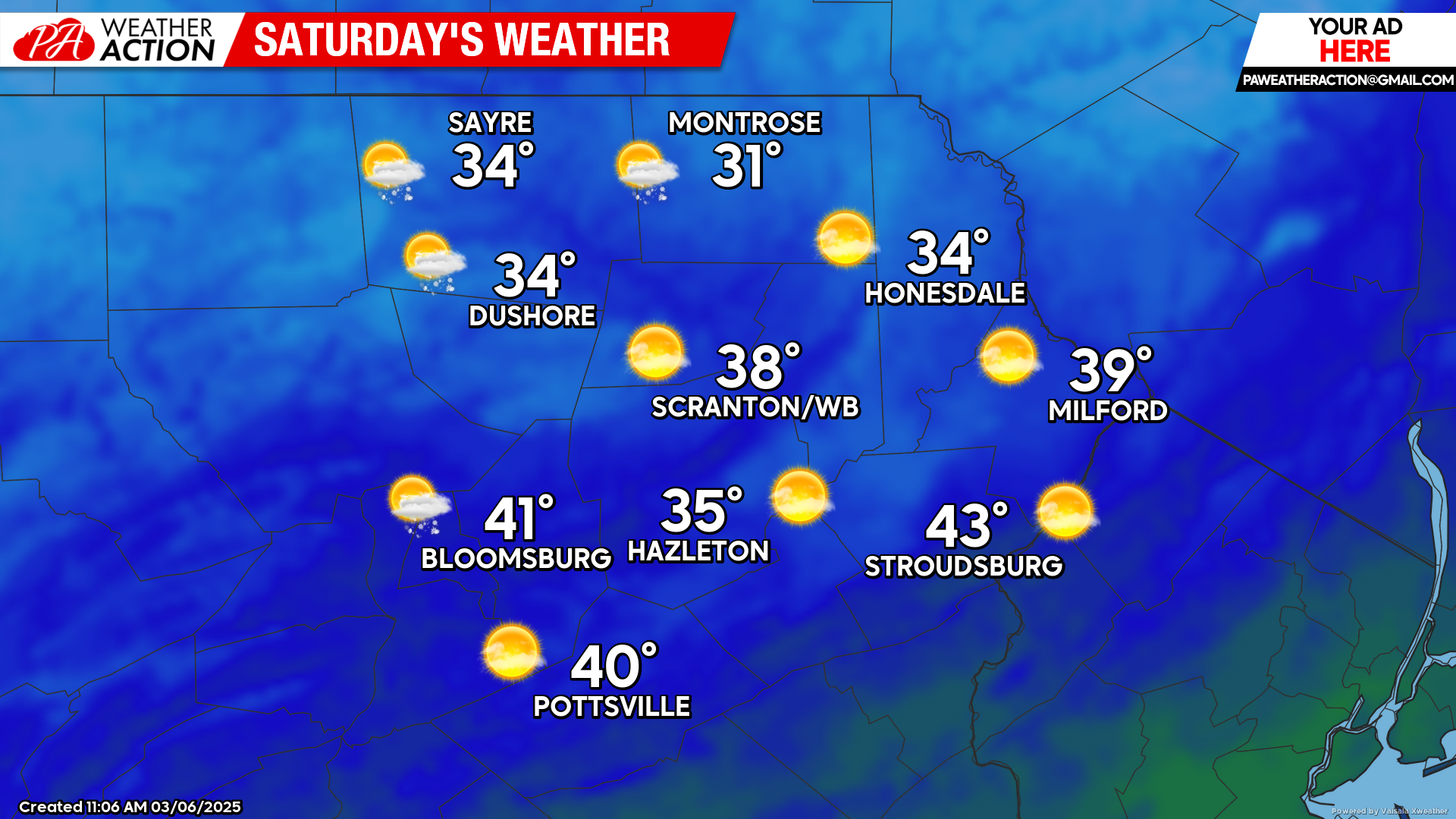
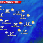
SATURDAY
Saturday will continue to be blustery and somewhat wintry with slightly colder-than-normal temperatures. There could be some snow flurries in the northern and western counties although most of the day will be sunny.
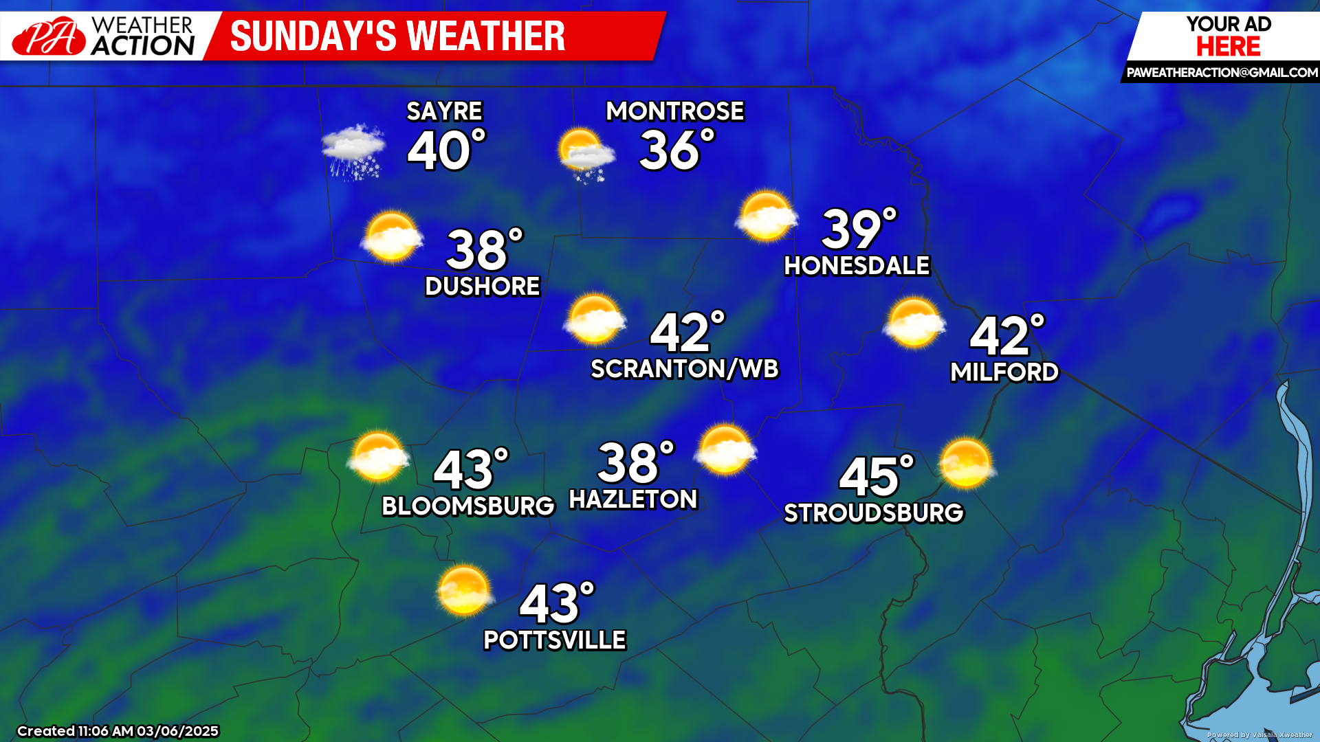
SUNDAY
High pressure will move into the area to bring sunshine and milder temperatures to most of the region. While there could be a few snow showers near the New York border, most of the area will be dry.

You must be logged in to post a comment.