
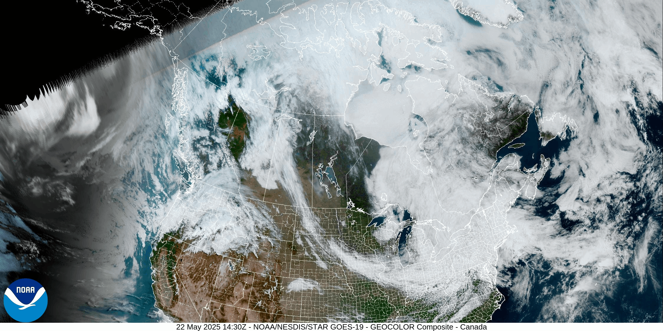
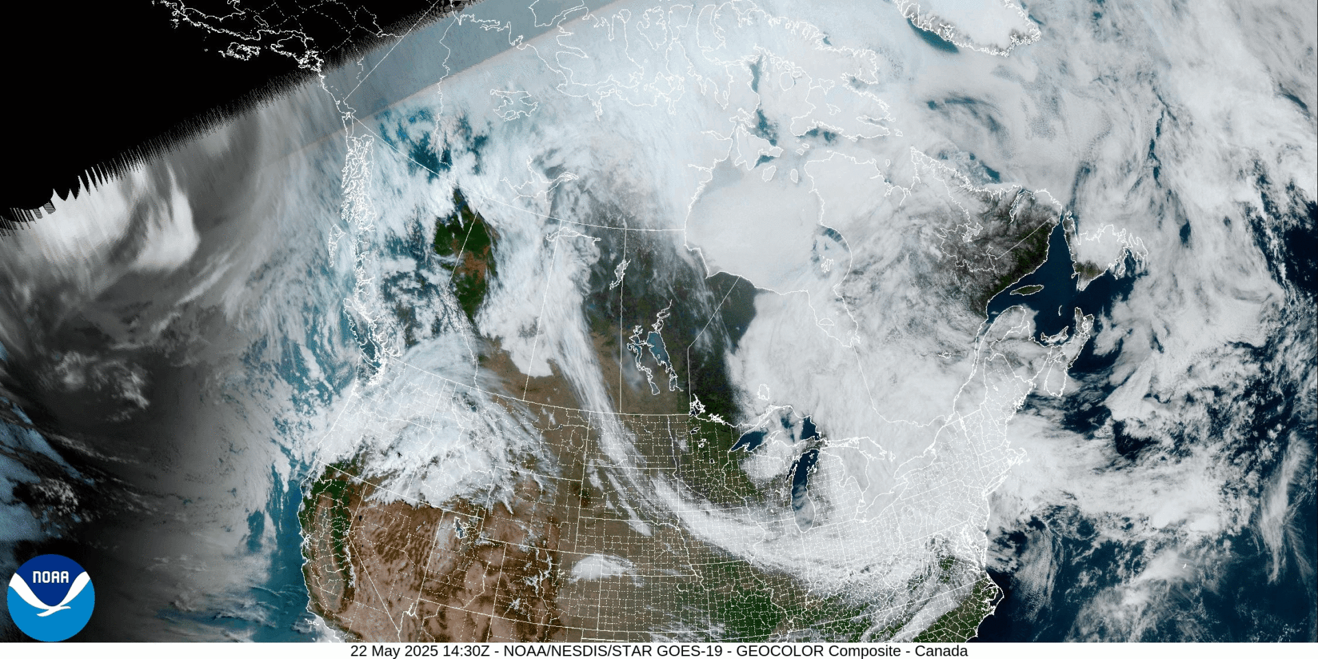
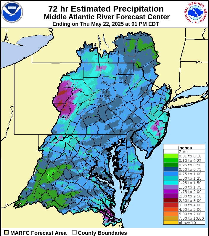
A large upper-level low with numerous imbedded disturbances is spiraling showers around much of the Northeast and Great Lakes. Rainfall amounts as of early Thursday afternoon range from a half inch to as much as two inches across our area.
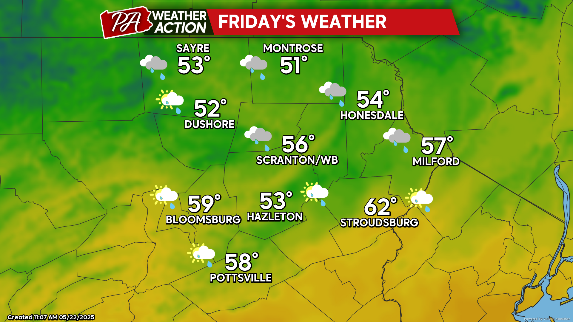
FRIDAY
A strong coastal low is currently developing off the New Jersey coast and will pivot northward tonight and into coastal Maine Friday. As that low lifts north of our area, Friday will feature scattered showers with a breezy wind from the west. While most of the day will be cloudy, there could be a few peeks of sun, especially across our southern counties. Temperatures will continue to be chilly for this time of year. Some of the higher peaks of Vermont and New Hampshire might even get some snow! Incidentally, 190 years ago (May 20-21 1835), Bradford County PA enjoyed up to two feet of snow!
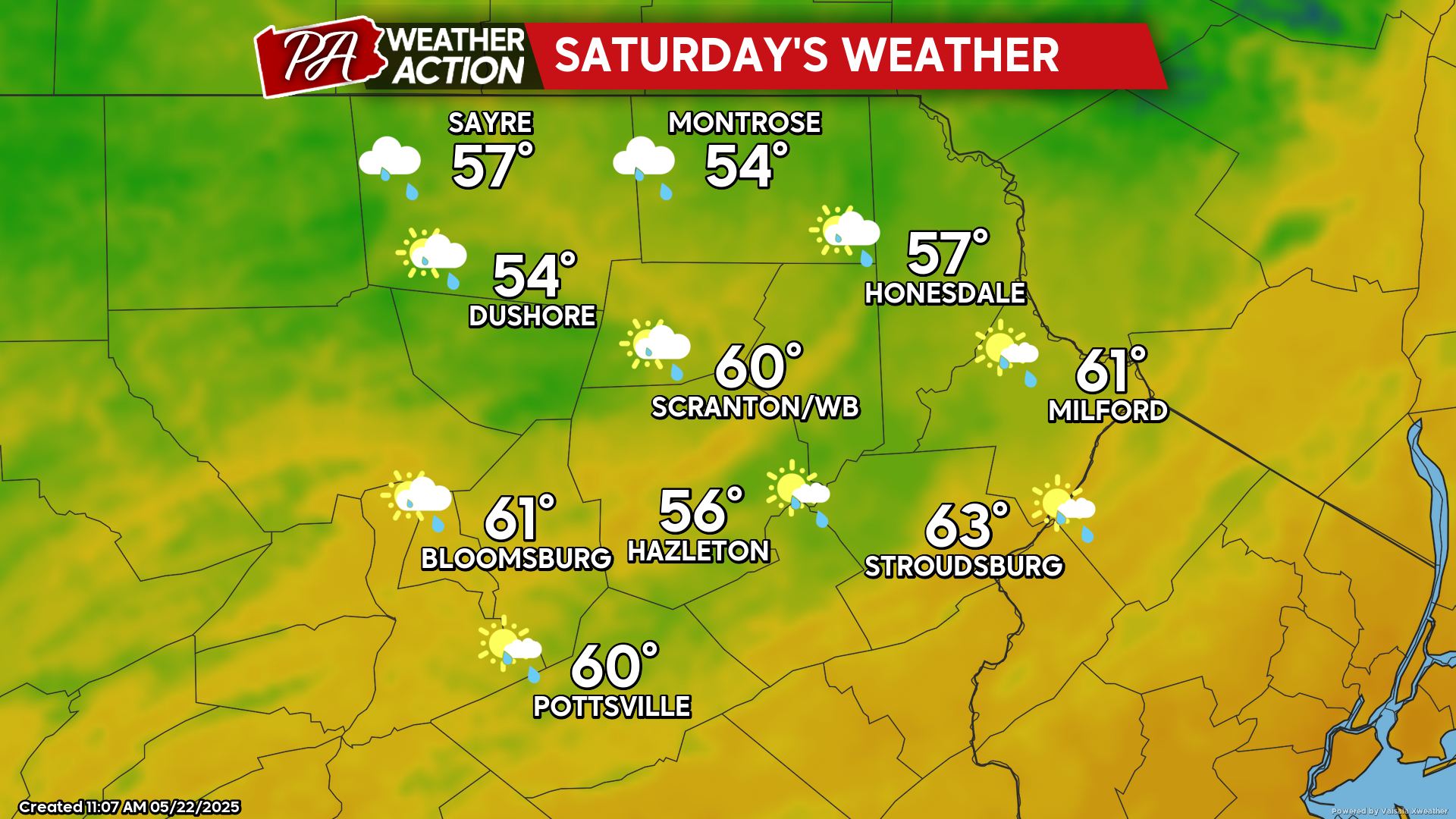
SATURDAY
The large upper-level low will be slow to relinquish control of our weather. Saturday will feature variably to partly cloud skies, a gusty west wind, and a splattering of showers, but it will not be a washout.
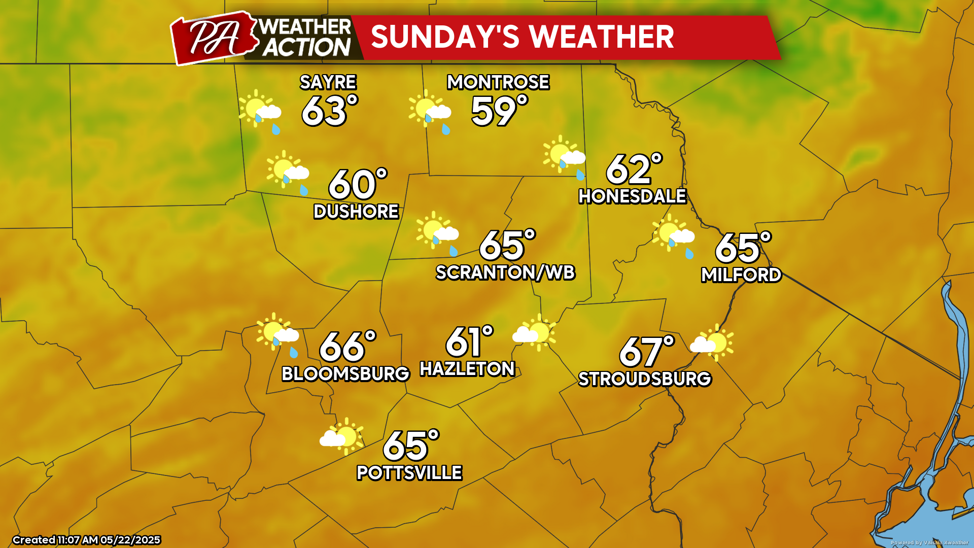
SUNDAY
The gusty west wind will continue, along with variable clouds and scattered showers. It will not be a washout, and temperatures will at least be warmer than what we are experiencing today. Enjoy!
You must be logged in to post a comment.