
A disturbance brought rain showers to our area this morning, with around a tenth to a quarter of an inch falling. Mild weather will continue into Saturday ahead of the next storm system which will pass north of our area early Sunday. After the recent reprieve from the relentless arctic air, another shot is poised to afflict our area later this weekend into early next week. Milder weather is anticipated by midweek.
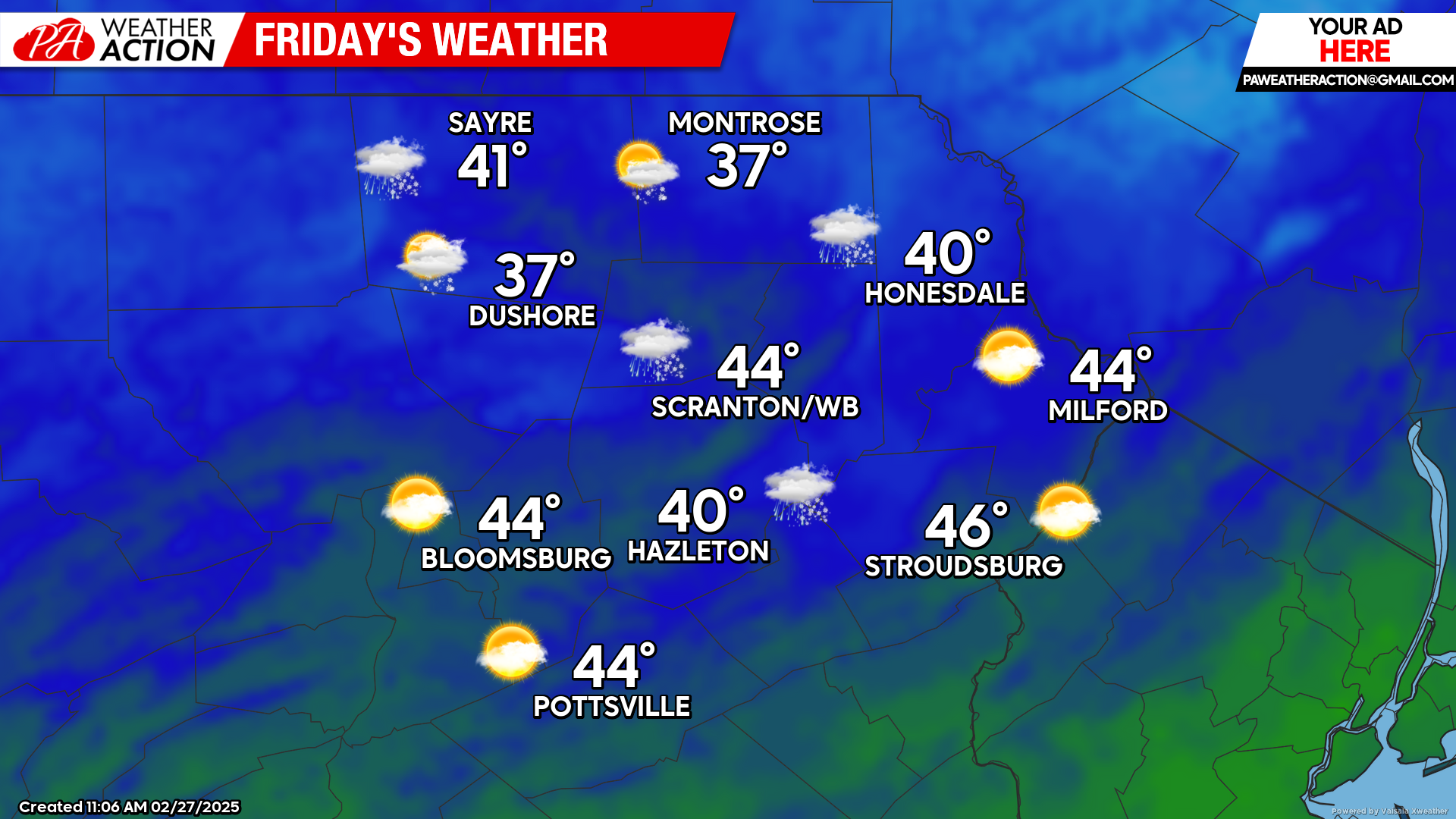
FRIDAY
Friday will feature partly cloudy skies for the morning hours. By afternoon, the northern counties and higher elevations will have clouds and some scattered rain and snow showers. Any precipitation amounts will be very light.
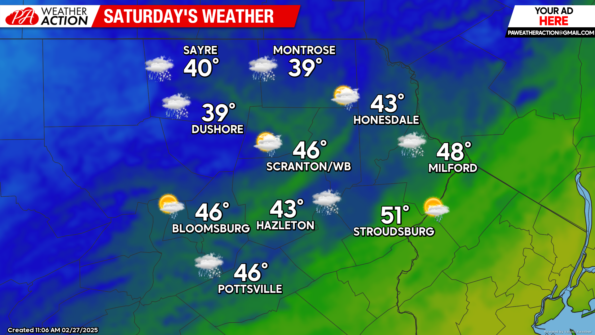
SATURDAY
A strong storm system will move eastward through the Great Lakes and into New York State by evening. Gusty wind from the southwest will bring milder air into the southern half of our area during the morning hours, pushing temperatures above 50 in the southern valleys. A cold front will cross the area late morning, with the wind becoming northwest behind the front and gusting to 30 mph. There will be some light rain showers sweeping through the area, possibly mix with snow showers for our northern counties and higher elevations. Temperatures will fall during the afternoon and into the evening as the storm system circulates arctic air into our area.
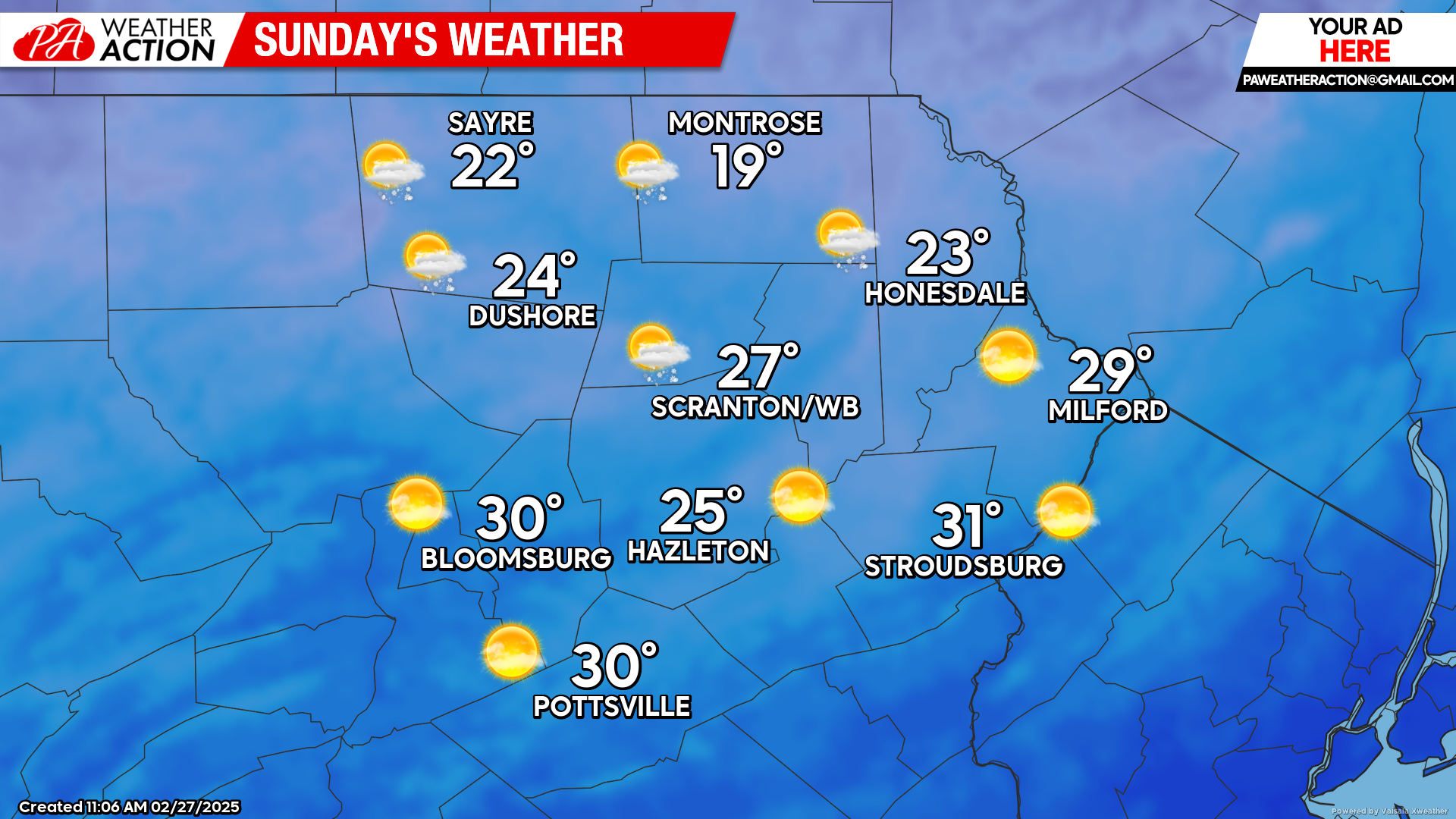
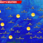
SUNDAY
Gusty northwest wind will continue to deliver a flow of arctic air into our region. While temperatures in our southern valleys will get close to freezing with sunny skies, the higher elevations of our northern counties could remain in the teens with scattered flurries.

You must be logged in to post a comment.