
A potentially record breaking cold morning is expected Friday morning after Thursday’s coastal storm wraps up. The coastal storm will help produce even colder conditions than we are experiencing now with much windier conditions.
Take a look at the incredibly cold pool of air centering right over Pennsylvania Friday morning: 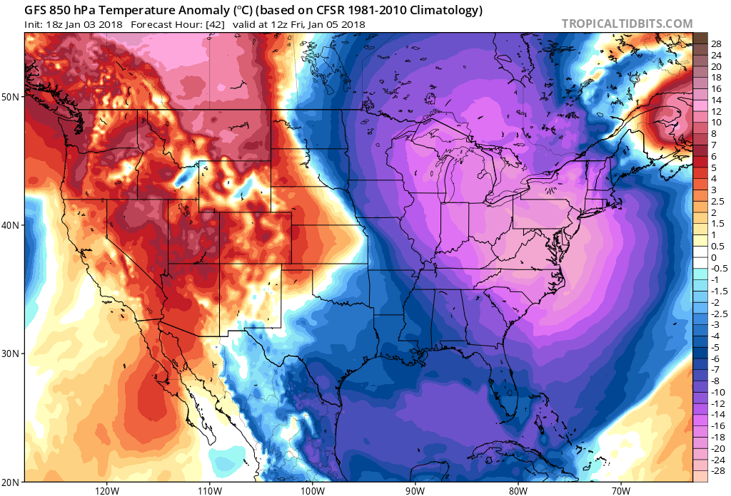
Temperatures will struggle to get out of the single digits for high temperatures for many areas, with other areas only getting into the teens. Below is the GFS predicted high temperatures for Friday: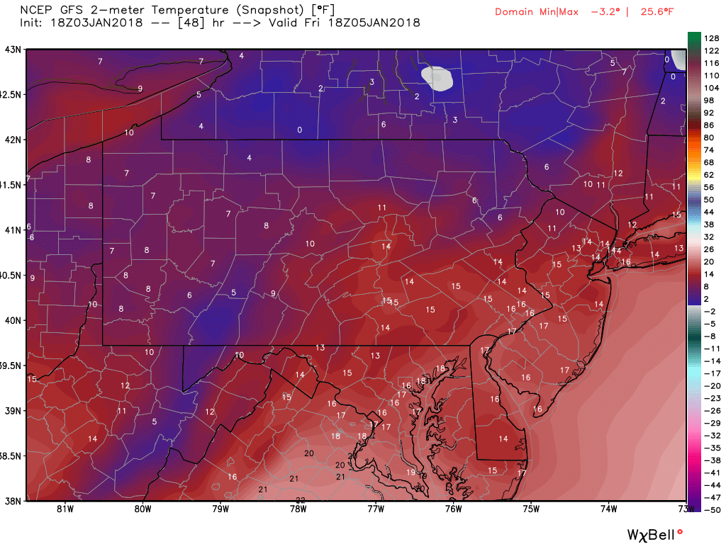 The wind will be gusting strong Friday. Sustained winds of 20 to 30 MPH are anticipated with gusts higher. Wind chill values will be well below zero degrees Friday morning. If schools do not delay or cancel Friday, make sure your children are bundled up Friday morning. This is serious cold weather. It would not take much time for frostbite to occur without proper clothing. And PLEASE do not forget to bring in any pets that are outside.
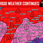
PICTURED BELOW IS EXPECTED WIND CHILL VALUES FOR FRIDAY
MORNING:
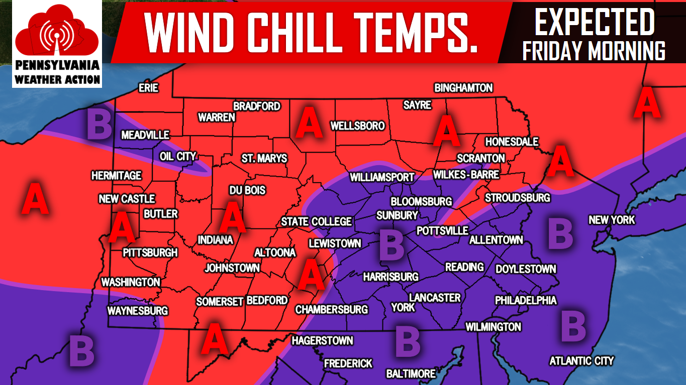
Area A: Wind chill values of -20 to -30 are expected Friday morning. Frostbite could occur rapidly with these temperatures if skin is exposed. Dress appropriately. Bring in all pets!
Area B: Wind chill values of -10 to -20 degrees are expected Friday morning. Frostbite could occur rapidly with these temperatures if skin is exposed. Dress appropriately. Bring in all pets!
Download our app to stay ahead of the storm>>>Click here to download our app!
The cold does not go away this weekend. Saturday and Sunday look almost as cold. We will keep you updated with the frigid cold temperatures and of course the current coastal storm, make sure you have our Facebook page liked, click here>>>Pennsylvania Weather Action’s Facebook Page.
Also, get our free app for updates on the cold and future storms>>>Click here to download our app!
Share the news about the expected serious cold temperatures to your family and friends by using our icon below, stay safe!
You must be logged in to post a comment.