Clouds will begin to disperse this morning, allowing for plenty of sunshine by the afternoon hours! Below is a look a the latest satellite imagery:

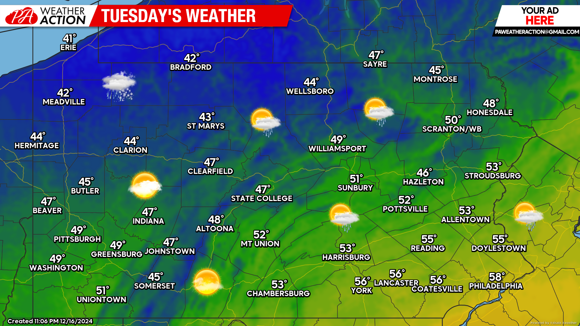
Today’s Weather Forecast: 8/10
Any lingering clouds this morning will giveaway to a mix of clouds and sunshine by the afternoon hours with temperatures in the 40s and 50s across the state.
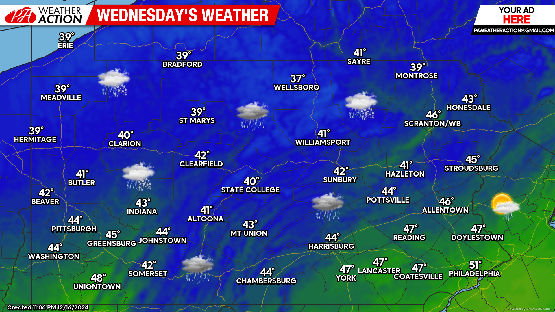
Wednesday’s Weather Forecast: 2/10
The next storm system to impact the area arrives for Wednesday, this time mainly in the form of rain. Locations in far northern Pennsylvania will likely see a sleet/snow mix to start before changing to rain, however little to no accumulations are expected at this time.
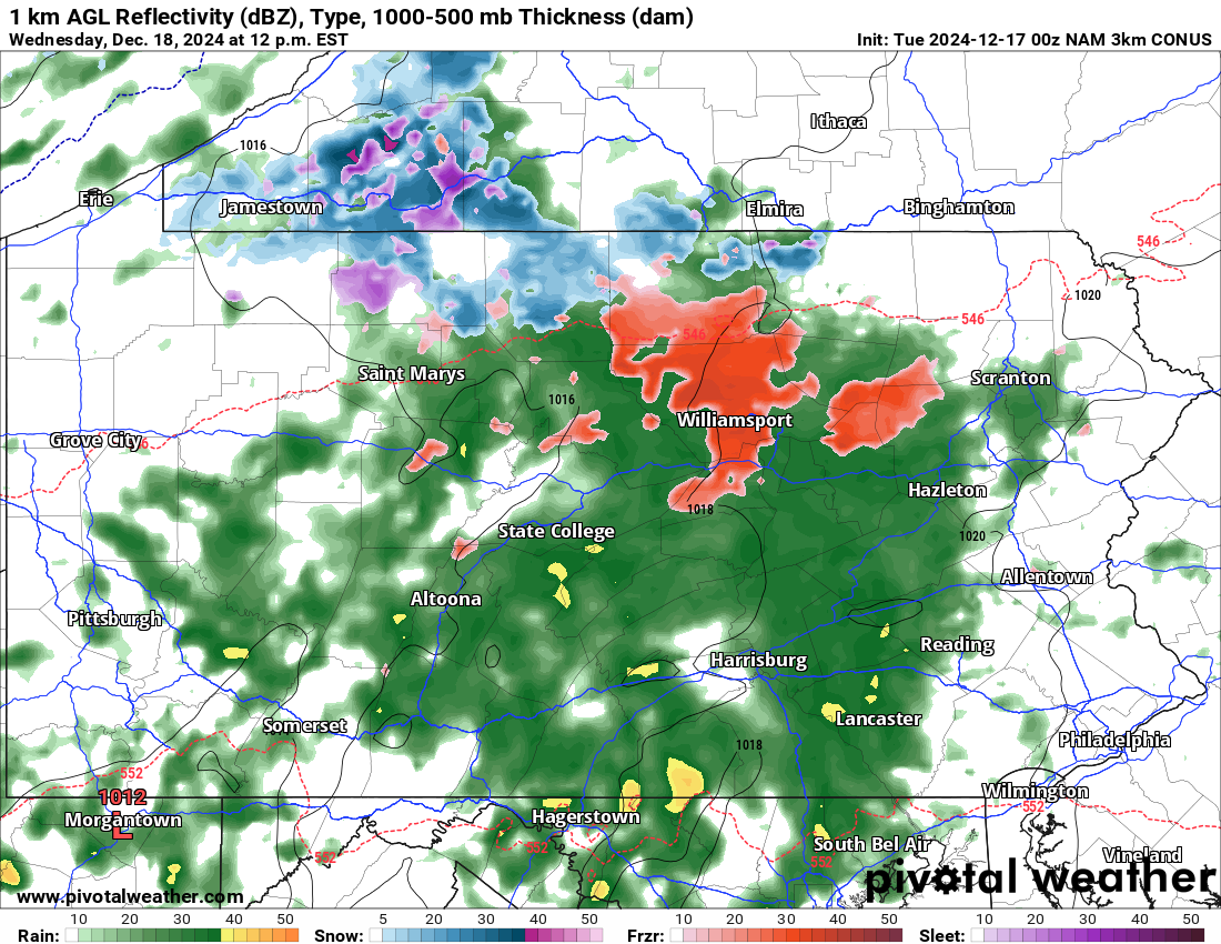
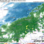
Future Radar Valid for 12:00 PM Wednesday:
Below is a look at the Hi-Res NAM future radar valid for 12:00 PM. Rain showers will overspread much of the area tomorrow by the late morning hours. There is enough cold air in place, that areas north of I-80, especially along the PA/NY border will start off as a period of sleet and snow before changing to plain rain.
Any sleet or snow accumulations will not be enough to warrant any sort of snow map at this time and we expect it to stay this way. The main story will be the rain. The rain will continue at varying rates Wednesday until the nighttime hours.
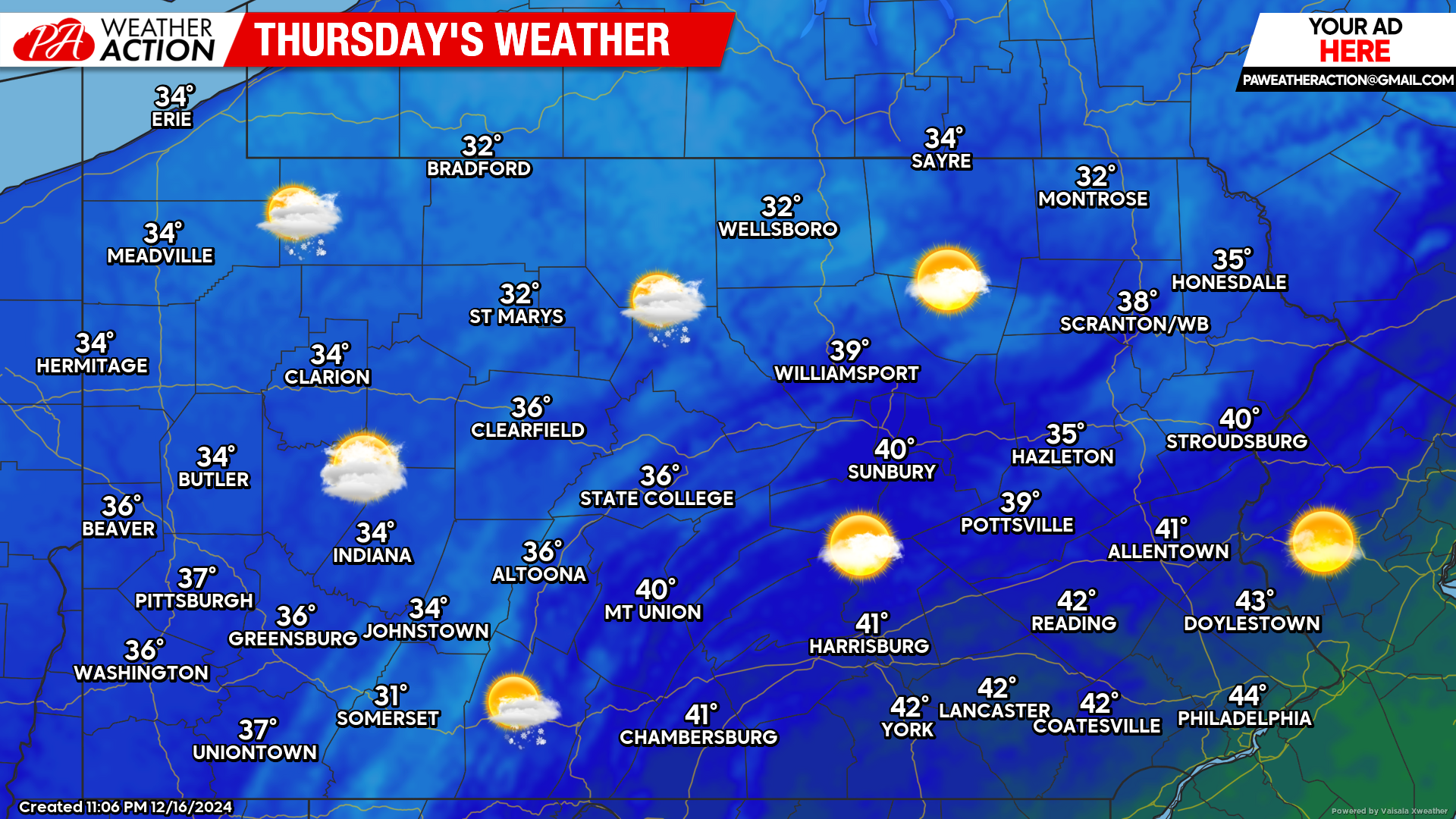
Thursday’s Weather Forecast: 8/10
Thursday will feature a mix of clouds and sunshine with temperatures in the 30s and low 40s. Lake effect snow showers are possible across northwest Pennsylvania.

You must be logged in to post a comment.