
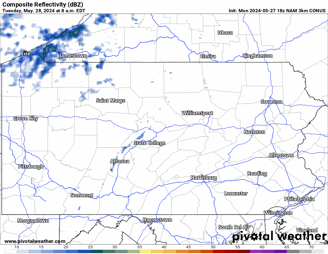
Yesterday was one of the more active severe weather days so far this season, but now things are clearing out this morning looking at our satellite imagery:

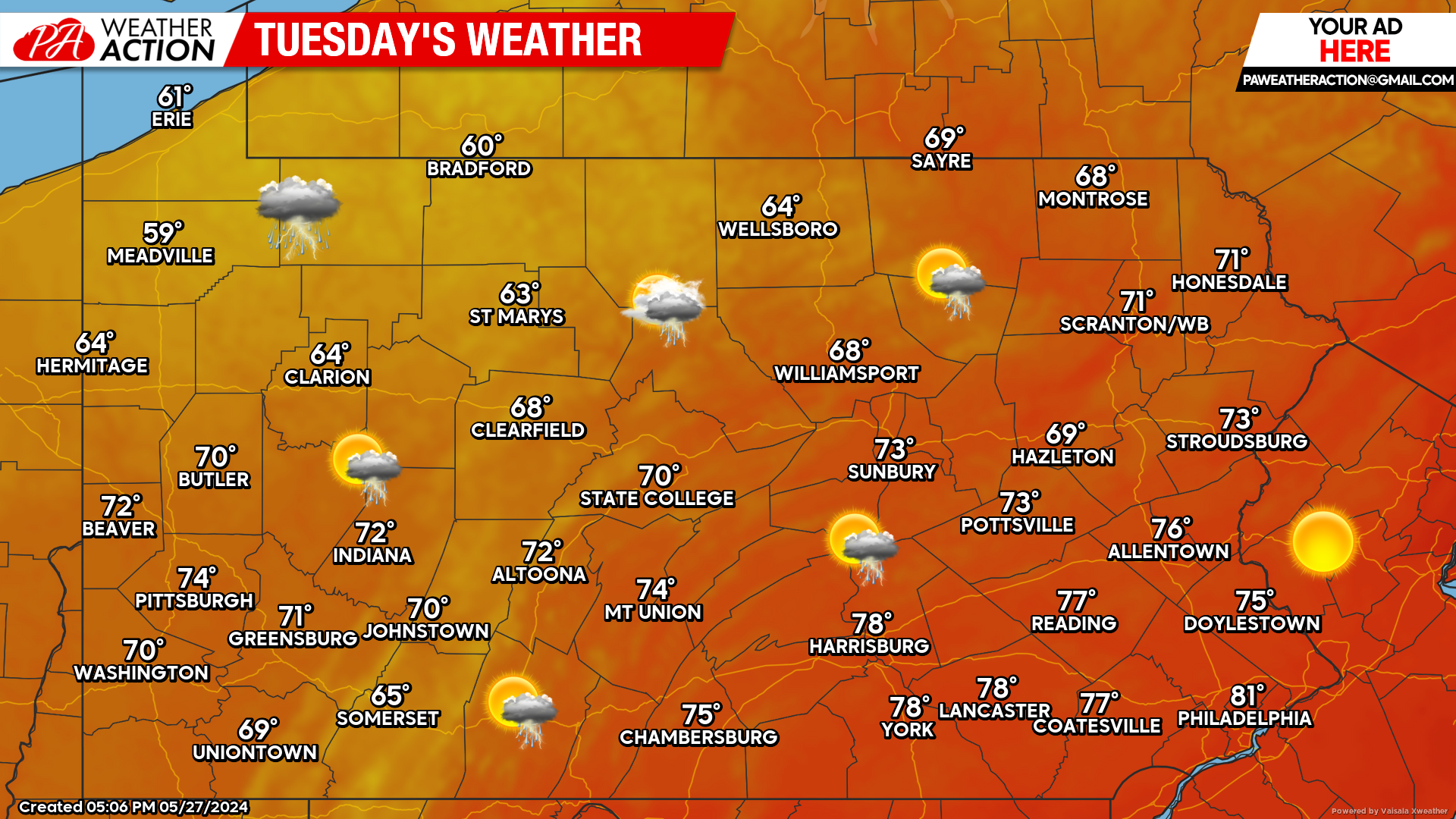
Today’s Weather Forecast: 8/10
For many areas, conditions will be near perfect. However, thanks to yesterday’s disturbance moving out of the area, colder air is dragging behind it for western areas. A scatter shower or thunderstorm is possible.
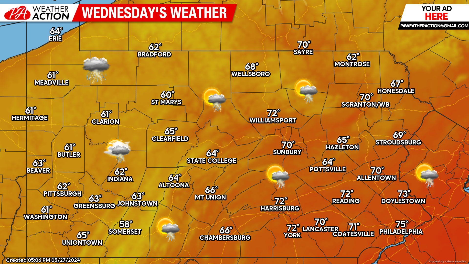
Wednesday’s Forecast: 6/10
Wednesday features the better opportunity for showers and thunderstorms across the state. On top of showers and storms, the pool of cooler conditions will have overspread the entire region.
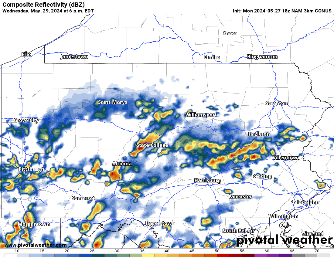
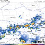
Hi-Res NAM Future Radar Valid through Early Thursday AM:
Using the Hi-Res NAM future radar, it really likes the idea of mostly calm conditions today and then by Wednesday afternoon a large area of scattered showers and thunderstorms to develop. For time reference, look at the top left of the graphic below:
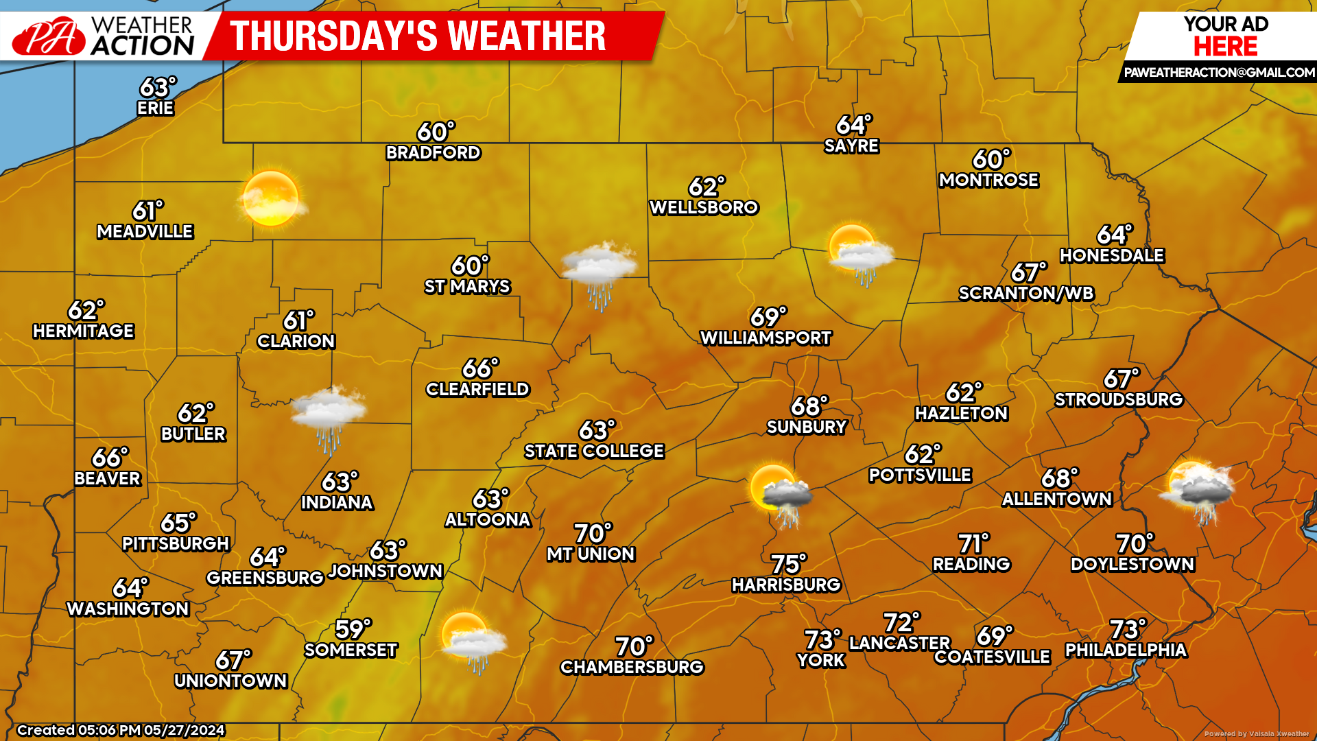
Thursday’s Weather Forecast: 8/10
Minus an isolated shower or thunderstorm, Thursday looks to be absolutely beautiful. Temperatures will remain on the cooler side, especially across the western third of the state and near the Poconos.
Weekend Update:
Model guidance continues to be locked in for a mostly dry weekend both Saturday and Sunday. Looks like a fantastic weekend with temperatures in the 70s. As always, keep it here for the latest!
You must be logged in to post a comment.