

Good afternoon! I hope everyone has had an enjoyable week so far. The weather pattern has been rather stagnant and quiet throughout much of this week with consistent mostly cloudy conditions and temperatures hovering in the 50s. As we head into the weekend, unfortunately, major changes are coming to the forecast as yet another low pressure system tracks into our region. When was the last time we have had a dry weekend, great question right?
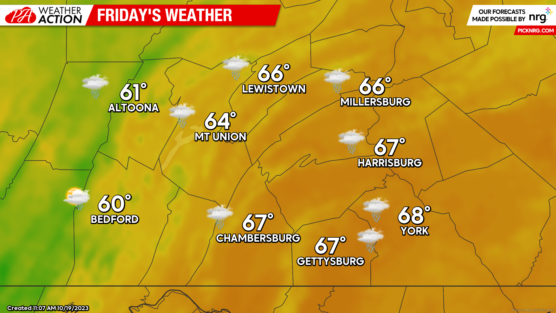
FRIDAY:
Friday will bring a rather unsettled end to the weekend as a cold front approaches the region. Ahead of the cold front, expect a warm southerly flow of 10-15 MPH, which will allow temperatures to climb into the 60s for much of the region. As the cold front moves through, expect widespread showers to move through with the wind direction changing to more of a westerly flow of 5-10 MPH. Temperatures will also drop into the low-to-mid 50s as the cold front passes through, making for a blustery and chilly evening.
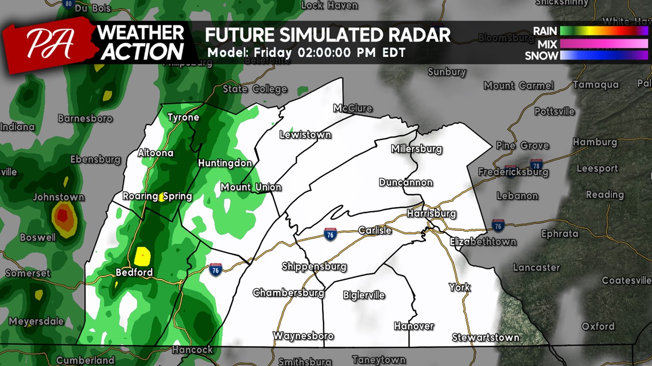
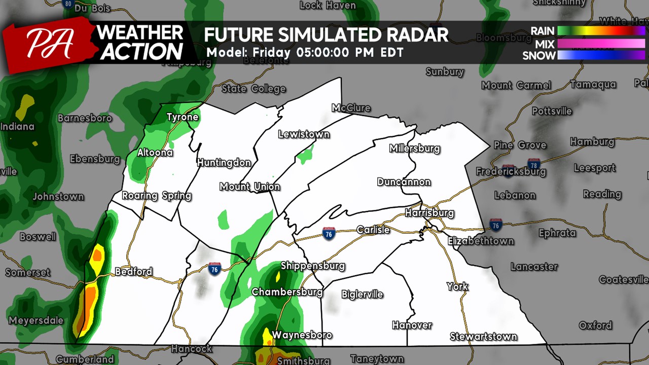
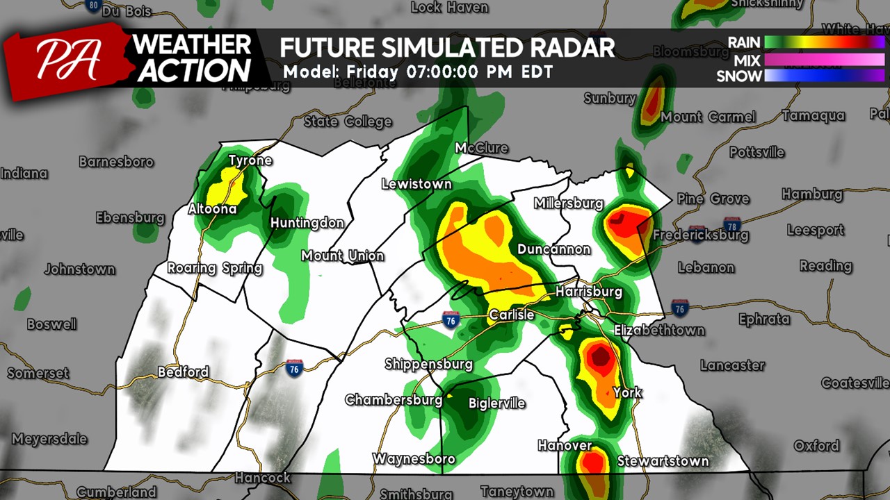
FUTURE RADAR:
*Keep in mind, this is a simulated radar (general idea) and actual precipitation coverage/intensity tomorrow afternoon/evening may be different than shown below*
As we head into the early afternoon hours, showers will begin to move into the western portions of the area. These showers will continue to progress toward the east over the afternoon and evening hours.
Heading into the evening hours, there may be breaks in the rain showers across the area, with the most coverage of shower activity across the western and central zones.
As we head into the sunset hour and beyond, we will see a higher coverage of showers (and potentially an isolated thunderstorm) across the eastern areas, especially impacting Harrisburg and surrounding towns. If you are planning to head out during the evening hours, including Friday Night Lights football games, make sure to bring your umbrellas and rain gear!
Heading later into the overnight hours, much of the precipitation threat will be coming to an end across our local region with the axis of the showers across southeast Pennsylvania.
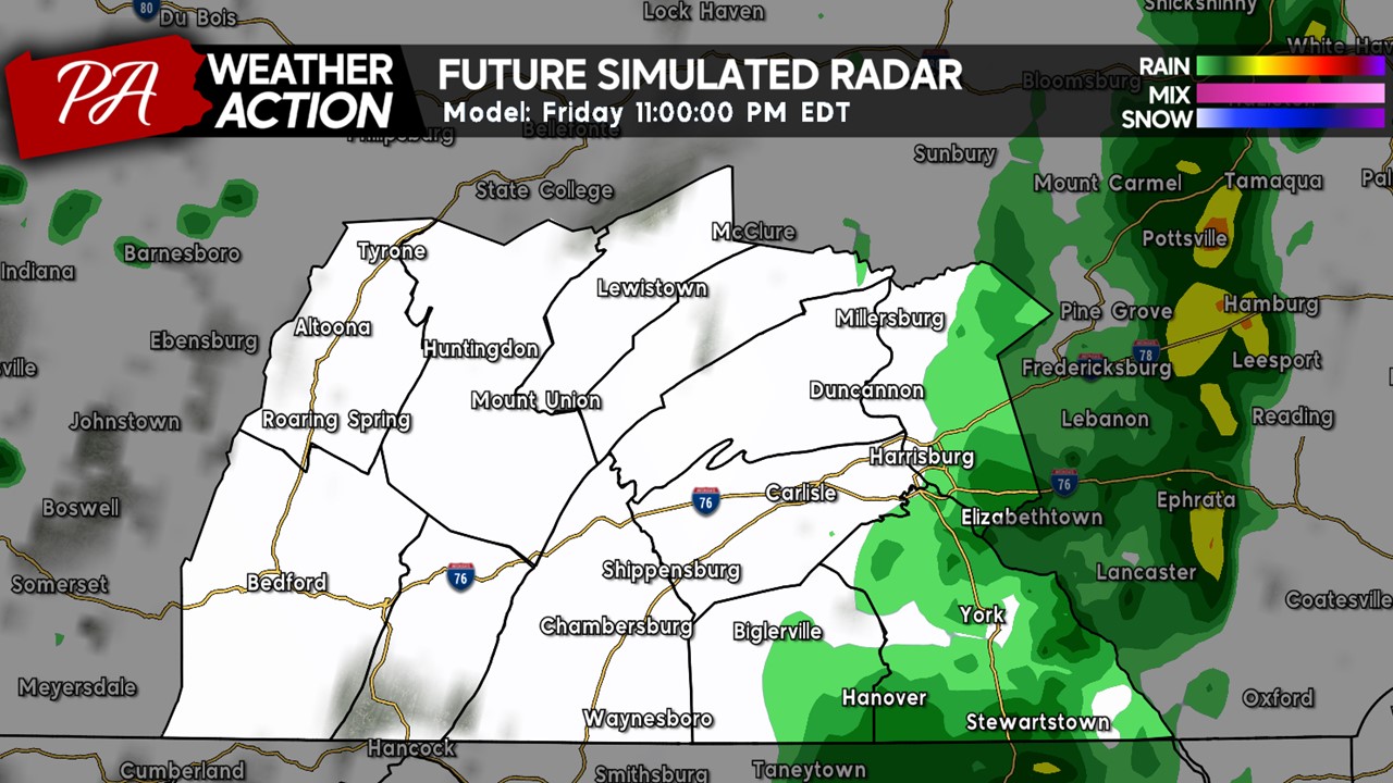
Overall, due to the scattered nature of the showers tomorrow afternoon and evening, some areas may be missed out completely while some areas see numerous rounds of showers. If you are planning to be outdoors tomorrow, it will be good to bring the rain coat and umbrella just in case you are affected by one of the showers. Depending on the amount of instability that develops during the afternoon (if there is any clearing of the clouds), there may be a few scattered rumbles of thunder across the eastern counties.
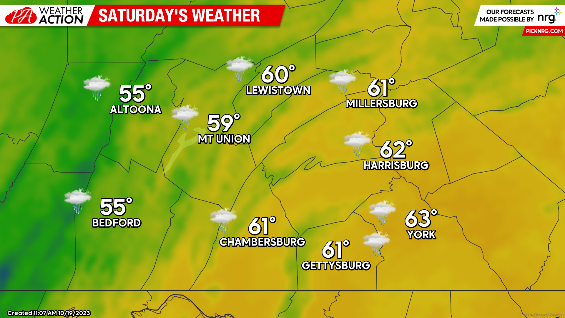
SATURDAY:
In the wake of the cold front passage on Friday, Saturday’s high temperatures will be much lower across the region with highs ranging from the mid-50s to low-60s. Expect mostly cloudy conditions with hit-and-miss showers across the region, primarily during the morning and afternoon hours. If you have any outdoor Saturday plans, make sure to pack the rain gear in case you are affected by these short-lived showers! Expect sustained winds of 15-20 MPH out of the west with wind gusts reaching as high as 30-35 MPH at times, making for a pretty blustery afternoon and evening.
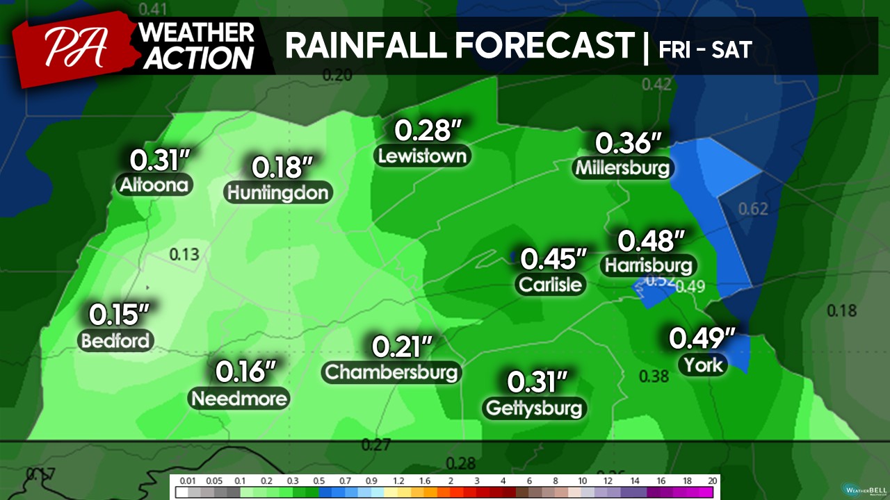
TOTAL PRECIPITATION:
Here are the projected rainfall amounts for Friday and Saturday combined. Around 80% of these amounts will fall on Friday, with additional rainfall expected from the hit-and-miss showers Saturday afternoon throughout the region. Overall, it will be significantly drier compared to last weekend, where widespread amounts of 0.75 – 1.50″ were reported across the region.
SUNDAY:
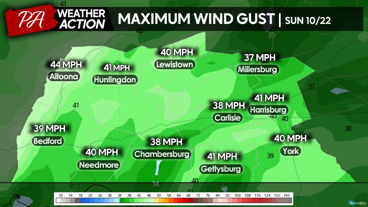
Sunday will bring even cooler conditions to the region as we see a cool, northerly wind bring in colder air from southern Canada. Expect a mix of sun and clouds across the area with high temperatures reaching the low-50s to upper-50s. Sunday will bring the most windy day of the season yet- with a sustained northwesterly wind of 15-25 MPH with gusts reaching 40-45 MPH at times across the area. These higher winds will make it feel a bit colder at times throughout the afternoon A few isolated hit-and-miss showers will be possible in the far western counties, especially across the highest elevations.
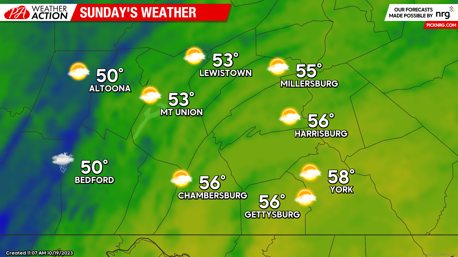
As mentioned previously, Sunday will be a rather windy day! Expect wind gusts as high as 40-45 MPH across portions of the region during the afternoon and evening hours. Combined with air temperatures in the 50s, the “wind chill” index may dip into the mid-to-upper 40s at times during higher peaks of wind. If you are planning to be outdoors for extended periods of time on Sunday, make sure to dress appropriately!
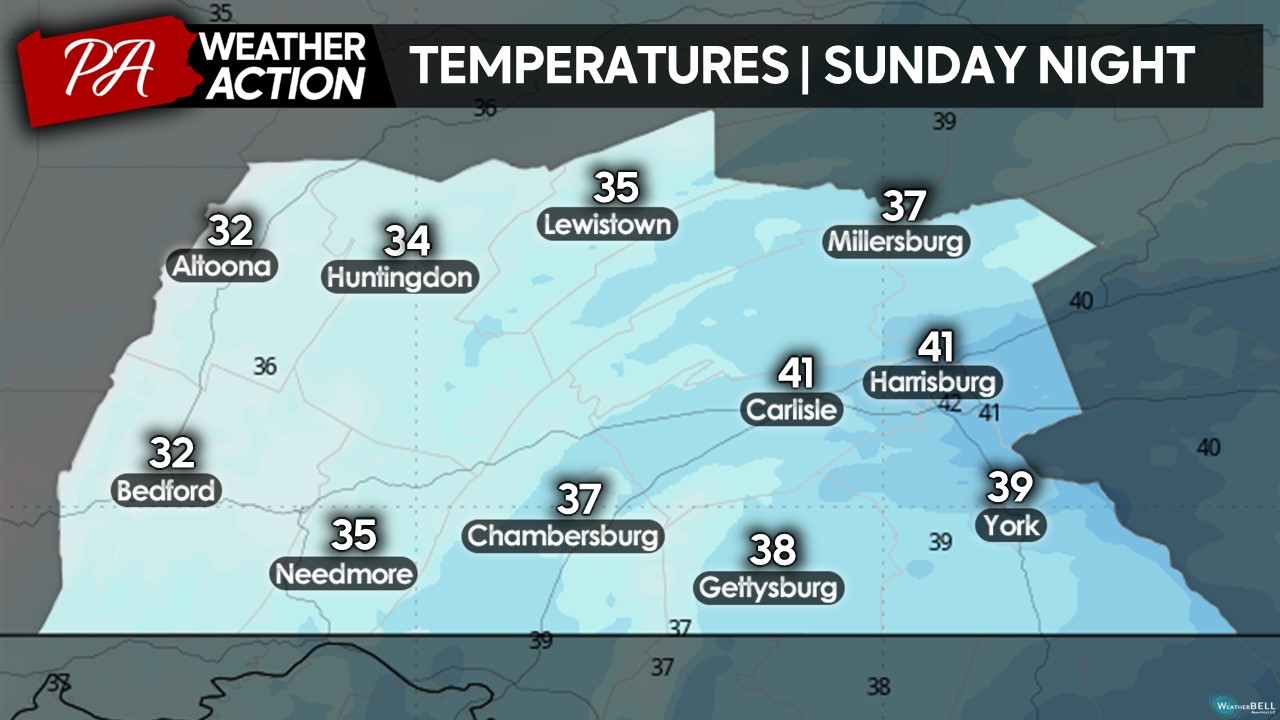
Sunday night may bring the coldest overnight lows to the region this season yet- with many areas dropping into the low-t0-mid 30s. It is possible some parts of the region will see the first frost of the season, especially in the valleys and highest elevations. If you have sensitive outdoor vegetation, it may a good idea to bring those plants indoors over the next few days before early next week!
Anyway, I hope you have a great weekend despite the potential rain showers, gusty winds, and cooler conditions. The fall foliage colors are beginning to show up in greater concentrations, especially in the higher elevations and northern counties. It will not be too bad of a weekend to check out some of the colors as peak color is not that far off! If you have any questions regarding the forecast, please feel free to reach out!
Denys Khrulov

You must be logged in to post a comment.