
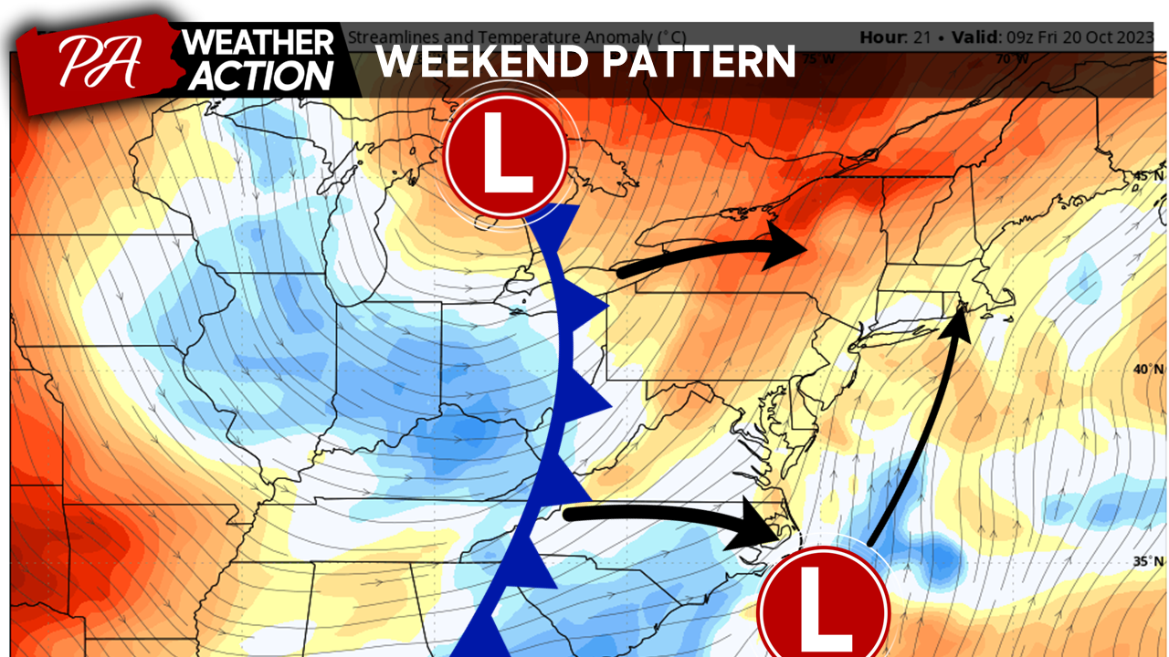
The passage of a cold front late Thursday and early Friday will bring unseasonably cooler temperatures and a lingering chance for rain for most of the region this weekend. Clearing, but windy, weather conditions are expected on Sunday. Cooler evening temperatures bring the chance for widespread frost on Monday morning.
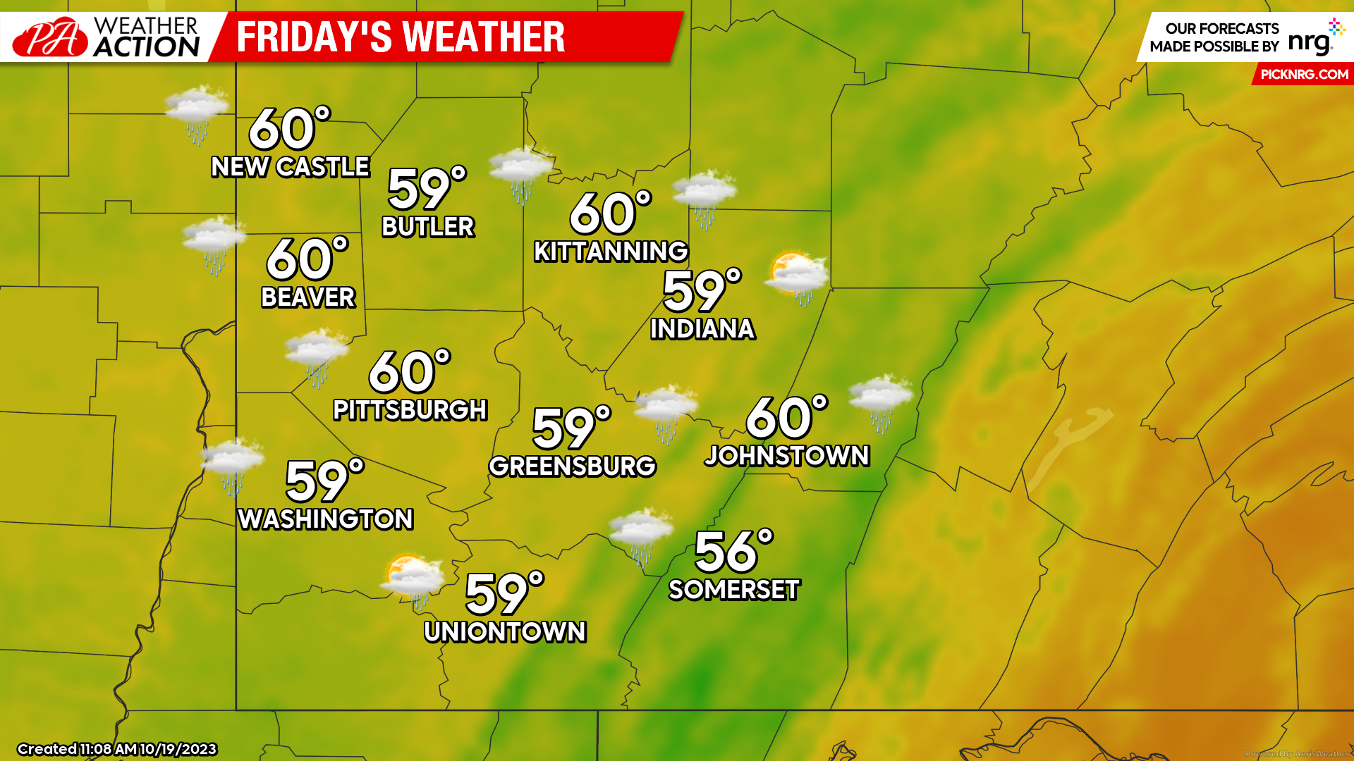
Friday
Rain can be expected, primarily in the morning hours, with an ongoing chance for showers throughout the day. High temperatures will near 60 degrees for the majority of the region. Winds will be out of the South at 5-10 mph. Evening lows will be range between the mid 40s and low 50s.
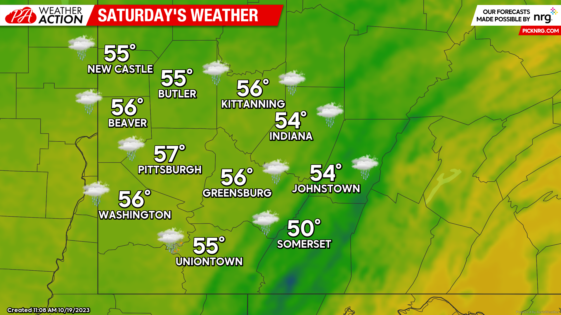
Saturday
Showers will remain likely throughout the day. Slightly cooler, with high temperatures ranging from the low to mid 50s. Winds will be out of the West at 8-15 mph. The higher elevations could experience wind speed between 15-20 mph, with some gusts up to 30 mph. Regional lows will range between 40-50 degrees.
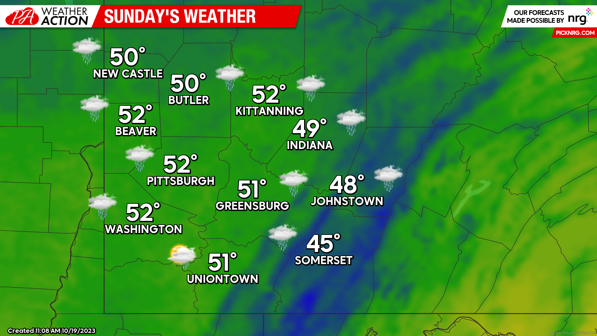
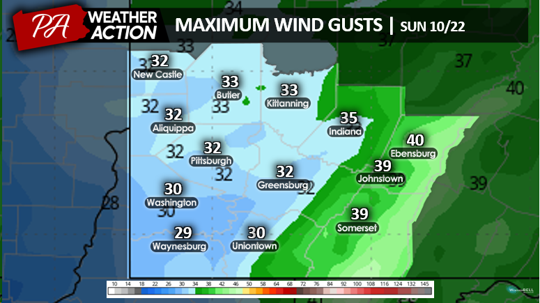
Sunday
A slight chance of rain in the morning hours will be followed up by clearing skies and windy conditions. Winds will be out of the Northwest at 13-18 mph. The higher elevations will have sustained winds around 20 mph, with gusts of up to 40 mph. High temperatures will be in the low 50s to mid 40s. Evening lows will be in the low 40s, with some locations dropping to the high 30s. The cooler evening temperatures and breezy conditions may bring wind chill values to the low 30s, and in some areas the mid 20s. There is also a chance for widespread frost Monday morning.


You must be logged in to post a comment.