
Yesterday was quite the active day for severe weather. Many of us even experienced overnight thunderstorms, which have since cleared the state. Below is a look at our latest satellite imagery showing a much clearer picture as we dry out from the storms:

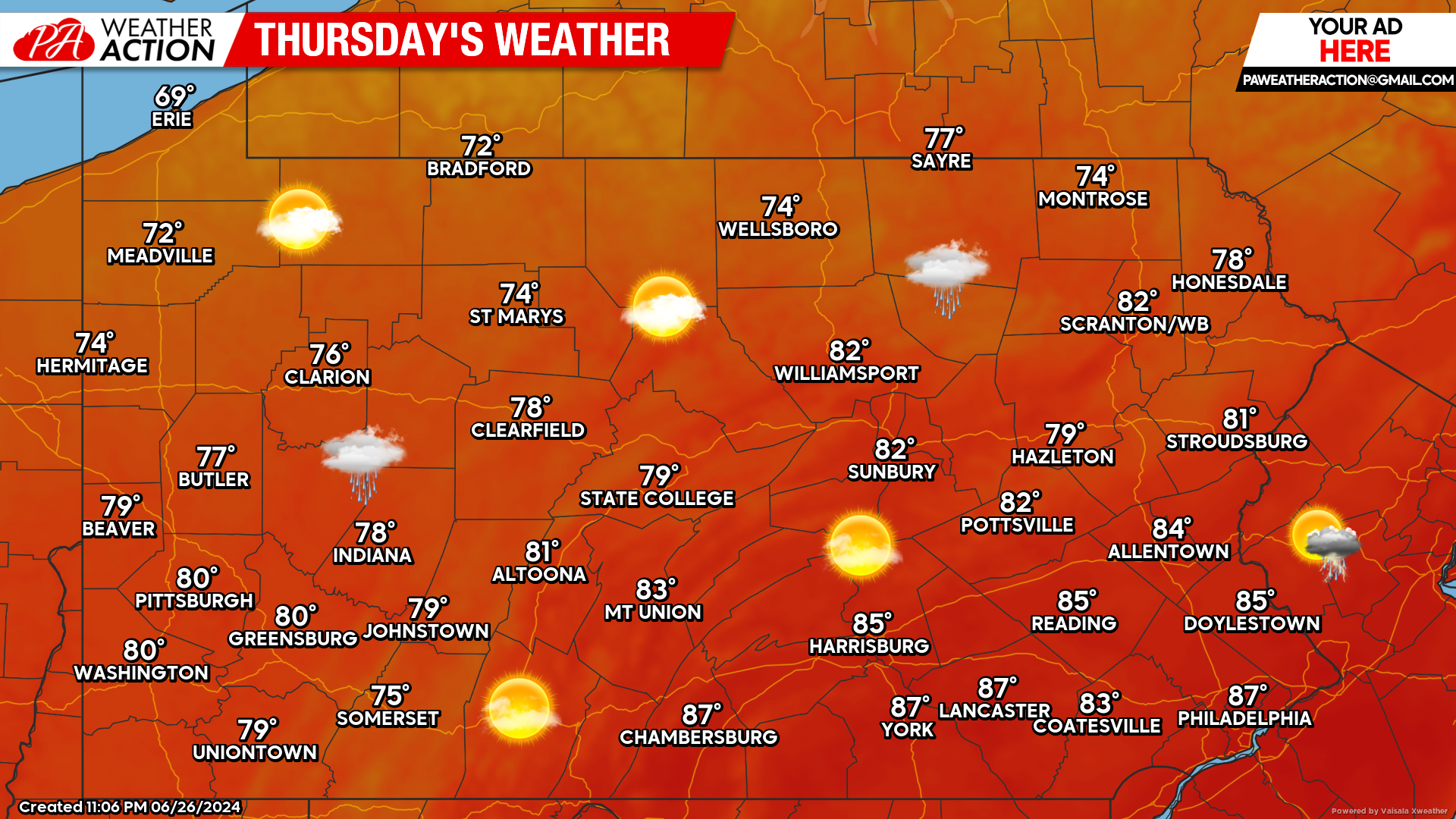
Today’s Forecast: 9/10
Today paints a much drier picture across the state. An isolated shower cannot be completely ruled out, however most areas will remain completely dry with temperatures ranging from the 70s into the upper 80s.
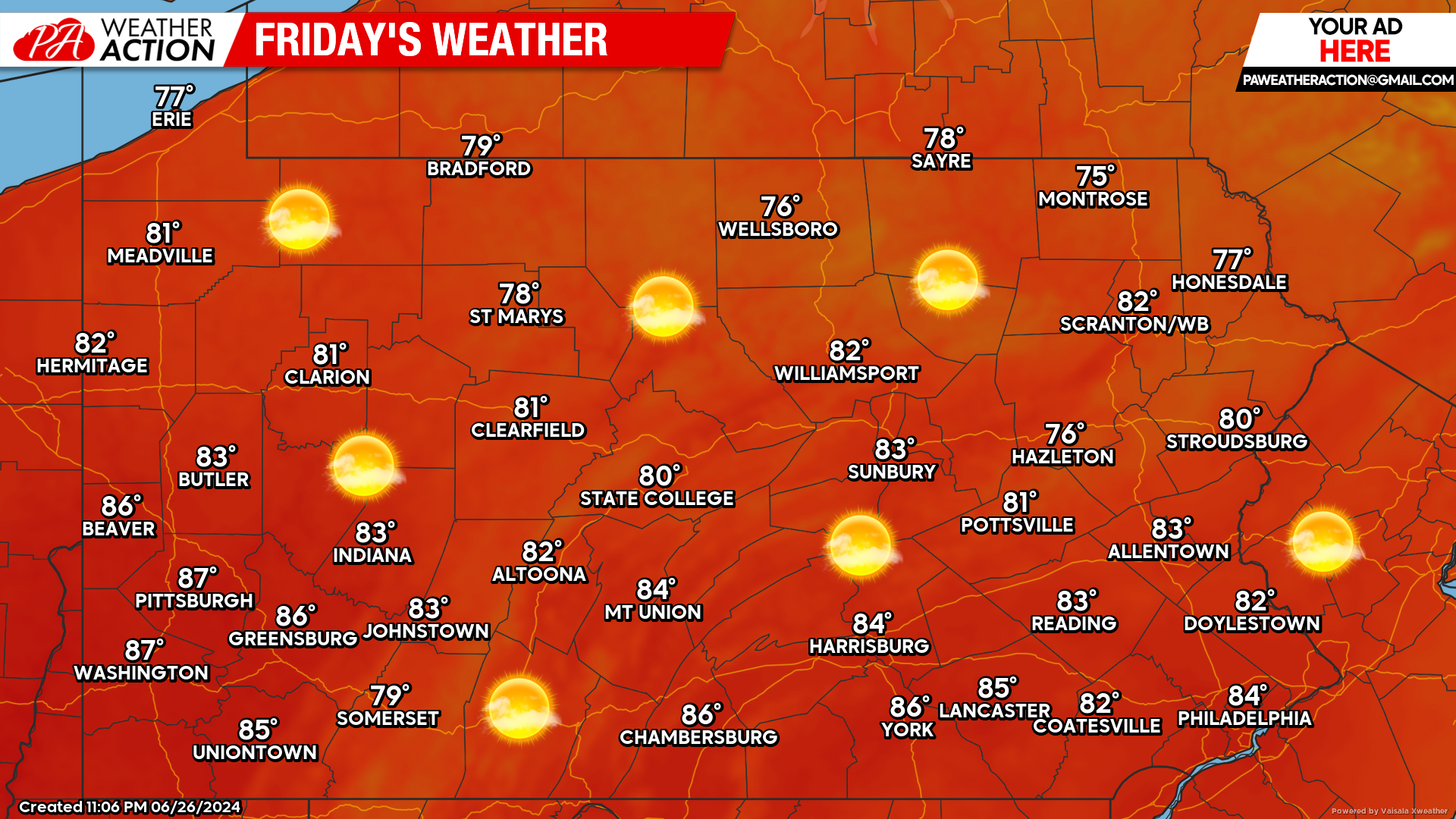
Friday’s Weather Forecast: 10/10
Friday’s forecast will be absolutely perfect. Mostly clear skies with temperatures hovering in the upper 70s to the middle 80s across the state.
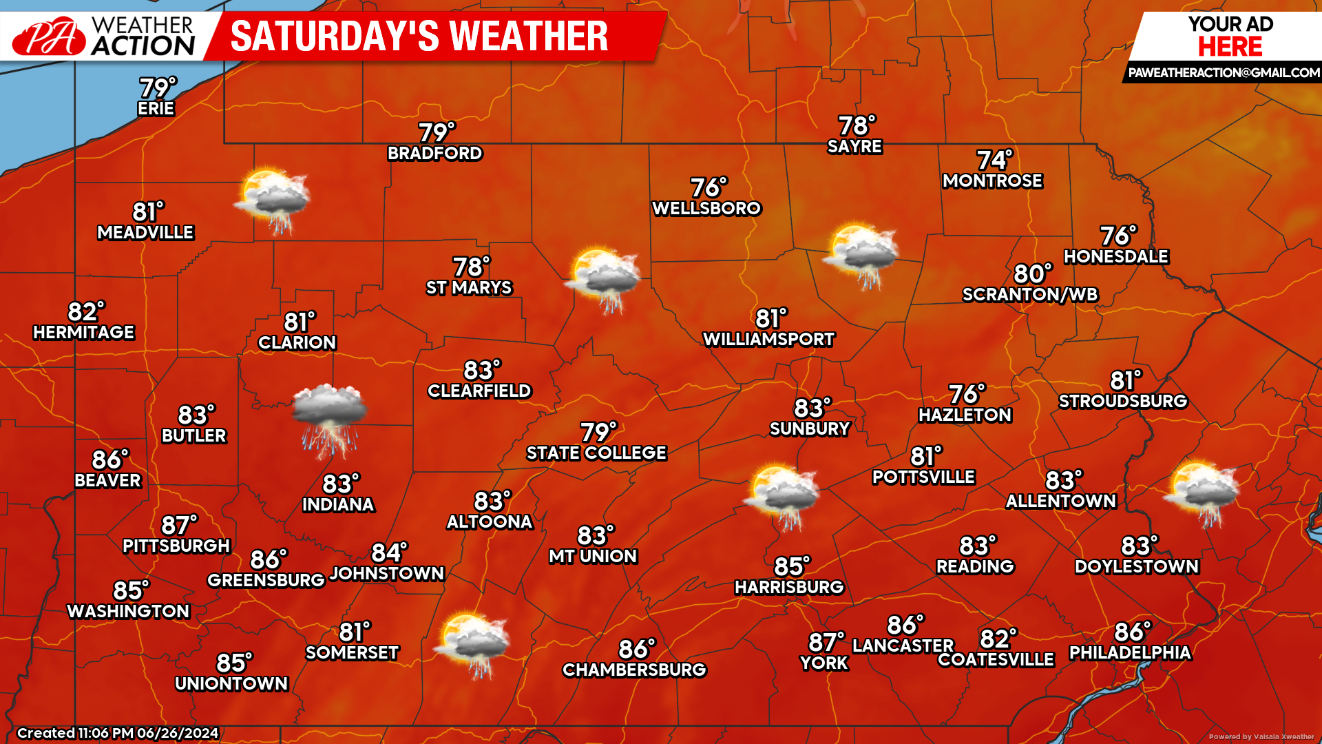
Saturday’s Weather Forecast: 6/10
Saturday will feature another chance of widespread thunderstorms. These thunderstorms will have the potential for heavy downpours and damaging winds.
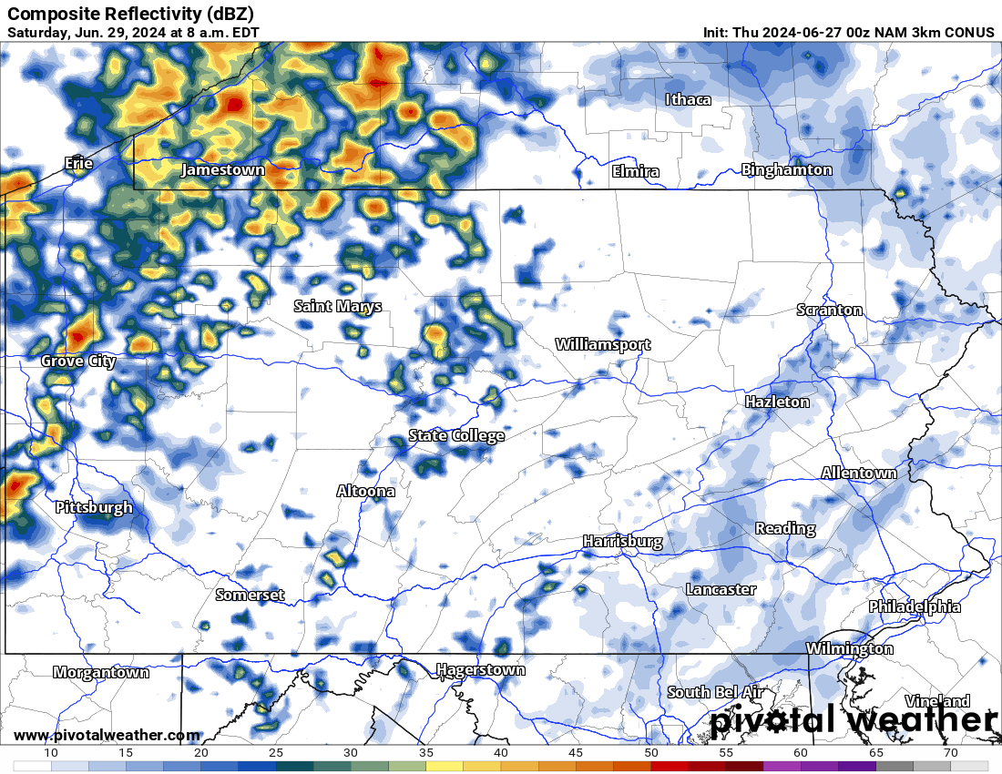
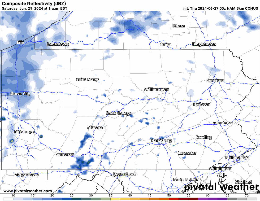
Hi-Res NAM Future Radar For Saturday Morning:
Taking a look at the future Hi-Res NAM radar, we can see the development of widespread thunderstorms across Western Pennsylvania by mid-morning Saturday. This is as far out as the model extends, we will have more updates as we get closer.

You must be logged in to post a comment.