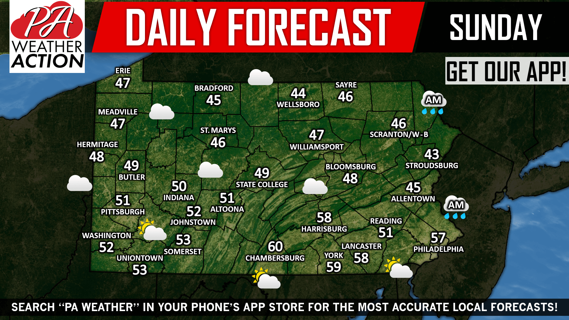
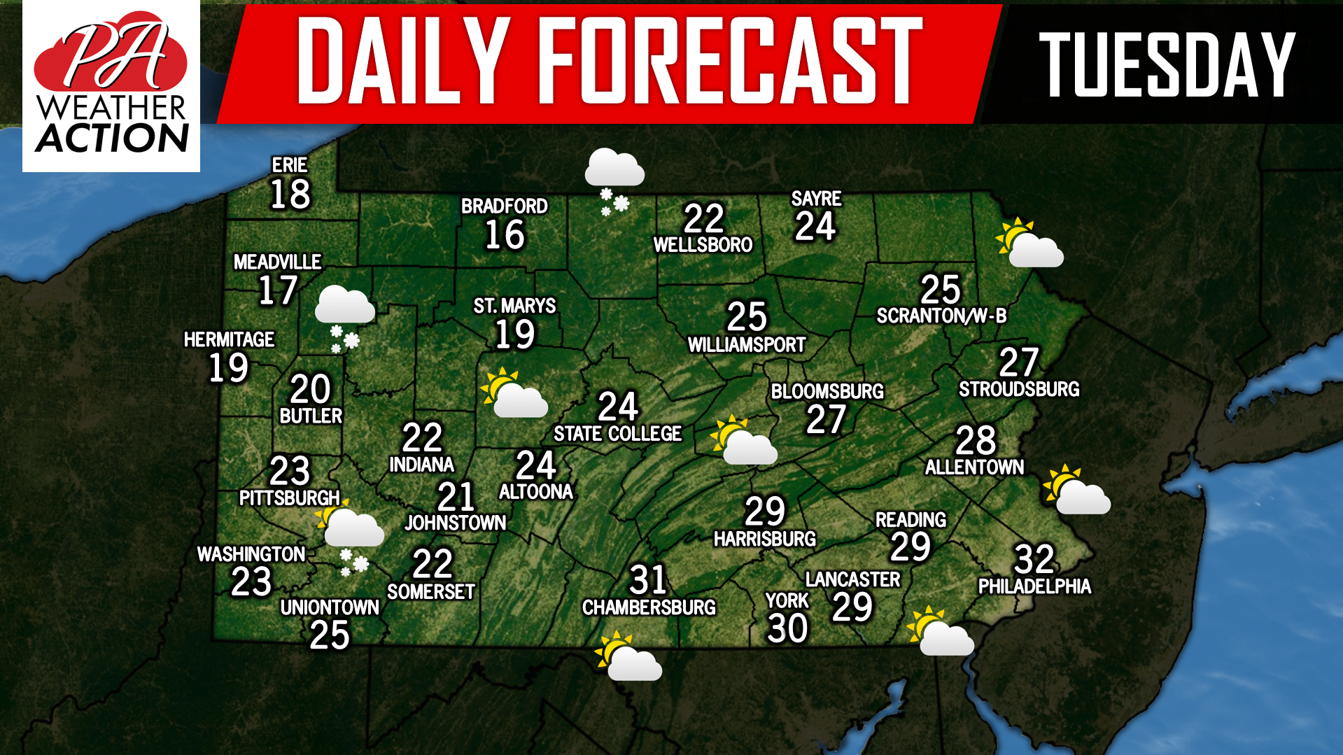
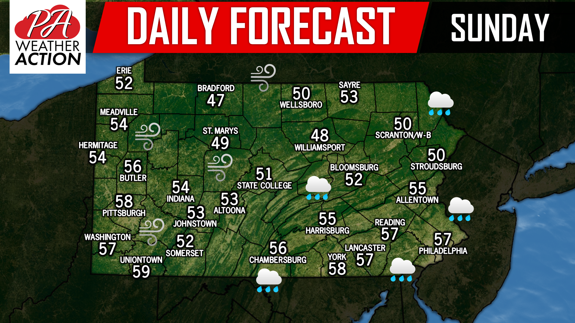
Unfortunately for Central and Eastern PA yesterday, stubborn clouds would not breakup over the region keeping temperatures in the 40s. For those those that did…
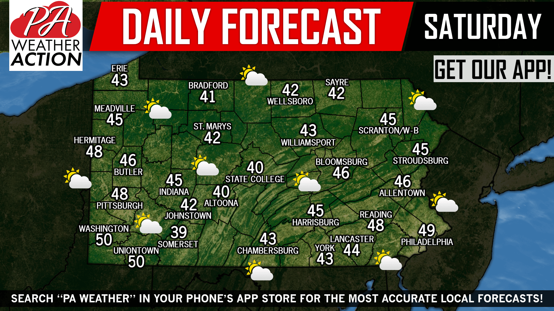
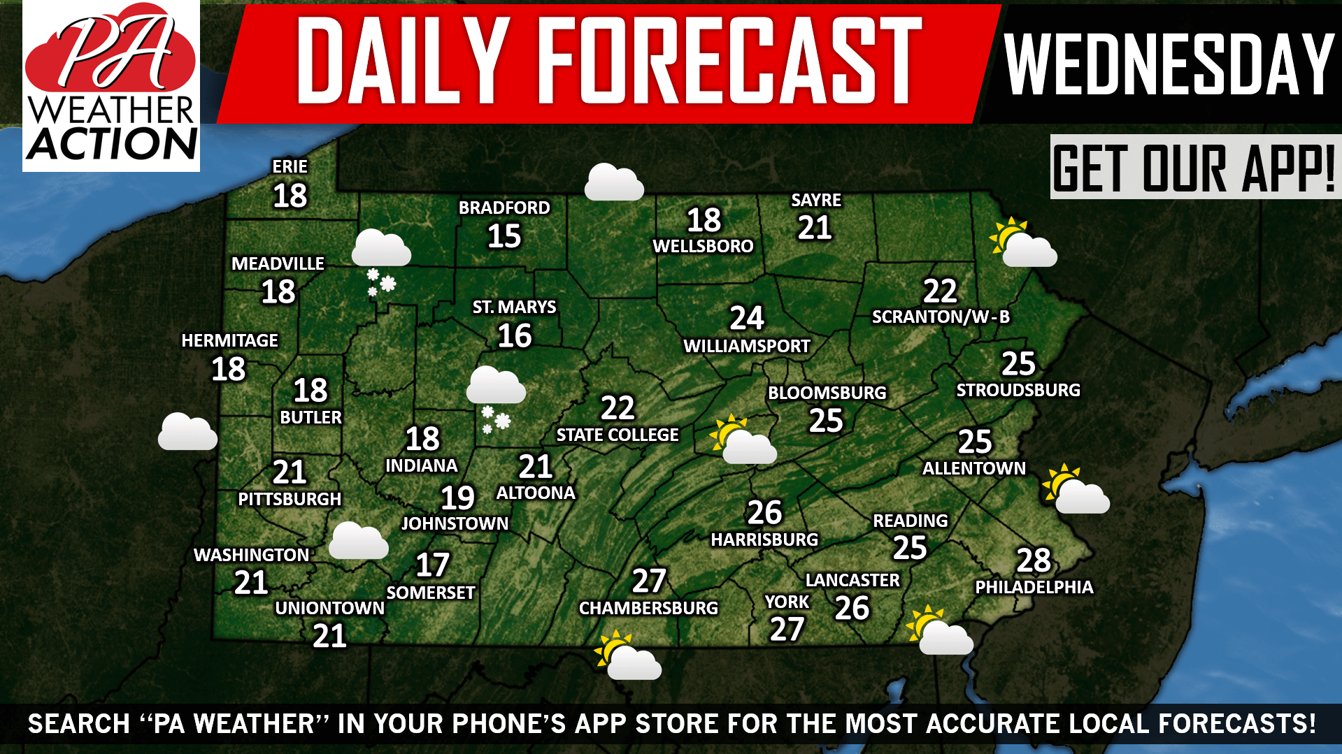
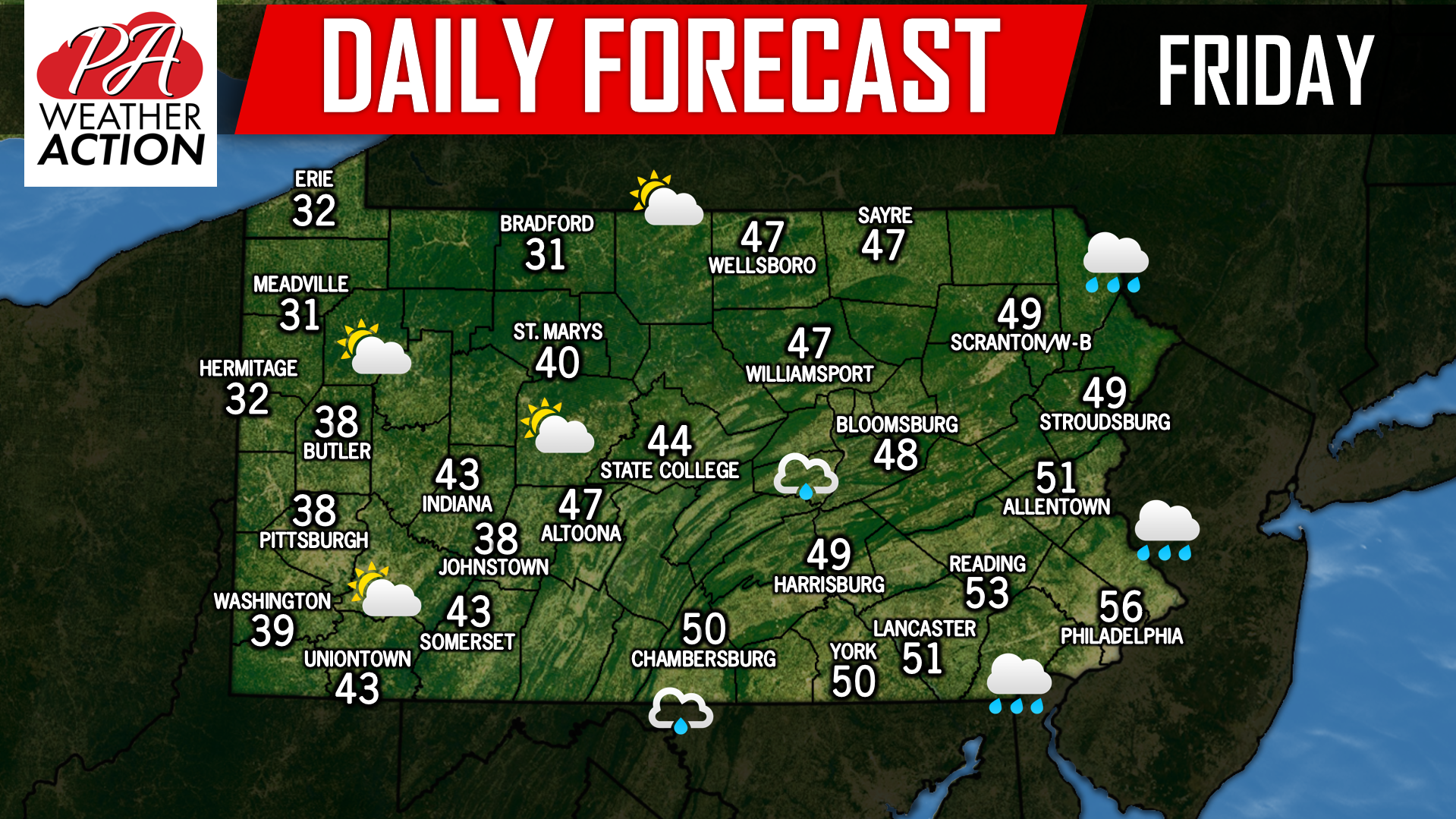
Another windy day is on tap for Pennsylvania again with temperatures much colder than yesterday with temperatures generally in the 20s and 30s. High Wind…