

Happy Independence Day! After the refreshing start to this week, oppressive humidity is returning today. The humidity will bring the opportunity to spark natural fireworks during the afternoon of July 4th. This opportunity will last until a cold front crosses our area Saturday night. The high humidity could fuel localized heavy rainfall in excess of 1-2″.
Meanwhile, Beryl has encountered a more-hostile atmospheric environment and continues to weaken. As of 2pm, Beryl is located about 275 miles ESE of Tulum Mexico, moving WNW at 18 mph. Beryl currently has 110mph winds, and will continue to weaken. Beryl is expected to make landfall on the Yucatan Peninsula as a Cat 1 storm tonight, emerge in the Gulf of Mexico as a tropical storm Friday evening, and possibly regain Cat 1 hurricane strength before landfall near the Mexico/Texas border Monday morning.

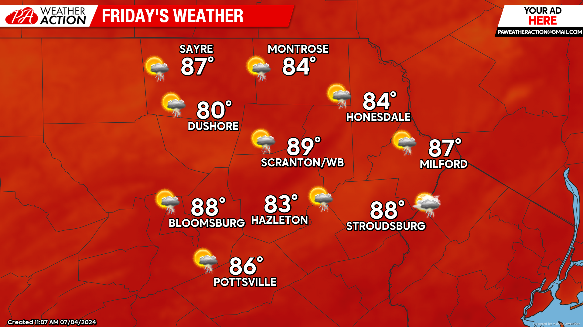
FRIDAY
Friday will be very humid, with the continued potential for thunderstorms. Some thunderstorms could produce locally heavy rainfall. The high humidity will also prevent overnight temperatures from falling below 70 in most locations.
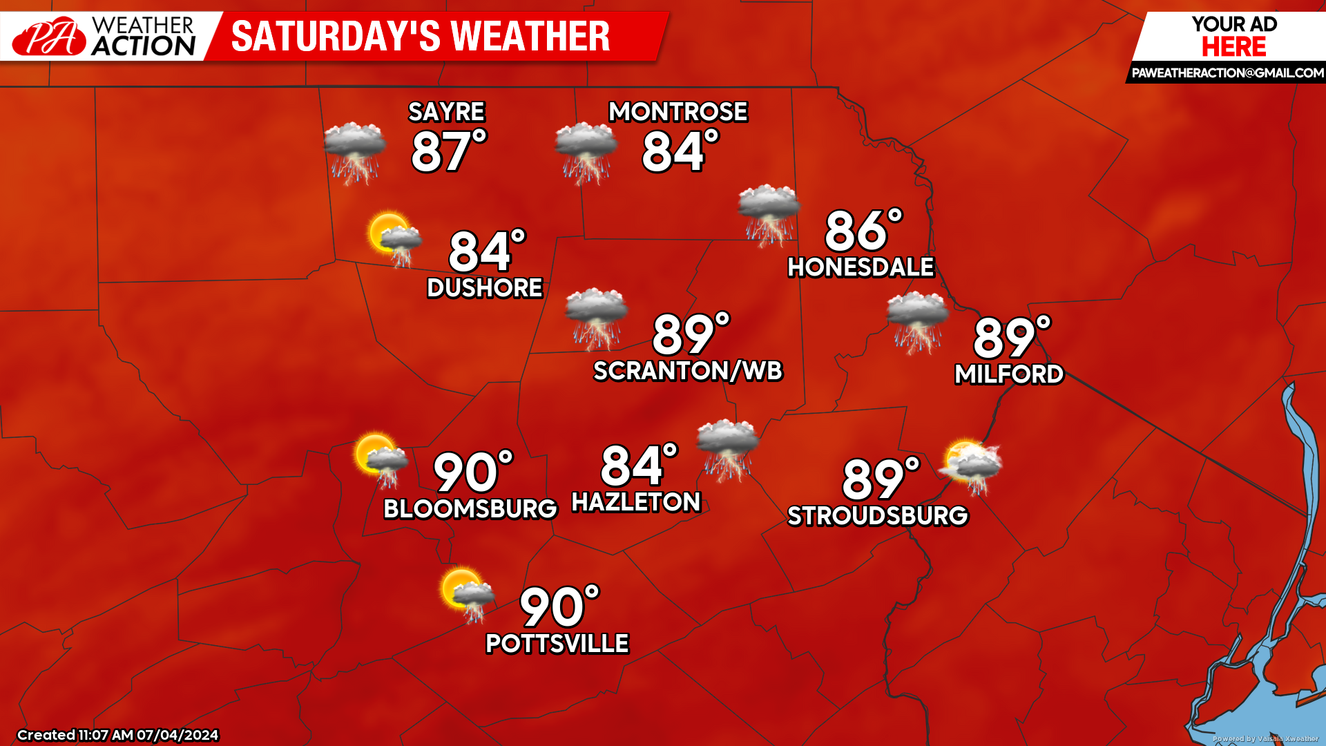
SATURDAY
Saturday will be another hot and humid day with the opportunity for scattered thunderstorms with heavy downpours. A cold front will cross our area during the evening hours.
SUNDAY
The aforementioned cold front will deliver dry weather, lower humidity and slightly lower temperatures for Sunday. The dry weather will last into Monday, but humidity and another opportunity for thunderstorms will return for Tuesday-Wednesday of next week.

You must be logged in to post a comment.