
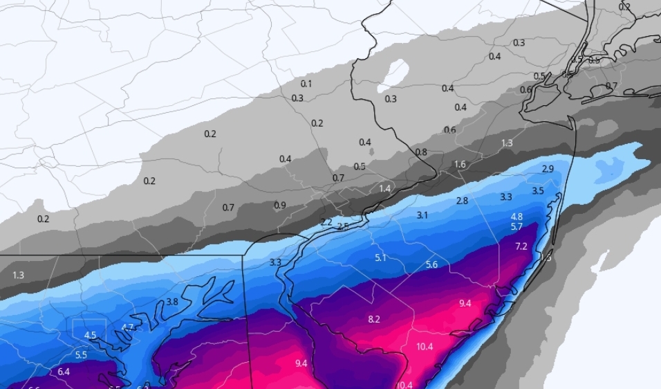
Recent model trends have sparked plenty of excitement among people to our south, and rightfully so. An area of energy in the Lower Mississippi Valley will tilt negative much earlier than expected just a day ago. As a result, a quick-hitting but powerful winter storm will dump snow, and possibly even produce scattered thundersnow across parts of Virginia, Maryland, Delaware, and Southern New Jersey.
For Pennsylvania though, a partly cloudy and blustery day is on tap. A few snow showers may fall in extreme Southern PA. Best chances for any accumulating snow will be near Philadelphia and right along the Delaware River south of Levittown.
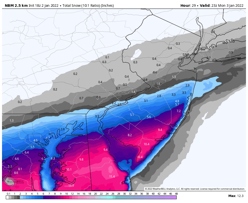
There will be a very sharp northern gradient, and models do have a tendency to overdo a trend and pull it back slightly in the final 24 hours as we’ve seen in today’s afternoon runs.
Friday still presents a great potential, but details remain very fuzzy. Stay tuned for that one. Sorry we couldn’t make it happen with this one snow lovers!


You must be logged in to post a comment.