
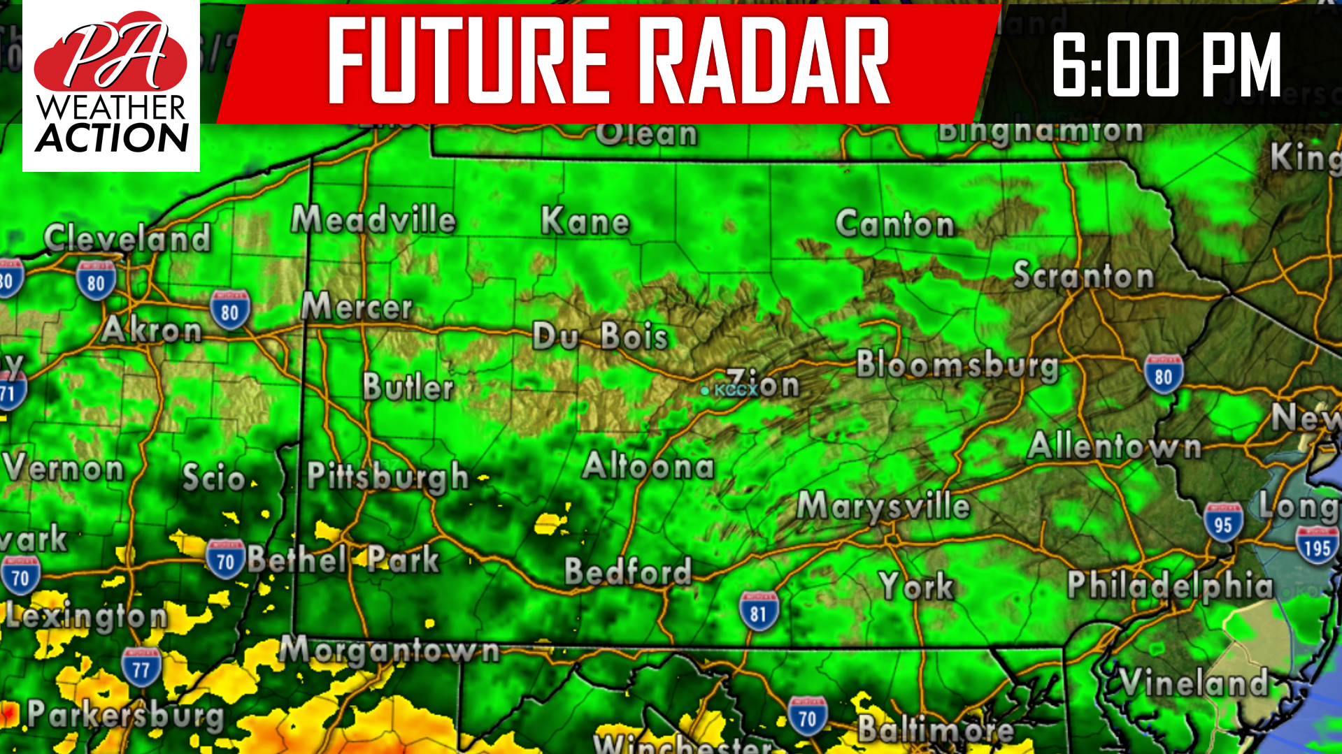
A late October Nor’easter is taking shape over the south this morning and will continue to strengthen as we move forward during the daylight hours today. The low pressure system will transfer its energy to the coast early this afternoon and will push northward as we progress into the evening hours. Steady rainfall is not anticipated to begin until after 6:00 PM this evening. Below is a look at the future radar showing the rainfall edging into Southern Pennsylvania:
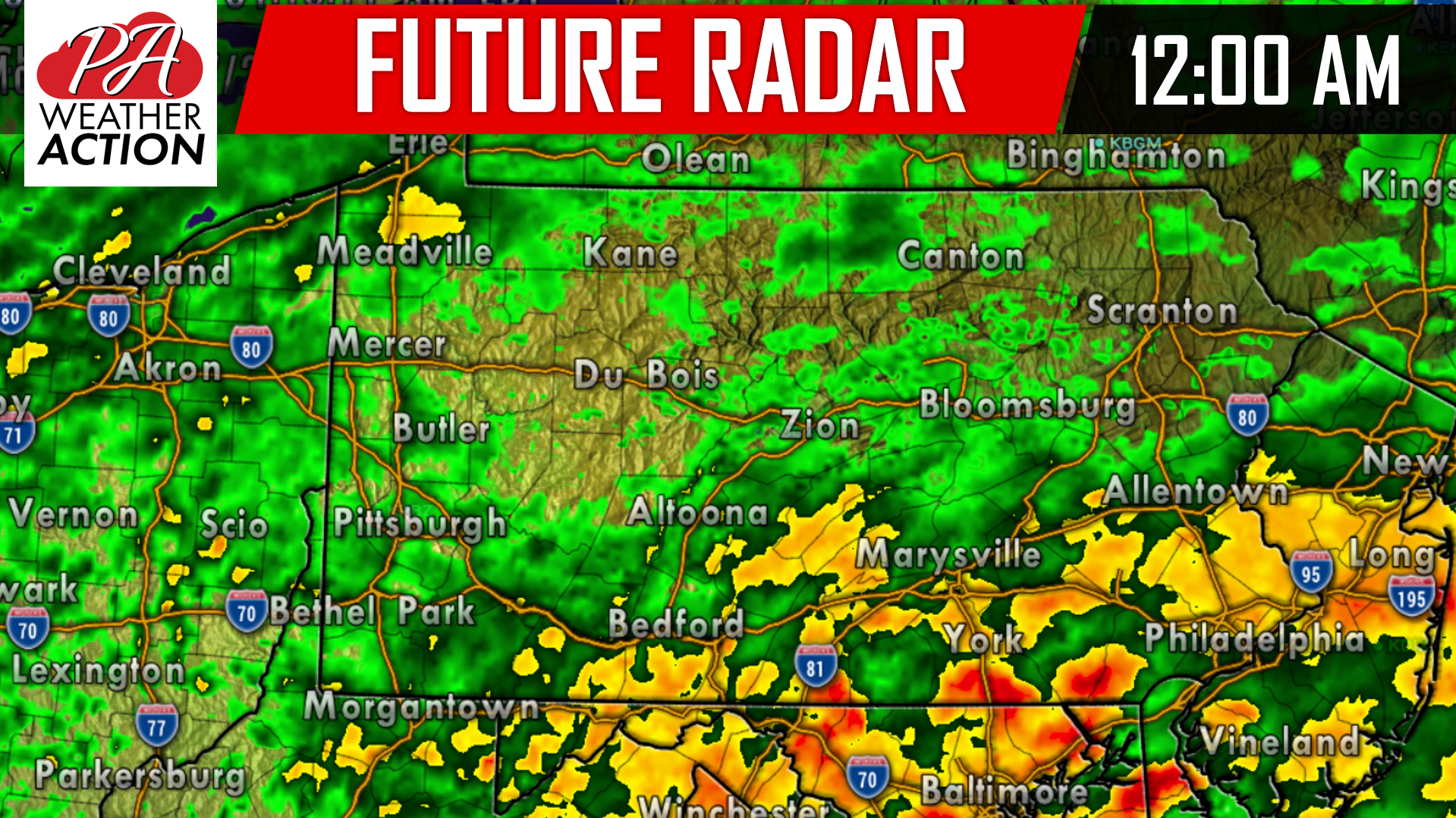
Heavier bands of rain will develop overnight tonight and into the morning hours Saturday as the coastal storm nears our area. With the heavier bands of rain, winds will also begin to pick up overnight tonight and all day Saturday. Winds between 20 and 30 MPH can be expected with gusts higher at times. Below is a look at the future radar for 12:00 AM Saturday:
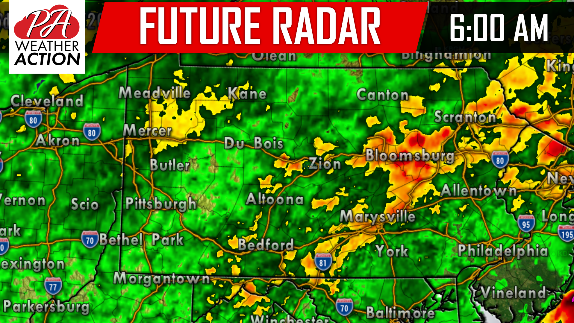
The first half of Saturday will be a washout for just about everywhere. Taking the future radar to 6:00 AM Saturday morning, there is no end in sight for the rainfall:
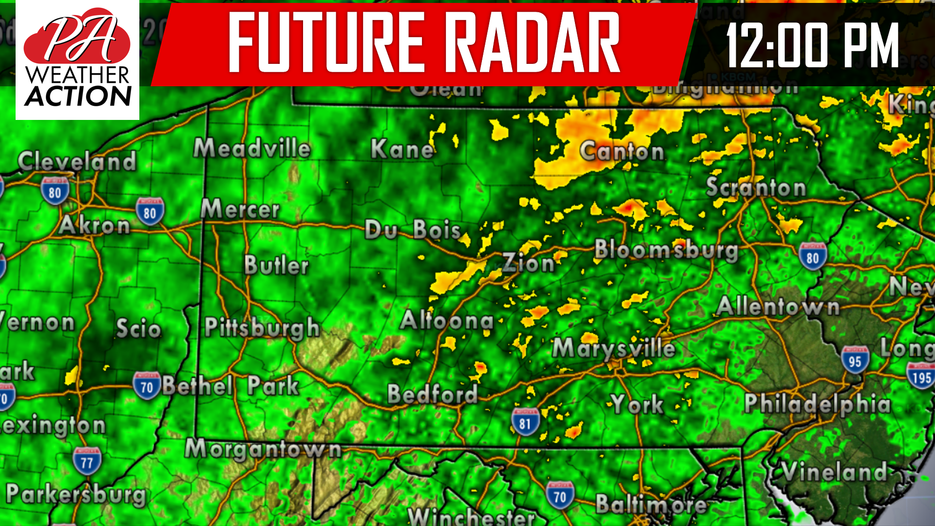
For those that are planning to attend any college football tailgates and games Saturday, plan accordingly. The rain will continue steady and heavy throughout the early afternoon hours Saturday before tapering to scattered rain and even snow showers for areas in Northern Pennsylvania Saturday evening: Below is a look at the future radar for 12:00 PM Saturday afternoon:
Again we do not anticipate the rain to completely shutoff until late Saturday night and for some areas even early Sunday morning. However, the bulk of the steadier rainfall will be over after 4:00 PM Saturday.
EXPECTED RAINFALL TOTALS:
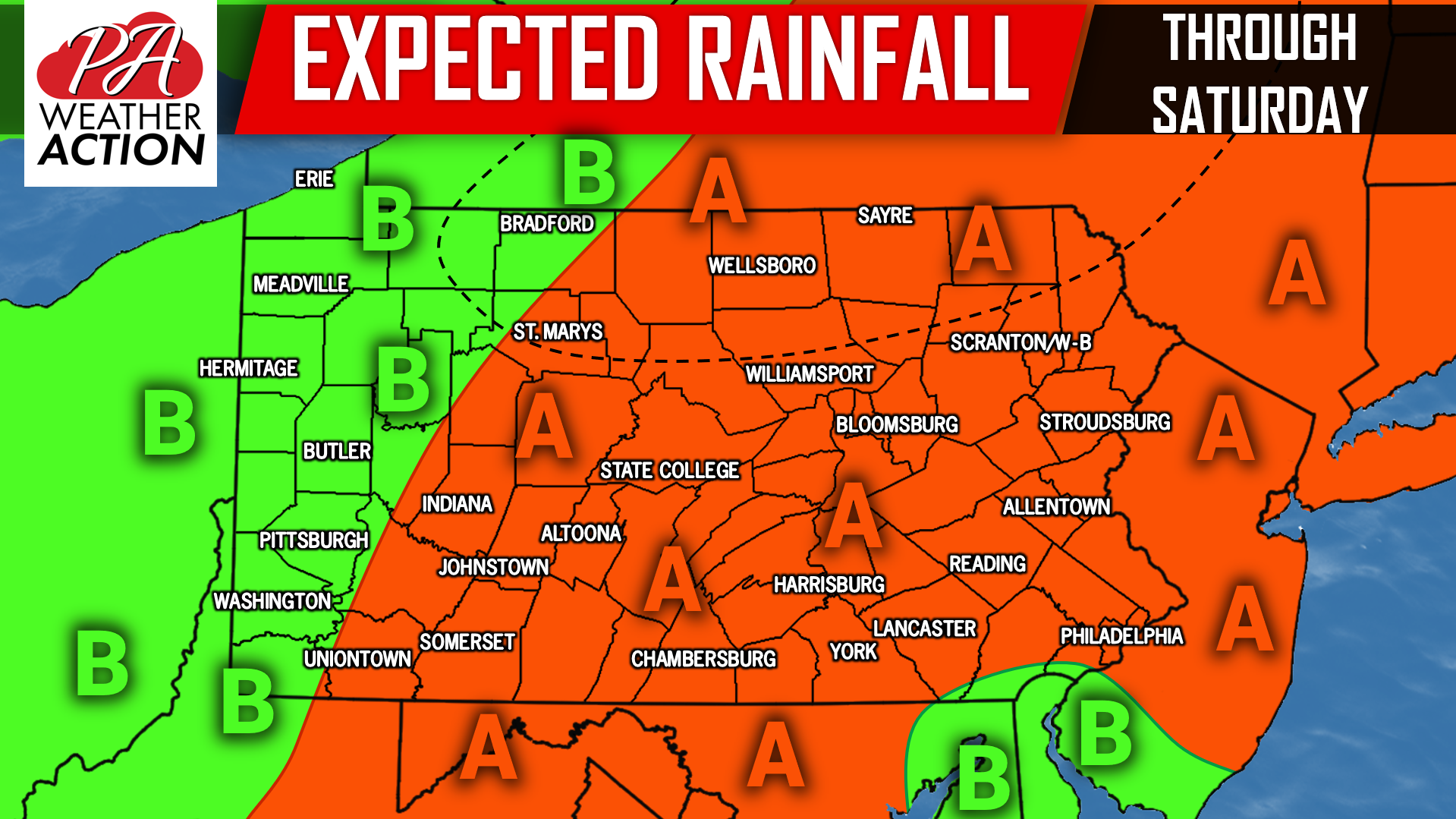
Area A: In general, 1 to 2 inches of rainfall can be expected, with isolated locations receiving more. Winds will be whipping 20 to 30 MPH Saturday with gusts higher at times.
Area B: A half inch to 1 inch of rainfall can be expected for these locations. Winds will be whipping 20 to 30 MPH Saturday with gusts higher at times.
**For areas outlined in the black dashed line in Northern PA only**: Locations in this area have the best opportunity to change rain showers to snow showers Saturday evening. We do not anticipate any accumulations, but do not be surprised if you see snowflakes fly Saturday evening!
For the latest weather information, follow our Facebook page by clicking here: Pennsylvania Weather Action’s Facebook page
Download our app today to keep you ahead of this weekend’s Nor’easter, click here: Pennsylvania Weather Action’s App
You must be logged in to post a comment.