
For those that have been following us since we released our official winter outlook back in early November, you are aware we have been expecting a colder than normal December that would allow for many areas to begin the winter season snowy. Sure enough, all guidance and observations over the last week suggests we are right on track for a very cold December and potentially snowy.
A cold and snowy December has been rather unusual around Pennsylvania over the last few years. In fact our last cold and snowy December was back in 2013. Since then, our Decembers have been rather warm and snow-less. Take a look at temperatures anomalies from December 2015 (left) and December 2016 (right) below: 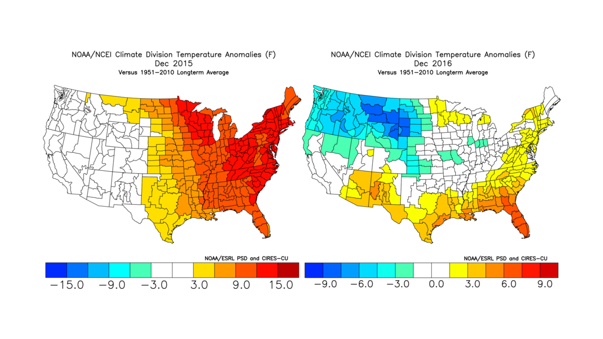
Almost 100% of the time, pattern changers are caused by a strong storm system. This pattern changer is no different. A strong low pressure will gather strength over the Mid-West early next week. By Tuesday the system will push north into Canada, as it does, a trailing cold front will push through our area Tuesday night into Wednesday. Rain showers are expected during this time, however temperatures will be crashing as the cold front pushes through. If the rain/snow line catches up to the precipitation, rain showers could turn over to snow showers on Wednesday. The European model does suggest this for the interior portions of Pennsylvania. We will continue to monitor that potential as we move closer.
Until the cold front passes by, the first several days of December will be warmer than average, very similar to the past week or so. Below is a look at the temperature pattern beginning December 1st through December 6th:
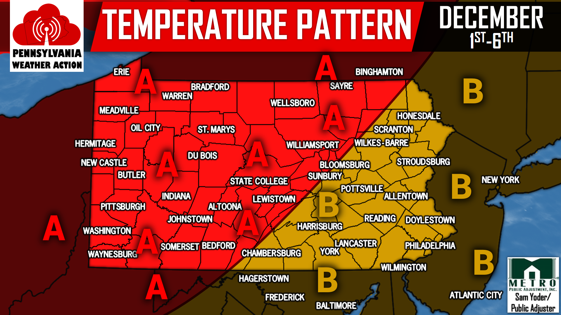
AREA A: Temperatures will average above normal through December 6th.
AREA B: Temperatures will average slightly above normal through December 6th.
The storm that will deliver the cold front is the pattern changer going forward from December 7th onward. The West Coast will be dominated by a ridge, while the East Coast is dominated by a trough. This will allow for sustained cold, with several days struggling to reach the mid 30s for high temperatures for many locations. Below is a look at the United States weather pattern going forward using the GEFS valid for December 8th: 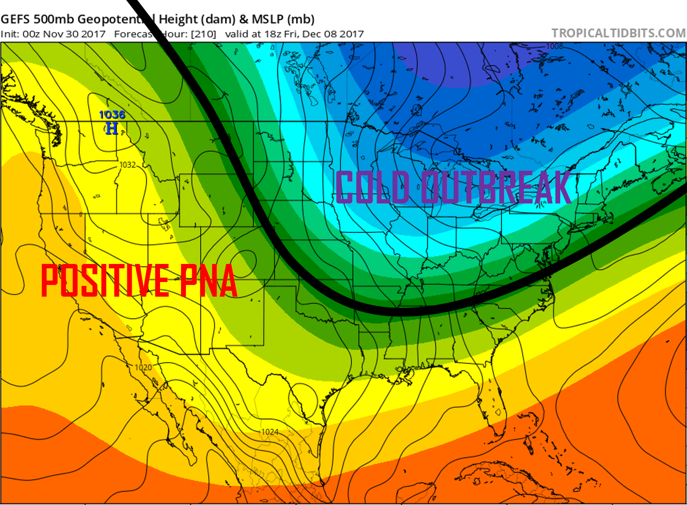
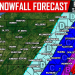
The black line indicates the jet stream. In this type of pattern, Pennsylvania is sitting pretty for snow lovers. Plenty of cold air in place, now we just need some precipitation. Currently we are not tracking any storm in particular as it is too far out to do so, however there are many opportunities for snow down the line.
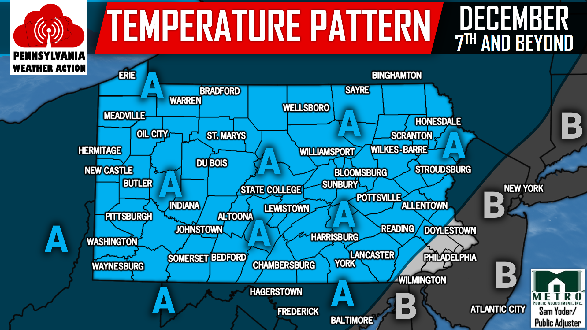
Below is the expected temperature pattern from December 7th onward:
AREA A: Below to well below normal temperatures is expected from December 7th onward. This increases the opportunity for above normal snowfall to occur during the month of December.
AREA B: Below normal temperatures is expected from December 7th onward. This increases the opportunity for above normal snowfall to occur during the month of December.
It is imperative to have us liked on Facebook as we approach December so you can stay ahead of the winter weather, click here>>>Pennsylvania Weather Action’s Facebook Page
Share the wintry news with your family and friends using our icons below!

You must be logged in to post a comment.