
Below average temperatures are expected this week. The passage of a low pressure system will bring chances for rain through mid-week, some rainfall could be heavy at times.
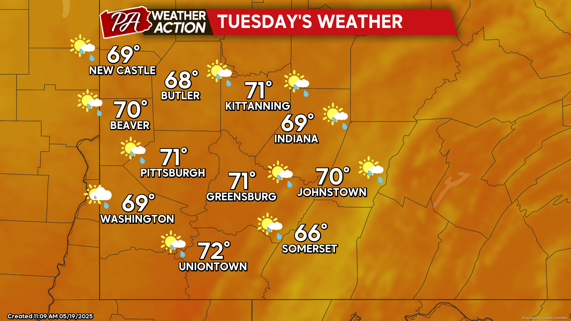
Tuesday
Mostly sunny conditions will transition to the chance for showers in the evening and overnight hours. Highs will be in the low 70s to mid 60s, lows will be in the mid to low 50s. Winds will be out of the east at 5-7 mph.
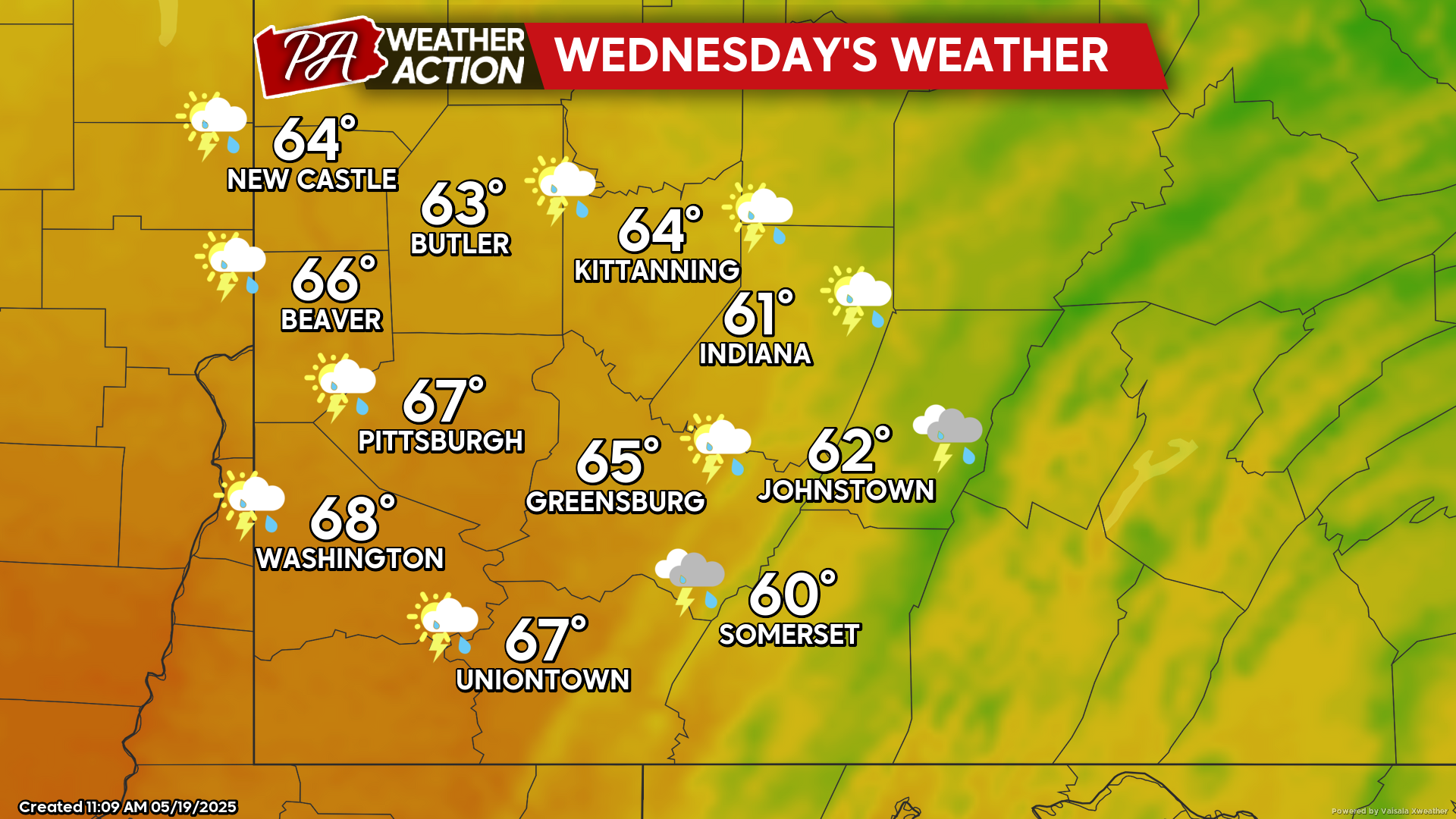
Wednesday
Showers and thunderstorms are expected, with the greatest chance for thunderstorms being in the afternoon hours. Highs will be in the mid to low 60s, lows will be in the low 50s to mid 40s. Winds will be out of the south-southeast at 5-10 mph, wind gusts approaching 20+ mph are possible.
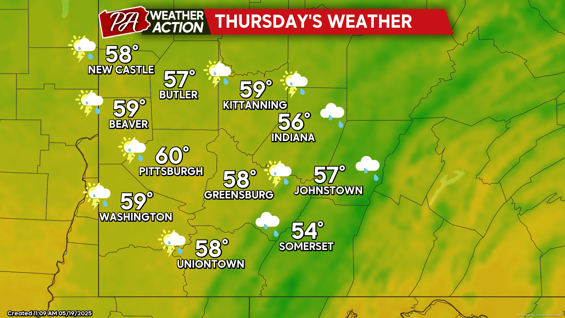
Thursday
Showers and thunderstorms are expected to continue. Highs will be in the low 60s to mid 50s, lows will be in the mid to low 40s. Winds will be out of the west at 5-10 mph, wind gusts approaching 25 mph are possible at times.
Chances for showers will continue Friday and early Saturday. Be sure to follow PA Weather Action for more details and daily statewide forecasts.

You must be logged in to post a comment.