
A low pressure system will bring daily rain chances for most of the week. Temperatures will gradually rise after a cool down expected on Tuesday. Severe thunderstorms are possible late Thursday into Friday.
Tuesday
Patchy fog during the morning hours will transition to mostly cloudy conditions with a chance for afternoon showers and thunderstorms. Highs will be in the low 70s to mid 60s, lows will be in the low 60s to upper 50s. Winds will be out of the southeast at 5-15 mph, wind gusts could approach 25 mph, especially in any thunderstorms.

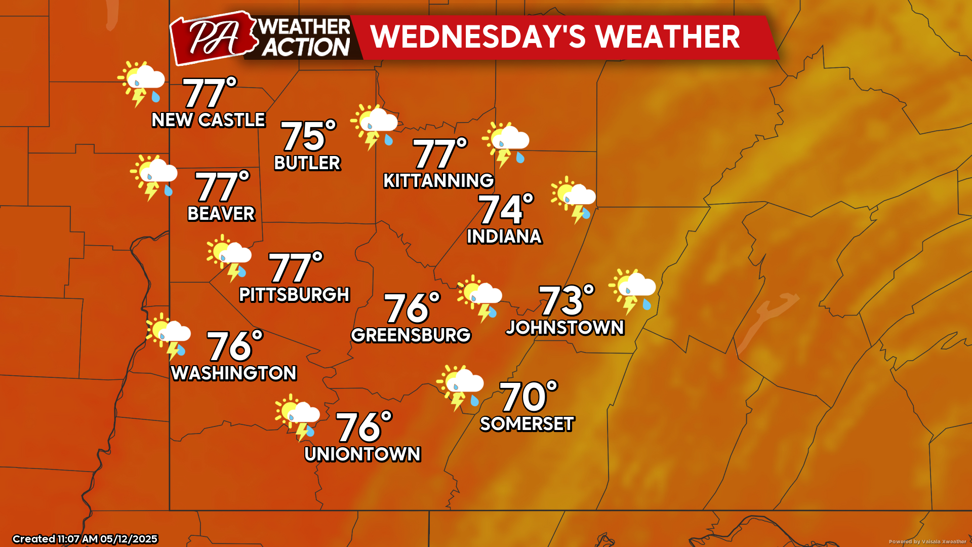
Wednesday
Mostly cloudy conditions with afternoon showers and possibly a thunderstorm. Highs will be in the mid to low 70s, lows will be in the low 60s to mid 50s. Winds will be out of the southeast at 5-10 mph.
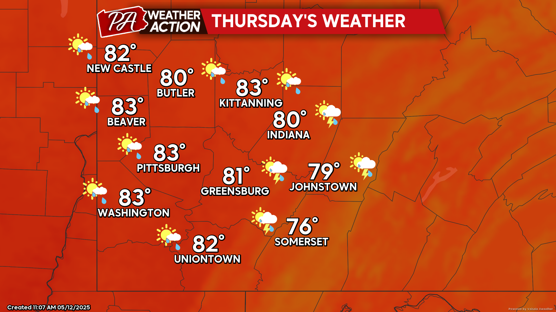
Thunrsday
Mostly sunny conditions will transition to afternoon showers and thunderstorms, some storms may be severe later in the day. Temperatures will be above average with highs in the low 80s to mid 70s, lows will be in the mid 60s to upper 50s.
Chances for showers will continue throughout the week and into the weekend. Be sure to follow PA Weather Action for more details and daily statewide forecasts.


You must be logged in to post a comment.