
Showers and thunderstorms are expected through midweek, extending and expanding the chances for flash flooding in flood-prone areas. Some storms could be severe within the region. Windy conditions are expected on Thursday.
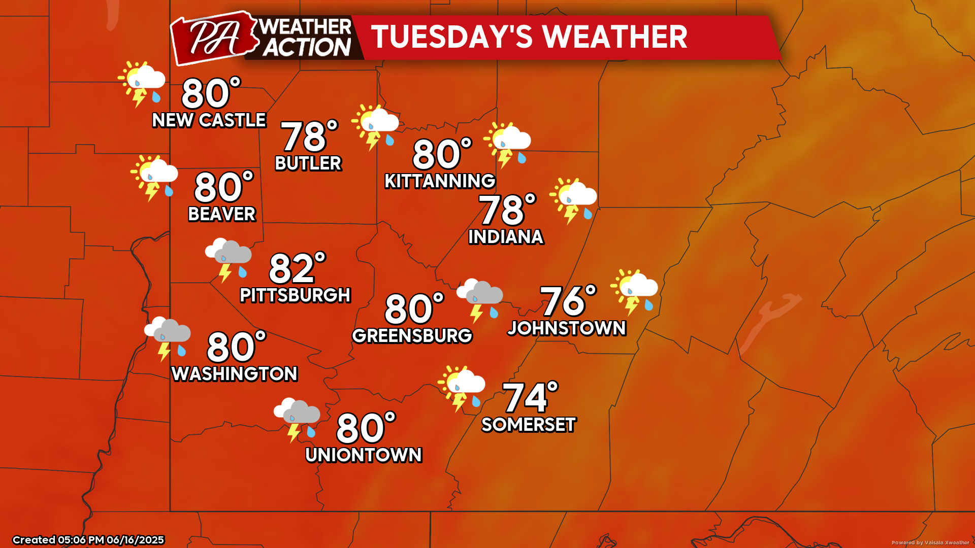
Tuesday
Showers and thunderstorms, with the potential for thunderstorms being greatest beginning in the late afternoon hours and continuing overnight. Highs will be in the low 80s to mid 70s, with lows in the upper to mid 60s. Winds will be out of the south-southwest at 3-8 mph.
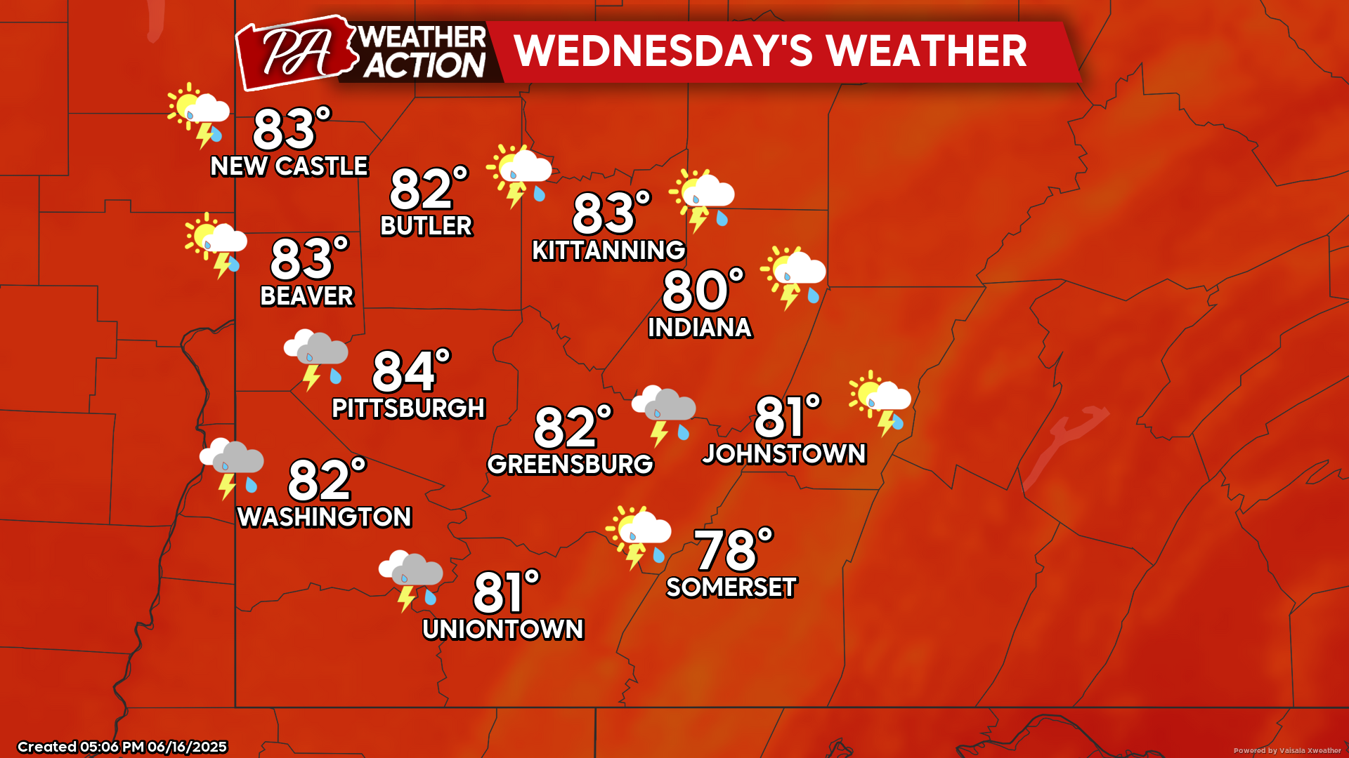
Wednesday
Showers and thunderstorms with multiple rounds of storms are possible throughout the day. Highs will be in the low 80s to upper 70s, lows will be in the low 70s to mid 60s. Winds will be out of the southwest at 5-10 mph, and wind gusts approaching 25 mph are possible in some areas.
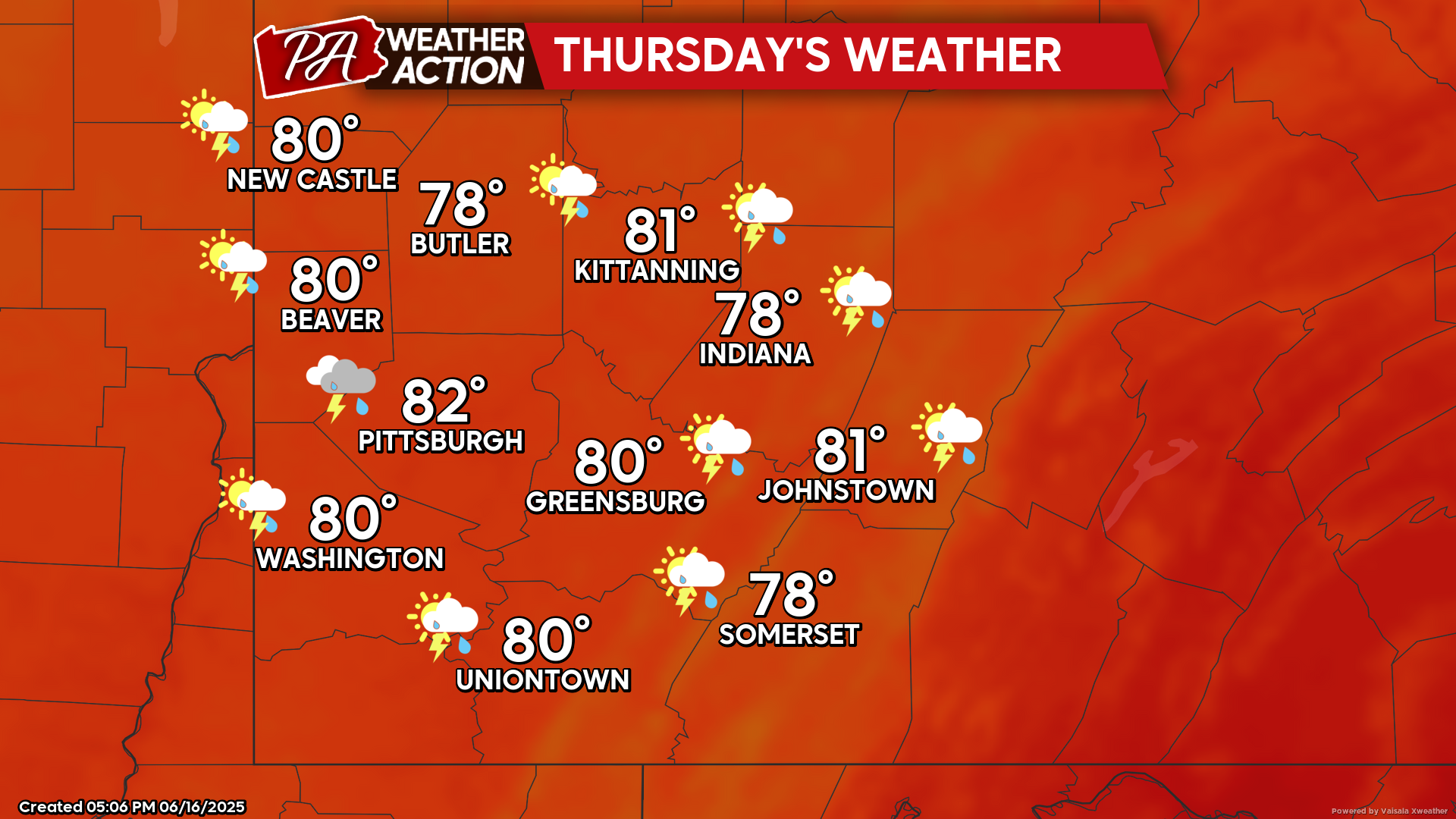
Thursday
Breezy conditions with chances for showers and thunderstorms throughout the day. Highs will be in the low 80s to upper 70s, lows will be in the low 60s to upper 50s. Winds will be out of the southwest, increasing throughout the day, between 10-25 mph, with wind gusts approaching 45 mph being possible throughout the region.
Drier conditions are expected this weekend. Be sure to follow PA Weather Action for more details and daily statewide forecasts.

You must be logged in to post a comment.