
Clouds will be increasing today as a result from our approaching system that will deliver a period of light snow beginning late tonight into tomorrow morning. 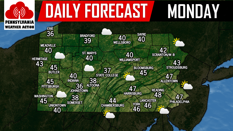
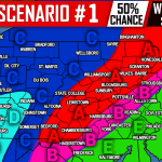
There will be adjustments on our final call this evening with snowfall amounts, however timing looks to remain the same. Snow will begin to overspread Western Pennsylvania after 9:00 PM tonight and will spread eastward into Central and Eastern Pennsylvania after midnight. Below is the latest future radar valid for 1:00 AM tomorrow morning: 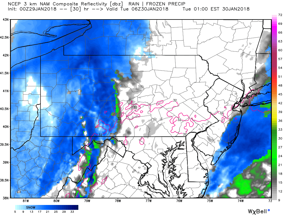
This will be a quick hitter and amounts will be on the light side. But once again, this is another system because of the timing, it will impact the morning commute to work and school tomorrow. The snow will likely not clear out of Eastern Pennsylvania until late tomorrow morning. Below is the future radar valid for 10:00 AM tomorrow morning: 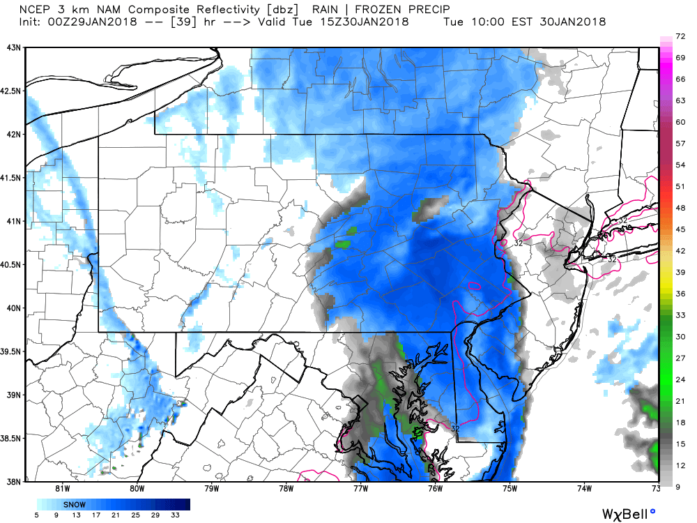
We will have our final forecast out this evening, but if you missed last night’s first call, click this link here>>>First Call Snow Forecast
You must be logged in to post a comment.