
A mix of clouds and sunshine is expected today with temperatures in the 30s and 40s. 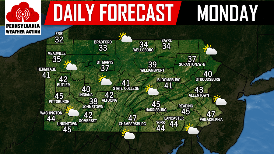
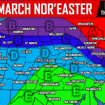
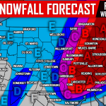
We continue to watch a coastal storm system that has the potential to make an impact for many areas in our region especially across Eastern Pennsylvania. As of this morning, the National Weather Service has issued a Winter Storm Watch for several counties in Eastern Pennsylvania. With that being said, there is still a significant difference in the model guidance we look at.
There will be a sharp cutoff to the western edge of the precipitation shield from this storm system. Where exactly this cutoff sets up, will determine how much snow our coverage area will see. Taking a look at the latest NAM future radar valid for 7:00 PM, it shows the heaviest snows confined to the Eastern third of Pennsylvania: 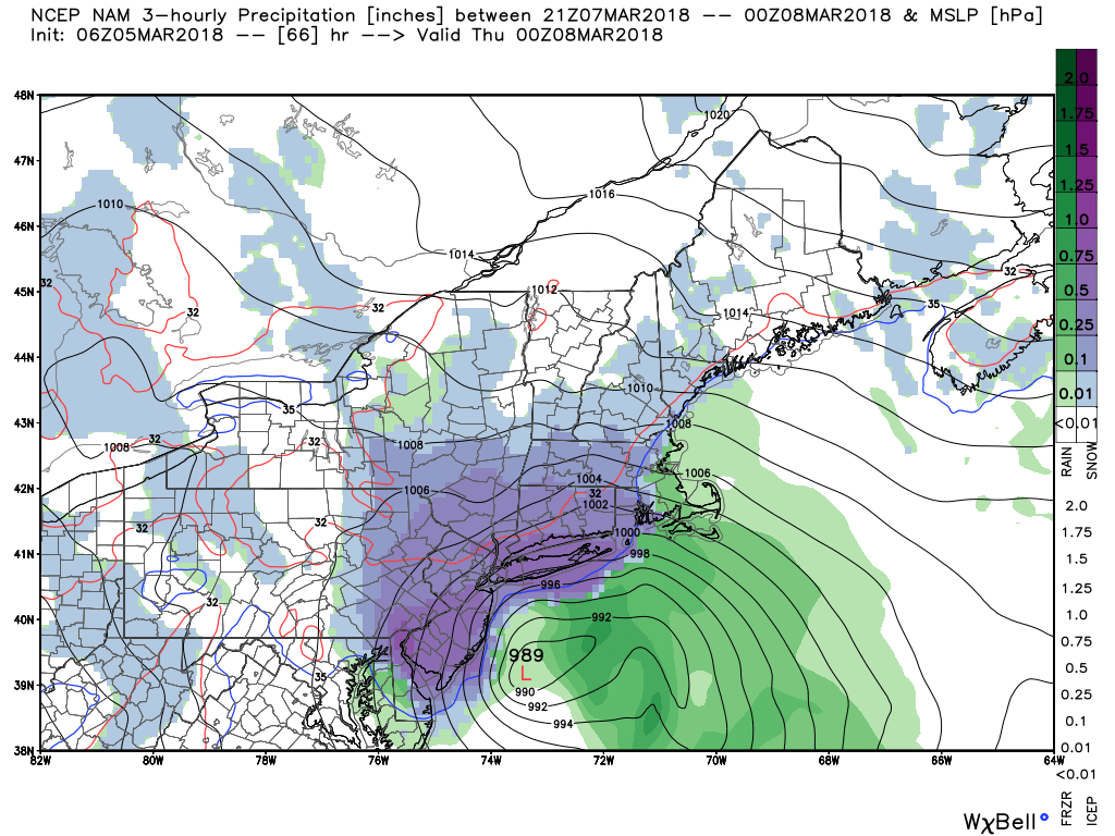
If this particular scenario did play out verbatim, Eastern Pennsylvania would receive a significant to major snowstorm. However, other guidance suggest this cutoff to be farther east. In that scenario, the heavier bands of snow stay in New Jersey and miss our area.
We have a lot to narrow down over the next 12 hours until we release our first call this evening. What we do have narrowed down at this point is timing. If this storm does occur, snow will begin late Wednesday morning and will continue through Wednesday night.
You must be logged in to post a comment.