
Since our first call yesterday afternoon, model guidance has trended west with the precipitation for our coastal storm. While this does increase snow totals for many people, areas in far Southeast Pennsylvania might have their totals trimmed down. As a result of the west trend, the storm system will be warmer for these areas. Mixing with sleet and even plain rain is definitely possible at times around Philadelphia.
An area of rain and snow that has already developed across Central Pennsylvania this afternoon will continue to push east. By nighttime, the majority of this precipitation will be all snow. This is not directly associated with our coastal storm. This is overrunning precipitation, or in other words “bonus precipitation”. Below is a look at 11:00 PM tonight: 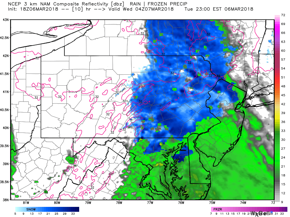
The overrunning precipitation will continue through at least 3:00 AM. There is likely to be a break in the action before our coastal storm really begins to strengthen and move up the coast until about 7:00 AM tomorrow morning. By 8:00 AM, heavy snow is pushing northwest into Southeast PA and the Lower Susquehanna Valley: 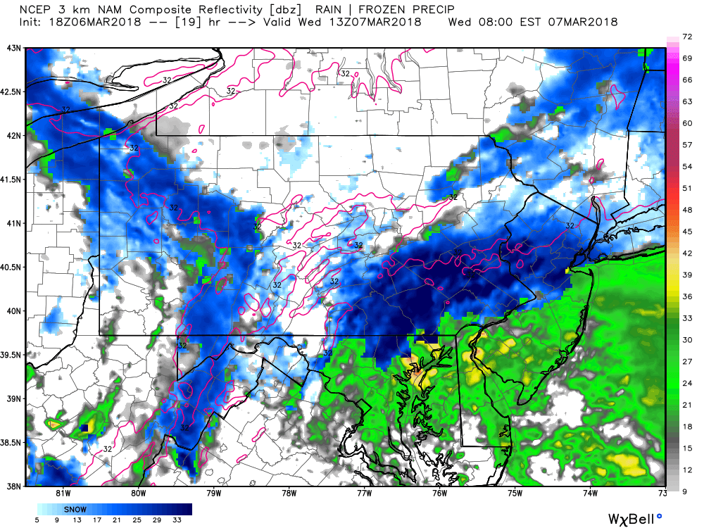
Notice far Southeast Pennsylvania is right next to the rain/snow line. By 11:00 AM heavy snow has made its way into much Central and Eastern Pennsylvania: 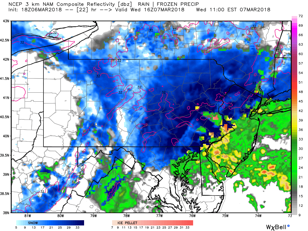
Snow will continue to fall heavily across Central and Eastern Pennsylvania as we move forward to 2:00 PM Wednesday afternoon. Snowfall rates as high as 2″ per hour are certainly possible under the strongest bands: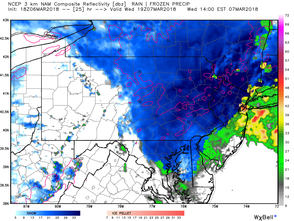
By 5:00 PM tomorrow afternoon snow will be wrapping up in Central Pennsylvania, but heavy snow will still be falling across Eastern Pennsylvania: 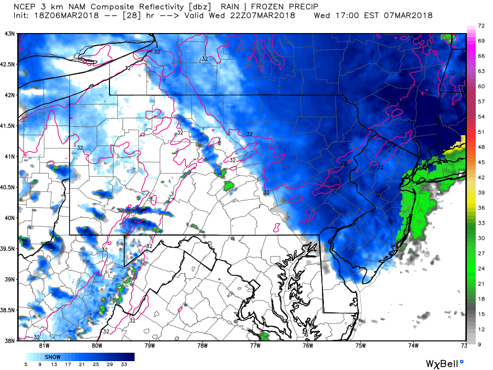
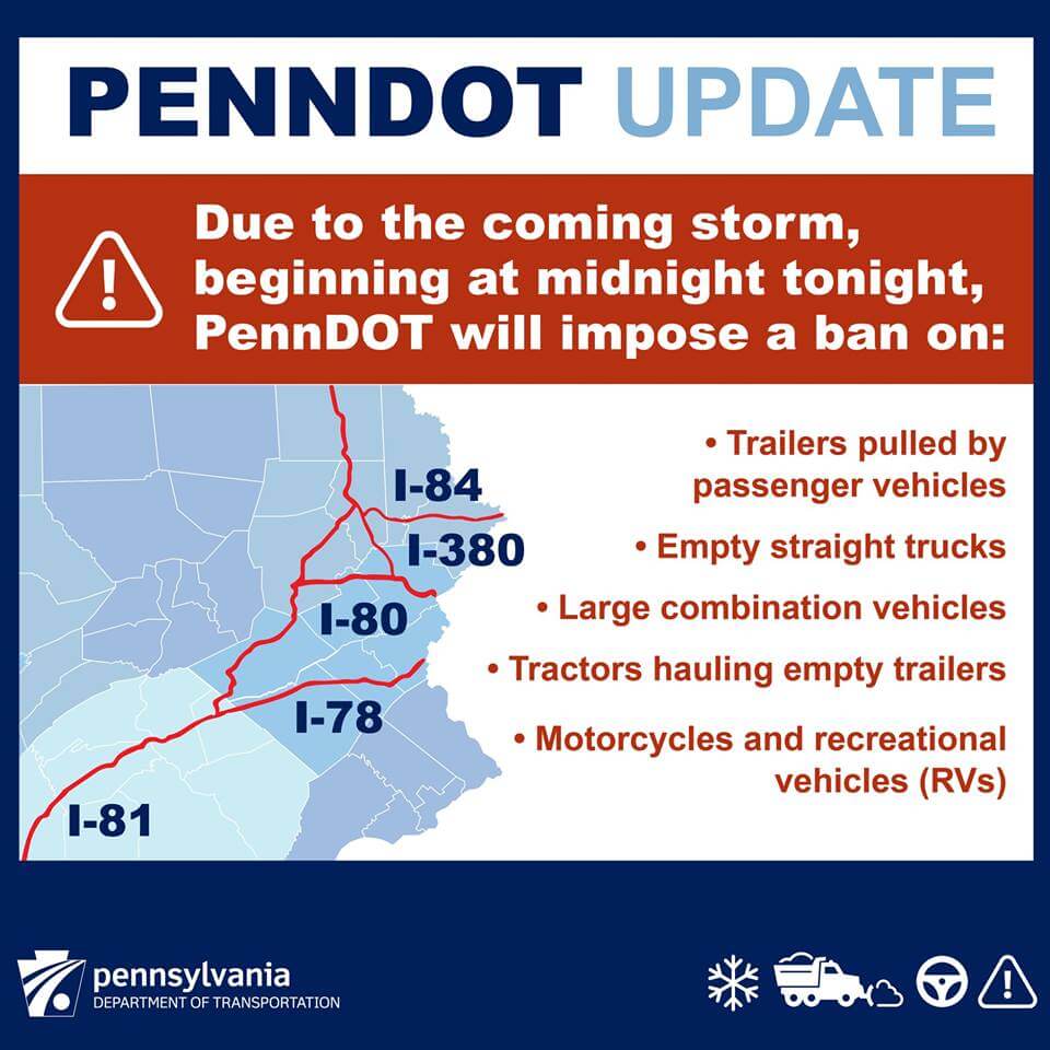
Snow will not taper off in Eastern Pennsylvania until 7:00 PM Wednesday Evening. PennDOT will impose a ban on major roadways in Eastern PA at midnight tonight. Here are the details:
FINAL CALL SNOWFALL FORECAST FOR WEDNESDAY’S MAJOR WINTER STORM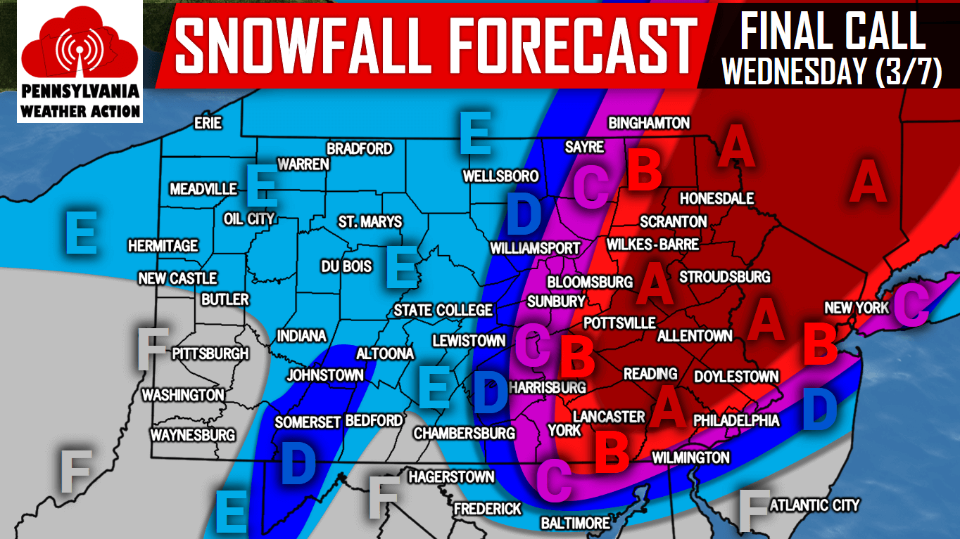
Area A: Snow accumulations of 12-18″ are expected within this area. Travel will be near-impossible Wednesday. Snowfall rates of 1-2″ an hour expected.
Area B: Snow accumulations of 8-12″ are expected within this area. Travel will be very difficult to near impossible Wednesday.
Area C: Snow accumulations of 5-8″ are expected within this area. Travel will be difficult Wednesday.
Area D: Snow accumulations of 3-5″ are expected within this area. Travel will be hazardous especially on secondary roads.
Area E: Snow accumulations of 1-3″ are expected within this area.
Area F: Snow accumulations of <1″ are expected within this area.
Be sure to follow us on our Facebook page for updates and live streams during this Major Winter Storm by clicking here>>>PA Weather Action on Facebook
Warn your friends and family of this imminent major winter storm using the sharing icons below!

You must be logged in to post a comment.