
After a steady rain for our central and eastern counties early this morning, temperatures will rise well into the 50s for most areas out ahead of a strong cold front. Temperatures will peak during the early afternoon for many of us before rapidly crashing later in the afternoon and evening. Winds will be on the increase as well as we reach the afternoon hours and will only get stronger as we head into nighttime. All of the state is under a high wind warning, which is not too common around our area. Sustain wind speeds of 20 to 40 MPH is likely, with winds gusting to 50 to 60 MPH at times. Scattered power outages are possible due to the gusty wind. 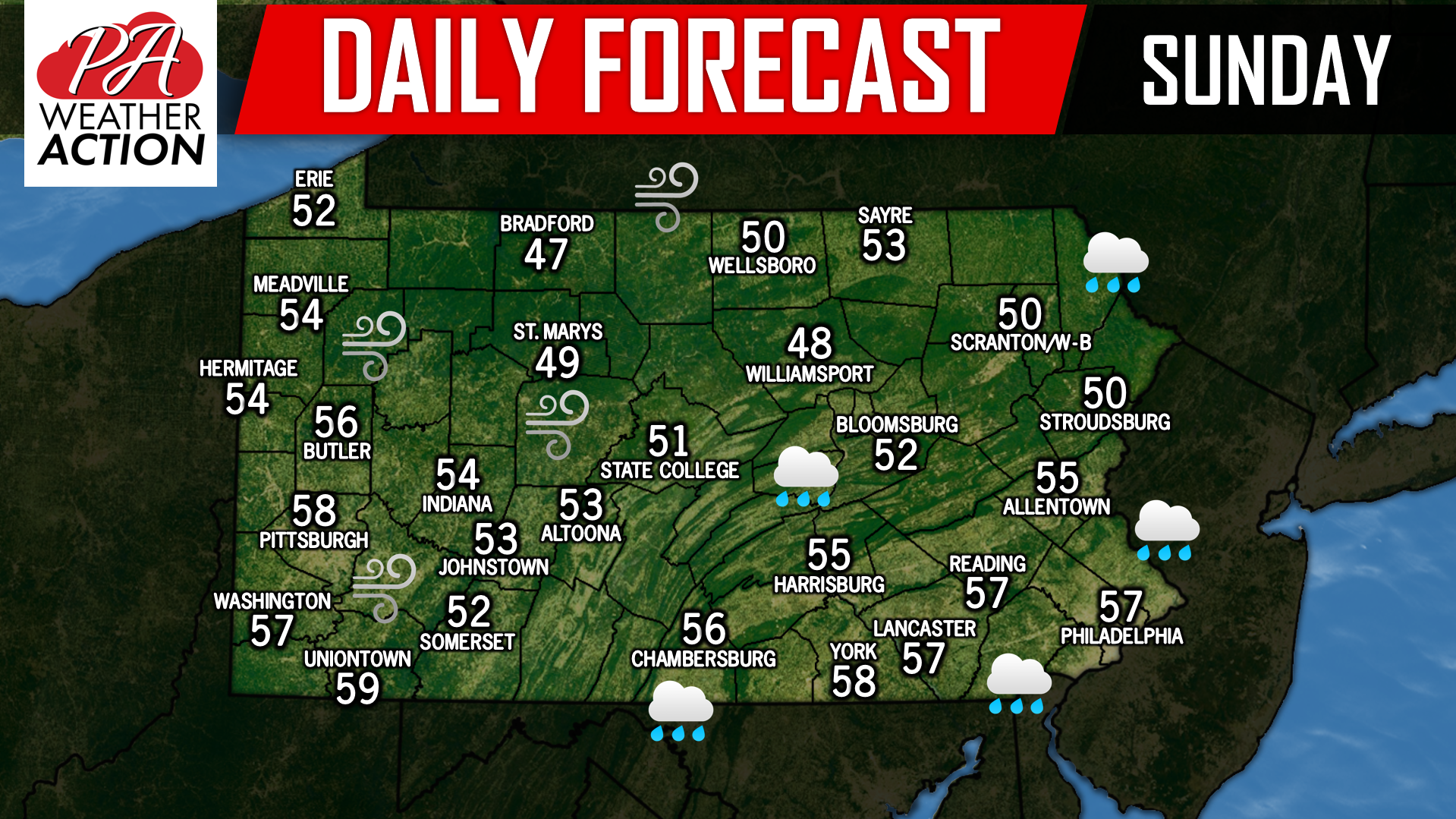
Posted inDaily Forecast
Daily Forecast for Sunday, February 24th, 2019
Post navigation
Previous Post
 Final Call for Wednesday’s Significant Winter Storm
You must be logged in to post a comment.