
In the last 24 hours, model guidance has expanded the shield of heavy snow about 50 miles north, while keeping a quick changeover to sleet out of the picture in Southern PA. As a result, you will see our snowfall forecast now gets areas around and even north of i-80 in on the action.
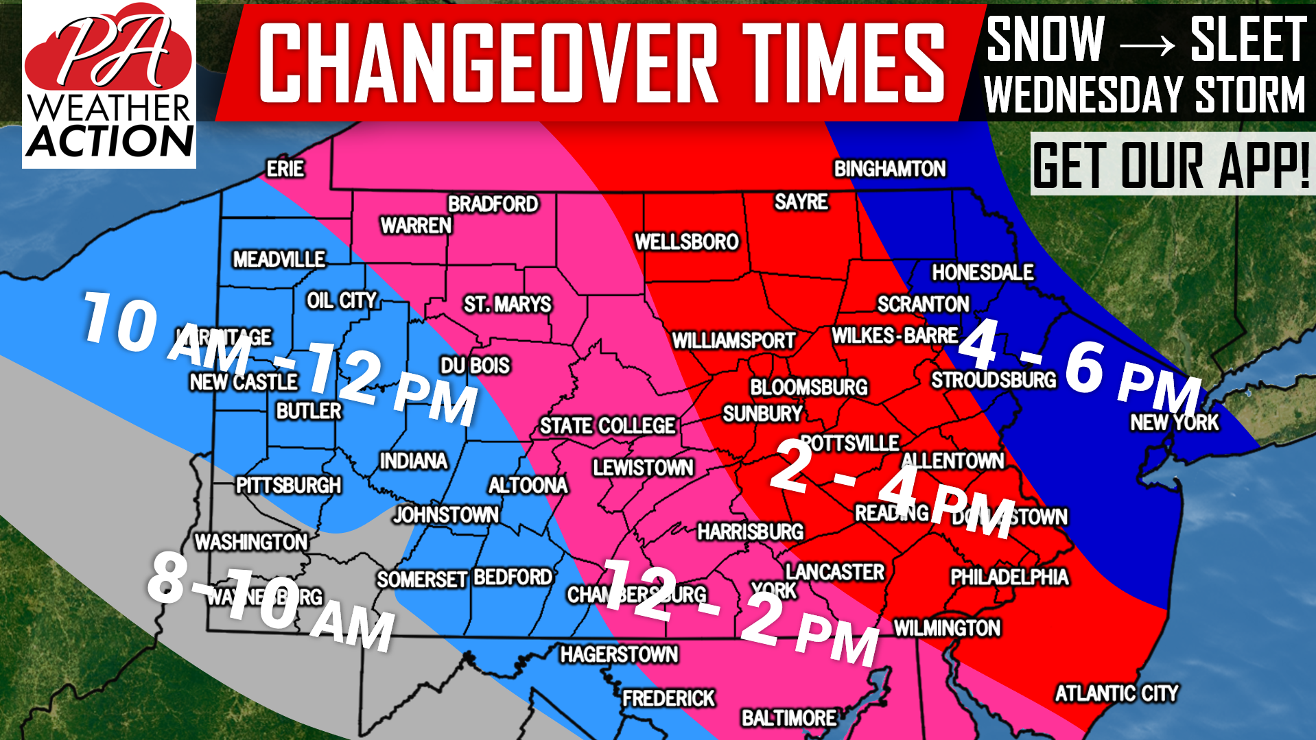
All of us will start as snow, which will come in from southwest to northeast Wednesday Morning. By the afternoon, we will changeover from southwest to northeast to sleet, followed by freezing rain. We will get into precise timing with future radar, but first here is a graphic showing when we expected heavy snow to transition to sleet.
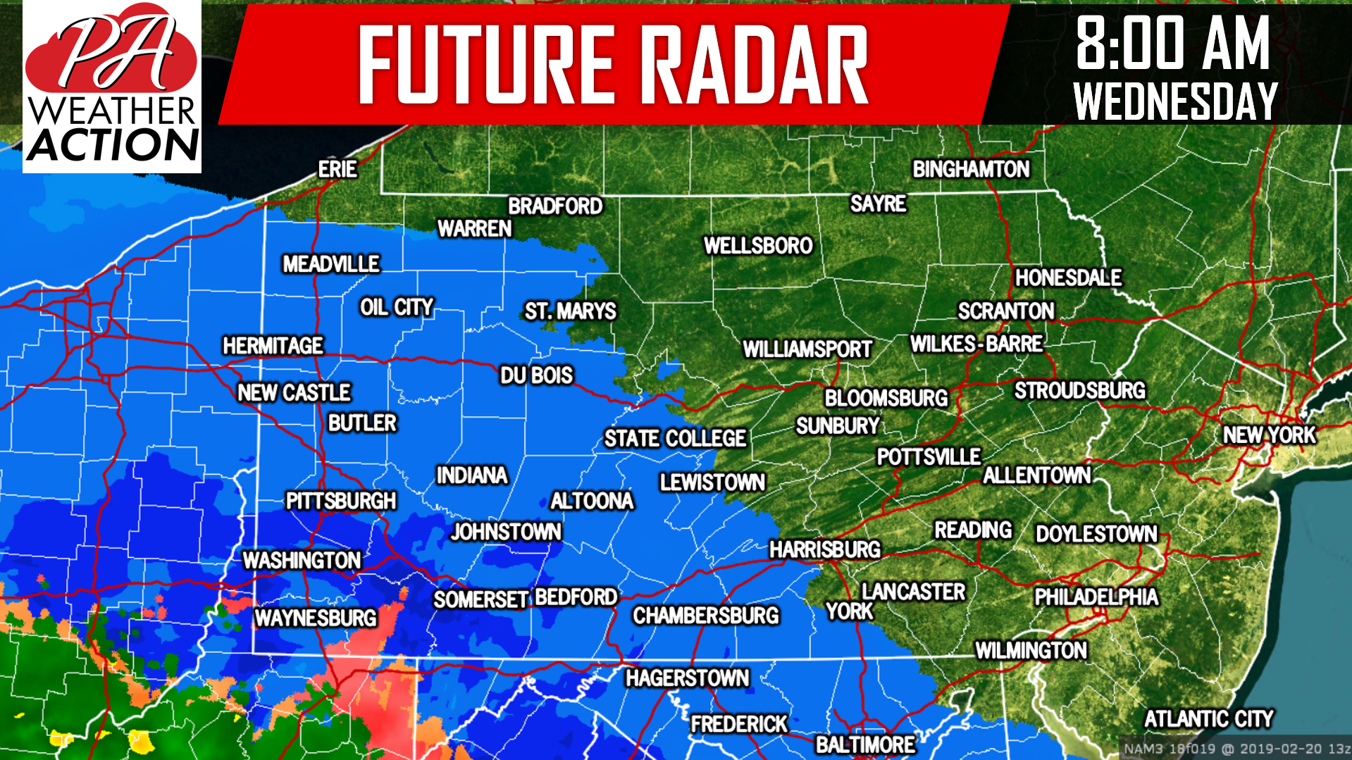
By 8:00 AM Wednesday morning, moderate to heavy snow will overspread much of the western half of the state. The morning commute will not be impacted, which is good and bad. The evening commute is going to be very hazardous. Because while these snow totals aren’t anything major, there is a big difference in 5 – 8″ falling in 15 hours, as opposed to six. Road crews will not be able to keep up with the snowfall rate in many areas. Here is future radar for 8:00 AM Wednesday:
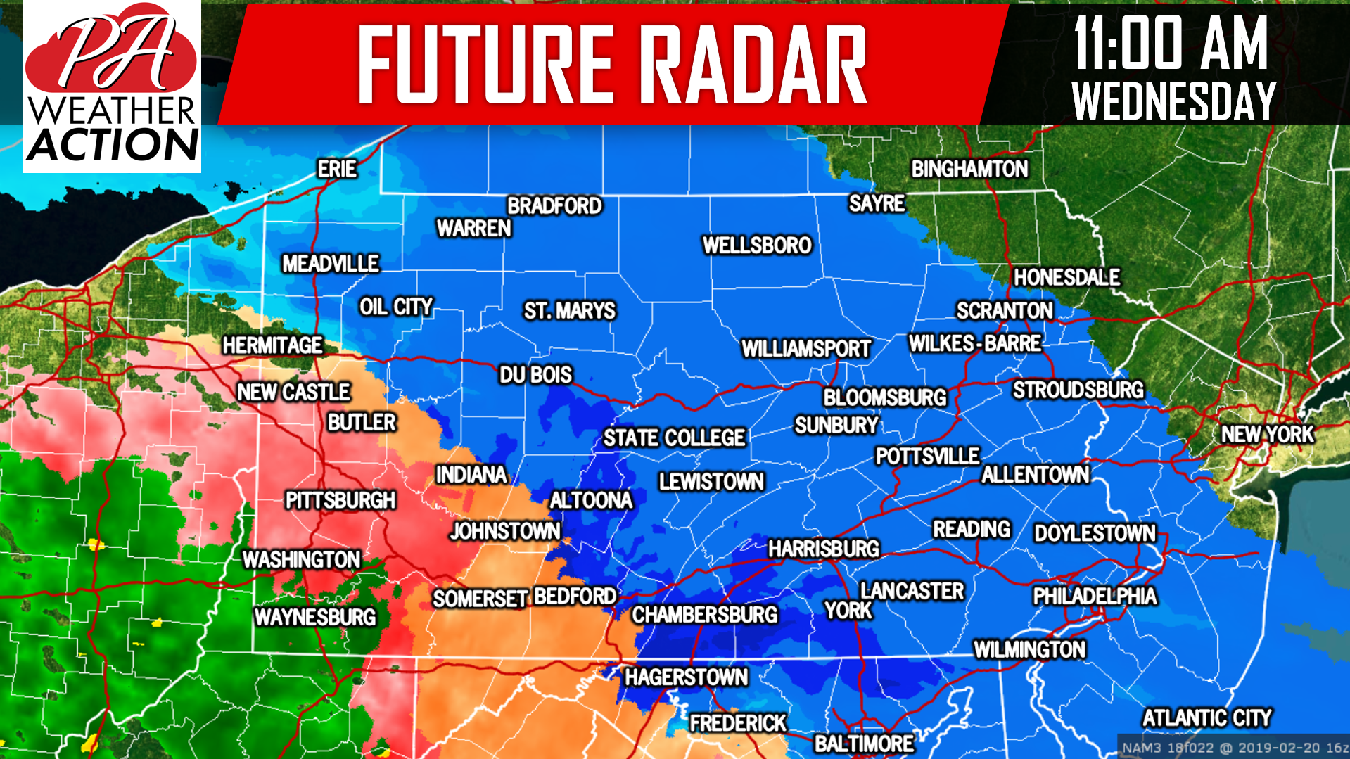
 The heaviest snowfall rates of 1 – 2″ an hour will come around lunchtime for many of us. Southwest PA will be likely have changed over to a wintry mix, while snow in Eastern PA pushes as far north as Scranton. Below is future radar for 11:00 Wednesday:
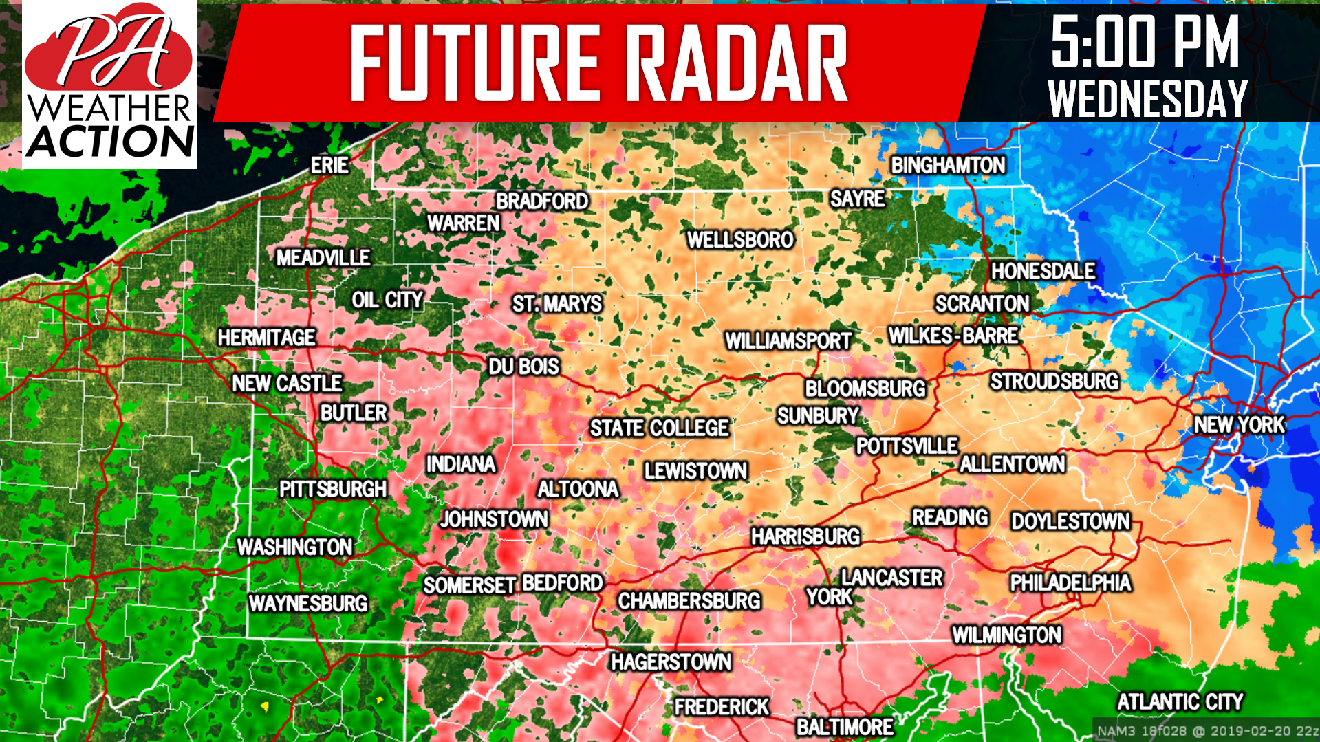
 By 5:00 PM Wednesday we will have a mess of freezing rain and sleet across the state, with Southwest PA rising above freezing and turning to plain rain:
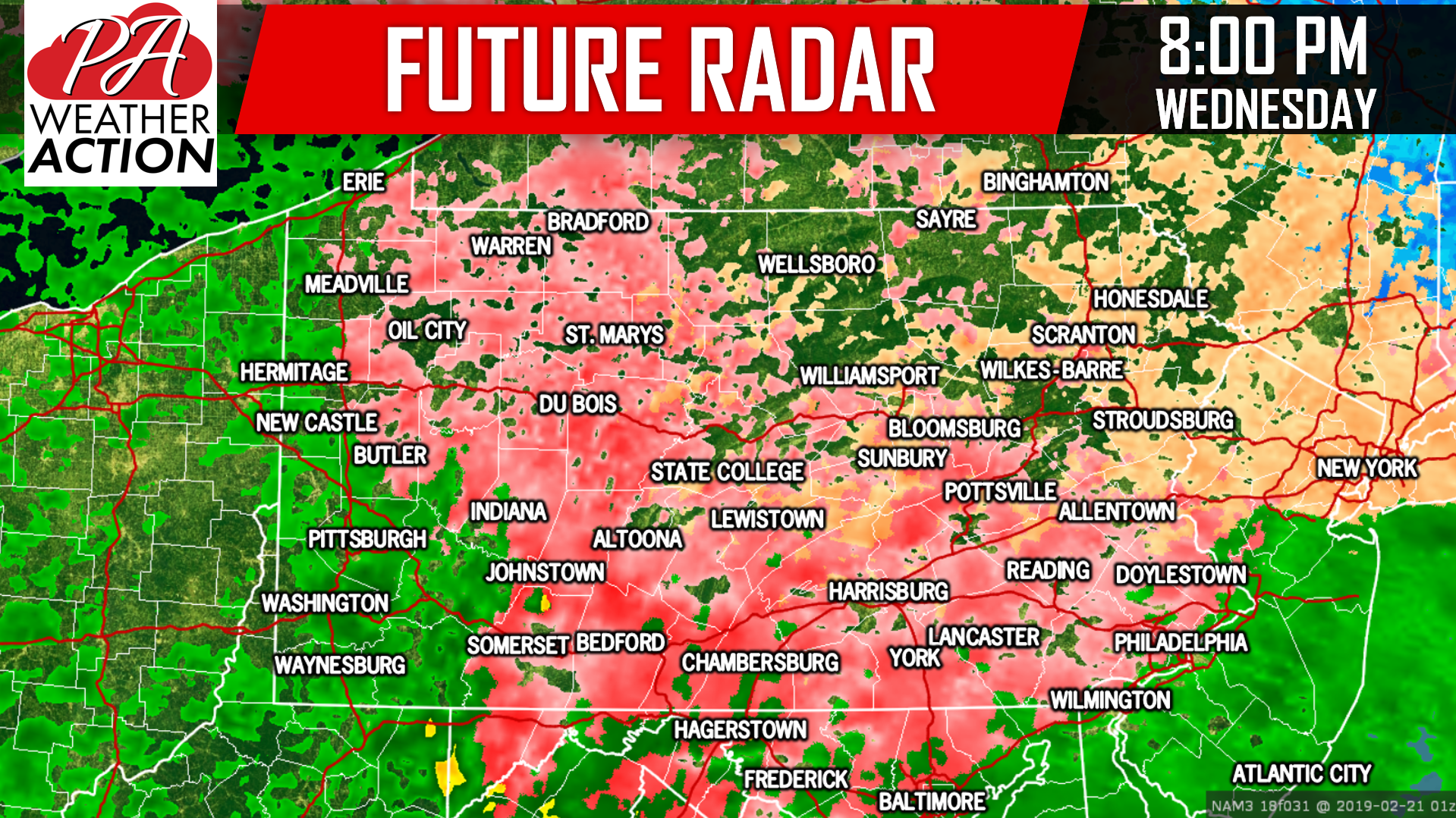
 Finally, many of us will be seeing freezing rain by the time 8:00 PM Wednesday Evening rolls around:
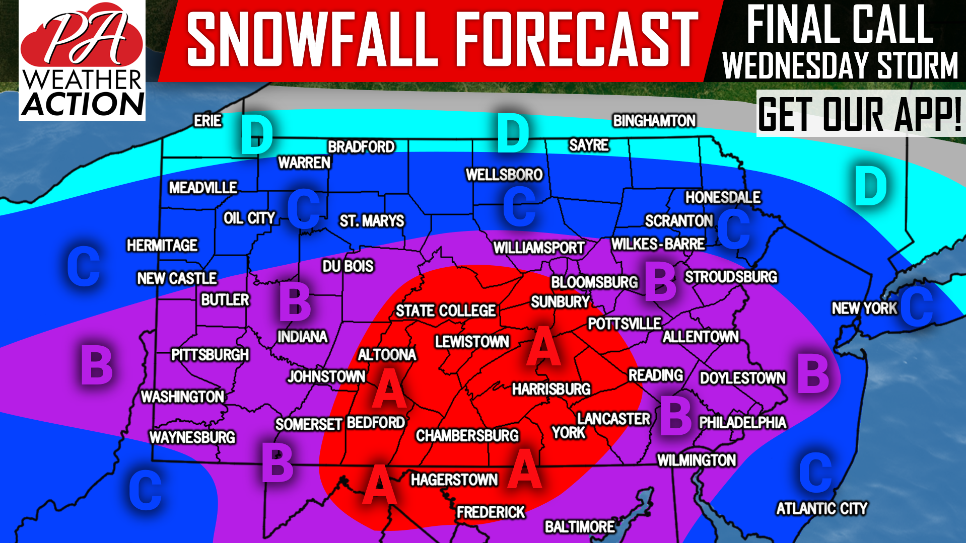
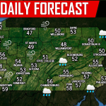
FINAL CALL SNOWFALL FORECAST FOR WEDNESDAY
Be sure to view our ice forecast below this.
Area A: Snowfall of 5 – 8″ expected. Visibility of a quarter mile and snow and ice-covered roadways will make travel dangerous on primary roads to near-impossible on secondary roads by late morning Wednesday, through Wednesday Night.
Area B: Snowfall of 3 – 5″ expected. Visibility of a quarter mile and snow and ice-covered roadways will make travel dangerous by late morning Wednesday, through Wednesday Night.
Area C: Snowfall of 2 – 3″ expected. Visibility of a quarter to a half mile and snow and ice-covered roadways will make travel very hazardous in the late morning through Wednesday Night.
Area D: Snowfall of 1 – 2″ expected.
FINAL CALL ICE FORECAST FOR WEDNESDAY
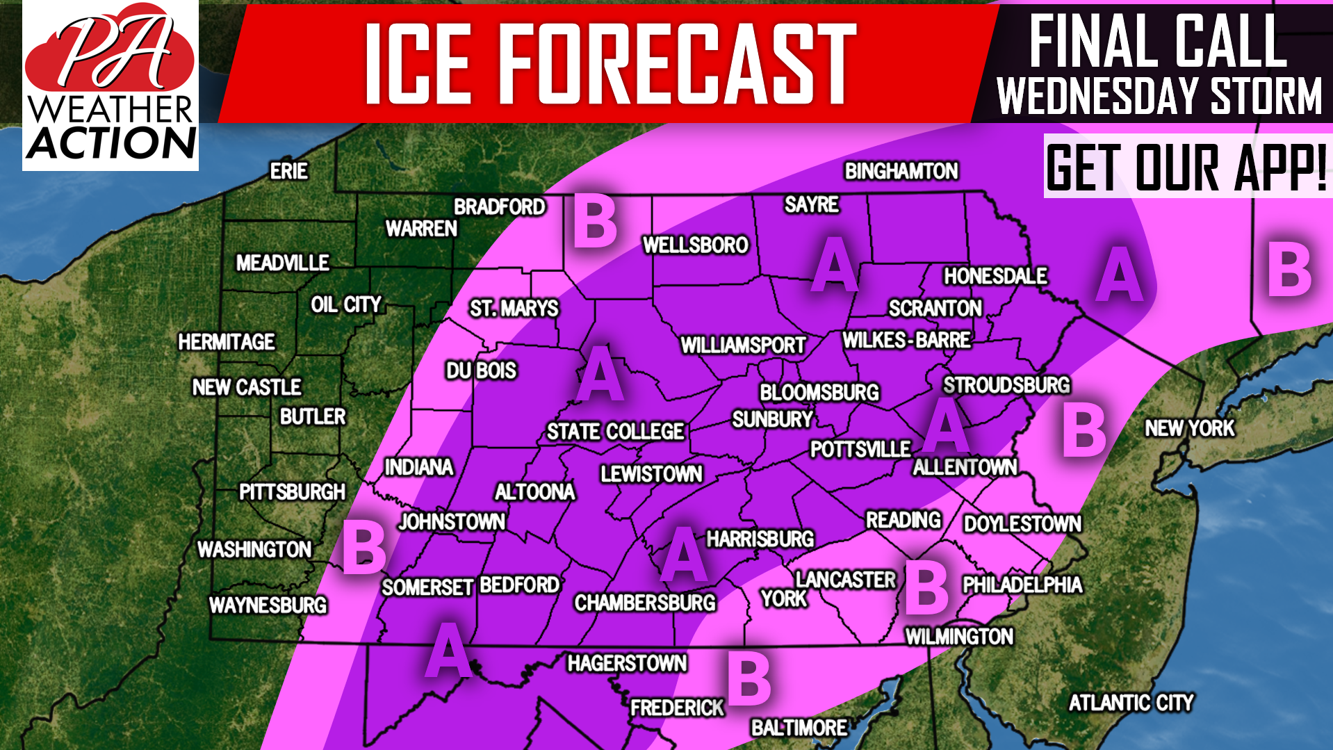
Area A: Ice accumulation of .10 – .25″ expected. Scattered power outages possible.
Area B: Ice accumulation of .01 – .10″ expected. Isolated power outages possible.
Download our app for your area’s alerts, hourly & daily forecast, radar and road condition cameras, download our free app >>> PA Weather App!
Be sure to share this important forecast with your friends and family using the button below!
You must be logged in to post a comment.