
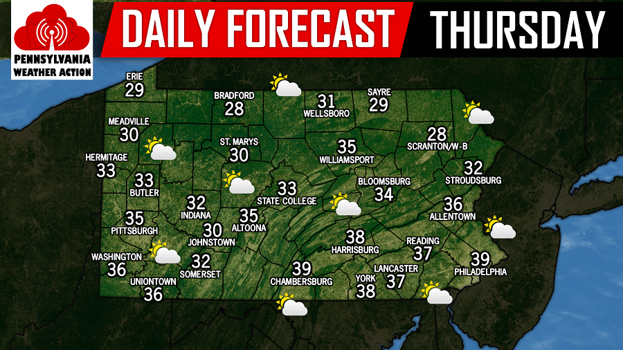
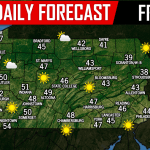
A calm and quiet seasonal winter day is expected across the state today. Clouds may dominate the morning hours, but peaks of sunshine are expected, especially during the afternoon hours.
Our next chance of precipitation continues to be late Saturday night into the early morning hours of Sunday. The good news is, the precipitation will be in the form of light rain. Below is the GFS valid for 1:00 AM Sunday morning: 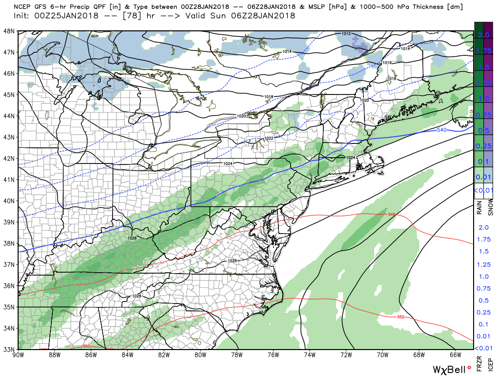 After this system passes through, our attention turns to a potential coastal system for Monday. As it stands right now, storm remains far enough out to sea to spare any of the region from snow. If this storm were to take a track closer to the coast, regions especially across Eastern Pennsylvania could see a period of snow on Monday.
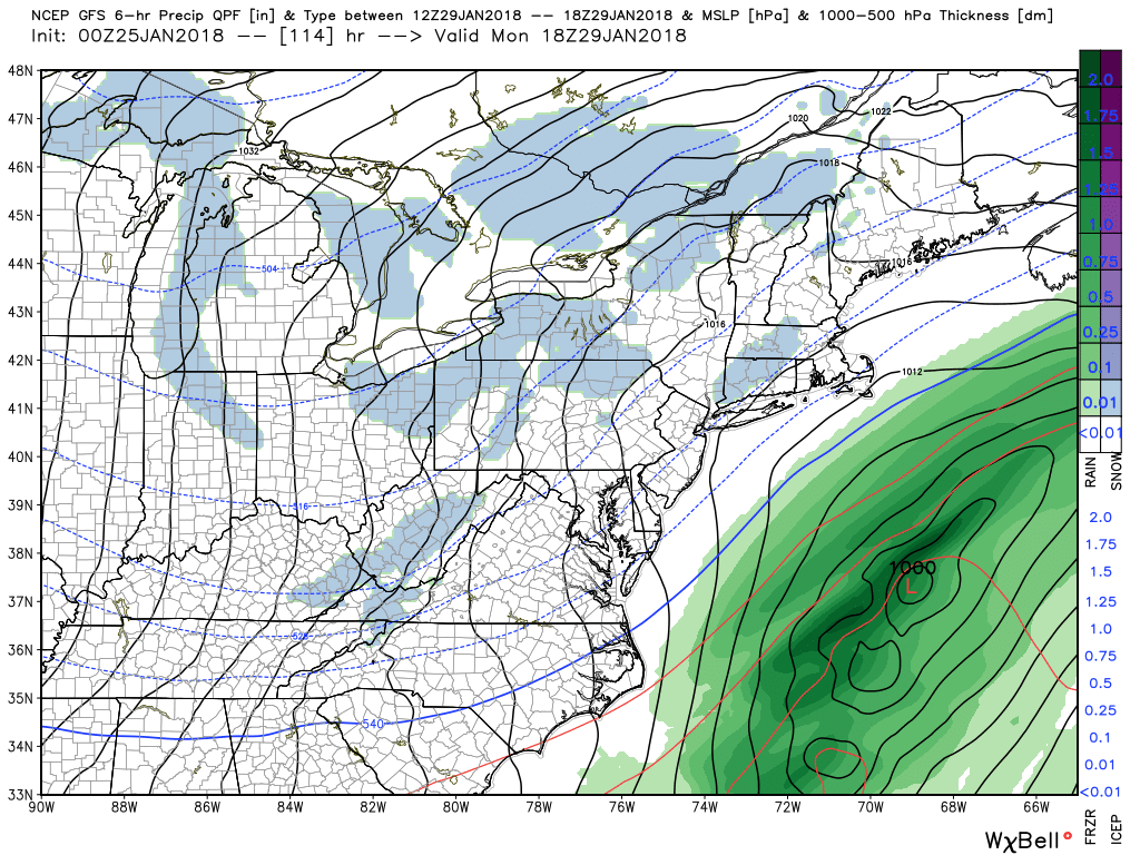
We currently are in favor of this model depiction. We do not believe this storm will come close enough to the coast to produce snow for the area. However, we are in favor of a storm just a few days later around February 2nd. Details need to be ironed out whether it is rain and/or snow so we will have more on that system in the coming days, stay tuned!
You must be logged in to post a comment.