
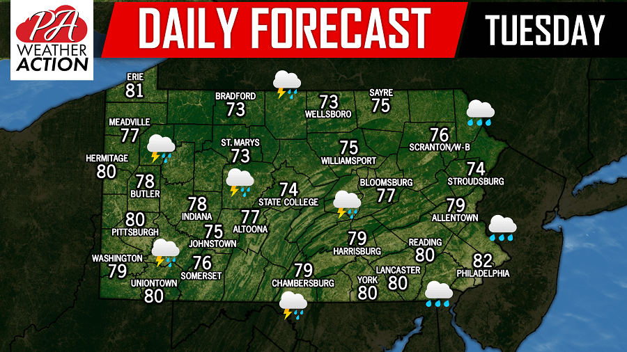
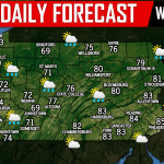
Scattered showers are likely this morning and into the early afternoon hours as a warm front passes through the region with temperatures in the 70s and 80s.
Below is a look at the future radar for 2:00 PM this afternoon: 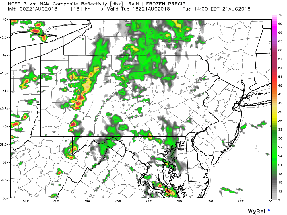
The severe weather will arrive later this evening and into the nighttime hours as a trailing cold front sweeps into the area. Western Pennsylvania and parts of Central Pennsylvania continue to have the best chance to experience the severe weather this time around. It is anticipated the line of storms will weaken as it progresses into Eastern Pennsylvania. Below is a look at 9:00 PM tonight: 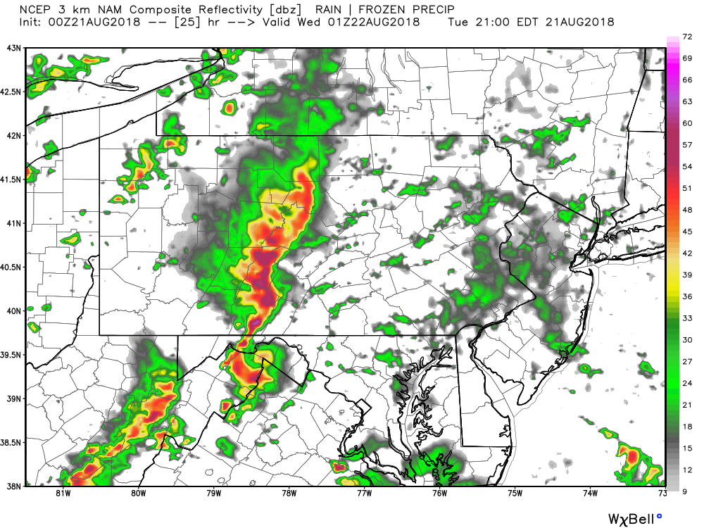
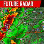
If our future radar is even close to verifying, that is a very potent line of storms capable of producing damaging winds in excess of 60 mph, large hail, and the potential for an isolated tornado or two. We will have all the latest watches and warnings posted on our Facebook page. Have a great Tuesday!
You must be logged in to post a comment.